Filters: Tags: Ash Fall (X) > partyWithName: State of Alaska, Department of Natural Resources, Division of Geological & Geophysical Surveys (X)
1 result (35ms)|
Filters
Date Range
Contacts Tag Types Tag Schemes |
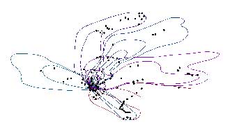
The 2009 eruption of Redoubt Volcano included 19 major tephra-producing explosions. Mass per unit area (MPUA) ash fall sampling of the resulting deposits allowed us to create isomass contours of the ash fall. This dataset contains the vector digital shapefiles of the ash fall contours for the explosive events. In addition, a point digital shapefile is included that describes more than 400 ash fall samples that were collected. For a detailed account of the 2009 eruption of Redoubt Volcano, see Schaefer, J.R., ed., 2012, The 2009 eruption of Redoubt Volcano, Alaska, with contributions by Bull, Katharine, Cameron, Cheryl, Coombs, Michelle, Diefenbach, Angie, Lopez, Taryn, McNutt, Steve, Neal, Christina, Payne, Allison,...
|

|
