Filters: Tags: Aspen (X)
77 results (121ms)|
Filters
Date Range
Extensions Types Contacts
Categories Tag Types
|
Reports of decreasing quaking aspen (Populus tremuloides) cover in forests of the western USA have caused concern about the long-term persistence of aspen on landscape scales. We assessed changes in overstory aspen dominance on the Uncompahgre Plateau in western Colorado over a 20 year period. We measured stand density, species composition and regeneration in 53 undisturbed, mature pure aspen, pure conifer, and mixed aspen/conifer stands originally inventoried between 1979 and 1983. Ages of overstory and understory trees were used to evaluate long-term change in regeneration and overstory development. While pure aspen stands occupy 16% of the study area, mixed aspen and conifer stands cover 62% of the forested landscape...
Categories: Publication;
Types: Citation,
Journal Citation;
Tags: Forest Ecology and Management,
Populus tremuloides Colorado,
aspen,
aspen decline,
vegetation change
Human activities have caused the decline of numerous species and ecosystems. To promote ecosystem resilience, recent management efforts aim to maintain ecosystem patterns and processes within their historical range of variability. There has been substantial concern that quaking aspen, the most widely distributed tree in North America and the most important deciduous tree in the subalpine forests of the Rocky Mountains, has declined significantly in the western landscape during the 20th century. This reported decline has been attributed to conifer encroachment associated with fire exclusion, as well as other causes. To assess long-term changes in the extent of quaking aspen in a 175000-ha study area in western Colorado,...
Categories: Publication;
Types: Citation,
Journal Citation;
Tags: Colorado,
Ecological Applications,
USA,
aspen,
fire,
Prescribed burns to restore aspen habitat on one of the most important elk calving areas for Afton herd and important for aspen-dependent species, transition and winter range for elk, mule deer, and moose east of Alpine, transition and winter range for mule deer and elk of crucial winter range just east of Smoot, and sagebrush, aspen, meadow, and willow habitat on transition range for mule deer and elk 30 miles up the Greys River. In addition, determine 1) locations and distribution of aspen stands on the district that are in need of treatment and 2) prioritize stands relative to level of risk, this information to be used in formulating an aspen treatment schedule. (This assessment would be consistent with methodology...
Categories: Project;
Types: Map Service,
OGC WFS Layer,
OGC WMS Layer,
OGC WMS Service,
ScienceBase Project;
Tags: Greys River District,
Habitat,
aspen,
habitat conservation project,
wildlife

These data were extracted from the CALVEG Existing Vegetation tiles, using the CWHR type, Hardwood (including Montane Hardwood Conifer, Montane Hardwood, Aspen) and clipped to the South Sierra Nevada Zone for the CA LCC.These CALVEG Existing Vegetation tiles have been crosswalked to other classification systems, including the California Wildlife Habitat Relationship System (CWHR).The CWHR habitat classification scheme has been developed to support the CWHR System, a wildlife information system and predictive model for California's regularly-occurring birds, mammals, reptiles and amphibians. When first published in 1988, the classification scheme had 53 habitats. These habitats â except the non-vegetated Barren...
The importance of efficaciously assessing the risk for introduction and establishment of pest species is an increasingly important ecological and economic issue. Evaluation of climate is fundamental to determining the potential success of an introduced or invasive insect pest. However, evaluating climatic suitability poses substantial difficulties; climate can be measured and assessed in a bewildering array of ways. Some physiological filter, in essence a lens that focuses climate through the requirements and constraints of a potential pest introduction, is required. Difficulties in assessing climate suitability are further exacerbated by the effects of climate change. Gypsy moth (Lymantria dispar L.) is an exotic,...
Categories: Publication;
Types: Citation,
Journal Citation;
Tags: Ecological Applications,
Lymantria dispar,
aspen,
climate change,
climatic suitability,
These data were extracted from the CALVEG Existing Vegetation tiles, using the CWHR type, Hardwood (including Montane Hardwood Conifer, Montane Hardwood, Aspen) and clipped to the North Sierra Nevada Zone for the CA LCC.These CALVEG Existing Vegetation tiles have been crosswalked to other classification systems, including the California Wildlife Habitat Relationship System (CWHR).The CWHR habitat classification scheme has been developed to support the CWHR System, a wildlife information system and predictive model for California's regularly-occurring birds, mammals, reptiles and amphibians. When first published in 1988, the classification scheme had 53 habitats. These habitats â except the non-vegetated Barren...
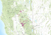
A 10 km moving window was used on the Sagebrush conservation element to determine the relative density of Sagebrush within the moving window.
USGS Historical Quadrangle in GeoPDF.
USGS Historical Quadrangle in GeoPDF.
Repeat photography samples were used to analyze how the structure and site-specific distribution of forests may or may not have changed during the past century in the San Juan Mountains, Colorado. Systematic evaluation of 146 photosets was combined with field observations to identify trends in vegetation change. Both conifers and deciduous trees (e.g., aspen) have increased in extent. Forest recovery from large disturbances that occurred during Euro-American settlement contributed substantially to this increase. Trees also encroached into grass/shrublands, but less than half of photosets show tree invasion, and invasion is more common in small grass/shrubland openings interspersed with forest than in large openings....
Categories: Publication;
Types: Citation,
Journal Citation;
Tags: Forest Ecology and Management,
aspen,
landscape change,
mountain grasslands,
repeat photography,
The proposed action is to conduct several different forms of forest and rangeland health treatments to improve and restore good health conditions in aspen woodlands and rangelenads on roughly between 700,000-750,000 acres of public lands. The goal is to implement a combination of treatments (mechanical removal of conifer encroachment in aspen stands, prescribed burning, hazardous fuels reduction and mechanical brush beating) within identified areas of forest and rangelands to improve aspen stands, rangeland vegetation, and riparian ecosystem health; improve livestock grazing and wildlife habitat conditions; and reduce hazardous fire fuel build up within juniper woodlands. This is an effort to improve the overall...
Categories: Project;
Types: Map Service,
OGC WFS Layer,
OGC WMS Layer,
OGC WMS Service,
ScienceBase Project;
Tags: Habitat,
aspen,
habitat conservation project
This data set contains imagery from the National Agriculture Imagery Program (NAIP). The NAIP program is administered by USDA FSA and has been established to support two main FSA strategic goals centered on agricultural production. These are, increase stewardship of America's natural resources while enhancing the environment, and to ensure commodities are procured and distributed effectively and efficiently to increase food security. The NAIP program supports these goals by acquiring and providing ortho imagery that has been collected during the agricultural growing season in the U.S. The NAIP ortho imagery is tailored to meet FSA requirements and is a fundamental tool used to support FSA farm and conservation programs....
This data set contains imagery from the National Agriculture Imagery Program (NAIP). The NAIP program is administered by USDA FSA and has been established to support two main FSA strategic goals centered on agricultural production. These are, increase stewardship of America's natural resources while enhancing the environment, and to ensure commodities are procured and distributed effectively and efficiently to increase food security. The NAIP program supports these goals by acquiring and providing ortho imagery that has been collected during the agricultural growing season in the U.S. The NAIP ortho imagery is tailored to meet FSA requirements and is a fundamental tool used to support FSA farm and conservation programs....
Core Research Center, core D641, from well operated by MOUNTAIN FUEL SUPPLYRaw Properties from download, web scrape, MapServer, and Macrostrat API{"Lib Num": "D641", "API Num": "4903705236", "Operator": "MOUNTAIN FUEL SUPPLY", "Well Name": "1 CAPITAL", "Field": "PRETTY WATER CREEK", "State": "WY", "County": "SWEETWATER", "Type": "FULL", "Photos": "T", "Thin Sec": "T", "Analysis": "T", "Latitude": "41.29585", "Longitude": "-109.10653", "coordinates_geohash": "9x66vjxjc86s", "Source": "FROM STATE RECORDS", "Security Flag": "NO SPECIAL RESTRICTIONS", "crc_collection_name": "core", "sb_parent_id": "4f4e49dae4b07f02db5e0486", "intervals": [{"Formation": "ASPEN", "Age": "CRET", "Min Depth": "3693", "Max Depth": "3791"},...
Prescribed burns to restore aspen habitat on one of the most important elk calving areas for Afton herd and important for aspen-dependent species, transition and winter range for elk, mule deer, and moose east of Alpine, transition and winter range for mule deer and elk of crucial winter range just east of Smoot, and sagebrush, aspen, meadow, and willow habitat on transition range for mule deer and elk 30 miles up the Greys River. In addition, determine 1) locations and distribution of aspen stands on the district that are in need of treatment and 2) prioritize stands relative to level of risk, this information to be used in formulating an aspen treatment schedule. (This assessment would be consistent with methodology...
Categories: Project;
Types: Map Service,
OGC WFS Layer,
OGC WMS Layer,
OGC WMS Service,
ScienceBase Project;
Tags: Habitat,
aspen,
habitat conservation project,
wildlife
The Forest Service proposes two prescribed burns at Weiner Creek (1,500 acres) and Lower Cottonwood Creek (400 acres) to restore aspen habitat in one of the most important elk calving areas for the Afton herd and important for aspen-dependent species, transition and winter range for elk, mule deer, and moose east of Alpine, transition and winter range for mule deer and elk of crucial winter range just east of Smoot, and sagebrush, aspen, meadow, and willow habitat on transition range for mule deer and elk 30 miles up the Greys River.
Categories: Project;
Types: Map Service,
OGC WFS Layer,
OGC WMS Layer,
OGC WMS Service,
ScienceBase Project;
Tags: Habitat,
aspen,
elk,
habitat conservation project,
moose,
This data set contains imagery from the National Agriculture Imagery Program (NAIP). The NAIP program is administered by USDA FSA and has been established to support two main FSA strategic goals centered on agricultural production. These are, increase stewardship of America's natural resources while enhancing the environment, and to ensure commodities are procured and distributed effectively and efficiently to increase food security. The NAIP program supports these goals by acquiring and providing ortho imagery that has been collected during the agricultural growing season in the U.S. The NAIP ortho imagery is tailored to meet FSA requirements and is a fundamental tool used to support FSA farm and conservation programs....
A 10 km moving window was used on the aspen conservation element to determine the relative density of aspen within the moving window.
Riparian vegetation communities were extracted from state ReGAP and Landfire Exisitng Vegetation (California only). The individual rasters were mosaiced to create a single raster than represent Riparian vegetation with the NGB ecoregion.
Development change agents were mosaiced together and the euclidean distance was calculated. Aspen communiities were used to extract the distances. The resulting layer was used in the intactness calculation.
|

|
