Filters: Tags: Atlantic (X)
233 results (9ms)|
Filters
Contacts
(Less)
|
This data set contains imagery from the National Agriculture Imagery Program (NAIP). The NAIP program is administered by USDA FSA and has been established to support two main FSA strategic goals centered on agricultural production. These are increase stewardship of America's natural resources while enhancing the environment, and to ensure commodities are procured and distributed effectively and efficiently to increase food security. The NAIP program supports these goals by acquiring and providing ortho imagery that has been collected during the agricultural growing season in the U.S. The NAIP ortho imagery is tailored to meet FSA requirements and is a fundamental tool used to support FSA farm and conservation programs....
This data set contains imagery from the National Agriculture Imagery Program (NAIP). The NAIP program is administered by USDA FSA and has been established to support two main FSA strategic goals centered on agricultural production. These are, increase stewardship of America's natural resources while enhancing the environment, and to ensure commodities are procured and distributed effectively and efficiently to increase food security. The NAIP program supports these goals by acquiring and providing ortho imagery that has been collected during the agricultural growing season in the U.S. The NAIP ortho imagery is tailored to meet FSA requirements and is a fundamental tool used to support FSA farm and conservation programs....
This data set contains imagery from the National Agriculture Imagery Program (NAIP). The NAIP program is administered by USDA FSA and has been established to support two main FSA strategic goals centered on agricultural production. These are, increase stewardship of America's natural resources while enhancing the environment, and to ensure commodities are procured and distributed effectively and efficiently to increase food security. The NAIP program supports these goals by acquiring and providing ortho imagery that has been collected during the agricultural growing season in the U.S. The NAIP ortho imagery is tailored to meet FSA requirements and is a fundamental tool used to support FSA farm and conservation programs....
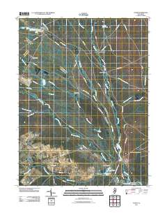
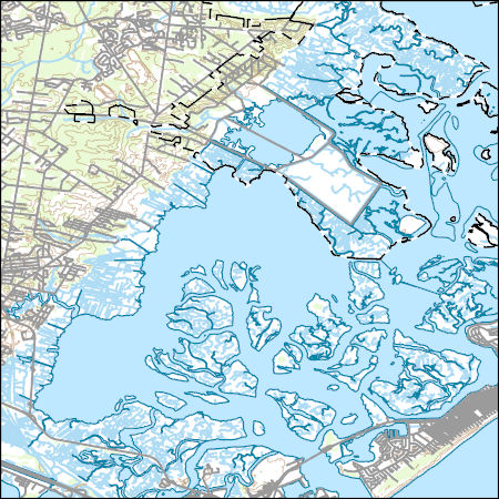
Layered GeoPDF 7.5 Minute Quadrangle Map. Layers of geospatial data include orthoimagery, roads, grids, geographic names, elevation contours, hydrography, and other selected map features.
Layered geospatial PDF Map. Layers of geospatial data include orthoimagery, roads, grids, geographic names, elevation contours, hydrography, and other selected map features.
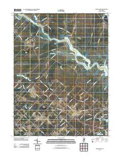
Layered GeoPDF 7.5 Minute Quadrangle Map. Layers of geospatial data include orthoimagery, roads, grids, geographic names, elevation contours, hydrography, and other selected map features.
Layered GeoPDF 7.5 Minute Quadrangle Map. Layers of geospatial data include orthoimagery, roads, grids, geographic names, elevation contours, hydrography, and other selected map features.
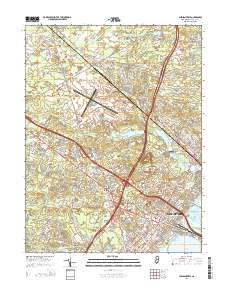
Layered GeoPDF 7.5 Minute Quadrangle Map. Layers of geospatial data include orthoimagery, roads, grids, geographic names, elevation contours, hydrography, and other selected map features.
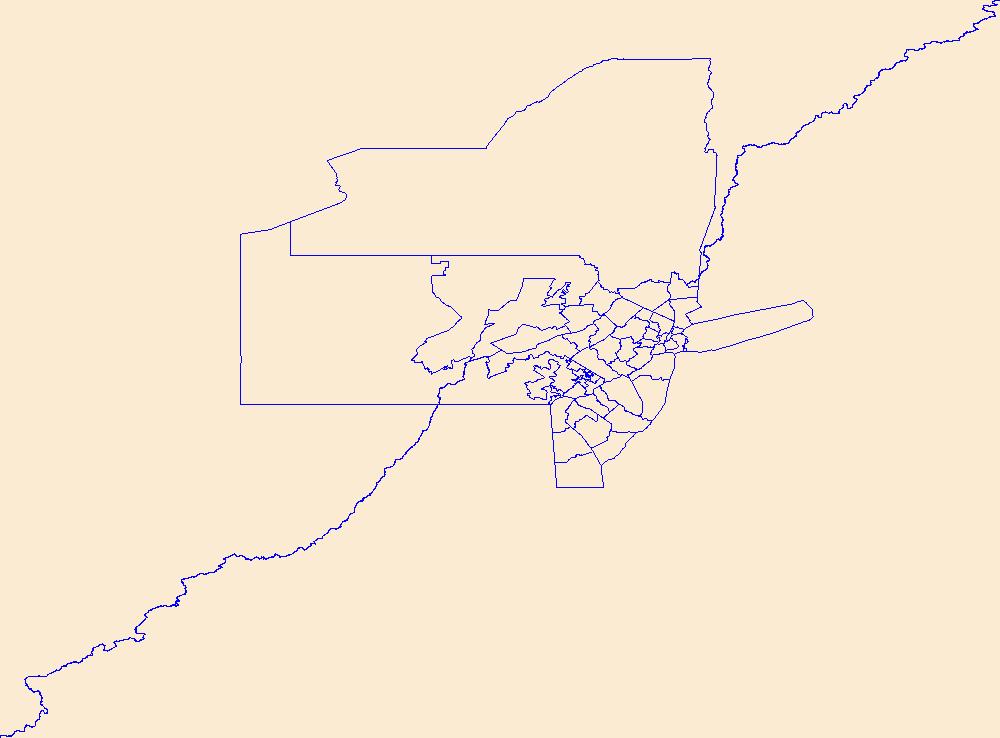
USGS National Boundary Dataset (NBD) in New Jersey State or Territory (published 20240215) Shapefile
Geospatial data is comprised of government boundaries.
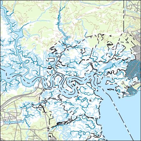
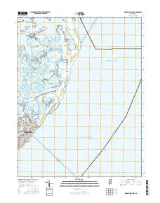
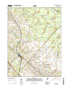
Layers of geospatial data include contours, boundaries, land cover, hydrography, roads, transportation, geographic names, structures, and other selected map features.
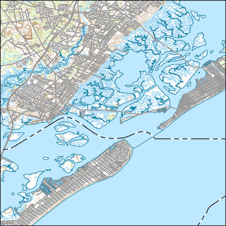
Layers of geospatial data include contours, boundaries, land cover, hydrography, roads, transportation, geographic names, structures, and other selected map features.
Layers of geospatial data include contours, boundaries, land cover, hydrography, roads, transportation, geographic names, structures, and other selected map features.

Layers of geospatial data include contours, boundaries, land cover, hydrography, roads, transportation, geographic names, structures, and other selected map features.
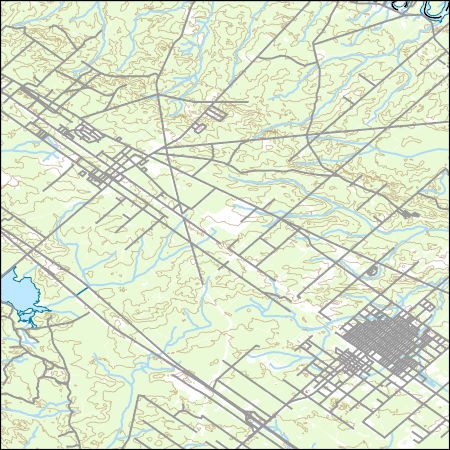
Layers of geospatial data include contours, boundaries, land cover, hydrography, roads, transportation, geographic names, structures, and other selected map features.
In 2012, Hurricane Sandy struck the Northeastern US causing devastation among coastal ecosystems. Post-hurricane marsh restoration efforts have included sediment deposition, planting of vegetation, and restoring tidal hydrology. The work presented here is part of a larger project funded by the National Fish and Wildlife Foundation (NFWF) to monitor the post-restoration ecological resilience of coastal ecosystems in the wake of Hurricane Sandy. The U.S. Geological Survey Woods Hole Coastal and Marine Science Center made in-situ observations during 2018-2019 and 2022-2023 at two sites: Thompsons Beach, NJ and Stone Harbor, NJ. Marsh creek hydrodynamics and water quality including currents, waves, water levels, water...
Categories: Data;
Types: Downloadable,
Map Service,
OGC WFS Layer,
OGC WMS Layer,
Shapefile;
Tags: Atlantic,
Hurricane Sandy,
National Fish and Wildlife Foundation,
New Jersey,
Stone Harbor,
In 2012, Hurricane Sandy struck the Northeastern US causing devastation among coastal ecosystems. Post-hurricane marsh restoration efforts have included sediment deposition, planting of vegetation, and restoring tidal hydrology. The work presented here is part of a larger project funded by the National Fish and Wildlife Foundation (NFWF) to monitor the post-restoration ecological resilience of coastal ecosystems in the wake of Hurricane Sandy. The U.S. Geological Survey Woods Hole Coastal and Marine Science Center made in-situ observations during 2018-2019 and 2022-2023 at two sites: Thompsons Beach, NJ and Stone Harbor, NJ. Marsh creek hydrodynamics and water quality including currents, waves, water levels, water...
The U.S. Geological Survey (USGS) developed a regression model for estimating mean August baseflow per square mile of drainage area in cooperation with National Oceanic and Atmospheric Administration (NOAA) to help resource managers assess relative amounts of baseflow in streams with Maine Atlantic Salmon habitat (Lombard and others, 2021). The model was applied to each reach of a stream network derived from select National Hydrography Dataset Plus High-Resolution (NHDPlusHR) data in the State of Maine south of 46º 21′55″ N latitude. The spatial coverage developed from the stream network contains model-estimated mean August baseflow per square mile of drainage area as an attribute of each NHDPlusHR reach. Please...
Categories: Data,
Data Release - Revised;
Types: ArcGIS REST Map Service,
ArcGIS Service Definition,
Downloadable,
Map Service,
OGC WFS Layer,
OGC WMS Layer,
OGC WMS Service;
Tags: Atlantic,
Atlantic Salmon,
August,
Distinct Population Segment,
Hydrology,
Variability in sediment properties with depth and the thickness of individual sedimentary layers are critical determinants of seabed acoustic response. The New England Mud Patch (NEMP), located south of Cape Cod, is an unusual feature on the U.S. Continental Shelf in that it is composed of fine-grained sediment layers containing a relatively-homogeneous mix of sand, silt, and clay-sized particles bounded by more typical sandy shelf sediments. The unique characteristics and nature of this deposit is due to a derivation of sediments that have been transported to, and deposited in, a basal bowl-shaped depression since the last glacial maximum. Ninety-two piston, vibra-, and gravity cores with a maximum length of 8.2...
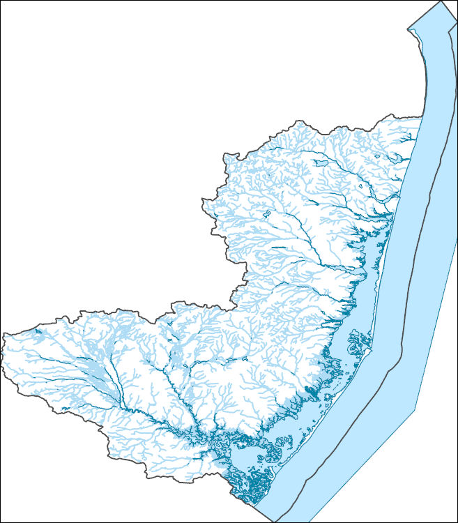
The National Hydrography Dataset (NHD) is a feature-based database that interconnects and uniquely identifies the stream segments or reaches that make up the nation's surface water drainage system. NHD data was originally developed at 1:100,000-scale and exists at that scale for the whole country. This high-resolution NHD, generally developed at 1:24,000/1:12,000 scale, adds detail to the original 1:100,000-scale NHD. (Data for Alaska, Puerto Rico and the Virgin Islands was developed at high-resolution, not 1:100,000 scale.) Local resolution NHD is being developed where partners and data exist. The NHD contains reach codes for networked features, flow direction, names, and centerline representations for areal water...

The National Hydrography Dataset (NHD) is a feature-based database that interconnects and uniquely identifies the stream segments or reaches that make up the nation's surface water drainage system. NHD data was originally developed at 1:100,000-scale and exists at that scale for the whole country. This high-resolution NHD, generally developed at 1:24,000/1:12,000 scale, adds detail to the original 1:100,000-scale NHD. (Data for Alaska, Puerto Rico and the Virgin Islands was developed at high-resolution, not 1:100,000 scale.) Local resolution NHD is being developed where partners and data exist. The NHD contains reach codes for networked features, flow direction, names, and centerline representations for areal water...
|

|
