Filters: Tags: Available Water (X) > partyWithName: Conservation Biology Institute (X)
33 results (94ms)|
Filters
Date Range
Tag Schemes |
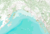
This dataset represents the soil water storage capacity (AWS in mm at 0.25 m depth) from SSURGO and STATSGO soil descriptions for soil map units in the state of southern Alaska that lie within the North Pacific Landscape Conservation Cooperative. Available Water Storage 0-25 cm - Weighted Average (centimeters). Available water storage (AWS). The volume of water that the soil, to a depth of 25 centimeters, can store that is available to plants. It is reported as the weighted average of all components in the map unit, and is expressed as centimeters of water. AWS is calculated from AWC (available water capacity) which is commonly estimated as the difference between the water contents at 1/10 or 1/3 bar (field capacity)...

This dataset represents the soil water storage capacity (AWS in mm at 0.5 m depth) from SSURGO and STATSGO soil descriptions for soil map units in the state of southern Alaska that lie within the North Pacific Landscape Conservation Cooperative. Available Water Storage 0-50 cm - Weighted Average (centimeters). Available water storage (AWS). The volume of water that the soil, to a depth of 50 centimeters, can store that is available to plants. It is reported as the weighted average of all components in the map unit, and is expressed as centimeters of water. AWS is calculated from AWC (available water capacity) which is commonly estimated as the difference between the water contents at 1/10 or 1/3 bar (field capacity)...

This dataset represents the soil water storage capacity (AWS in mm at 0.5 m depth) from SSURGO and STATSGO soil descriptions for soil map units in the state of northern California that lie within the North Pacific Landscape Conservation Cooperative. Available Water Storage 0-50 cm - Weighted Average (centimeters). Available water storage (AWS). The volume of water that the soil, to a depth of 50 centimeters, can store that is available to plants. It is reported as the weighted average of all components in the map unit, and is expressed as centimeters of water. AWS is calculated from AWC (available water capacity) which is commonly estimated as the difference between the water contents at 1/10 or 1/3 bar (field...

This dataset represents the soil water storage capacity (AWS in mm at 0.5 m depth) from SSURGO and STATSGO soil descriptions for soil map units in the state of western Oregon that lie within the North Pacific Landscape Conservation Cooperative. Available Water Storage 0-50 cm - Weighted Average (centimeters). Available water storage (AWS). The volume of water that the soil, to a depth of 50 centimeters, can store that is available to plants. It is reported as the weighted average of all components in the map unit, and is expressed as centimeters of water. AWS is calculated from AWC (available water capacity) which is commonly estimated as the difference between the water contents at 1/10 or 1/3 bar (field capacity)...

This dataset covers the southern half of the Southern Rockies Landscape Conservation Cooperative. It was aggregated and converted to raster by Conservation Biology Institute as part of a soil vulnerability study funded in part by the Southern Rockies LCC. The soil data come from a digital soil survey, the most detailed level of soil geographic data developed by the National Cooperative Soil Survey. The information was prepared by digitizing maps, by compiling information onto a planimetric correct base and digitizing, or by revising digitized maps using remotely sensed and other information. This data set consists of georeferenced digital map data and computerized attribute data. The map data are in a soil survey...

This dataset covers the southern half of the Southern Rockies Landscape Conservation Cooperative. It was aggregated and converted to raster by Conservation Biology Institute as part of a soil vulnerability study funded in part by the Southern Rockies LCC. The soil data come from a digital soil survey, the most detailed level of soil geographic data developed by the National Cooperative Soil Survey. The information was prepared by digitizing maps, by compiling information onto a planimetric correct base and digitizing, or by revising digitized maps using remotely sensed and other information. This data set consists of georeferenced digital map data and computerized attribute data. The map data are in a soil survey...

This dataset represents the soil water storage capacity (AWS in mm at 0.25 m depth) from SSURGO and STATSGO soil descriptions for soil map units in the state of southern Alaska that lie within the North Pacific Landscape Conservation Cooperative. Available Water Storage 0-25 cm - Weighted Average (centimeters). Available water storage (AWS). The volume of water that the soil, to a depth of 25 centimeters, can store that is available to plants. It is reported as the weighted average of all components in the map unit, and is expressed as centimeters of water. AWS is calculated from AWC (available water capacity) which is commonly estimated as the difference between the water contents at 1/10 or 1/3 bar (field capacity)...

This dataset covers the northern half of the Southern Rockies Landscape Conservation Cooperative. It was aggregated and converted to raster by Conservation Biology Institute as part of a soil vulnerability study funded in part by the Southern Rockies LCC. The soil data come from a digital soil survey, the most detailed level of soil geographic data developed by the National Cooperative Soil Survey. The information was prepared by digitizing maps, by compiling information onto a planimetric correct base and digitizing, or by revising digitized maps using remotely sensed and other information. This data set consists of georeferenced digital map data and computerized attribute data. The map data are in a soil survey...
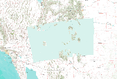
This dataset covers the southern half of the Southern Rockies Landscape Conservation Cooperative. It was aggregated and converted to raster by Conservation Biology Institute as part of a soil vulnerability study funded in part by the Southern Rockies LCC. The soil data come from a digital soil survey, the most detailed level of soil geographic data developed by the National Cooperative Soil Survey. The information was prepared by digitizing maps, by compiling information onto a planimetric correct base and digitizing, or by revising digitized maps using remotely sensed and other information. This data set consists of georeferenced digital map data and computerized attribute data. The map data are in a soil survey...

This dataset represents the soil water storage capacity (AWS in mm at 0.25 m depth) from SSURGO and STATSGO soil descriptions for soil map units in the state of northern California that lie within the North Pacific Landscape Conservation Cooperative. Available Water Storage 0-25 cm - Weighted Average (centimeters). Available water storage (AWS). The volume of water that the soil, to a depth of 25 centimeters, can store that is available to plants. It is reported as the weighted average of all components in the map unit, and is expressed as centimeters of water. AWS is calculated from AWC (available water capacity) which is commonly estimated as the difference between the water contents at 1/10 or 1/3 bar (field...

This dataset represents the soil water storage capacity (AWS in mm at 0.5 m depth) from SSURGO and STATSGO soil descriptions for soil map units in the state of southern Alaska that lie within the North Pacific Landscape Conservation Cooperative. Available Water Storage 0-50 cm - Weighted Average (centimeters). Available water storage (AWS). The volume of water that the soil, to a depth of 50 centimeters, can store that is available to plants. It is reported as the weighted average of all components in the map unit, and is expressed as centimeters of water. AWS is calculated from AWC (available water capacity) which is commonly estimated as the difference between the water contents at 1/10 or 1/3 bar (field capacity)...

This dataset represents the soil water storage capacity (AWS in mm at 1.0 m depth) from SSURGO and STATSGO soil descriptions for soil map units in the state of western Oregon that lie within the North Pacific Landscape Conservation Cooperative. Available Water Storage 0-100 cm - Weighted Average (centimeters). Available water storage (AWS). The volume of water that the soil, to a depth of 100 centimeters, can store that is available to plants. It is reported as the weighted average of all components in the map unit, and is expressed as centimeters of water. AWS is calculated from AWC (available water capacity) which is commonly estimated as the difference between the water contents at 1/10 or 1/3 bar (field capacity)...

This dataset represents the soil pH from SSURGO and STATSGO soil descriptions for soil map units in the state of northern California that lie within the North Pacific Landscape Conservation Cooperative. Available Water Storage 0-100 cm - Weighted Average (centimeters). Available water storage (AWS). The volume of water that the soil, to a depth of 100 centimeters, can store that is available to plants. It is reported as the weighted average of all components in the map unit, and is expressed as centimeters of water. AWS is calculated from AWC (available water capacity) which is commonly estimated as the difference between the water contents at 1/10 or 1/3 bar (field capacity) and 15 bars (permanent wilting point)...

This dataset represents the soil pH from SSURGO and STATSGO soil descriptions for soil map units in the state of western Washington that lie within the North Pacific Landscape Conservation Cooperative. The amount of water that an increment of soil depth, inclusive of fragments, can store that is available to plants. AWC is expressed as a volume fraction, and is commonly estimated as the difference between the water contents at 1/10 or 1/3 bar (field capacity) and 15 bars (permanent wilting point) tension and adjusted for salinity, and fragments.

This dataset represents the soil water storage capacity (AWS in mm at 0.25 m depth) from SSURGO and STATSGO soil descriptions for soil map units in the state of western Oregon that lie within the North Pacific Landscape Conservation Cooperative. Available Water Storage 0-25 cm - Weighted Average (centimeters). Available water storage (AWS). The volume of water that the soil, to a depth of 25 centimeters, can store that is available to plants. It is reported as the weighted average of all components in the map unit, and is expressed as centimeters of water. AWS is calculated from AWC (available water capacity) which is commonly estimated as the difference between the water contents at 1/10 or 1/3 bar (field capacity)...

This dataset represents the soil water storage capacity (AWS in mm at 1.5 m depth) from SSURGO and STATSGO soil descriptions for soil map units in the state of western Oregon that lie within the North Pacific Landscape Conservation Cooperative. Available Water Storage 0-150 cm - Weighted Average (centimeters). Available water storage (AWS). The volume of water that the soil, to a depth of 150 centimeters, can store that is available to plants. It is reported as the weighted average of all components in the map unit, and is expressed as centimeters of water. AWS is calculated from AWC (available water capacity) which is commonly estimated as the difference between the water contents at 1/10 or 1/3 bar (field capacity)...

This dataset represents the soil water capacity (AWC) from SSURGO and STATSGO soil descriptions for soil map units in the state of western Oregon that lie within the North Pacific Landscape Conservation Cooperative. The amount of water that an increment of soil depth, inclusive of fragments, can store that is available to plants. AWC is expressed as a volume fraction, and is commonly estimated as the difference between the water contents at 1/10 or 1/3 bar (field capacity) and 15 bars (permanent wilting point) tension and adjusted for salinity, and fragments.

This dataset covers the northern half of the Southern Rockies Landscape Conservation Cooperative. It was aggregated and converted to raster by Conservation Biology Institute as part of a soil vulnerability study funded in part by the Southern Rockies LCC. The soil data come from a digital soil survey, the most detailed level of soil geographic data developed by the National Cooperative Soil Survey. The information was prepared by digitizing maps, by compiling information onto a planimetric correct base and digitizing, or by revising digitized maps using remotely sensed and other information. This data set consists of georeferenced digital map data and computerized attribute data. The map data are in a soil survey...

This dataset represents the soil water storage capacity (AWS in mm at 1.5 m depth) from SSURGO and STATSGO soil descriptions for soil map units in the state of southern Alaska that lie within the North Pacific Landscape Conservation Cooperative. Available Water Storage 0-150 cm - Weighted Average (centimeters). Available water storage (AWS). The volume of water that the soil, to a depth of 150 centimeters, can store that is available to plants. It is reported as the weighted average of all components in the map unit, and is expressed as centimeters of water. AWS is calculated from AWC (available water capacity) which is commonly estimated as the difference between the water contents at 1/10 or 1/3 bar (field capacity)...

This dataset represents the soil water storage capacity (AWS in mm at 1.0 m depth) from SSURGO and STATSGO soil descriptions for soil map units in the state of southern Alaska that lie within the North Pacific Landscape Conservation Cooperative. Available Water Storage 0-100 cm - Weighted Average (centimeters). Available water storage (AWS). The volume of water that the soil, to a depth of 100 centimeters, can store that is available to plants. It is reported as the weighted average of all components in the map unit, and is expressed as centimeters of water. AWS is calculated from AWC (available water capacity) which is commonly estimated as the difference between the water contents at 1/10 or 1/3 bar (field capacity)...
|

|
