Filters: Tags: BARTLESVILLE (X)
31 results (10ms)|
Filters
Date Range
Contacts
Categories Tag Types Tag Schemes |
Core Research Center, core S186, from well operated by RUNNING FOXES PETROLEUMRaw Properties from download, web scrape, MapServer, and Macrostrat API{"Lib Num": "S186", "API Num": "1501123331", "Operator": "RUNNING FOXES PETROLEUM", "Well Name": "VOGEL 36-INJ2", "Field": "DEVON", "State": "KS", "County": "BOURBON", "Type": "FULL", "Photos": "T", "Thin Sec": "F", "Analysis": "F", "Latitude": "37.912146", "Longitude": "-94.830157", "coordinates_geohash": "9ysxdjdy30jz", "Source": "FROM STATE RECORDS", "Security Flag": "NO SPECIAL RESTRICTIONS", "crc_collection_name": "core", "sb_parent_id": "4f4e49dae4b07f02db5e0486", "intervals": [{"Formation": "BARTLESVILLE", "Age": "PENNSYLVANIAN", "Min Depth": "420", "Max Depth":...
Categories: Physical Item;
Tags: BARTLESVILLE,
Marmaton Group,
Marmaton Group,
PENNSYLVANIAN,
Pennsylvanian,
Core Research Center, core S194, from well operated by RUNNING FOXES PETROLEUMRaw Properties from download, web scrape, MapServer, and Macrostrat API{"Lib Num": "S194", "API Num": "1501123330", "Operator": "RUNNING FOXES PETROLEUM", "Well Name": "VOGEL 36-INJ1", "Field": "DEVON", "State": "KS", "County": "BOURBON", "Type": "FULL", "Photos": "T", "Thin Sec": "F", "Analysis": "F", "Latitude": "37.912146", "Longitude": "-94.827824", "coordinates_geohash": "9ysxdjsqr81x", "Source": "FROM STATE RECORDS", "Security Flag": "NO SPECIAL RESTRICTIONS", "crc_collection_name": "core", "sb_parent_id": "4f4e49dae4b07f02db5e0486", "intervals": [{"Formation": "BARTLESVILLE", "Age": "PENNSYLVANIAN", "Min Depth": "422", "Max Depth":...
Categories: Physical Item;
Tags: BARTLESVILLE,
Marmaton Group,
Marmaton Group,
PENNSYLVANIAN,
Pennsylvanian,
This digital geospatial compilation gathered paleoflow indicators from current-formed sedimentary structures throughout the Paleozoic Ozark uplift, Arkoma foreland basin, and Ouachita fold-thrust-belt of eastern Oklahoma and western Arkansas from existing publications. This dataset consists of unidirectional and bidirectional paleocurrents observed from a variety of bedform types represented by approximately 9,958 individual measurements and 665 calculated means (one .csv file) plotted as points (one .shp file) with subordinate Ordovician-Silurian and primarily Mississippian-Pennsylvanian ages.
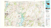
USGS Historical Quadrangle in GeoPDF.
Core Research Center, core S156, from well operated by RUNNING FOXES PETROLEUMRaw Properties from download, web scrape, MapServer, and Macrostrat API{"Lib Num": "S156", "API Num": "2421722662", "Operator": "RUNNING FOXES PETROLEUM", "Well Name": "EMMERSON 5-6A-3", "Field": "THOMAS", "State": "MO", "County": "VERNON", "Type": "FULL", "Photos": "T", "Thin Sec": "F", "Analysis": "F", "Latitude": "37.94", "Longitude": "-94.611778", "coordinates_geohash": "9ysxz4cb9b95", "Source": "FROM STATE RECORDS", "Security Flag": "NO SPECIAL RESTRICTIONS", "crc_collection_name": "core", "sb_parent_id": "4f4e49dae4b07f02db5e0486", "intervals": [{"Formation": "BARTLESVILLE", "Age": "PENNSYLVANIAN", "Min Depth": "282", "Max Depth":...
Core Research Center, core S182, from well operated by RUNNING FOXES PETROLEUMRaw Properties from download, web scrape, MapServer, and Macrostrat API{"Lib Num": "S182", "API Num": "2421722606", "Operator": "RUNNING FOXES PETROLEUM", "Well Name": "STONER 13-6A INJ3", "Field": "THOMAS", "State": "MO", "County": "VERNON", "Type": "FULL", "Photos": "T", "Thin Sec": "F", "Analysis": "F", "Latitude": "37.933194", "Longitude": "-94.612444", "coordinates_geohash": "9ysxz192f7bk", "Source": "FROM STATE RECORDS", "Security Flag": "NO SPECIAL RESTRICTIONS", "crc_collection_name": "core", "sb_parent_id": "4f4e49dae4b07f02db5e0486", "intervals": [{"Formation": "BARTLESVILLE", "Age": "PENNSYLVANIAN", "Min Depth": "273", "Max...
Core Research Center, core S272, from well operated by RUNNING FOXES PETROLEUMRaw Properties from download, web scrape, MapServer, and Macrostrat API{"Lib Num": "S272", "API Num": "1501123295", "Operator": "RUNNING FOXES PETROLEUM", "Well Name": "VOGEL 2-1A", "Field": "CHEROKEE BASIN COAL FIELD", "State": "KS", "County": "BOURBON", "Type": "FULL", "Photos": "T", "Thin Sec": "F", "Analysis": "F", "Latitude": "37.9062621", "Longitude": "-94.8289588", "coordinates_geohash": "9ysxdheevp7m", "Source": "FROM STATE RECORDS", "Security Flag": "NO SPECIAL RESTRICTIONS", "crc_collection_name": "core", "sb_parent_id": "4f4e49dae4b07f02db5e0486", "intervals": [{"Formation": "EXCELLO", "Age": "PENNSYLVANIAN", "Min Depth": "142",...
Categories: Physical Item;
Tags: BARTLESVILLE,
EXCELLO,
Marmaton Group,
Marmaton Group,
PENNSYLVANIAN,
Core Research Center, core S230, from well operated by RUNNING FOXES PETROLEUMRaw Properties from download, web scrape, MapServer, and Macrostrat API{"Lib Num": "S230", "API Num": "1501123737", "Operator": "RUNNING FOXES PETROLEUM", "Well Name": "SHAW 1-25B INJ", "Field": "THOMAS", "State": "KS", "County": "BOURBON", "Type": "THICK SLAB", "Photos": "T", "Thin Sec": "F", "Analysis": "F", "Latitude": "37.9347416", "Longitude": "-94.6158265", "coordinates_geohash": "9ysxycycgkq7", "Source": "FROM STATE RECORDS", "Security Flag": "NO SPECIAL RESTRICTIONS", "crc_collection_name": "core", "sb_parent_id": "4f4e49dae4b07f02db5e0486", "intervals": [{"Formation": "BARTLESVILLE", "Age": "PENNSYLVANIAN", "Min Depth": "258",...
Categories: Physical Item;
Tags: BARTLESVILLE,
Marmaton Group,
Marmaton Group,
PENNSYLVANIAN,
Pennsylvanian,
Core Research Center, core W150, from well operated by NORSTARRaw Properties from download, web scrape, MapServer, and Macrostrat API{"Lib Num": "W150", "API Num": "1501122819", "Operator": "NORSTAR", "Well Name": "JK CORPORATION 18-38", "Field": "SAVONBURG", "State": "KS", "County": "BOURBON", "Type": "FULL", "Photos": "F", "Thin Sec": "F", "Analysis": "F", "Latitude": "37.78103", "Longitude": "-95.03402", "coordinates_geohash": "9ysqvmy66y6w", "Source": "PROVIDED BY DONOR", "Security Flag": "NO SPECIAL RESTRICTIONS", "crc_collection_name": "core", "sb_parent_id": "4f4e49dae4b07f02db5e0486", "intervals": [{"Formation": "BARTLESVILLE", "Age": "PENN", "Min Depth": "553", "Max Depth": "565"}], "crcwc_url": "https://my.usgs.gov/crcwc/core/report/14727",...
Categories: Physical Item;
Tags: BARTLESVILLE,
PENN,
Pennsylvanian,
Pleasanton Group,
Pleasanton Group,
Core Research Center, core S338, from well operated by RUNNING FOXES PETROLEUMRaw Properties from download, web scrape, MapServer, and Macrostrat API{"Lib Num": "S338", "API Num": "1501123204", "Operator": "RUNNING FOXES PETROLEUM", "Well Name": "VOGEL 15-36D", "Field": "CHEROKEE BASIN COAL FIELD", "State": "KS", "County": "BOURBON", "Type": "FULL", "Photos": "T", "Thin Sec": "F", "Analysis": "F", "Latitude": "37.9076848", "Longitude": "-94.8289985", "coordinates_geohash": "9ysxdhgsk0te", "Source": "FROM STATE RECORDS", "Security Flag": "NO SPECIAL RESTRICTIONS", "crc_collection_name": "core", "sb_parent_id": "4f4e49dae4b07f02db5e0486", "intervals": [{"Formation": "EXCELLO", "Age": "PENNSYLVANIAN", "Min Depth":...
Categories: Physical Item;
Tags: BARTLESVILLE,
EXCELLO,
Marmaton Group,
Marmaton Group,
PENNSYLVANIAN,
Core Research Center, core R739, from well operated by KENNEDY & MITCHELLRaw Properties from download, web scrape, MapServer, and Macrostrat API{"Lib Num": "R739", "API Num": "1501522311", "Operator": "KENNEDY & MITCHELL", "Well Name": "9 BLOOD", "Field": "MUDDY CREEK SW EXPL", "State": "KS", "County": "BUTLER", "Type": "FULL", "Photos": "T", "Thin Sec": "F", "Analysis": "F", "Latitude": "37.506707", "Longitude": "-96.960106", "coordinates_geohash": "9yej3egu3uby", "Source": "FROM STATE RECORDS", "Security Flag": "NO SPECIAL RESTRICTIONS", "crc_collection_name": "core", "sb_parent_id": "4f4e49dae4b07f02db5e0486", "intervals": [{"Formation": "BARTLESVILLE", "Age": "PENN", "Min Depth": "2831", "Max Depth": "2856"}],...
Core Research Center, core S298, from well operated by RUNNING FOXES PETROLEUMRaw Properties from download, web scrape, MapServer, and Macrostrat API{"Lib Num": "S298", "API Num": "1501123215", "Operator": "RUNNING FOXES PETROLEUM", "Well Name": "WADE 16-30", "Field": "WILDCAT", "State": "KS", "County": "BOURBON", "Type": "FULL", "Photos": "T", "Thin Sec": "F", "Analysis": "F", "Latitude": "37.9234934", "Longitude": "-94.8063648", "coordinates_geohash": "9ysxdxu07ed9", "Source": "FROM STATE RECORDS", "Security Flag": "NO SPECIAL RESTRICTIONS", "crc_collection_name": "core", "sb_parent_id": "4f4e49dae4b07f02db5e0486", "intervals": [{"Formation": "BARTLESVILLE", "Age": "PENNSYLVANIAN", "Min Depth": "496", "Max Depth":...
Categories: Physical Item;
Tags: BARTLESVILLE,
Marmaton Group,
Marmaton Group,
PENNSYLVANIAN,
PENNSYLVANIAN,
Core Research Center, core S263, from well operated by RUNNING FOXES PETROLEUMRaw Properties from download, web scrape, MapServer, and Macrostrat API{"Lib Num": "S263", "API Num": "2421722663", "Operator": "RUNNING FOXES PETROLEUM", "Well Name": "EMMERSON 5-6A-4", "Field": "THOMAS", "State": "MO", "County": "VERNON", "Type": "THICK SLAB", "Photos": "T", "Thin Sec": "F", "Analysis": "F", "Latitude": "37.94", "Longitude": "-94.6106", "coordinates_geohash": "9ysxz4f8t0x7", "Source": "FROM STATE RECORDS", "Security Flag": "NO SPECIAL RESTRICTIONS", "crc_collection_name": "core", "sb_parent_id": "4f4e49dae4b07f02db5e0486", "intervals": [{"Formation": "BARTLESVILLE", "Age": "PENNSYLVANIAN", "Min Depth": "291", "Max Depth":...
Core Research Center, core S226, from well operated by RUNNING FOXES PETROLEUMRaw Properties from download, web scrape, MapServer, and Macrostrat API{"Lib Num": "S226", "API Num": "2421722409", "Operator": "RUNNING FOXES PETROLEUM", "Well Name": "KEITH 4-29B", "Field": "STOTESBURY", "State": "MO", "County": "VERNON", "Type": "THICK SLAB", "Photos": "T", "Thin Sec": "F", "Analysis": "F", "Latitude": "37.972028", "Longitude": "-94.594222", "coordinates_geohash": "9yu8p2we4g5f", "Source": "FROM STATE RECORDS", "Security Flag": "NO SPECIAL RESTRICTIONS", "crc_collection_name": "core", "sb_parent_id": "4f4e49dae4b07f02db5e0486", "intervals": [{"Formation": "BARTLESVILLE", "Age": "PENNSYLVANIAN", "Min Depth": "142", "Max...
Core Research Center, core W151, from well operated by NORSTARRaw Properties from download, web scrape, MapServer, and Macrostrat API{"Lib Num": "W151", "API Num": "1501122814", "Operator": "NORSTAR", "Well Name": "JK CORPORATION 18-36", "Field": "SAVONBURG", "State": "KS", "County": "BOURBON", "Type": "SLABBED", "Photos": "F", "Thin Sec": "F", "Analysis": "F", "Latitude": "37.7791", "Longitude": "-95.03527", "coordinates_geohash": "9ysqvmmrjwwt", "Source": "PROVIDED BY DONOR", "Security Flag": "NO SPECIAL RESTRICTIONS", "crc_collection_name": "core", "sb_parent_id": "4f4e49dae4b07f02db5e0486", "intervals": [{"Formation": "BARTLESVILLE", "Age": "PENN", "Min Depth": "573", "Max Depth": "593"}], "crcwc_url": "https://my.usgs.gov/crcwc/core/report/14728",...
Categories: Physical Item;
Tags: BARTLESVILLE,
PENN,
Pennsylvanian,
Pleasanton Group,
Pleasanton Group,
Core Research Center, core S235, from well operated by RUNNING FOXES PETROLEUMRaw Properties from download, web scrape, MapServer, and Macrostrat API{"Lib Num": "S235", "API Num": "2421722591", "Operator": "RUNNING FOXES PETROLEUM", "Well Name": "EMMERSON 12-6B-1", "Field": "THOMAS", "State": "MO", "County": "VERNON", "Type": "THICK SLAB", "Photos": "T", "Thin Sec": "F", "Analysis": "F", "Latitude": "37.93733333", "Longitude": "-94.61302778", "coordinates_geohash": "9ysxz42buxt0", "Source": "FROM STATE RECORDS", "Security Flag": "NO SPECIAL RESTRICTIONS", "crc_collection_name": "core", "sb_parent_id": "4f4e49dae4b07f02db5e0486", "intervals": [{"Formation": "BARTLESVILLE", "Age": "PENNSYLVANIAN", "Min Depth": "257",...
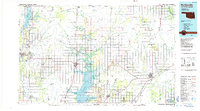
USGS Historical Quadrangle in GeoPDF.
Core Research Center, core S356, from well operated by RUNNING FOXES PETROLEUMRaw Properties from download, web scrape, MapServer, and Macrostrat API{"Lib Num": "S356", "API Num": "2421722449", "Operator": "RUNNING FOXES PETROLEUM", "Well Name": "MASHEK 5-17A-INJ", "Field": null, "State": "MO", "County": "VERNON", "Type": "SLABBED", "Photos": "T", "Thin Sec": "F", "Analysis": "F", "Latitude": "37.91116", "Longitude": "-94.59405", "coordinates_geohash": "9ysxxmw8wbkn", "Source": "FROM STATE RECORDS", "Security Flag": "NO SPECIAL RESTRICTIONS", "crc_collection_name": "core", "sb_parent_id": "4f4e49dae4b07f02db5e0486", "intervals": [{"Formation": "BARTLESVILLE", "Age": "PENNSYLVANIAN", "Min Depth": "274", "Max Depth":...
Core Research Center, core S364, from well operated by RUNNING FOXES PETROLEUMRaw Properties from download, web scrape, MapServer, and Macrostrat API{"Lib Num": "S364", "API Num": "2421722580", "Operator": "RUNNING FOXES PETROLEUM", "Well Name": "EMMERSON 5-6D-1", "Field": "THOMAS", "State": "MO", "County": "VERNON", "Type": "THICK SLAB", "Photos": "T", "Thin Sec": "F", "Analysis": "F", "Latitude": "37.93908333", "Longitude": "-94.61063889", "coordinates_geohash": "9ysxz4dehmdr", "Source": "FROM STATE RECORDS", "Security Flag": "NO SPECIAL RESTRICTIONS", "crc_collection_name": "core", "sb_parent_id": "4f4e49dae4b07f02db5e0486", "intervals": [{"Formation": "BARTLESVILLE", "Age": "PENNSYLVANIAN", "Min Depth": "272",...
Core Research Center, core D084, from well operated by KENNEDY & MITCHELLRaw Properties from download, web scrape, MapServer, and Macrostrat API{"Lib Num": "D084", "API Num": "1501522248", "Operator": "KENNEDY & MITCHELL", "Well Name": "8 BLOOD", "Field": "MUDDY CREEK SOUTHWEST", "State": "KS", "County": "BUTLER", "Type": "SLABBED", "Photos": "F", "Thin Sec": "F", "Analysis": "F", "Latitude": "37.513045", "Longitude": "-96.95676", "coordinates_geohash": "9yej3tn1rdrv", "Source": "FROM STATE RECORDS", "Security Flag": "NO SPECIAL RESTRICTIONS", "crc_collection_name": "core", "sb_parent_id": "4f4e49dae4b07f02db5e0486", "intervals": [{"Formation": "BARTLESVILLE", "Age": "PENN", "Min Depth": "2820", "Max Depth": "2851"}],...
|

|
