Filters: Tags: BLUE RIVER (X)
21 results (95ms)|
Filters
Date Range
Types Contacts
Categories Tag Types Tag Schemes |
This data set contains imagery from the National Agriculture Imagery Program (NAIP). The NAIP program is administered by USDA FSA and has been established to support two main FSA strategic goals centered on agricultural production. These are, increase stewardship of America's natural resources while enhancing the environment, and to ensure commodities are procured and distributed effectively and efficiently to increase food security. The NAIP program supports these goals by acquiring and providing ortho imagery that has been collected during the agricultural growing season in the U.S. The NAIP ortho imagery is tailored to meet FSA requirements and is a fundamental tool used to support FSA farm and conservation programs....
These data were collected during a travel time and dissolved oxygen study along a 1-mile reach of the Blue River downstream from 58th Street in Kansas City, Missouri. The study was a cooperative effort between the U.S. Geological Survey (USGS), the U.S. Environmental Protection Agency Urban Waters Federal Partnership program, and the Kansas City, Missouri, Water Services Department. This is part of a larger USGS effort supporting the Middle Blue River Basin Urban Waters Federal Partnership. This data release contains continuous water-quality measurements (Blue_River_CQWM.csv), rhodamine dye sensor data (Blue_River_dye_profiles.csv), analytical data from synoptic water-quality samples (Blue_River_QWDATA.csv), manual...
Categories: Data;
Types: Map Service,
OGC WFS Layer,
OGC WMS Layer,
OGC WMS Service;
Tags: Blue River,
Kansas City,
Missouri,
USGS Science Data Catalog (SDC),
Water Quality,

The Blue River drains approximately 680 square miles west of the Continental Divide in central Colorado before flowing northward into the Colorado River near Kremmling, Colorado. The Blue River watershed (BRW) is almost entirely located in Summit County and includes the towns of Breckenridge, Dillon, Frisco, Montezuma, and Silverthorne. Dillon Reservoir and Green Mountain Reservoir are major water storage facilities in the watershed. The BRW upstream from Dillon Reservoir is in the Colorado Mineral Belt, a zone of economically significant metals deposits. Hard-rock mining was the major industry in this area from 1859 through the first half of the 1900s. With the development of ski areas beginning in 1945 and the...
This data set contains imagery from the National Agriculture Imagery Program (NAIP). The NAIP program is administered by USDA FSA and has been established to support two main FSA strategic goals centered on agricultural production. These are, increase stewardship of America's natural resources while enhancing the environment, and to ensure commodities are procured and distributed effectively and efficiently to increase food security. The NAIP program supports these goals by acquiring and providing ortho imagery that has been collected during the agricultural growing season in the U.S. The NAIP ortho imagery is tailored to meet FSA requirements and is a fundamental tool used to support FSA farm and conservation programs....
Discrete volumetric and mid-section stream discharge measurements were conducted from July through October 2020 in H.J. Andrews Experimental Forest near Blue River, OR. The measured streams are part of the Lookout Creek basin, draining into Blue River and subsequently the McKenzie River on the west slope of the Cascade Range. ORWSC Streamflow measurements supplemented an eco-drought low-flow modeling project in partnership with the Forest and Rangeland Ecosystem Science Center (FRESC) and the USGS Water Mission Area (WMA). Measurements were collected at 25 selected sites with co-located HOBO data loggers and 7 miscellaneous (MISC) sites with no data loggers present. HOBO logger data were collected and processed...
Categories: Data;
Types: Map Service,
OGC WFS Layer,
OGC WMS Layer,
OGC WMS Service;
Tags: Blue River,
H.J. Andrews Experimental Forest,
Lookout Creek,
Oregon,
USGS Science Data Catalog (SDC),
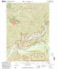
USGS Historical Quadrangle in GeoPDF.
Field measurements of flow depth and velocity and river discharge were collected from two cross-sections on the Blue River in Colorado using an acoustic Doppler current profiler (ADCP). These data were used to assess the accuracy of surface flow velocities inferred from thermal image time series, acquired from an unmanned aircraft system (UAS), via particle image velocimetry (PIV). These data sets were collected to support research focused on developing innovative methods for non-contact measurement of river discharge based on various forms of remotely sensed data. The ADCP data were collected with a SonTek RiverSurveyor S5 mounted on a hydroboard towed behind an inflatable kayak. Four passes were made across...
Categories: Data;
Types: Map Service,
OGC WFS Layer,
OGC WMS Layer,
OGC WMS Service;
Tags: Blue River,
Colorado,
Remote sensing,
River discharge,
acoustic Doppler current profiler,
This data set contains imagery from the National Agriculture Imagery Program (NAIP). The NAIP program is administered by USDA FSA and has been established to support two main FSA strategic goals centered on agricultural production. These are, increase stewardship of America's natural resources while enhancing the environment, and to ensure commodities are procured and distributed effectively and efficiently to increase food security. The NAIP program supports these goals by acquiring and providing ortho imagery that has been collected during the agricultural growing season in the U.S. The NAIP ortho imagery is tailored to meet FSA requirements and is a fundamental tool used to support FSA farm and conservation programs....
Field-based real-time kinematic (RTK) GNSS surveys of water surface elevation and channel bed topography were collected along the Blue River, focusing on two cross-sections from which remotely sensed data were obtained. These data were used to assess the accuracy of river bed elevations inferred from the ASTRALiTe bathymetric lidar, acquired from an unmanned aircraft system (UAS). These data sets were collected to support research focused on developing innovative methods for non-contact measurement of river discharge based on various forms of remotely sensed data. The RTK GNSS surveys were performed using a local base station and Trimble R8 and R10 receivers while wading the channel at each cross-section. Additional...
Categories: Data;
Types: Map Service,
OGC WFS Layer,
OGC WMS Layer,
OGC WMS Service;
Tags: Blue River,
Colorado,
bathymetry,
depth,
remote sensing,
The U.S. Geological Survey contracted with Juniper Unmanned to conduct field tests of the ASTRALiTe bathymetric lidar system on the Blue River just upstream of its confluence with the Colorado River near Kremmling, Colorado, on October 18, 2018. The objective of this project was to assess the potential to map river bathymetry (i.e., channel bed topography) using lidar data collected from an unmanned aircraft system (UAS). The ASTRALiTe lidar instrument was mounted on a DJI Matrice 600 Pro UAS owned and operated by Juniper Unmanned. As part of the study, Juniper's pilot flew the ASTRALiTe instrument across 2 river transects (cross-stream) on the Blue River. This data release includes data delivered to the USGS by...
Categories: Data;
Types: Map Service,
OGC WFS Layer,
OGC WMS Layer,
OGC WMS Service;
Tags: Blue River,
Colorado,
UAS,
Unmanned Aircraft System,
bathymetric lidar,
To suport an investigation of the feasibility of measuring river discharge using remotely sensed data acquired from an unmanned aircraft system (UAS), several types of remotely sensed data and field measurements were collected from two cross-sections on the Blue River in Colorado, just upstream of its confluence with the upper Colorado River, on October 18, 2018. This parent data release includes links to child pages for the following data sets: 1) Lidar data used for mapping channel bathymetry (depth), acquired with a novel instrument that was developed by ASTRALiTe to distinguish between returns from the water surface and riverbed based on the polarization of laser pulses. 2) Thermal image time series used to...
Types: Map Service,
OGC WFS Layer,
OGC WMS Layer,
OGC WMS Service;
Tags: Bathymetry,
Blue River,
Colorado,
Geomorphology,
Hydrology,
This data set contains imagery from the National Agriculture Imagery Program (NAIP). The NAIP program is administered by USDA FSA and has been established to support two main FSA strategic goals centered on agricultural production. These are, increase stewardship of America's natural resources while enhancing the environment, and to ensure commodities are procured and distributed effectively and efficiently to increase food security. The NAIP program supports these goals by acquiring and providing ortho imagery that has been collected during the agricultural growing season in the U.S. The NAIP ortho imagery is tailored to meet FSA requirements and is a fundamental tool used to support FSA farm and conservation programs....
This data set contains imagery from the National Agriculture Imagery Program (NAIP). The NAIP program is administered by USDA FSA and has been established to support two main FSA strategic goals centered on agricultural production. These are, increase stewardship of America's natural resources while enhancing the environment, and to ensure commodities are procured and distributed effectively and efficiently to increase food security. The NAIP program supports these goals by acquiring and providing ortho imagery that has been collected during the agricultural growing season in the U.S. The NAIP ortho imagery is tailored to meet FSA requirements and is a fundamental tool used to support FSA farm and conservation programs....
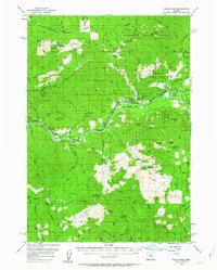
USGS Historical Quadrangle in GeoPDF.
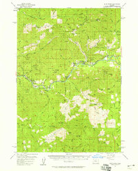
USGS Historical Quadrangle in GeoPDF.
This data is a compilation of fishery monitoring data collected by state agencies over several decades in tailwaters downriver of dams in Colorado, Utah, Montana, Wyoming, Idaho, New Mexico, Arizona, California, and Oregon. Specifically, the data contained herein is summary data used in four generalized linear mixed models that were developed to assess the biological and hydrologic factors that influence rainbow and brown trout recruitment and adult size in tailwaters across the western United States.
Categories: Data;
Types: Citation;
Tags: Anderson Ranch dam,
Beaverhead River,
Bighorn River,
Blue River,
Boysen dam,
This data set contains imagery from the National Agriculture Imagery Program (NAIP). The NAIP program is administered by USDA FSA and has been established to support two main FSA strategic goals centered on agricultural production. These are, increase stewardship of America's natural resources while enhancing the environment, and to ensure commodities are procured and distributed effectively and efficiently to increase food security. The NAIP program supports these goals by acquiring and providing ortho imagery that has been collected during the agricultural growing season in the U.S. The NAIP ortho imagery is tailored to meet FSA requirements and is a fundamental tool used to support FSA farm and conservation programs....
This dataset is a collection of hyperspectral imagery profiles of algae, many associated with Harmful Algae Blooms (HABs). Data were collected using a microscope-based hyperspectral imaging system with the cooperation of the National Institute of Standards and Technology. Samples were collected from U.S. Geological Survey (USGS) water quality sampling efforts, to include water quality parameters and algal biomass. Data are shown in basic hyperspectral imagery form, normalized to 1.
Categories: Data;
Tags: Blue Mesa Reservoir, CO,
Blue River,
Clackamas,
Cougar Reservoir,
Crane Prairie Reservoir,
The U.S. Geological Survey contracted with Juniper Unmanned to conduct field tests of the Infrared Cameras Inc. (ICI) Mirage camera on the Blue River just upstream of its confluence with the Colorado River near Kremmling, Colorado, on October 18, 2018. The objective of this project was to assess the potential to infer surface flow velocities in rivers by applying a particle image velocimetry (PIV) algorithm to aerial thermal infrared image time series collected from an unmanned aircraft system (UAS). The ICI Mirage (3-5 µm thermal IR) and a Sony DSC QX-30 (natural color) cameras were mounted on a Gremsy H7 gimbal, integrated with the ICI sensor control module (SCM), and mounted to a DJI Matrice 600 Pro UAS owned...
This data set contains imagery from the National Agriculture Imagery Program (NAIP). The NAIP program is administered by USDA FSA and has been established to support two main FSA strategic goals centered on agricultural production. These are, increase stewardship of America's natural resources while enhancing the environment, and to ensure commodities are procured and distributed effectively and efficiently to increase food security. The NAIP program supports these goals by acquiring and providing ortho imagery that has been collected during the agricultural growing season in the U.S. The NAIP ortho imagery is tailored to meet FSA requirements and is a fundamental tool used to support FSA farm and conservation programs....
|

|
