Filters: Tags: BROWN CREEK (X)
14 results (293ms)|
Filters
Date Range
Extensions Types Contacts
Categories Tag Types Tag Schemes |
This data provides an estimated raster surface of dissolved oxygen values across a region covered by an August 23, 2016 AUV survey. The raster was generated by using a natural neighbors interplator within a GIS on the empirical data set. This interpolator was chosen due to the non-normal distribution observed among the data, and its ability to produce smoother approximations than alternative interpolation methods. There are three files available for download in the 'Attached Files' section below. There is a zip file which contains the interpolated dissolved oxygen surface, an xml file which contains metadata, and a layer file which can be used to import the layer's symbology.
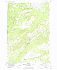
USGS Historical Quadrangle in GeoPDF.
This data provides an estimated raster surface of dissolved oxygen values across a region covered by an August 26, 2016 AUV survey. The raster was generated by using a natural neighbors interplator within a GIS on the empirical data set. This interpolator was chosen due to the non-normal distribution observed among the data, and its ability to produce smoother approximations than alternative interpolation methods. There are three files available for download in the 'Attached Files' section below. There is a zip file which contains the interpolated dissolved oxygen surface, an xml file which contains metadata, and a layer file which can be used to import the layer's symbology.
This data set contains imagery from the National Agriculture Imagery Program (NAIP). The NAIP program is administered by USDA FSA and has been established to support two main FSA strategic goals centered on agricultural production. These are, increase stewardship of America's natural resources while enhancing the environment, and to ensure commodities are procured and distributed effectively and efficiently to increase food security. The NAIP program supports these goals by acquiring and providing ortho imagery that has been collected during the agricultural growing season in the U.S. The NAIP ortho imagery is tailored to meet FSA requirements and is a fundamental tool used to support FSA farm and conservation programs....
This data set provides locations and values of water quality parameters from a survey conducted on August 24, 2016 using an Autonomous Underwater Vehicle (AUV) in Nicoll Bay, NY. During the August 24 survey, 17,808 observations of water quality parameters were made. Parameters collected include dissolved oxygen, pH, water temperature, specific conductance, and salinity. Data was collected in approximately east-west transects by the AUV, with the northern-most transects made first. Data was collected between the hours of 1 am and 5 am to obtain minimum DO values in the daily cycle. There are three files available for download in the 'Attached Files' section below. There is a zip file which contains the observation...
Categories: Data;
Types: Downloadable,
Map Service,
OGC WFS Layer,
OGC WMS Layer,
Shapefile;
Tags: Autonomous Underwater Vehicle,
Brown Creek,
Connetquot River,
Great South Bay,
Long Island,
This data set contains imagery from the National Agriculture Imagery Program (NAIP). The NAIP program is administered by USDA FSA and has been established to support two main FSA strategic goals centered on agricultural production. These are, increase stewardship of America's natural resources while enhancing the environment, and to ensure commodities are procured and distributed effectively and efficiently to increase food security. The NAIP program supports these goals by acquiring and providing ortho imagery that has been collected during the agricultural growing season in the U.S. The NAIP ortho imagery is tailored to meet FSA requirements and is a fundamental tool used to support FSA farm and conservation programs....
This data set contains imagery from the National Agriculture Imagery Program (NAIP). The NAIP program is administered by USDA FSA and has been established to support two main FSA strategic goals centered on agricultural production. These are, increase stewardship of America's natural resources while enhancing the environment, and to ensure commodities are procured and distributed effectively and efficiently to increase food security. The NAIP program supports these goals by acquiring and providing ortho imagery that has been collected during the agricultural growing season in the U.S. The NAIP ortho imagery is tailored to meet FSA requirements and is a fundamental tool used to support FSA farm and conservation programs....
This data provides an estimated raster surface of dissolved oxygen values across a region covered by an August 24, 2016 AUV survey. The raster was generated by using a natural neighbors interplator within a GIS on the empirical data set. This interpolator was chosen due to the non-normal distribution observed among the data, and its ability to produce smoother approximations than alternative interpolation methods. There are three files available for download in the 'Attached Files' section below. There is a zip file which contains the interpolated dissolved oxygen surface, an xml file which contains metadata, and a layer file which can be used to import the layer's symbology
This data set contains imagery from the National Agriculture Imagery Program (NAIP). The NAIP program is administered by USDA FSA and has been established to support two main FSA strategic goals centered on agricultural production. These are, increase stewardship of America's natural resources while enhancing the environment, and to ensure commodities are procured and distributed effectively and efficiently to increase food security. The NAIP program supports these goals by acquiring and providing ortho imagery that has been collected during the agricultural growing season in the U.S. The NAIP ortho imagery is tailored to meet FSA requirements and is a fundamental tool used to support FSA farm and conservation programs....
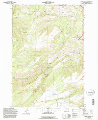
USGS Historical Quadrangle in GeoPDF.
This data set provides locations and values of water quality parameters from a survey conducted on August 25, 2016 using an Autonomous Underwater Vehicle (AUV) in Nicoll Bay, NY. During the August 25 survey, 12,275 observations of water quality parameters were made. Parameters collected include dissolved oxygen, pH, water temperature, specific conductance, and salinity. Data was collected in approximately east-west transects by the AUV, with the northern-most transects made first. Data was collected between the hours of 1 am and 5 am to obtain minimum DO values in the daily cycle. There are three files available for download in the 'Attached Files' section below. There is a zip file which contains the observation...
Categories: Data;
Types: Downloadable,
Map Service,
OGC WFS Layer,
OGC WMS Layer,
Shapefile;
Tags: Autonomous Underwater Vehicle,
Brown Creek,
Connetquot River,
Great South Bay,
Long Island,
This data set provides locations and values of water quality paramters from a survey conducted on August 26, 2016 using an Autonomous Underwater Vehicle (AUV) in Patchogue Bay, NY. During the August 26 survey, 16,487 observations of water quality parameters were made. Parameters collected include dissolved oxygen, pH, water temperature, specific conductance, and salinity. Data was collected in approximately east-west transects by the AUV, with the northern-most transects made first. Data was collected between the hours of 1 am and 5 am to obtain minimum DO values in the daily cycle. There are three files available for download in the 'Attached Files' section below. There is a zip file which contains the observation...
Categories: Data;
Types: Downloadable,
Map Service,
OGC WFS Layer,
OGC WMS Layer,
Shapefile;
Tags: Autonomous Underwater Vehicle,
Brown Creek,
Connetquot River,
Great South Bay,
Long Island,
This data provides an estimated raster surface of dissolved oxygen values across a region covered by an August 25, 2016 AUV survey. The raster was generated by using a natural neighbors interplator within a GIS on the empirical data set. This interpolator was chosen due to the non-normal distribution observed among the data, and its ability to produce smoother approximations than alternative interpolation methods. There are three files available for download in the 'Attached Files' section below. There is a zip file which contains the interpolated dissolved oxygen surface, an xml file which contains metadata, and a layer file which can be used to import the layer's symbology
This data set provides locations and values of water quality parametersters from a survey conducted on August 23, 2016 using an Autonomous Underwater Vehicle (AUV) in Nicoll Bay, NY. During the August 23 survey, 13,910 observations of water quality parameters were made. Parameters collected include dissolved oxygen, pH, water temperature, specific conductance, and salinity. Data was collected in approximately east-west transects by the AUV, with the northern-most transects made first. Data was collected between the hours of 1 am and 5 am to obtain minimum DO values in the daily cycle. There are three files available for download in the 'Attached Files' section below. There is a zip file which contains the observation...
Categories: Data;
Types: Downloadable,
Map Service,
OGC WFS Layer,
OGC WMS Layer,
Shapefile;
Tags: Autonomous Underwater Vehicle,
Brown Creek,
Connetquot River,
Great South Bay,
Long Island,
|

|
