Filters: Tags: Baggs (X)
17 results (13ms)|
Filters
Date Range
Extensions Types Contacts
Categories Tag Types Tag Schemes |
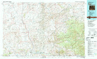
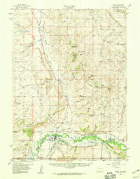
USGS Historical Quadrangle in GeoPDF.
Mule deer in the Atlantic Rim South population are part of the Baggs herd unit that is managed for approximately 19,000 animals. These mule deer winter in the sagebrush canyons and basins north and west of Baggs, Wyoming and migrate north and east 20–50 mi (32–80 km) to various summer ranges (fig. 23). Many of these deer must navigate coal-bed methane developments situated along the migration route between their seasonal ranges. In addition to navigating gas developments, many of these deer cross Highway 789 during winter and migration. The Wyoming Department of Transportation (WYDOT) recently installed two underpasses and several mi of game-proof fencing to facilitate highway crossings across Highway 789 and help...
Categories: Data;
Types: Downloadable,
Map Service,
OGC WFS Layer,
OGC WMS Layer,
Shapefile;
Tags: Baggs,
United States,
Wyoming,
animal behavior,
migration (organisms),
The Baggs Mule Deer Corridor was officially designated by the Wyoming Game and Fish Department (WGFD) in 2018 (fig. 24). The Baggs Herd is managed for approximately 19,000 animals, and the corridor is based on two wintering deer populations: a northern and southern segment. Animals in the north segment occupy a relatively small winter range along a pinyon-juniper ridge that runs along the east side of Highway 789. From there, deer migrate north and west to summer ranges on Atlantic Rim, the Sand Hills, and the head of Savery Creek. The southern segment occupies a larger sagebrush winter range on both sides of Highway 789, some of which extends into Colorado. These animals migrate north and west to summer ranges...
Categories: Data;
Types: Downloadable,
Map Service,
OGC WFS Layer,
OGC WMS Layer,
Shapefile;
Tags: Baggs,
United States,
animal behavior,
economy,
environment,
Mule deer in the Platte Valley North population are part of the larger Platte Valley herd unit with an estimated population of 11,000 animals (fig. 28). These mule deer winter in the sagebrush canyons and basins near the Platte River north of Saratoga, Wyoming. Other segments of this population winter in the Chokecherry Knob area, south of Sinclair, and the Dana Ridge area just north of I-80. The migratory patterns of these deer are diverse and vary with each winter range. Deer in this part of the Platte Valley have a noticeably higher proportion of resident animals compared to the Platte Valley South population. For example, half of the mule deer near I-80 are residents. Improving the connectivity of deer migration...
Categories: Data;
Types: Downloadable,
Map Service,
OGC WFS Layer,
OGC WMS Layer,
Shapefile;
Tags: Baggs,
United States,
Wyoming,
animal behavior,
migration (organisms),
This data set contains imagery from the National Agriculture Imagery Program (NAIP). The NAIP program is administered by USDA FSA and has been established to support two main FSA strategic goals centered on agricultural production. These are, increase stewardship of America's natural resources while enhancing the environment, and to ensure commodities are procured and distributed effectively and efficiently to increase food security. The NAIP program supports these goals by acquiring and providing ortho imagery that has been collected during the agricultural growing season in the U.S. The NAIP ortho imagery is tailored to meet FSA requirements and is a fundamental tool used to support FSA farm and conservation programs....
This data set contains imagery from the National Agriculture Imagery Program (NAIP). The NAIP program is administered by USDA FSA and has been established to support two main FSA strategic goals centered on agricultural production. These are, increase stewardship of America's natural resources while enhancing the environment, and to ensure commodities are procured and distributed effectively and efficiently to increase food security. The NAIP program supports these goals by acquiring and providing ortho imagery that has been collected during the agricultural growing season in the U.S. The NAIP ortho imagery is tailored to meet FSA requirements and is a fundamental tool used to support FSA farm and conservation programs....
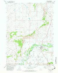
This data contains fences within the southwest portion of Wyoming at a 1:100,000 scale. A two and one-half year inventory of fences on federal lands was conducted by the Bureau of Land Management (BLM) from 1990 to 1992. The attribute fields describe the type of fences, the 30 x 60- minute quadrangle map which they are found, the ownership of the land, the year the fence was built, and their location according to township, range and section.
The Baggs Mule Deer Corridor was officially designated by the Wyoming Game and Fish Department (WGFD) in 2018 (fig. 24). The Baggs Herd is managed for approximately 19,000 animals, and the corridor is based on two wintering deer populations: a northern and southern segment. Animals in the north segment occupy a relatively small winter range along a pinyon-juniper ridge that runs along the east side of Highway 789. From there, deer migrate north and west to summer ranges on Atlantic Rim, the Sand Hills, and the head of Savery Creek. The southern segment occupies a larger sagebrush winter range on both sides of Highway 789, some of which extends into Colorado. These animals migrate north and west to summer ranges...
Categories: Data;
Types: Downloadable,
Map Service,
OGC WFS Layer,
OGC WMS Layer,
Shapefile;
Tags: Baggs,
United States,
animal behavior,
economy,
environment,
This data set contains imagery from the National Agriculture Imagery Program (NAIP). The NAIP program is administered by USDA FSA and has been established to support two main FSA strategic goals centered on agricultural production. These are, increase stewardship of America's natural resources while enhancing the environment, and to ensure commodities are procured and distributed effectively and efficiently to increase food security. The NAIP program supports these goals by acquiring and providing ortho imagery that has been collected during the agricultural growing season in the U.S. The NAIP ortho imagery is tailored to meet FSA requirements and is a fundamental tool used to support FSA farm and conservation programs....
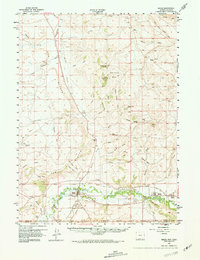
USGS Historical Quadrangle in GeoPDF.
This data set contains imagery from the National Agriculture Imagery Program (NAIP). The NAIP program is administered by USDA FSA and has been established to support two main FSA strategic goals centered on agricultural production. These are, increase stewardship of America's natural resources while enhancing the environment, and to ensure commodities are procured and distributed effectively and efficiently to increase food security. The NAIP program supports these goals by acquiring and providing ortho imagery that has been collected during the agricultural growing season in the U.S. The NAIP ortho imagery is tailored to meet FSA requirements and is a fundamental tool used to support FSA farm and conservation programs....
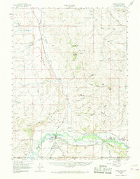
USGS Historical Quadrangle in GeoPDF.
Mule deer in the Atlantic Rim North population are part of the Baggs herd unit that is managed for approximately 19,000 animals. These mule deer winter in the pinyon-juniper and sagebrush badlands near Dad, Wyoming and migrate north and east 10–35 mi (16–56 km) to various summer ranges (fig. 22). Many of these deer must navigate coal-bed methane development that is situated along the migration route between their seasonal ranges. In addition to gas development, portions of their summer range overlap with areas of wind-energy development; roadway mortality remains an issue on Highway 789. These data provide the location of migration routes for mule deer (Odocoileus hemionus) in the Clarks Fork population in Wyoming....
Categories: Data;
Types: Downloadable,
Map Service,
OGC WFS Layer,
OGC WMS Layer,
Shapefile;
Tags: Baggs,
United States,
Wyoming,
animal behavior,
migration (organisms),
USGS Historical Quadrangle in GeoPDF.
USGS Historical Quadrangle in GeoPDF.
This data set contains imagery from the National Agriculture Imagery Program (NAIP). The NAIP program is administered by USDA FSA and has been established to support two main FSA strategic goals centered on agricultural production. These are, increase stewardship of America's natural resources while enhancing the environment, and to ensure commodities are procured and distributed effectively and efficiently to increase food security. The NAIP program supports these goals by acquiring and providing ortho imagery that has been collected during the agricultural growing season in the U.S. The NAIP ortho imagery is tailored to meet FSA requirements and is a fundamental tool used to support FSA farm and conservation programs....
This data set contains imagery from the National Agriculture Imagery Program (NAIP). The NAIP program is administered by USDA FSA and has been established to support two main FSA strategic goals centered on agricultural production. These are, increase stewardship of America's natural resources while enhancing the environment, and to ensure commodities are procured and distributed effectively and efficiently to increase food security. The NAIP program supports these goals by acquiring and providing ortho imagery that has been collected during the agricultural growing season in the U.S. The NAIP ortho imagery is tailored to meet FSA requirements and is a fundamental tool used to support FSA farm and conservation programs....
|

|
