Filters: Tags: Baker Island (X)
5 results (29ms)|
Filters
Date Range
Types Contacts
Categories Tag Types Tag Schemes |
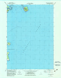
USGS Historical Quadrangle in GeoPDF.
This data set contains imagery from the National Agriculture Imagery Program (NAIP). The NAIP program is administered by USDA FSA and has been established to support two main FSA strategic goals centered on agricultural production. These are, increase stewardship of America's natural resources while enhancing the environment, and to ensure commodities are procured and distributed effectively and efficiently to increase food security. The NAIP program supports these goals by acquiring and providing ortho imagery that has been collected during the agricultural growing season in the U.S. The NAIP ortho imagery is tailored to meet FSA requirements and is a fundamental tool used to support FSA farm and conservation programs....

USGS Historical Quadrangle in GeoPDF.
Ferromanganese crust samples were collected via dredge during four oceanographic research cruises to the western equatorial Pacific Ocean. The location (latitude, longitude, depth) and concentrations of 27 major and trace elements in the most recent growth layers of ferromanganese crusts from 57 dredge sites are presented here, as well as select seawater chemistry at each location. These data were used in statistical analyses to determine how oceanographic conditions affect the chemical composition of ferromanganese crusts throughout the region. The changes in ferromanganese crust composition show that modern measurements of these primary oceanographic parameters, as well as paleoceanographic reconstructions, can...
Categories: Data;
Tags: Assessments,
Baker Island,
CMHRP,
Coastal and Marine Hazards and Resources Program,
Geochemistry,
This data set contains imagery from the National Agriculture Imagery Program (NAIP). The NAIP program is administered by USDA FSA and has been established to support two main FSA strategic goals centered on agricultural production. These are, increase stewardship of America's natural resources while enhancing the environment, and to ensure commodities are procured and distributed effectively and efficiently to increase food security. The NAIP program supports these goals by acquiring and providing ortho imagery that has been collected during the agricultural growing season in the U.S. The NAIP ortho imagery is tailored to meet FSA requirements and is a fundamental tool used to support FSA farm and conservation programs....
|

|
