Filters: Tags: Barstow (X)
26 results (381ms)|
Filters
Date Range
Types Contacts
Categories Tag Types Tag Schemes |
The National Aeronautics and Space Administration, working with members of the scientific community, has determined that early manned lunar exploration will be oriented primarily to investigations in the geosciences. Exploration by man on the lunar surface will, therefore be geological, geophysical, geochemical, geochemical, and surveying in nature, and will be directed to the physical and chemical characteristics of the lunar crust, and to measurements that will furnish data pertinent to understanding the physics of the Moon. Scientific exploration of the Moon will provide information fundamental to understanding the origin and composition of the Solar System, and engineering data important to the design of specific...
This data set contains imagery from the National Agriculture Imagery Program (NAIP). The NAIP program is administered by USDA FSA and has been established to support two main FSA strategic goals centered on agricultural production. These are, increase stewardship of America's natural resources while enhancing the environment, and to ensure commodities are procured and distributed effectively and efficiently to increase food security. The NAIP program supports these goals by acquiring and providing ortho imagery that has been collected during the agricultural growing season in the U.S. The NAIP ortho imagery is tailored to meet FSA requirements and is a fundamental tool used to support FSA farm and conservation programs....
This dataset provides geochronologic and geochemical data for selected metasedimentary and associated rock samples collected in the Lane Mountain area about 20 kilometers northeast of Barstow, California. Geochronologic data were obtained for 24 samples, and geochemical data were obtained for 5 of these. The dataset consists of four tables in csv (comma separated values) format: (1) sample localities and lithology; (2) LA-SF-ICPMS (Laser Ablation Sector Field Inductively Coupled Plasma Mass Spectrometry) U-Pb (uranium-lead) zircon geochronologic data; (3) SHRIMP-RG (Sensitive High-Resolution Ion Microprobe-Reverse Geometry) U-Pb zircon geochronologic data; and (4) whole-rock geochemical data determined by ICP-AES-MS...
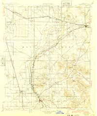
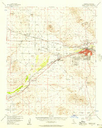
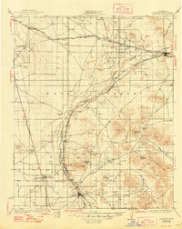
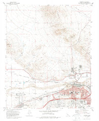
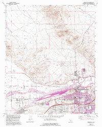
USGS Historical Quadrangle in GeoPDF.
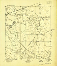
USGS Historical Quadrangle in GeoPDF.

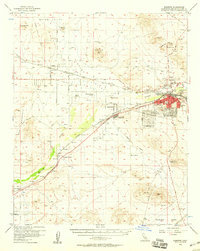
USGS Historical Quadrangle in GeoPDF.
Data for groundwater-levels measured in 616 wells during water year 2020 (November 2019-June 2020) by the United States Geological Survey (USGS), the Mojave Water Agency (MWA), and other local water districts were compiled to construct a regional water-table shapefile for 2020. The regional water-table shapefile shows the elevation of the water table in and around the Mojave River and Morongo areas, in San Bernardino County, California.
Types: Map Service,
OGC WFS Layer,
OGC WMS Layer,
OGC WMS Service;
Tags: Barstow,
California,
Coyote Lake,
Hydrology,
Joshua Tree North,
This data release contains numerical U- and Th-isotopic data used to calculate uranium-series age estimates and initial 234U/238U activity ratios for samples of carbonate-rich clast coatings, oncoidal tufa rinds, calcite-replaced rhizoliths, carbonate nodules, and ostracod shells from sites associated with different lake levels of paleo Lake Manix near Barsow, CA. In addition, measured U concentrations and 234U/238U activity ratios for modern streamflow in the Mojave River and shallow groundwater from wells along the course of the Mojave River and nearby vicinity are included to help define the uranium-isotope composition of water that likely supplied paleolakes. Electronic data included herein support age interpretations...
This data set contains imagery from the National Agriculture Imagery Program (NAIP). The NAIP program is administered by USDA FSA and has been established to support two main FSA strategic goals centered on agricultural production. These are, increase stewardship of America's natural resources while enhancing the environment, and to ensure commodities are procured and distributed effectively and efficiently to increase food security. The NAIP program supports these goals by acquiring and providing ortho imagery that has been collected during the agricultural growing season in the U.S. The NAIP ortho imagery is tailored to meet FSA requirements and is a fundamental tool used to support FSA farm and conservation programs....
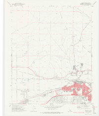
USGS Historical Quadrangle in GeoPDF.
These data on the concentrations of 27 selected elements were collected using a field portable (handheld) X-ray fluorescence (pXRF) instrument (Groover and Izbicki, 2016) equipped with a 4-watt Ta/Au X-ray tube on samples of 1) surficial alluvium, 2) rock, and 3) archived core material and drill cuttings from monitoring wells across an approximately 14,300 square kilometer area in the western part of the Mojave Desert, between 60 to 210 kilometers (km) northeast of Los Angeles, California. These samples were measured using a pXRF as part of a regional-scale investigation of naturally-occurring trace elements (including arsenic, chromium, and uranium) dissolved in groundwater (Groover and Izbicki, 2018), and a local-scale...
Types: Map Service,
OGC WFS Layer,
OGC WMS Layer,
OGC WMS Service;
Tags: Arsenic,
Barstow,
California (CA),
Chromium,
El Mirage,
USGS Historical Quadrangle in GeoPDF.
USGS Historical Quadrangle in GeoPDF.
Data for groundwater-levels measured in 707 wells during January-July 2018 by the United States Geological Survey (USGS), the Mojave Water Agency (MWA), and other local water districts were compiled to construct a regional water-table shapefile for 2018. The regional water-table shapefile shows the elevation of the water table in and around the Mojave River and Morongo areas, in San Bernardino County, California.
Types: Map Service,
OGC WFS Layer,
OGC WMS Layer,
OGC WMS Service;
Tags: Barstow,
California,
Coyote Lake,
Hydrology,
Joshua Tree North,
USGS Historical Quadrangle in GeoPDF.
This data set contains imagery from the National Agriculture Imagery Program (NAIP). The NAIP program is administered by USDA FSA and has been established to support two main FSA strategic goals centered on agricultural production. These are, increase stewardship of America's natural resources while enhancing the environment, and to ensure commodities are procured and distributed effectively and efficiently to increase food security. The NAIP program supports these goals by acquiring and providing ortho imagery that has been collected during the agricultural growing season in the U.S. The NAIP ortho imagery is tailored to meet FSA requirements and is a fundamental tool used to support FSA farm and conservation programs....

USGS Historical Quadrangle in GeoPDF.
USGS Historical Quadrangle in GeoPDF.
USGS Historical Quadrangle in GeoPDF.
These data were collected using field portable (handheld) X-ray fluorescence (pXRF) equipped with a 4-watt Ta/Au X-ray tube. Samples of surficial alluvium, rock, and archived drill cuttings from monitoring wells in the western part of the Mojave Desert, 60 to 210 kilometers (km) northeast of Los Angeles, California, were measured using as part of an investigation of naturally-occurring trace elements dissolved in groundwater. Surficial alluvium samples were collected from small stream channels draining distinct geologic units, or from previously mapped river deposits, and generally consisted of silt, sand, and granules to small pebbles. Twigs and other detritus were removed prior to measurement. Rocks were collected...
|

|
