Filters: Tags: Basalt (X)
141 results (30ms)|
Filters
Date Range
Extensions Types Contacts
Categories Tag Types
|
The 2018 lower East Rift Zone eruption of Kilauea Volcano began in the late afternoon of 3 May, with fissure 1 opening and erupting lava onto Mohala Street in the Leilani Estates subdivision, part of the lower Puna District of the Island of Hawai'i. For the first week of the eruption, relatively viscous lava flowed only within a kilometer (0.6 miles) of the fissures within Leilani Estates, before activity shifted downrift (east-northeast) and out of the subdivision during mid-May. Around 18 May, activity along the lower East Rift Zone intensified, and fluid lava erupting at higher effusion rates from the downrift fissures reached the ocean within two days. Near the end of May, this more vigorous activity shifted...
Categories: Data;
Types: Downloadable,
Map Service,
OGC WFS Layer,
OGC WMS Layer,
Shapefile;
Tags: East Rift Zone,
Fissures06And13Flow,
Green Lake,
Hawai'i,
Hawaii,
The Taupo Volcanic Zone (TVZ), New Zealand, is the most productive area of explosive silicic volcanism in the world. Faulted early and middle Pleistocene volcanic products are generally concealed beneath voluminous, generally unfaulted, younger volcanic products. An exception is the southeast margin of the TVZ where the two parallel, northeast-trending Paeroa and Te Weta Fault blocks expose Quaternary volcanic products consisting predominantly of caldera-related, rhyolitic ignimbrites and lacustrine sediments. The Taupo-Reporoa Basin is situated along the eastern part of the map area, and its northernmost part underwent collapse to form Reporoa Caldera. The Paeroa Fault block is the largest exposed fault block within...
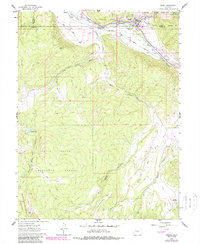
USGS Historical Quadrangle in GeoPDF.
Core Research Center, cutting FC02466, from well operated by SKELLYRaw Properties from download, web scrape, MapServer, and Macrostrat API{"Lib Num": "FC02466", "API Num": "0201505053", "Operator": "SKELLY", "Well Name": "1 ARIZ FED A", "Field": null, "State": "AZ", "County": "MOHAVE", "Thin Sec": "F", "Analysis": "F", "Latitude": "36.8084547", "Longitude": "-113.008749", "coordinates_geohash": "9qx9kkv8c332", "Source": "FROM STATE RECORDS", "Min": "0", "Max": "4030", "Security Flag": null, "crc_collection_name": "cutting", "sb_parent_id": "4f4e49d8e4b07f02db5df2d2", "intervals": [{"Formation": null, "Age": null, "Min Depth": null, "Max Depth": null}], "crcwc_url": "https://my.usgs.gov/crcwc/cutting/report/50784",...
Categories: Physical Item;
Tags: Lower Triassic,
Shnabkaib Member,
Shnabkaib Member,
basalt,
dolomite,
Core Research Center, cutting FC00174, from well operated by EL PASO NAT GASRaw Properties from download, web scrape, MapServer, and Macrostrat API{"Lib Num": "FC00174", "API Num": "0200560001", "Operator": "EL PASO NAT GAS", "Well Name": "5 WILLIAMS", "Field": null, "State": "AZ", "County": "COCONINO", "Thin Sec": "F", "Analysis": "F", "Latitude": "35.3217", "Longitude": "-111.901091", "coordinates_geohash": "9w22vwh5gd4g", "Source": "CENTER OF QUARTER SECTION", "Min": "460", "Max": "2350", "Security Flag": null, "crc_collection_name": "cutting", "sb_parent_id": "4f4e49d8e4b07f02db5df2d2", "intervals": [{"Formation": null, "Age": null, "Min Depth": null, "Max Depth": null}], "crcwc_url": "https://my.usgs.gov/crcwc/cutting/report/46878",...
Categories: Physical Item;
Tags: Holocene to middle Pliocene basaltic rocks,
Zanclean - Holocene,
andesite,
basalt,
dacite,
Core Research Center, cutting DZ14033, from well operated by WEBB RESOURCES TRICO PETR INCRaw Properties from download, web scrape, MapServer, and Macrostrat API{"Lib Num": "DZ14033", "API Num": "0510706010", "Operator": "WEBB RESOURCES TRICO PETR INC", "Well Name": "17-15 FEDERAL FLATTOP", "Field": null, "State": "CO", "County": "ROUTT", "Thin Sec": "F", "Analysis": "F", "Latitude": "40.233804", "Longitude": "-107.191915", "coordinates_geohash": "9x5ubu34zkej", "Source": "FROM STATE RECORDS", "Min": "0", "Max": "4325", "Security Flag": null, "crc_collection_name": "cutting", "sb_parent_id": "4f4e49d8e4b07f02db5df2d2", "intervals": [{"Formation": null, "Age": null, "Min Depth": null, "Max Depth": null}], "crcwc_url":...
Core Research Center, cutting FC00467, from well operated by CITY OF FLAGSTAFFRaw Properties from download, web scrape, MapServer, and Macrostrat API{"Lib Num": "FC00467", "API Num": "0200505007", "Operator": "CITY OF FLAGSTAFF", "Well Name": "1 FLAGSTAFF", "Field": null, "State": "AZ", "County": "COCONINO", "Thin Sec": "F", "Analysis": "F", "Latitude": "35.158686", "Longitude": "-111.727979", "coordinates_geohash": "9w28186njqhe", "Source": "CENTER OF SECTION", "Min": "0", "Max": "610", "Security Flag": null, "crc_collection_name": "cutting", "sb_parent_id": "4f4e49d8e4b07f02db5df2d2", "intervals": [{"Formation": null, "Age": null, "Min Depth": null, "Max Depth": null}], "crcwc_url": "https://my.usgs.gov/crcwc/cutting/report/47934",...
Categories: Physical Item;
Tags: Holocene to middle Pliocene basaltic rocks,
Zanclean - Holocene,
andesite,
basalt,
dacite,
This data set contains imagery from the National Agriculture Imagery Program (NAIP). The NAIP program is administered by USDA FSA and has been established to support two main FSA strategic goals centered on agricultural production. These are, increase stewardship of America's natural resources while enhancing the environment, and to ensure commodities are procured and distributed effectively and efficiently to increase food security. The NAIP program supports these goals by acquiring and providing ortho imagery that has been collected during the agricultural growing season in the U.S. The NAIP ortho imagery is tailored to meet FSA requirements and is a fundamental tool used to support FSA farm and conservation programs....
Kasatochi is a small, isolated island volcano in the center of the Aleutian Island chain. It consists of a roughly circular cone approximately 3 km in diameter with a lake-filled central crater that is 1.2 km in diameter and extends from the highest point on the island to sea level. The oldest unit recognized is a thick series of mid-Pleistocene glaciovolcanic deposits consisting of autobrecciated lava, lahars, and volumetrically minor lava masses that we believe to have been emplaced underneath a regional ice cap. This unit is unconformably overlain by several massive Holocene lavas, above which lies a thick sequence of latest-Holocene pyroclastic deposits likely deposited during the crater-forming eruption. The...
Re-analyses of sample pulps and bulk rejects from historic USBM rock and heavy-mineral-concentrate samples were conducted by the Alaska Division of Geological & Geophysical Surveys (DGGS) as part of the State of Alaska's Strategic and Critical Minerals Assessment project, which is designed to evaluate Alaska's potential for these resources. The objective of this resource assessment is to expand the state's geochemical database by obtaining and publishing modern, quantitative geochemical analyses for historic USBM samples, where available. Highlights of this re-analysis project include heavy mineral concentrates with up 7,220 ppm Sn, 5,870 ppm Cr, and 17,000 ppm Mn.
The 2018 lower East Rift Zone eruption of Kilauea Volcano began in the late afternoon of 3 May, with fissure 1 opening and erupting lava onto Mohala Street in the Leilani Estates subdivision, part of the lower Puna District of the Island of Hawai'i. For the first week of the eruption, relatively viscous lava flowed only within a kilometer (0.6 miles) of the fissures within Leilani Estates, before activity shifted downrift (east-northeast) and out of the subdivision during mid-May. Around 18 May, activity along the lower East Rift Zone intensified, and fluid lava erupting at higher effusion rates from the downrift fissures reached the ocean within two days. Near the end of May, this more vigorous activity shifted...
Categories: Data;
Types: Downloadable,
Map Service,
OGC WFS Layer,
OGC WMS Layer,
Shapefile;
Tags: East Rift Zone,
Fissure15FlowA,
Green Lake,
Hawai'i,
Hawaii,
The 2018 lower East Rift Zone eruption of Kilauea Volcano began in the late afternoon of 3 May, with fissure 1 opening and erupting lava onto Mohala Street in the Leilani Estates subdivision, part of the lower Puna District of the Island of Hawai'i. For the first week of the eruption, relatively viscous lava flowed only within a kilometer (0.6 miles) of the fissures within Leilani Estates, before activity shifted downrift (east-northeast) and out of the subdivision during mid-May. Around 18 May, activity along the lower East Rift Zone intensified, and fluid lava erupting at higher effusion rates from the downrift fissures reached the ocean within two days. Near the end of May, this more vigorous activity shifted...
Categories: Data;
Types: Downloadable,
Map Service,
OGC WFS Layer,
OGC WMS Layer,
Shapefile;
Tags: East Rift Zone,
Fissure19Flow,
Green Lake,
Hawai'i,
Hawaii,
A database of geologic map of Three Sisters Volcanic Cluster as described in the original abstract: The geologic map represents part of a late Quaternary volcanic field within which scores of eruptions have taken place over the last 50,000 years, some as recently as ~1,500 years ago. No rocks of early Pleistocene (or greater) age crop out within the map area, although volcanic and derivative sedimentary rocks of Miocene and Pliocene age are widespread to the east and west and are certainly buried beneath the younger volcanic field. Of the 145 volcanic map units described herein, only 22 are certainly older than late Pleistocene (>126 ka), and 12 are postglacial (<15 ka). The oldest unit identified yields an age...
Categories: Data;
Types: ArcGIS REST Map Service,
ArcGIS Service Definition,
Downloadable,
Map Service;
Tags: Andesite,
Basalt,
Basaltic andesite,
Bend, Oregon,
Dacite,
Core Research Center, cutting DC01441, from well operated by HEDGES-MACKIERaw Properties from download, web scrape, MapServer, and Macrostrat API{"Lib Num": "DC01441", "API Num": "3000707038", "Operator": "HEDGES-MACKIE", "Well Name": "1 MCDANIEL-HMB", "Field": null, "State": "NM", "County": "COLFAX", "Thin Sec": "F", "Analysis": "F", "Latitude": "36.3490802774", "Longitude": "-105.0468481143", "coordinates_geohash": "9wmqc95hxp8v", "Source": "CENTER OF QUARTER SECTION", "Min": "29", "Max": "657", "Security Flag": null, "crc_collection_name": "cutting", "sb_parent_id": "4f4e49d8e4b07f02db5df2d2", "intervals": [{"Formation": null, "Age": null, "Min Depth": null, "Max Depth": null}], "crcwc_url": "https://my.usgs.gov/crcwc/cutting/report/45827",...
Core Research Center, cutting CZ14078, from well operated by CONOCORaw Properties from download, web scrape, MapServer, and Macrostrat API{"Lib Num": "CZ14078", "API Num": "1101990000", "Operator": "CONOCO", "Well Name": "1 GENTILE VALLEY", "Field": "WILDCAT", "State": "ID", "County": "BONNEVILLE", "Thin Sec": "F", "Analysis": "F", "Latitude": "43.08935", "Longitude": "-111.53288", "coordinates_geohash": "9x8tnh0jxt0b", "Source": "FROM STATE RECORDS", "Min": "167", "Max": "9907", "Security Flag": null, "crc_collection_name": "cutting", "sb_parent_id": "4f4e49d8e4b07f02db5df2d2", "intervals": [{"Formation": null, "Age": null, "Min Depth": null, "Max Depth": null}], "crcwc_url": "https://my.usgs.gov/crcwc/cutting/report/27277",...
Categories: Physical Item;
Tags: Basalt (Pleistocene and Pliocene),
Piacenzian - Late Pleistocene,
basalt
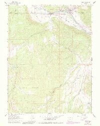
USGS Historical Quadrangle in GeoPDF.
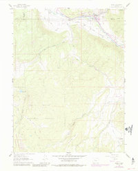
USGS Historical Quadrangle in GeoPDF.
Core Research Center, cutting CZ12742, from well operated by POLUMBUS CORPORATIONRaw Properties from download, web scrape, MapServer, and Macrostrat API{"Lib Num": "CZ12742", "API Num": "4902920641", "Operator": "POLUMBUS CORPORATION", "Well Name": "29-1 CARTER MOUNTAIN", "Field": "WC", "State": "WY", "County": "PARK", "Thin Sec": "F", "Analysis": "F", "Latitude": "44.19167", "Longitude": "-109.26069", "coordinates_geohash": "9xf73syg1kke", "Source": "FROM STATE RECORDS", "Min": "380", "Max": "5820", "Security Flag": null, "crc_collection_name": "cutting", "sb_parent_id": "4f4e49d8e4b07f02db5df2d2", "intervals": [{"Formation": null, "Age": null, "Min Depth": null, "Max Depth": null}], "crcwc_url": "https://my.usgs.gov/crcwc/cutting/report/24328",...
Categories: Physical Item;
Tags: Absaroka Volcanic Supergroup: Sunlight Group,
Eocene,
Sunlight Group,
andesite,
basalt,
Core Research Center, cutting DZ19794, from well operated by CHEVRON USARaw Properties from download, web scrape, MapServer, and Macrostrat API{"Lib Num": "DZ19794", "API Num": "0510706129", "Operator": "CHEVRON USA", "Well Name": "1-19 FEDERAL", "Field": null, "State": "CO", "County": "ROUTT", "Thin Sec": "F", "Analysis": "F", "Latitude": "40.039497", "Longitude": "-106.964207", "coordinates_geohash": "9x5gvbzncr4r", "Source": "FROM STATE RECORDS", "Min": "120", "Max": "5220", "Security Flag": null, "crc_collection_name": "cutting", "sb_parent_id": "4f4e49d8e4b07f02db5df2d2", "intervals": [{"Formation": null, "Age": null, "Min Depth": null, "Max Depth": null}], "crcwc_url": "https://my.usgs.gov/crcwc/cutting/report/42657",...
Core Research Center, cutting DZ18910, from well operated by ARCO OIL & GASRaw Properties from download, web scrape, MapServer, and Macrostrat API{"Lib Num": "DZ18910", "API Num": "4302730028", "Operator": "ARCO OIL & GAS", "Well Name": "1 MEADOW FEDERAL", "Field": null, "State": "UT", "County": "MILLARD", "Thin Sec": "F", "Analysis": "F", "Latitude": "38.87292", "Longitude": "-112.58651", "coordinates_geohash": "9qzvnh950jt2", "Source": "FROM STATE RECORDS", "Min": "600", "Max": "15000", "Security Flag": null, "crc_collection_name": "cutting", "sb_parent_id": "4f4e49d8e4b07f02db5df2d2", "intervals": [{"Formation": null, "Age": null, "Min Depth": null, "Max Depth": null}], "crcwc_url": "https://my.usgs.gov/crcwc/cutting/report/41881",...
Categories: Physical Item;
Tags: Fine-grained lacustrine deposits over basalt of Beaver Ridge,
Quaternary,
alluvium,
basalt
|

|
