Filters: Tags: Basalt (X)
141 results (38ms)|
Filters
Date Range
Extensions Types Contacts
Categories Tag Types
|
This geologic database is a digitized version of the 1:24,000-scale original analog geologic map titled "Geologic map of the Parker NW, Parker, and parts of the Whipple Mountains SW and Whipple Wash quadrangles, California and Arizona", published by the U.S. Geological Survey (USGS) in 1980. The map area straddles the Arizona-California border and includes the community of Parker, AZ, and the southeastern part of the Whipple Mountains, where the prominent Whipple Mountains Detachment Fault separates lower plate Cretaceous and older gneisses from upper plate crystalline, volcanic, and sedimentary rocks. The Whipple Mountains are surrounded by numerous Neogene sedimentary units that record the arrival and subsequent...
Core Research Center, core R244, from well operated by COLORADO SCHOOL OF MINESRaw Properties from download, web scrape, MapServer, and Macrostrat API{"Lib Num": "R244", "API Num": null, "Operator": "COLORADO SCHOOL OF MINES", "Well Name": "KELLER WELL / NSF WELL", "Field": null, "State": "HI", "County": "HAWAII", "Type": "FULL", "Photos": "F", "Thin Sec": "F", "Analysis": "T", "Latitude": "19.39861111", "Longitude": "-155.28222222", "coordinates_geohash": "8e3w67qvjgny", "Source": "PROVIDED BY DONOR", "Security Flag": null, "crc_collection_name": "core", "sb_parent_id": "4f4e49dae4b07f02db5e0486", "intervals": [{"Formation": null, "Age": null, "Min Depth": null, "Max Depth": null}], "crcwc_url": "https://my.usgs.gov/crcwc/core/report/117461",...
Core Research Center, cutting DZ16917, from well operated by KINO OIL CO.Raw Properties from download, web scrape, MapServer, and Macrostrat API{"Lib Num": "DZ16917", "API Num": "0202520011", "Operator": "KINO OIL CO.", "Well Name": "1 COPE-BRADSHAW", "Field": "SEDONA", "State": "AZ", "County": "YAVAPAI", "Thin Sec": "F", "Analysis": "F", "Latitude": "34.90333431", "Longitude": "-111.925388", "coordinates_geohash": "9w0qt1fqtmjg", "Source": "FROM STATE RECORDS", "Min": "100", "Max": "3200", "Security Flag": null, "crc_collection_name": "cutting", "sb_parent_id": "4f4e49d8e4b07f02db5df2d2", "intervals": [{"Formation": null, "Age": null, "Min Depth": null, "Max Depth": null}], "crcwc_url": "https://my.usgs.gov/crcwc/cutting/report/40115",...
Categories: Physical Item;
Tags: Pliocene-Miocene,
Sedimentary rocks,
basalt,
conglomerate,
sandstone,
Core Research Center, cutting DZ19041, from well operated by SUMATRA ENERGYRaw Properties from download, web scrape, MapServer, and Macrostrat API{"Lib Num": "DZ19041", "API Num": "0200120279", "Operator": "SUMATRA ENERGY", "Well Name": "1-17 SANTA FE RR", "Field": "HLB", "State": "AZ", "County": "APACHE", "Thin Sec": "F", "Analysis": "F", "Latitude": "34.44686067", "Longitude": "-109.620629", "coordinates_geohash": "9w45cwbew0nx", "Source": "FROM STATE RECORDS", "Min": "530", "Max": "4140", "Security Flag": null, "crc_collection_name": "cutting", "sb_parent_id": "4f4e49d8e4b07f02db5df2d2", "intervals": [{"Formation": null, "Age": null, "Min Depth": null, "Max Depth": null}], "crcwc_url": "https://my.usgs.gov/crcwc/cutting/report/42322",...
Categories: Physical Item;
Tags: Holocene to middle Pliocene basaltic rocks,
Zanclean - Holocene,
andesite,
basalt,
dacite,
Near View of 1267. Garfield Co., Utah. Basalt, Head of Rock Creek. Old Lave (foreground) and end of newer flow (center). 1944.
Categories: Image;
Tags: Basalt,
Garfield County, Utah,
Gregory, H.E. Collection,
Photographers,
photo print
The Blue Ridge belt in northwestern North Carolina and northeastern Tennessee is composed chiefly of 1,000-million to 1,100-million-year-old metamorphic and plutonic rocks that have been thrust many miles northwestward across unmetamorphosed Cambrian(?) and Cambrian sedimentary rocks of the Unaka belt. The Blue Ridge thrust sheet is rooted on the southeast along the Brevard zone, a zone of strike-slip faulting along which metamorphic and plutonic rocks of the Inner Piedmont belt are juxtaposed with rocks of the Blue Ridge. Near the southeastern edge of the Blue Ridge belt, the Blue Ridge thrust sheet is breached by erosion, and the rocks beneath are exposed in the Grandfather Mountain window, which is 45 miles long...
The 2018 lower East Rift Zone eruption of Kilauea Volcano began in the late afternoon of 3 May, with fissure 1 opening and erupting lava onto Mohala Street in the Leilani Estates subdivision, part of the lower Puna District of the Island of Hawai'i. For the first week of the eruption, relatively viscous lava flowed only within a kilometer (0.6 miles) of the fissures within Leilani Estates, before activity shifted downrift (east-northeast) and out of the subdivision during mid-May. Around 18 May, activity along the lower East Rift Zone intensified, and fluid lava erupting at higher effusion rates from the downrift fissures reached the ocean within two days. Near the end of May, this more vigorous activity shifted...
Categories: Data;
Types: Downloadable,
Map Service,
OGC WFS Layer,
OGC WMS Layer,
Shapefile;
Tags: East Rift Zone,
Fissure05Flow,
Green Lake,
Hawai'i,
Hawaii,
The 2018 lower East Rift Zone eruption of Kilauea Volcano began in the late afternoon of 3 May, with fissure 1 opening and erupting lava onto Mohala Street in the Leilani Estates subdivision, part of the lower Puna District of the Island of Hawai'i. For the first week of the eruption, relatively viscous lava flowed only within a kilometer (0.6 miles) of the fissures within Leilani Estates, before activity shifted downrift (east-northeast) and out of the subdivision during mid-May. Around 18 May, activity along the lower East Rift Zone intensified, and fluid lava erupting at higher effusion rates from the downrift fissures reached the ocean within two days. Near the end of May, this more vigorous activity shifted...
Categories: Data;
Types: Downloadable,
Map Service,
OGC WFS Layer,
OGC WMS Layer,
Shapefile;
Tags: East Rift Zone,
Fissure09Flow,
Green Lake,
Hawai'i,
Hawaii,
The 2018 lower East Rift Zone eruption of Kilauea Volcano began in the late afternoon of 3 May, with fissure 1 opening and erupting lava onto Mohala Street in the Leilani Estates subdivision, part of the lower Puna District of the Island of Hawai'i. For the first week of the eruption, relatively viscous lava flowed only within a kilometer (0.6 miles) of the fissures within Leilani Estates, before activity shifted downrift (east-northeast) and out of the subdivision during mid-May. Around 18 May, activity along the lower East Rift Zone intensified, and fluid lava erupting at higher effusion rates from the downrift fissures reached the ocean within two days. Near the end of May, this more vigorous activity shifted...
Categories: Data;
Types: Downloadable,
Map Service,
OGC WFS Layer,
OGC WMS Layer,
Shapefile;
Tags: East Rift Zone,
Fissure12Flow,
Green Lake,
Hawai'i,
Hawaii,
The 2018 lower East Rift Zone eruption of Kilauea Volcano began in the late afternoon of 3 May, with fissure 1 opening and erupting lava onto Mohala Street in the Leilani Estates subdivision, part of the lower Puna District of the Island of Hawai'i. For the first week of the eruption, relatively viscous lava flowed only within a kilometer (0.6 miles) of the fissures within Leilani Estates, before activity shifted downrift (east-northeast) and out of the subdivision during mid-May. Around 18 May, activity along the lower East Rift Zone intensified, and fluid lava erupting at higher effusion rates from the downrift fissures reached the ocean within two days. Near the end of May, this more vigorous activity shifted...
Categories: Data;
Types: Downloadable,
Map Service,
OGC WFS Layer,
OGC WMS Layer,
Shapefile;
Tags: East Rift Zone,
Fissure16Flow,
Green Lake,
Hawai'i,
Hawaii,
The 2018 lower East Rift Zone eruption of Kilauea Volcano began in the late afternoon of 3 May, with fissure 1 opening and erupting lava onto Mohala Street in the Leilani Estates subdivision, part of the lower Puna District of the Island of Hawai'i. For the first week of the eruption, relatively viscous lava flowed only within a kilometer (0.6 miles) of the fissures within Leilani Estates, before activity shifted downrift (east-northeast) and out of the subdivision during mid-May. Around 18 May, activity along the lower East Rift Zone intensified, and fluid lava erupting at higher effusion rates from the downrift fissures reached the ocean within two days. Near the end of May, this more vigorous activity shifted...
Categories: Data;
Types: Downloadable,
Map Service,
OGC WFS Layer,
OGC WMS Layer,
Shapefile;
Tags: East Rift Zone,
Fissure23Flow,
Green Lake,
Hawai'i,
Hawaii,
Geologists from the Alaska Division of Geological & Geophysical Surveys (DGGS) Mineral Resources Section conducted four weeks of helicopter-supported mapping and fieldwork from June 26 through July 24, 2013. The Styx River project in the Lime Hills C-1 Quadrangle was part of the State-funded Airborne Geophysical/Geological Mineral Inventory (AGGMI) program as part of the State's Strategic Minerals Assessment Project, an initiative designed to evaluate Alaska's potential for rare-earth elements, PGEs, and other similarly supply-challenged resources. The Styx River project area has active and ongoing mineral exploration for deposit types including porphyry copper/molybdenum/gold, reduced intrusion-related gold, and...
This data set contains imagery from the National Agriculture Imagery Program (NAIP). The NAIP program is administered by USDA FSA and has been established to support two main FSA strategic goals centered on agricultural production. These are, increase stewardship of America's natural resources while enhancing the environment, and to ensure commodities are procured and distributed effectively and efficiently to increase food security. The NAIP program supports these goals by acquiring and providing ortho imagery that has been collected during the agricultural growing season in the U.S. The NAIP ortho imagery is tailored to meet FSA requirements and is a fundamental tool used to support FSA farm and conservation programs....
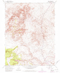
USGS Historical Quadrangle in GeoPDF.
Core Research Center, cutting DZ17325, from well operated by AMERICAN QUASARRaw Properties from download, web scrape, MapServer, and Macrostrat API{"Lib Num": "DZ17325", "API Num": "3600900018", "Operator": "AMERICAN QUASAR", "Well Name": "25-33 LONGVIEW FIBER", "Field": null, "State": "OR", "County": "COLUMBIA", "Thin Sec": "F", "Analysis": "F", "Latitude": "45.97248", "Longitude": "-123.24127", "coordinates_geohash": "c20me943n72t", "Source": "FROM STATE RECORDS", "Min": "1070", "Max": "7000", "Security Flag": null, "crc_collection_name": "cutting", "sb_parent_id": "4f4e49d8e4b07f02db5df2d2", "intervals": [{"Formation": null, "Age": null, "Min Depth": null, "Max Depth": null}], "crcwc_url": "https://my.usgs.gov/crcwc/cutting/report/39263",...
Categories: Physical Item;
Tags: Astoria Group; Scappoose Formation,
Oligocene/Miocene,
Scappoose Formation,
basalt,
conglomerate,
Core Research Center, cutting FC02043, from well operated by T G TRaw Properties from download, web scrape, MapServer, and Macrostrat API{"Lib Num": "FC02043", "API Num": "0201560003", "Operator": "T G T", "Well Name": "1 U S A-SCHRIEBER", "Field": null, "State": "AZ", "County": "MOHAVE", "Thin Sec": "F", "Analysis": "F", "Latitude": "36.73323344", "Longitude": "-113.663625", "coordinates_geohash": "9qx0vx0dte42", "Source": "FROM STATE RECORDS", "Min": "130", "Max": "4015", "Security Flag": null, "crc_collection_name": "cutting", "sb_parent_id": "4f4e49d8e4b07f02db5df2d2", "intervals": [{"Formation": null, "Age": null, "Min Depth": null, "Max Depth": null}], "crcwc_url": "https://my.usgs.gov/crcwc/cutting/report/49164",...
The 2018 lower East Rift Zone eruption of Kīlauea Volcano began in the late afternoon of 3 May, with fissure 1 opening and erupting lava onto Mohala Street in the Leilani Estates subdivision, part of the lower Puna District of the Island of Hawaiʻi. For the first week of the eruption, relatively viscous lava flowed only within a kilometer (0.6 miles) of the fissures within Leilani Estates, before activity shifted downrift (east-northeast) and out of the subdivision during mid-May. Around 18 May, activity along the lower East Rift Zone intensified, and fluid lava erupting at higher effusion rates from the downrift fissures reached the ocean within two days. Near the end of May, this more vigorous activity shifted...
Types: Map Service,
OGC WFS Layer,
OGC WMS Layer,
OGC WMS Service,
Shapefile;
Tags: East Rift Zone,
Green Lake,
Hawaii,
Hawaiʻi,
Island of Hawaiʻi,
Basalt columns in canyon just below dam at San Miguel Regla. Hidalgo, Mexico. November 1949.
Columnar basalt pavement in bottom of canyon just below dam at San Miguel Hegla. Hidalgo, Mexico. November 1949.
This dataset contains digital data that were used for the creation of a geologic map shown in Figure 3 in USGS SIR 2017-5150; Postglacial Eruptive History and Geochemistry of Semisopochnoi Volcano, Western Aleutian Islands, Alaska by Coombs, M.L. and others. The map shows the generalized geology of the island and the locations of stations occupied during field work conducted in the summer of 2005. The data are based on mapping completed during the field work, high-resolution digital imagery, and geochemical and radiometric analyses of rock and soil samples.
|

|
