Filters
Date Range
Contacts
Tag Types
Tag Schemes
|
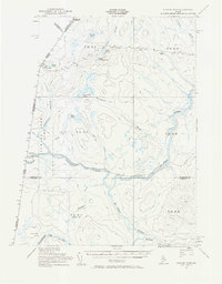
USGS Historical Quadrangle in GeoPDF.
Tags: 15 x 15 minute,
Beaver Pond,
Downloadable Data,
GeoPDF,
GeoTIFF, All tags...
Historical Topographic Maps,
Historical Topographic Maps 15 x 15 Minute Map Series,
ME,
Map,
imageryBaseMapsEarthCover, Fewer tags
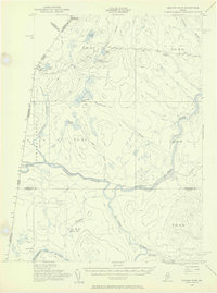
USGS Historical Quadrangle in GeoPDF.
Tags: 15 x 15 minute,
Beaver Pond,
Downloadable Data,
GeoPDF,
GeoTIFF, All tags...
Historical Topographic Maps,
Historical Topographic Maps 15 x 15 Minute Map Series,
ME,
Map,
imageryBaseMapsEarthCover, Fewer tags

The 1:100,000-scale geologic map database of the South Boston 30' × 60' quadrangle, Virginia and North Carolina, provides geologic information for the Piedmont along the I-85 and U.S. Route 58 corridors and in the Roanoke River watershed, which includes the John H. Kerr Reservoir and Lake Gaston. The Raleigh terrane (located on the eastern side of the map) contains Neoproterozoic to early Paleozoic(?) polydeformed, amphibolite-facies gneisses and schists. The Carolina slate belt of the Carolina terrane (located in the central part of the map) contains Neoproterozoic metavolcanic and metasedimentary rocks at greenschist facies. Although locally complicated, the slate-belt structure mapped across the South Boston...
Tags: 30 x 60 minute,
Aaron Formation,
Aarons Creek,
Alkaline basalt,
Allen Creek, All tags...
Alluvium,
Amphibolite,
Argillite,
Armistead Branch,
Ashcake Creek,
Augen gneiss,
Averett,
Bagleys Mills,
Banister Lake,
Banister River,
Barnes Junction,
Basalt,
Baskerville,
Bears Element Creek,
Beaver Pond,
Beaver Pond Creek,
Beech Creek,
Bethel Hill,
Big Hounds Creek,
Big Juniper Creek,
Biotite gneiss,
Birch Creek,
Bishops Corner,
Black Walnut Creek,
Blackridge,
Blackstone Creek,
Blanes Millpond,
Bluestone Creek,
Bluestone Otter Creek,
Bluewing Creek,
Bowes Branch,
Boydton,
Bracey,
Brodnax,
Brunswick County,
Buckham Creek,
Buckhorn Creek,
Buckskin Creek,
Buffalo Creek,
Buffalo Junction,
Buffalo Springs,
Buggs Island,
Burton Branch,
Butcher Creek,
Cambrian,
Cargills Creek,
Carolina slate belt,
Carolina terrane,
Castle Creek,
Castle Heights,
Cataclasite,
Catawba Creek,
Cedar Creek,
Cenozoic,
Charlotte County,
Chase City,
Christie,
Clarksville,
Clarkton,
Clays Mill,
Clover,
Clover Creek,
Cluster Springs,
Coleman Creek,
Colluvium,
Conglomerate,
Connor Lake,
Cotton Creek,
Couches Creek,
Country Line complex,
Cox Creek,
Crooked Creek,
Crupper Run,
Crystal Hill,
Cub Creek,
Cunningham complex,
Dacite,
Dan River,
Devils Branch,
Devonian,
Diabase,
Difficult Creek,
Diorite,
Dixon Millpond,
Dockery Creek,
Drakes Branch,
Dryburg,
Dudley,
Dundas,
Ellis Creek,
Esnon,
Evans Creek,
Farmers Branch,
Felsic gneiss,
Finchley,
Finnewood Creek,
Finneywood,
Flat Creek,
Flat Rock Creek,
Forksville,
Formosa,
Fort Mitchell,
Gabbro,
Gibson Creek,
Gilliams Branch,
Gneiss,
Goodell Creek,
Granite,
Granitic gneiss,
Granodiorite,
Granville County,
Grassy Creek,
Great Creek,
Greenschist,
Gregory Corner,
Hagood Creek,
Halifax,
Halifax County,
Harmony,
Hawtree Creek,
Hitesburg,
Holocene,
Horsepen Creek,
Horseshoe Lake,
Hughs Lake,
Hunting Creek,
Hyco Formation,
Hyco River,
Island Creek,
Island Creek Reservoir,
Jeffress,
Johnson Creek,
Jurassic,
Kenbridge,
Kerr Reservoir,
Kettle Creek,
Kettlesticks Creek,
Kits Creek,
La Crosse,
Lake Gaston,
Lake Gordon,
Langford Pond,
Lawsons Creek,
Layton Creek,
Lennig,
Little Genito Creek,
Little Horsepen Creek,
Little Johnson Creek,
Little Juniper Creek,
Little Temble Creek,
Long Branch,
Lunenburg,
Lunenburg County,
Lyle Creek,
Marengo,
Mason Creek,
Mayo,
Mayo Creek,
Mayo Reservoir,
Mecklenburg County,
Mesozoic,
Metabasalt,
Metamorphic rock,
Metamorphic suite of South Hill,
Metasedimentary rock,
Metavolcanic rock,
Middle Meherrin River,
Mikes Creek,
Miles Creek,
Mill Branch,
Milton terrane,
Mines Creek,
Miocene,
Miry Creek,
Mississippian,
Mitchell Creek,
Monzodiorite,
Monzonite,
Moody Creek,
Mossingford,
Mount Laurel,
Mountain Creek,
Mylonite,
Nathalie,
Nelson,
Neogene,
Neoproterozoic,
North Carolina,
North Meherrin River,
North View,
Nutbush Creek,
Nutbush Creek mylonite zone,
Omega,
Ontario,
Ordovician,
Orthogneiss,
Otter Creek,
Paleozoic,
Palmer Crossroads,
Palmer Springs,
Panhandle Creek,
Parham Creek,
Pennsylvanian,
Permian,
Person County,
Peter Creek,
Philbeck Crossroads,
Phyllonite,
Piney Creek,
Piney Grove,
Plantersville,
Pleistocene,
Pliocene,
Poplar Creek,
Public Fork,
Quartz diorite,
Quartz monzonite,
Quartzite,
Quaternary,
Rabat,
Raleigh terrane,
Randolph,
Ready Creek,
Red Bank,
Red Oak,
Redlawn,
Reedy Creek,
Reeses Creek,
Rehoboth,
Reynolds Creek,
Rhyolite,
Riverdale,
Roanoke Creek,
Roanoke River,
Rocky Branch,
Sand,
Sandy Creek,
Saxe,
Schist,
Scotts Crossroad,
Scottsburg,
Seay Creek,
Shiny Rock,
Siddon,
Siltstone,
Silurian,
Sinai,
Skipwith,
Smith Creek,
South Boston,
South Hill,
South Meherrin River,
Spanish Grove,
Stokes Creek,
Stony Creek,
Taylors Creek,
Temble Creek,
Terrace,
The Ridge,
Tonalite,
Triassic,
Tungsten,
Twittys Creek,
USGS Science Data Catalog (SDC),
Union Level,
Vance County,
Vance pluton,
Victoria,
Virgilina,
Virgilina Formation,
Virginia,
Wallace Branch,
Warren County,
Wightman,
Winn Creek,
Wolf Trap Creek,
Wylliesburg,
abandoned mines and quarries,
bedrock geologic units,
copper,
earth sciences,
folding (geologic),
foliation (geologic),
fracture (geologic),
geologic contacts,
geologic maps,
geologic processes,
geologic structure,
geologic time periods,
geologic time scales,
geology,
geoscientificInformation,
geospatial datasets,
information product types,
inlandWaters,
lithology,
maps and atlases,
metamorphic rocks,
metamorphism (geological),
mining and quarrying,
place,
sedimentary rocks,
sedimentation,
society,
stratum,
structural geology,
structure,
surficial geologic units,
unconsolidated deposits,
utilitiesCommunication, Fewer tags
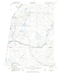
USGS Historical Quadrangle in GeoPDF.
Tags: 15 x 15 minute,
Beaver Pond,
Downloadable Data,
GeoPDF,
GeoTIFF, All tags...
Historical Topographic Maps,
Historical Topographic Maps 15 x 15 Minute Map Series,
ME,
Map,
imageryBaseMapsEarthCover, Fewer tags
|
|

