Filters
Date Range
Types
Contacts
Tag Types
Tag Schemes
|
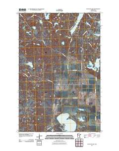
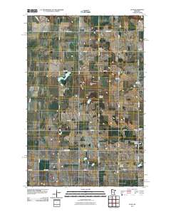
This data set contains imagery from the National Agriculture Imagery Program (NAIP). The NAIP program is administered by USDA FSA and has been established to support two main FSA strategic goals centered on agricultural production. These are, increase stewardship of America's natural resources while enhancing the environment, and to ensure commodities are procured and distributed effectively and efficiently to increase food security. The NAIP program supports these goals by acquiring and providing ortho imagery that has been collected during the agricultural growing season in the U.S. The NAIP ortho imagery is tailored to meet FSA requirements and is a fundamental tool used to support FSA farm and conservation programs....
Types: Citation;
Tags: 27005,
3.75 x 3.75 minute,
4609514,
Aerial Compliance,
BECKER CO MN FSA, All tags...
Becker,
Compliance,
Digital Ortho rectified Image,
Downloadable Data,
JPEG2000,
MN,
MN005,
NAIP,
Ortho Rectification,
Orthoimagery,
Quarter Quadrangle,
USDA National Agriculture Imagery Program (NAIP),
WOLF LAKE,
WOLF LAKE, SW,
farming, Fewer tags
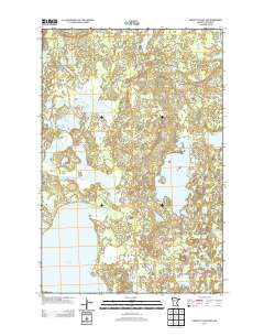
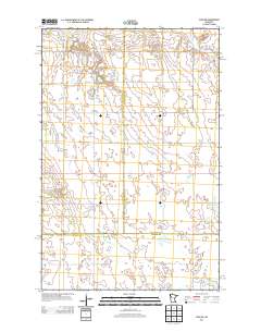
This data set contains imagery from the National Agriculture Imagery Program (NAIP). The NAIP program is administered by USDA FSA and has been established to support two main FSA strategic goals centered on agricultural production. These are, increase stewardship of America's natural resources while enhancing the environment, and to ensure commodities are procured and distributed effectively and efficiently to increase food security. The NAIP program supports these goals by acquiring and providing ortho imagery that has been collected during the agricultural growing season in the U.S. The NAIP ortho imagery is tailored to meet FSA requirements and is a fundamental tool used to support FSA farm and conservation programs....
Types: Citation;
Tags: 27005,
3.75 x 3.75 minute,
4609608,
Aerial Compliance,
BECKER CO MN FSA, All tags...
Becker,
Compliance,
Digital Ortho rectified Image,
Downloadable Data,
JPEG2000,
LAKE PARK,
LAKE PARK, SE,
MN,
MN005,
NAIP,
Ortho Rectification,
Orthoimagery,
Quarter Quadrangle,
USDA National Agriculture Imagery Program (NAIP),
farming, Fewer tags
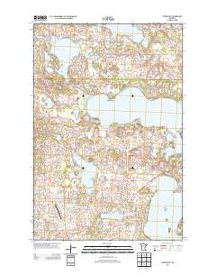
Layered GeoPDF 7.5 Minute Quadrangle Map. Layers of geospatial data include orthoimagery, roads, grids, geographic names, elevation contours, hydrography, and other selected map features.
Tags: 7.5 x 7.5 minute,
Becker,
Downloadable Data,
EarthCover,
GeoPDF, All tags...
Hubbard,
Imagery and Base Maps,
Map,
Minnesota,
Park Rapids NW, MN,
Public Land Survey System,
U.S. National Grid,
US,
US Topo,
US Topo Historical,
United States,
boundary,
contour,
geographic names,
hydrography,
imageryBaseMapsEarthCover,
orthoimage,
structures,
topographic,
transportation,
woodland, Fewer tags
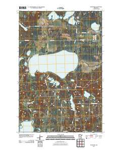
Layered GeoPDF 7.5 Minute Quadrangle Map. Layers of geospatial data include orthoimagery, roads, grids, geographic names, elevation contours, hydrography, and other selected map features.
Tags: 7.5 x 7.5 minute,
Becker,
Downloadable Data,
EarthCover,
GeoPDF, All tags...
Imagery and Base Maps,
Map,
Minnesota,
Ponsford, MN,
Public Land Survey System,
U.S. National Grid,
US,
US Topo,
US Topo Historical,
United States,
boundary,
contour,
geographic names,
hydrography,
imageryBaseMapsEarthCover,
orthoimage,
structures,
topographic,
transportation,
woodland, Fewer tags
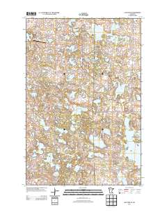
Layered GeoPDF 7.5 Minute Quadrangle Map. Layers of geospatial data include orthoimagery, roads, grids, geographic names, elevation contours, hydrography, and other selected map features.
Tags: 7.5 x 7.5 minute,
Becker,
Downloadable Data,
EarthCover,
GeoPDF, All tags...
Hubbard,
Imagery and Base Maps,
Map,
Minnesota,
Public Land Survey System,
Two Inlets, MN,
U.S. National Grid,
US,
US Topo,
US Topo Historical,
United States,
boundary,
contour,
geographic names,
hydrography,
imageryBaseMapsEarthCover,
orthoimage,
structures,
topographic,
transportation,
woodland, Fewer tags
Layered GeoPDF 7.5 Minute Quadrangle Map. Layers of geospatial data include orthoimagery, roads, grids, geographic names, elevation contours, hydrography, and other selected map features.
Tags: 7.5 x 7.5 minute,
Becker,
Big Basswood Lake, MN,
Downloadable Data,
EarthCover, All tags...
GeoPDF,
Imagery and Base Maps,
Map,
Minnesota,
Public Land Survey System,
U.S. National Grid,
US,
US Topo,
US Topo Historical,
United States,
boundary,
contour,
geographic names,
hydrography,
imageryBaseMapsEarthCover,
orthoimage,
structures,
topographic,
transportation,
woodland, Fewer tags
Layered GeoPDF 7.5 Minute Quadrangle Map. Layers of geospatial data include orthoimagery, roads, grids, geographic names, elevation contours, hydrography, and other selected map features.
Tags: 7.5 x 7.5 minute,
Becker,
Big Rush Lake, MN,
Downloadable Data,
EarthCover, All tags...
GeoPDF,
Imagery and Base Maps,
Map,
Minnesota,
U.S. National Grid,
US,
US Topo,
US Topo Historical,
United States,
contour,
geographic names,
hydrography,
imageryBaseMapsEarthCover,
orthoimage,
structures,
topographic,
transportation, Fewer tags
Layered GeoPDF 7.5 Minute Quadrangle Map. Layers of geospatial data include orthoimagery, roads, grids, geographic names, elevation contours, hydrography, and other selected map features.
Tags: 7.5 x 7.5 minute,
Becker,
Downloadable Data,
EarthCover,
GeoPDF, All tags...
Height of Land Lake, MN,
Imagery and Base Maps,
Map,
Minnesota,
Public Land Survey System,
U.S. National Grid,
US,
US Topo,
US Topo Historical,
United States,
boundary,
contour,
geographic names,
hydrography,
imageryBaseMapsEarthCover,
orthoimage,
structures,
topographic,
transportation,
woodland, Fewer tags
Layered GeoPDF 7.5 Minute Quadrangle Map. Layers of geospatial data include orthoimagery, roads, grids, geographic names, elevation contours, hydrography, and other selected map features.
Tags: 7.5 x 7.5 minute,
Becker,
Clay,
Downloadable Data,
EarthCover, All tags...
GeoPDF,
Imagery and Base Maps,
Lake Park SW, MN,
Map,
Minnesota,
Public Land Survey System,
U.S. National Grid,
US,
US Topo,
US Topo Historical,
United States,
boundary,
contour,
geographic names,
hydrography,
imageryBaseMapsEarthCover,
orthoimage,
structures,
topographic,
transportation,
woodland, Fewer tags
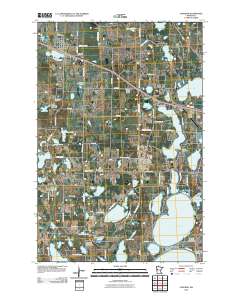
Layered GeoPDF 7.5 Minute Quadrangle Map. Layers of geospatial data include orthoimagery, roads, grids, geographic names, elevation contours, hydrography, and other selected map features.
Tags: 7.5 x 7.5 minute,
Audubon, MN,
Becker,
Downloadable Data,
EarthCover, All tags...
GeoPDF,
Imagery and Base Maps,
Map,
Minnesota,
U.S. National Grid,
US,
US Topo,
US Topo Historical,
United States,
contour,
geographic names,
hydrography,
imageryBaseMapsEarthCover,
orthoimage,
topographic,
transportation, Fewer tags
Layered GeoPDF 7.5 Minute Quadrangle Map. Layers of geospatial data include orthoimagery, roads, grids, geographic names, elevation contours, hydrography, and other selected map features.
Tags: 7.5 x 7.5 minute,
Becker,
Downloadable Data,
EarthCover,
Flom, MN, All tags...
GeoPDF,
Imagery and Base Maps,
Map,
Minnesota,
Norman,
U.S. National Grid,
US,
US Topo,
US Topo Historical,
United States,
contour,
geographic names,
hydrography,
imageryBaseMapsEarthCover,
orthoimage,
topographic,
transportation, Fewer tags
Layered GeoPDF 7.5 Minute Quadrangle Map. Layers of geospatial data include orthoimagery, roads, grids, geographic names, elevation contours, hydrography, and other selected map features.
Tags: 7.5 x 7.5 minute,
Becker,
Downloadable Data,
EarthCover,
Flom NE, MN, All tags...
GeoPDF,
Imagery and Base Maps,
Mahnomen,
Map,
Minnesota,
Norman,
Public Land Survey System,
U.S. National Grid,
US,
US Topo,
US Topo Historical,
United States,
boundary,
contour,
geographic names,
hydrography,
imageryBaseMapsEarthCover,
orthoimage,
structures,
topographic,
transportation,
woodland, Fewer tags
Layered GeoPDF 7.5 Minute Quadrangle Map. Layers of geospatial data include orthoimagery, roads, grids, geographic names, elevation contours, hydrography, and other selected map features.
Tags: 7.5 x 7.5 minute,
Becker,
Cormorant, MN,
Downloadable Data,
EarthCover, All tags...
GeoPDF,
Imagery and Base Maps,
Map,
Minnesota,
Otter Tail,
Public Land Survey System,
U.S. National Grid,
US,
US Topo,
US Topo Historical,
United States,
boundary,
contour,
geographic names,
hydrography,
imageryBaseMapsEarthCover,
orthoimage,
structures,
topographic,
transportation,
woodland, Fewer tags
Layered GeoPDF 7.5 Minute Quadrangle Map. Layers of geospatial data include orthoimagery, roads, grids, geographic names, elevation contours, hydrography, and other selected map features.
Tags: 7.5 x 7.5 minute,
Becker,
Downloadable Data,
EarthCover,
GeoPDF, All tags...
Imagery and Base Maps,
Map,
Minnesota,
Ponsford, MN,
U.S. National Grid,
US,
US Topo,
US Topo Historical,
United States,
contour,
geographic names,
hydrography,
imageryBaseMapsEarthCover,
orthoimage,
topographic,
transportation, Fewer tags
Layered GeoPDF 7.5 Minute Quadrangle Map. Layers of geospatial data include orthoimagery, roads, grids, geographic names, elevation contours, hydrography, and other selected map features.
Tags: 7.5 x 7.5 minute,
Becker,
Big Rush Lake, MN,
Downloadable Data,
EarthCover, All tags...
GeoPDF,
Imagery and Base Maps,
Map,
Minnesota,
Public Land Survey System,
U.S. National Grid,
US,
US Topo,
US Topo Historical,
United States,
boundary,
contour,
geographic names,
hydrography,
imageryBaseMapsEarthCover,
orthoimage,
structures,
topographic,
transportation,
woodland, Fewer tags
Layered geospatial PDF Map. Layers of geospatial data include orthoimagery, roads, grids, geographic names, elevation contours, hydrography, and other selected map features.
Tags: 7.5 x 7.5 minute,
Becker,
Downloadable Data,
EarthCover,
GeoPDF, All tags...
Imagery and Base Maps,
Map,
Minnesota,
Public Land Survey System,
Rochert, MN,
U.S. National Grid,
US,
US Topo,
US Topo Historical,
United States,
boundary,
contour,
geographic names,
hydrography,
imageryBaseMapsEarthCover,
orthoimage,
structures,
topographic,
transportation,
woodland, Fewer tags
The National Hydrography Dataset (NHD) is a feature-based database that interconnects and uniquely identifies the stream segments or reaches that make up the nation's surface water drainage system. NHD data was originally developed at 1:100,000-scale and exists at that scale for the whole country. This high-resolution NHD, generally developed at 1:24,000/1:12,000 scale, adds detail to the original 1:100,000-scale NHD. (Data for Alaska, Puerto Rico and the Virgin Islands was developed at high-resolution, not 1:100,000 scale.) Local resolution NHD is being developed where partners and data exist. The NHD contains reach codes for networked features, flow direction, names, and centerline representations for areal water...
Tags: Administrative watershed units,
Administrative watershed units,
Area of Complex Channels,
Area to be submerged,
Basin, All tags...
Basin,
Bay/Inlet,
Becker,
Boundaries,
Boundary,
Bridge,
Canal/Ditch,
Cass,
Clearwater,
Coastline,
Connector,
Crow Wing,
Dam/Weir,
Downloadable Data,
Drainage areas for surface water,
Drainageway,
Esri Shapefile nan,
Estuary,
Flow direction network,
Flume,
ForeShore,
Gaging Station,
Gate,
HU-8,
HU-8 Subbasin,
HU10,
HU12,
HU14,
HU16,
HU2,
HU4,
HU6,
HU8,
HU8_07010106,
HUC,
Hazard Zone,
Hubbard,
Hydrographic,
Hydrography,
Hydrography,
Hydrography,
Hydrologic Unit Code,
Hydrologic Units,
Ice mass,
Inundation Area,
Levee,
Line,
Lock Chamber,
MN,
Marsh,
Minnesota,
Morrison,
National Hydrography Dataset (NHD),
National Hydrography Dataset (NHD) Best Resolution,
National Hydrography Dataset (NHD) Best Resolution,
Nonearthen Shore,
Orthoimage,
Otter Tail,
Playa,
Point,
PointEvent,
Pond,
Rapids,
Rapids,
Reach,
Reach code,
Reef,
Region,
Reservoir,
Rock,
Sea/Ocean,
Shapefile,
Sink/Rise,
Sounding Datum Line,
Special Use Zone,
Special Use Zone Limit,
Spillway,
Stream,
Stream/River,
Sub-basin,
Sub-region,
Subbasin,
Submerged Stream,
Subregion,
Subwatershed,
Surface water systems,
Swamp,
Todd,
Topographic,
Tunnel,
US,
Underground Conduit,
United States,
WBD,
WBD,
Wadena,
Wall,
Wash,
Water Intake Outflow,
Waterfall,
Watershed,
Watershed Boundaries,
Watershed Boundary Dataset,
Watershed Boundary Dataset,
Well,
artificial path,
boundaries,
dams,
drainage systems and characteristics,
inlandWaters,
lakes,
ngda,
rivers, Fewer tags
The National Hydrography Dataset (NHD) is a feature-based database that interconnects and uniquely identifies the stream segments or reaches that make up the nation's surface water drainage system. NHD data was originally developed at 1:100,000-scale and exists at that scale for the whole country. This high-resolution NHD, generally developed at 1:24,000/1:12,000 scale, adds detail to the original 1:100,000-scale NHD. (Data for Alaska, Puerto Rico and the Virgin Islands was developed at high-resolution, not 1:100,000 scale.) Local resolution NHD is being developed where partners and data exist. The NHD contains reach codes for networked features, flow direction, names, and centerline representations for areal water...
Tags: Administrative watershed units,
Administrative watershed units,
Area of Complex Channels,
Area to be submerged,
Basin, All tags...
Basin,
Bay/Inlet,
Becker,
Boundaries,
Boundary,
Bridge,
Canal/Ditch,
Cass,
Clay,
Coastline,
Connector,
Dam/Weir,
Downloadable Data,
Drainage areas for surface water,
Drainageway,
Esri Shapefile nan,
Estuary,
Flow direction network,
Flume,
ForeShore,
Gaging Station,
Gate,
HU-8,
HU-8 Subbasin,
HU10,
HU12,
HU14,
HU16,
HU2,
HU4,
HU6,
HU8,
HU8_09020106,
HUC,
Hazard Zone,
Hydrographic,
Hydrography,
Hydrography,
Hydrography,
Hydrologic Unit Code,
Hydrologic Units,
Ice mass,
Inundation Area,
Levee,
Line,
Lock Chamber,
MN,
Marsh,
Minnesota,
ND,
National Hydrography Dataset (NHD),
National Hydrography Dataset (NHD) Best Resolution,
National Hydrography Dataset (NHD) Best Resolution,
Nonearthen Shore,
North Dakota,
Orthoimage,
Otter Tail,
Playa,
Point,
PointEvent,
Pond,
Rapids,
Rapids,
Reach,
Reach code,
Reef,
Region,
Reservoir,
Rock,
Sea/Ocean,
Shapefile,
Sink/Rise,
Sounding Datum Line,
Special Use Zone,
Special Use Zone Limit,
Spillway,
Stream,
Stream/River,
Sub-basin,
Sub-region,
Subbasin,
Submerged Stream,
Subregion,
Subwatershed,
Surface water systems,
Swamp,
Topographic,
Tunnel,
US,
Underground Conduit,
United States,
WBD,
WBD,
Wall,
Wash,
Water Intake Outflow,
Waterfall,
Watershed,
Watershed Boundaries,
Watershed Boundary Dataset,
Watershed Boundary Dataset,
Well,
Wilkin,
artificial path,
boundaries,
dams,
drainage systems and characteristics,
inlandWaters,
lakes,
ngda,
rivers, Fewer tags
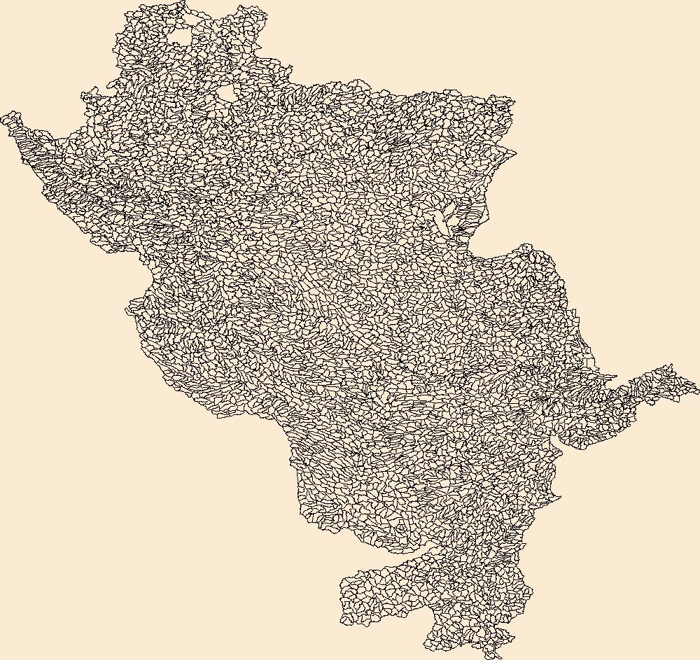
The Watershed Boundary Dataset (WBD) is a comprehensive aggregated collection of hydrologic unit data consistent with the national criteria for delineation and resolution. It defines the areal extent of surface water drainage to a point except in coastal or lake front areas where there could be multiple outlets as stated by the "Federal Standards and Procedures for the National Watershed Boundary Dataset (WBD)" "Standard" (https://pubs.usgs.gov/tm/11/a3/). Watershed boundaries are determined solely upon science-based hydrologic principles, not favoring any administrative boundaries or special projects, nor particular program or agency. This dataset represents the hydrologic unit boundaries to the 12-digit (6th level)...
Tags: 10-digit,
12-digit,
14-digit,
16-digit,
2-digit, All tags...
4-digit,
6-digit,
8-digit,
Adair,
Adams,
Aitkin,
Alexander,
Allamakee,
Anoka,
Appanoose,
Ashland,
Audrain,
Audubon,
Ballard,
Barron,
Basin,
Bayfield,
Becker,
Beltrami,
Benton,
Berrien,
Big Stone,
Black Hawk,
Blue Earth,
Bollinger,
Bond,
Boone,
Bremer,
Brookings,
Brown,
Buchanan,
Buena Vista,
Buffalo,
Bureau,
Burnett,
Butler,
Calhoun,
Callaway,
Cape Girardeau,
Carlton,
Carroll,
Carver,
Cass,
Cedar,
Cerro Gordo,
Champaign,
Chickasaw,
Chippewa,
Chisago,
Christian,
Clark,
Clarke,
Clay,
Clayton,
Clearwater,
Clinton,
Codington,
Coles,
Columbia,
Cook,
Cottonwood,
Crawford,
Crow Wing,
Dakota,
Dallas,
Dane,
Davis,
Day,
De Witt,
DeKalb,
Delaware,
Dent,
Des Moines,
Deuel,
Dickinson,
Dodge,
Douglas,
Downloadable Data,
DuPage,
Dubuque,
Dunn,
Eau Claire,
Effingham,
Elkhart,
Emmet,
Esri File GeoDatabase 10,
Faribault,
Fayette,
FileGDB,
Fillmore,
Floyd,
Fond du Lac,
Ford,
Forest,
Franklin,
Freeborn,
Fulton,
Gasconade,
Gogebic,
Goodhue,
Grant,
Green,
Green Lake,
Greene,
Grundy,
Guthrie,
HU-2,
HU-2 Region,
HU2_07,
HUC,
Hamilton,
Hancock,
Hardin,
Henderson,
Hennepin,
Henry,
Houston,
Howard,
Hubbard,
Humboldt,
Hydrography,
Hydrologic Unit Code,
Hydrologic Units,
IA,
IL,
IN,
Illinois,
Indiana,
Iowa,
Iowa,
Iron,
Iroquois,
Isanti,
Itasca,
Jackson,
Jasper,
Jefferson,
Jersey,
Jo Daviess,
Johnson,
Jones,
Juneau,
KY,
Kanabec,
Kandiyohi,
Kane,
Kankakee,
Kendall,
Kenosha,
Kentucky,
Keokuk,
Knox,
Kosciusko,
Kossuth,
La Crosse,
LaPorte,
LaSalle,
Lac qui Parle,
Lafayette,
Lake,
Langlade,
Le Sueur,
Lee,
Lewis,
Lincoln,
Linn,
Livingston,
Logan,
Louisa,
Lucas,
Lyon,
MI,
MN,
MO,
Macon,
Macoupin,
Madison,
Mahaska,
Marathon,
Maries,
Marion,
Marquette,
Marshall,
Martin,
Mason,
McDonough,
McHenry,
McLean,
McLeod,
Meeker,
Menard,
Mercer,
Michigan,
Mille Lacs,
Milwaukee,
Minnesota,
Mississippi,
Missouri,
Mitchell,
Monroe,
Montgomery,
Morgan,
Morrison,
Moultrie,
Mower,
Murray,
Muscatine,
ND,
National Watershed Boundary Dataset (WBD),
National Watershed Boundary Dataset (WBD),
Newton,
Nicollet,
Nobles,
North Dakota,
Ogle,
Olmsted,
Oneida,
Osage,
Otter Tail,
Palo Alto,
Peoria,
Pepin,
Perry,
Phelps,
Piatt,
Pierce,
Pike,
Pine,
Pipestone,
Pocahontas,
Polk,
Pope,
Portage,
Porter,
Poweshiek,
Price,
Pulaski,
Putnam,
Racine,
Ralls,
Ramsey,
Randolph,
Redwood,
Region,
Renville,
Reynolds,
Rice,
Richland,
Roberts,
Rock,
Rock Island,
Rusk,
SD,
Sac,
Sangamon,
Sauk,
Sawyer,
Schuyler,
Scotland,
Scott,
Shawano,
Shelby,
Sherburne,
Sibley,
South Dakota,
St. Charles,
St. Clair,
St. Croix,
St. Francois,
St. Joseph,
St. Louis,
Stark,
Starke,
Ste. Genevieve,
Stearns,
Steele,
Stephenson,
Stevens,
Story,
Sub-basin,
Sub-region,
Subwatershed,
Swift,
Tama,
Taylor,
Tazewell,
Texas,
Todd,
Traverse,
Trempealeau,
US,
Union,
United States,
Van Buren,
Vermilion,
Vernon,
Vilas,
WBD,
WI,
Wabasha,
Wadena,
Walworth,
Wapello,
Warren,
Waseca,
Washburn,
Washington,
Watershed,
Watershed Boundary Dataset,
Watonwan,
Waukesha,
Waushara,
Wayne,
Webster,
White,
Whiteside,
Will,
Williamson,
Winnebago,
Winneshiek,
Winona,
Wisconsin,
Wood,
Woodford,
Worth,
Wright,
Yellow Medicine,
inlandWaters, Fewer tags
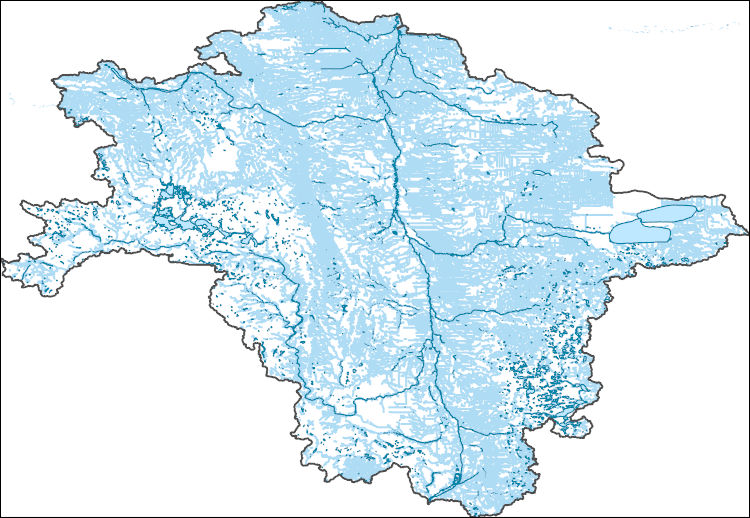
The National Hydrography Dataset (NHD) is a feature-based database that interconnects and uniquely identifies the stream segments or reaches that make up the nation's surface water drainage system. NHD data was originally developed at 1:100,000-scale and exists at that scale for the whole country. This high-resolution NHD, generally developed at 1:24,000/1:12,000 scale, adds detail to the original 1:100,000-scale NHD. (Data for Alaska, Puerto Rico and the Virgin Islands was developed at high-resolution, not 1:100,000 scale.) Local resolution NHD is being developed where partners and data exist. The NHD contains reach codes for networked features, flow direction, names, and centerline representations for areal water...
Tags: Administrative watershed units,
Administrative watershed units,
Area of Complex Channels,
Area to be submerged,
Barnes, All tags...
Basin,
Basin,
Bay/Inlet,
Becker,
Beltrami,
Benson,
Big Stone,
Boundaries,
Boundary,
Bridge,
Canal/Ditch,
Cass,
Cavalier,
Clay,
Clearwater,
Coastline,
Connector,
Dam/Weir,
Dickey,
Downloadable Data,
Drainage areas for surface water,
Drainageway,
Eddy,
Esri File GeoDatabase 10,
Estuary,
FileGDB,
Flow direction network,
Flume,
ForeShore,
Foster,
Gaging Station,
Gate,
Grand Forks,
Grant,
Griggs,
HU-4,
HU-4 Subregion,
HU10,
HU12,
HU14,
HU16,
HU2,
HU4,
HU4_0902,
HU6,
HU8,
HUC,
Hazard Zone,
Hydrographic,
Hydrography,
Hydrography,
Hydrography,
Hydrologic Unit Code,
Hydrologic Units,
Ice mass,
Inundation Area,
Itasca,
Kittson,
Koochiching,
Lake of the Woods,
Levee,
Line,
Lock Chamber,
MN,
Mahnomen,
Marsh,
Marshall,
McHenry,
McLean,
Minnesota,
ND,
National Hydrography Dataset (NHD),
National Hydrography Dataset (NHD) Best Resolution,
National Hydrography Dataset (NHD) Best Resolution,
Nelson,
Nonearthen Shore,
Norman,
North Dakota,
Orthoimage,
Otter Tail,
Pembina,
Pennington,
Pierce,
Playa,
Point,
PointEvent,
Polk,
Pond,
Ramsey,
Ransom,
Rapids,
Rapids,
Reach,
Reach code,
Red Lake,
Reef,
Region,
Reservoir,
Richland,
Roberts,
Rock,
Rolette,
Roseau,
SD,
Sargent,
Sea/Ocean,
Sheridan,
Sink/Rise,
Sounding Datum Line,
South Dakota,
Special Use Zone,
Special Use Zone Limit,
Spillway,
Steele,
Stevens,
Stream,
Stream/River,
Stutsman,
Sub-basin,
Sub-region,
Subbasin,
Submerged Stream,
Subregion,
Subwatershed,
Surface water systems,
Swamp,
Topographic,
Towner,
Traill,
Traverse,
Tunnel,
US,
Underground Conduit,
United States,
WBD,
WBD,
Wall,
Walsh,
Wash,
Water Intake Outflow,
Waterfall,
Watershed,
Watershed Boundaries,
Watershed Boundary Dataset,
Watershed Boundary Dataset,
Well,
Wells,
Wilkin,
artificial path,
boundaries,
dams,
drainage systems and characteristics,
inlandWaters,
lakes,
ngda,
rivers, Fewer tags
|
|

