Filters
Date Range
Contacts
Tag Types
Tag Schemes
|

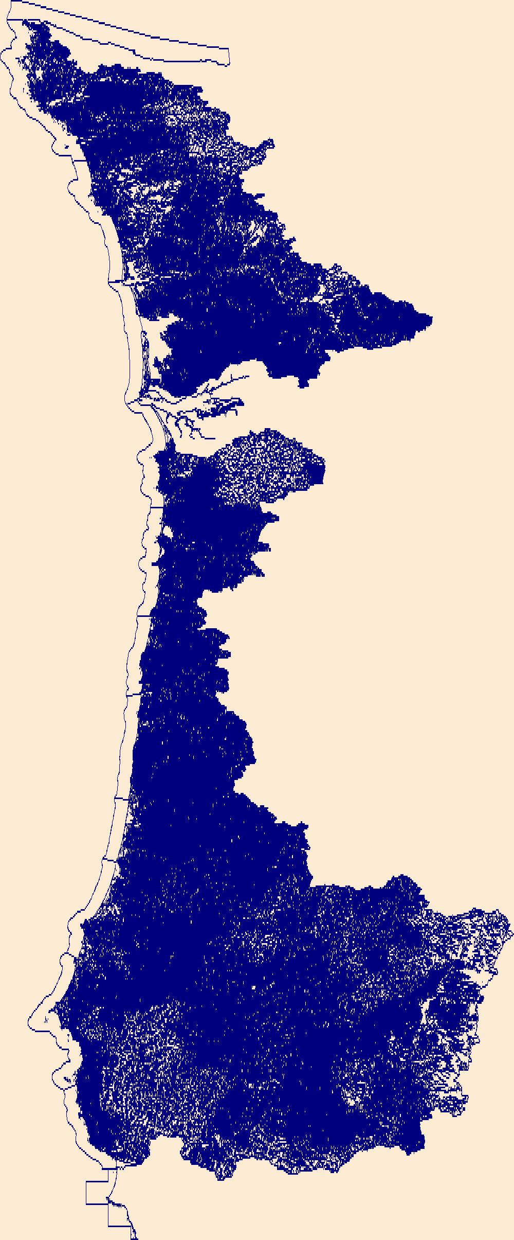
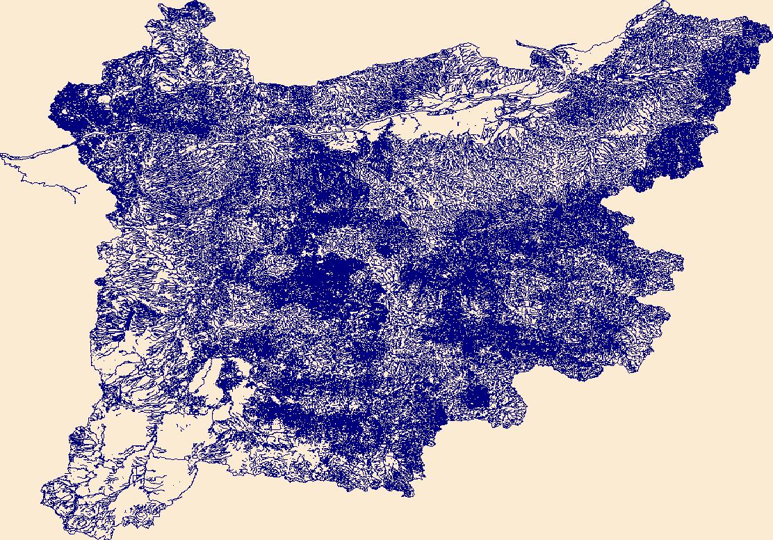
The High Resolution National Hydrography Dataset Plus (NHDPlus HR) is an integrated set of geospatial data layers, including the best available National Hydrography Dataset (NHD), the 10-meter 3D Elevation Program Digital Elevation Model (3DEP DEM), and the National Watershed Boundary Dataset (WBD). The NHDPlus HR combines the NHD, 3DEP DEMs, and WBD to create a stream network with linear referencing, feature naming, "value added attributes" (VAAs), elevation-derived catchments, and other features for hydrologic data analysis. The stream network with linear referencing is a system of data relationships applied to hydrographic systems so that one stream reach "flows" into another and "events" can be tied to and traced...
Tags: Adams County,
Benton County,
Chelan County,
Douglas County,
Downloadable Data, All tags...
Ferry County,
FileGDB,
FileGDB 10.1,
Franklin County,
Grant County,
HU-4 Subregion,
HU-4 Subregion,
HU4_1702,
Hydrography,
King County,
Kittitas County,
Lincoln County,
NHDPlus HR Rasters,
NHDPlus High Resolution (NHDPlus HR),
National Hydrography Dataset (NHD),
National Hydrography Dataset Plus High Resolution (NHDPlus HR),
National Hydrography Dataset Plus High Resolution (NHDPlus HR) Current,
Okanogan County,
Pend Oreille County,
Skagit County,
Snohomish County,
Spokane County,
Stevens County,
US,
United States,
WA,
Walla Walla County,
Washington,
Whatcom County,
Yakima County,
base maps,
cartography,
catchments,
channels,
digital elevation models,
drainage basins,
earth sciences,
elevation,
environment,
geographic information systems,
geoscientific,
geospatial analysis,
hydrographic datasets,
hydrographic features,
hydrology,
imagery,
inland waters,
lakes,
land surface characteristics,
reservoirs,
river reaches,
rivers,
streamflow,
streamflow data,
streams,
topography,
water bodies,
water quality,
water resources,
watersheds, Fewer tags

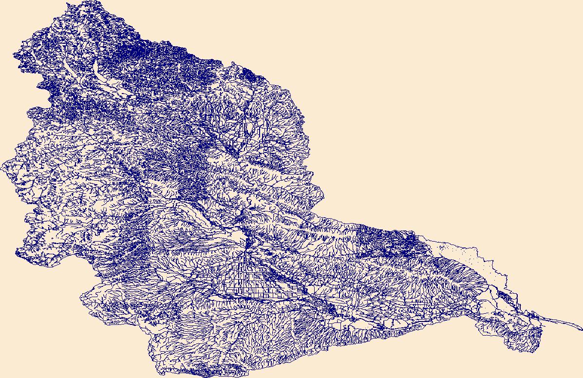
The High Resolution National Hydrography Dataset Plus (NHDPlus HR) is an integrated set of geospatial data layers, including the best available National Hydrography Dataset (NHD), the 10-meter 3D Elevation Program Digital Elevation Model (3DEP DEM), and the National Watershed Boundary Dataset (WBD). The NHDPlus HR combines the NHD, 3DEP DEMs, and WBD to create a stream network with linear referencing, feature naming, "value added attributes" (VAAs), elevation-derived catchments, and other features for hydrologic data analysis. The stream network with linear referencing is a system of data relationships applied to hydrographic systems so that one stream reach "flows" into another and "events" can be tied to and traced...
Tags: AR,
Arkansas,
Barry County,
Baxter County,
Benton County, All tags...
Boone County,
Butler County,
Carroll County,
Carter County,
Christian County,
Clay County,
Cleburne County,
Conway County,
Crawford County,
Dent County,
Douglas County,
Downloadable Data,
FileGDB,
FileGDB 10.1,
Franklin County,
Fulton County,
Greene County,
Greene County,
HU-4 Subregion,
HU-4 Subregion,
HU4_1101,
Howell County,
Hydrography,
Independence County,
Iron County,
Izard County,
Jackson County,
Lawrence County,
Lawrence County,
MO,
Madison County,
Marion County,
Missouri,
NHDPlus HR Rasters,
NHDPlus High Resolution (NHDPlus HR),
National Hydrography Dataset (NHD),
National Hydrography Dataset Plus High Resolution (NHDPlus HR),
National Hydrography Dataset Plus High Resolution (NHDPlus HR) Current,
Newton County,
Oregon County,
Ozark County,
Pope County,
Randolph County,
Reynolds County,
Ripley County,
Searcy County,
Shannon County,
Sharp County,
Stone County,
Stone County,
Taney County,
Texas County,
US,
United States,
Van Buren County,
Washington County,
Wayne County,
Webster County,
White County,
Woodruff County,
Wright County,
base maps,
cartography,
catchments,
channels,
digital elevation models,
drainage basins,
earth sciences,
elevation,
environment,
geographic information systems,
geoscientific,
geospatial analysis,
hydrographic datasets,
hydrographic features,
hydrology,
imagery,
inland waters,
lakes,
land surface characteristics,
reservoirs,
river reaches,
rivers,
streamflow,
streamflow data,
streams,
topography,
water bodies,
water quality,
water resources,
watersheds, Fewer tags
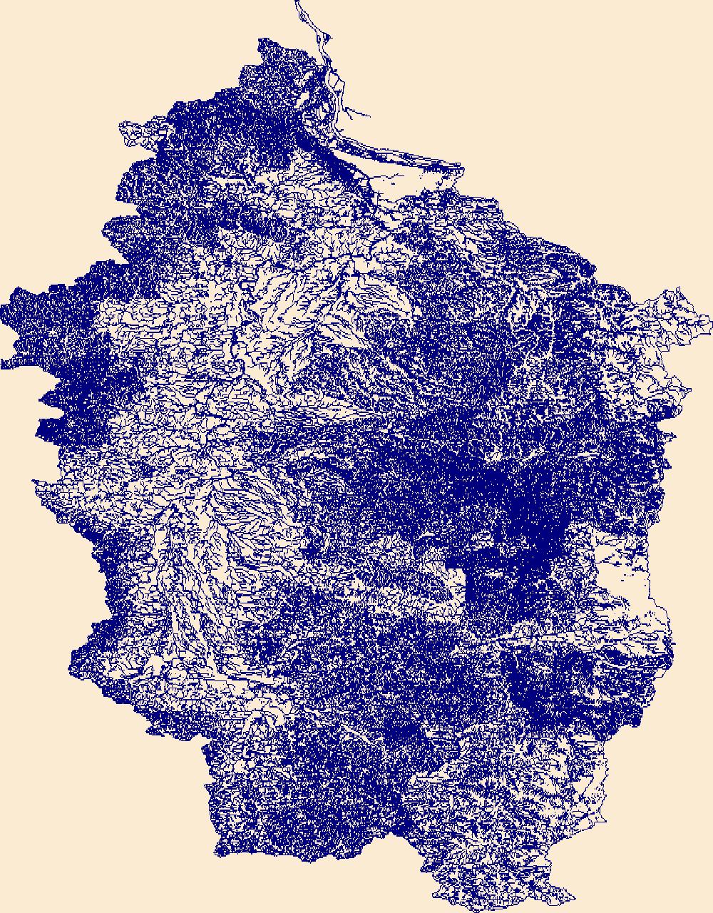
The High Resolution National Hydrography Dataset Plus (NHDPlus HR) is an integrated set of geospatial data layers, including the best available National Hydrography Dataset (NHD), the 10-meter 3D Elevation Program Digital Elevation Model (3DEP DEM), and the National Watershed Boundary Dataset (WBD). The NHDPlus HR combines the NHD, 3DEP DEMs, and WBD to create a stream network with linear referencing, feature naming, "value added attributes" (VAAs), elevation-derived catchments, and other features for hydrologic data analysis. The stream network with linear referencing is a system of data relationships applied to hydrographic systems so that one stream reach "flows" into another and "events" can be tied to and traced...
Tags: Benton County,
CA,
California,
Clallam County,
Clatsop County, All tags...
Columbia County,
Coos County,
Cowlitz County,
Curry County,
Del Norte County,
Douglas County,
Downloadable Data,
FileGDB,
FileGDB 10.1,
Grays Harbor County,
HU-4 Subregion,
HU-4 Subregion,
HU4_1710,
Hydrography,
Jackson County,
Jefferson County,
Josephine County,
Klamath County,
Lane County,
Lewis County,
Lincoln County,
Mason County,
NHDPlus HR Rasters,
NHDPlus High Resolution (NHDPlus HR),
National Hydrography Dataset (NHD),
National Hydrography Dataset Plus High Resolution (NHDPlus HR),
National Hydrography Dataset Plus High Resolution (NHDPlus HR) Current,
OR,
Oregon,
Pacific County,
Polk County,
Siskiyou County,
Thurston County,
Tillamook County,
US,
United States,
WA,
Wahkiakum County,
Washington,
Washington County,
Yamhill County,
base maps,
cartography,
catchments,
channels,
digital elevation models,
drainage basins,
earth sciences,
elevation,
environment,
geographic information systems,
geoscientific,
geospatial analysis,
hydrographic datasets,
hydrographic features,
hydrology,
imagery,
inland waters,
lakes,
land surface characteristics,
reservoirs,
river reaches,
rivers,
streamflow,
streamflow data,
streams,
topography,
water bodies,
water quality,
water resources,
watersheds, Fewer tags
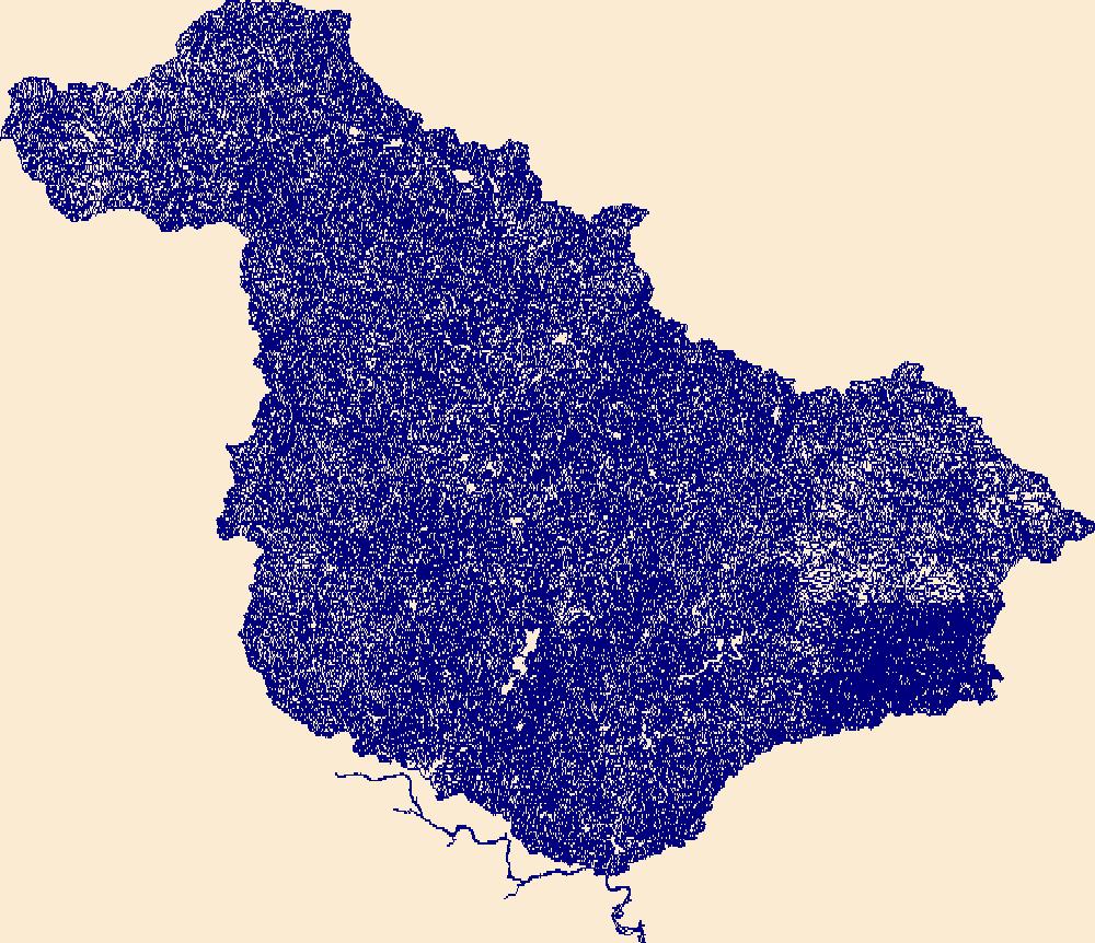
The High Resolution National Hydrography Dataset Plus (NHDPlus HR) is an integrated set of geospatial data layers, including the best available National Hydrography Dataset (NHD), the 10-meter 3D Elevation Program Digital Elevation Model (3DEP DEM), and the National Watershed Boundary Dataset (WBD). The NHDPlus HR combines the NHD, 3DEP DEMs, and WBD to create a stream network with linear referencing, feature naming, "value added attributes" (VAAs), elevation-derived catchments, and other features for hydrologic data analysis. The stream network with linear referencing is a system of data relationships applied to hydrographic systems so that one stream reach "flows" into another and "events" can be tied to and traced...
Tags: Benton County,
Chelan County,
Downloadable Data,
FileGDB,
FileGDB 10.1, All tags...
HU-4 Subregion,
HU-4 Subregion,
HU4_1703,
Hydrography,
King County,
Kittitas County,
Klickitat County,
Lewis County,
NHDPlus HR Rasters,
NHDPlus High Resolution (NHDPlus HR),
National Hydrography Dataset (NHD),
National Hydrography Dataset Plus High Resolution (NHDPlus HR),
National Hydrography Dataset Plus High Resolution (NHDPlus HR) Current,
Pierce County,
US,
United States,
WA,
Washington,
Yakima County,
base maps,
cartography,
catchments,
channels,
digital elevation models,
drainage basins,
earth sciences,
elevation,
environment,
geographic information systems,
geoscientific,
geospatial analysis,
hydrographic datasets,
hydrographic features,
hydrology,
imagery,
inland waters,
lakes,
land surface characteristics,
reservoirs,
river reaches,
rivers,
streamflow,
streamflow data,
streams,
topography,
water bodies,
water quality,
water resources,
watersheds, Fewer tags
The High Resolution National Hydrography Dataset Plus (NHDPlus HR) is an integrated set of geospatial data layers, including the best available National Hydrography Dataset (NHD), the 10-meter 3D Elevation Program Digital Elevation Model (3DEP DEM), and the National Watershed Boundary Dataset (WBD). The NHDPlus HR combines the NHD, 3DEP DEMs, and WBD to create a stream network with linear referencing, feature naming, "value added attributes" (VAAs), elevation-derived catchments, and other features for hydrologic data analysis. The stream network with linear referencing is a system of data relationships applied to hydrographic systems so that one stream reach "flows" into another and "events" can be tied to and traced...
Tags: Benton County,
Clackamas County,
Columbia County,
Deschutes County,
Douglas County, All tags...
Downloadable Data,
FileGDB,
FileGDB 10.1,
HU-4 Subregion,
HU-4 Subregion,
HU4_1709,
Hydrography,
Jefferson County,
Klamath County,
Lane County,
Lincoln County,
Linn County,
Marion County,
Multnomah County,
NHDPlus HR Rasters,
NHDPlus High Resolution (NHDPlus HR),
National Hydrography Dataset (NHD),
National Hydrography Dataset Plus High Resolution (NHDPlus HR),
National Hydrography Dataset Plus High Resolution (NHDPlus HR) Current,
OR,
Oregon,
Polk County,
Tillamook County,
US,
United States,
Wasco County,
Washington County,
Yamhill County,
base maps,
cartography,
catchments,
channels,
digital elevation models,
drainage basins,
earth sciences,
elevation,
environment,
geographic information systems,
geoscientific,
geospatial analysis,
hydrographic datasets,
hydrographic features,
hydrology,
imagery,
inland waters,
lakes,
land surface characteristics,
reservoirs,
river reaches,
rivers,
streamflow,
streamflow data,
streams,
topography,
water bodies,
water quality,
water resources,
watersheds, Fewer tags
The High Resolution National Hydrography Dataset Plus (NHDPlus HR) is an integrated set of geospatial data layers, including the best available National Hydrography Dataset (NHD), the 10-meter 3D Elevation Program Digital Elevation Model (3DEP DEM), and the National Watershed Boundary Dataset (WBD). The NHDPlus HR combines the NHD, 3DEP DEMs, and WBD to create a stream network with linear referencing, feature naming, "value added attributes" (VAAs), elevation-derived catchments, and other features for hydrologic data analysis. The stream network with linear referencing is a system of data relationships applied to hydrographic systems so that one stream reach "flows" into another and "events" can be tied to and traced...
Tags: AR,
Allen County,
Anderson County,
Arkansas,
Barry County, All tags...
Barton County,
Benton County,
Bourbon County,
Butler County,
Chase County,
Chautauqua County,
Cherokee County,
Cherokee County,
Christian County,
Coffey County,
Cowley County,
Craig County,
Crawford County,
Dade County,
Delaware County,
Downloadable Data,
Elk County,
FileGDB,
FileGDB 10.1,
Greenwood County,
HU-4 Subregion,
HU-4 Subregion,
HU4_1107,
Harvey County,
Hydrography,
Jasper County,
KS,
Kansas,
Labette County,
Lawrence County,
Lyon County,
MO,
Marion County,
Mayes County,
McDonald County,
McPherson County,
Missouri,
Montgomery County,
Morris County,
Muskogee County,
NHDPlus HR Rasters,
NHDPlus High Resolution (NHDPlus HR),
National Hydrography Dataset (NHD),
National Hydrography Dataset Plus High Resolution (NHDPlus HR),
National Hydrography Dataset Plus High Resolution (NHDPlus HR) Current,
Neosho County,
Newton County,
Nowata County,
OK,
Oklahoma,
Osage County,
Osage County,
Ottawa County,
Rogers County,
Stone County,
Tulsa County,
US,
United States,
Wabaunsee County,
Wagoner County,
Washington County,
Wilson County,
Woodson County,
base maps,
cartography,
catchments,
channels,
digital elevation models,
drainage basins,
earth sciences,
elevation,
environment,
geographic information systems,
geoscientific,
geospatial analysis,
hydrographic datasets,
hydrographic features,
hydrology,
imagery,
inland waters,
lakes,
land surface characteristics,
reservoirs,
river reaches,
rivers,
streamflow,
streamflow data,
streams,
topography,
water bodies,
water quality,
water resources,
watersheds, Fewer tags

The High Resolution National Hydrography Dataset Plus (NHDPlus HR) is an integrated set of geospatial data layers, including the best available National Hydrography Dataset (NHD), the 10-meter 3D Elevation Program Digital Elevation Model (3DEP DEM), and the National Watershed Boundary Dataset (WBD). The NHDPlus HR combines the NHD, 3DEP DEMs, and WBD to create a stream network with linear referencing, feature naming, "value added attributes" (VAAs), elevation-derived catchments, and other features for hydrologic data analysis. The stream network with linear referencing is a system of data relationships applied to hydrographic systems so that one stream reach "flows" into another and "events" can be tied to and traced...
Tags: AR,
Arkansas,
Benton County,
Bolivar County,
Calhoun County, All tags...
Carroll County,
Chickasaw County,
Chicot County,
Coahoma County,
DeSoto County,
Desha County,
Downloadable Data,
East Carroll County,
FileGDB,
FileGDB 10.1,
Grenada County,
HU-4 Subregion,
HU-4 Subregion,
HU4_0803,
Holmes County,
Humphreys County,
Hydrography,
Issaquena County,
LA,
Lafayette County,
Leflore County,
Louisiana,
MS,
Madison County,
Marshall County,
Mississippi,
Montgomery County,
NHDPlus HR Rasters,
NHDPlus High Resolution (NHDPlus HR),
National Hydrography Dataset (NHD),
National Hydrography Dataset Plus High Resolution (NHDPlus HR),
National Hydrography Dataset Plus High Resolution (NHDPlus HR) Current,
Panola County,
Pontotoc County,
Quitman County,
Sharkey County,
Shelby County,
Sunflower County,
TN,
Tallahatchie County,
Tate County,
Tennessee,
Tippah County,
Tunica County,
US,
Union County,
United States,
Warren County,
Washington County,
Webster County,
Yalobusha County,
Yazoo County,
base maps,
cartography,
catchments,
channels,
digital elevation models,
drainage basins,
earth sciences,
elevation,
environment,
geographic information systems,
geoscientific,
geospatial analysis,
hydrographic datasets,
hydrographic features,
hydrology,
imagery,
inland waters,
lakes,
land surface characteristics,
reservoirs,
river reaches,
rivers,
streamflow,
streamflow data,
streams,
topography,
water bodies,
water quality,
water resources,
watersheds, Fewer tags
The High Resolution National Hydrography Dataset Plus (NHDPlus HR) is an integrated set of geospatial data layers, including the best available National Hydrography Dataset (NHD), the 10-meter 3D Elevation Program Digital Elevation Model (3DEP DEM), and the National Watershed Boundary Dataset (WBD). The NHDPlus HR combines the NHD, 3DEP DEMs, and WBD to create a stream network with linear referencing, feature naming, "value added attributes" (VAAs), elevation-derived catchments, and other features for hydrologic data analysis. The stream network with linear referencing is a system of data relationships applied to hydrographic systems so that one stream reach "flows" into another and "events" can be tied to and traced...
Tags: Baker County,
Benton County,
Clackamas County,
Columbia County,
Crook County, All tags...
Deschutes County,
Douglas County,
Downloadable Data,
FileGDB,
FileGDB 10.1,
Gilliam County,
Grant County,
HU-4 Subregion,
HU-4 Subregion,
HU4_1707,
Harney County,
Hood River County,
Hydrography,
Jefferson County,
Klamath County,
Klickitat County,
Lake County,
Lane County,
Lewis County,
Linn County,
Marion County,
Morrow County,
Multnomah County,
NHDPlus HR Rasters,
NHDPlus High Resolution (NHDPlus HR),
National Hydrography Dataset (NHD),
National Hydrography Dataset Plus High Resolution (NHDPlus HR),
National Hydrography Dataset Plus High Resolution (NHDPlus HR) Current,
OR,
Oregon,
Sherman County,
Skamania County,
US,
Umatilla County,
Union County,
United States,
WA,
Walla Walla County,
Wallowa County,
Wasco County,
Washington,
Wheeler County,
Yakima County,
base maps,
cartography,
catchments,
channels,
digital elevation models,
drainage basins,
earth sciences,
elevation,
environment,
geographic information systems,
geoscientific,
geospatial analysis,
hydrographic datasets,
hydrographic features,
hydrology,
imagery,
inland waters,
lakes,
land surface characteristics,
reservoirs,
river reaches,
rivers,
streamflow,
streamflow data,
streams,
topography,
water bodies,
water quality,
water resources,
watersheds, Fewer tags

The High Resolution National Hydrography Dataset Plus (NHDPlus HR) is an integrated set of geospatial data layers, including the best available National Hydrography Dataset (NHD), the 10-meter 3D Elevation Program Digital Elevation Model (3DEP DEM), and the National Watershed Boundary Dataset (WBD). The NHDPlus HR combines the NHD, 3DEP DEMs, and WBD to create a stream network with linear referencing, feature naming, "value added attributes" (VAAs), elevation-derived catchments, and other features for hydrologic data analysis. The stream network with linear referencing is a system of data relationships applied to hydrographic systems so that one stream reach "flows" into another and "events" can be tied to and traced...
Tags: AR,
Adair County,
Arkansas,
Benton County,
Cherokee County, All tags...
Cleburne County,
Conway County,
Crawford County,
Creek County,
Delaware County,
Downloadable Data,
Faulkner County,
FileGDB,
FileGDB 10.1,
Franklin County,
Garland County,
Grant County,
HU-4 Subregion,
HU-4 Subregion,
HU4_1111,
Haskell County,
Hydrography,
Jefferson County,
Johnson County,
Latimer County,
Le Flore County,
Logan County,
Lonoke County,
Madison County,
McIntosh County,
Montgomery County,
Muskogee County,
NHDPlus HR Rasters,
NHDPlus High Resolution (NHDPlus HR),
National Hydrography Dataset (NHD),
National Hydrography Dataset Plus High Resolution (NHDPlus HR),
National Hydrography Dataset Plus High Resolution (NHDPlus HR) Current,
Newton County,
OK,
Oklahoma,
Okmulgee County,
Osage County,
Perry County,
Pittsburg County,
Polk County,
Pope County,
Pulaski County,
Saline County,
Scott County,
Searcy County,
Sebastian County,
Sequoyah County,
Tulsa County,
US,
United States,
Van Buren County,
Wagoner County,
Washington County,
White County,
Yell County,
base maps,
cartography,
catchments,
channels,
digital elevation models,
drainage basins,
earth sciences,
elevation,
environment,
geographic information systems,
geoscientific,
geospatial analysis,
hydrographic datasets,
hydrographic features,
hydrology,
imagery,
inland waters,
lakes,
land surface characteristics,
reservoirs,
river reaches,
rivers,
streamflow,
streamflow data,
streams,
topography,
water bodies,
water quality,
water resources,
watersheds, Fewer tags

The High Resolution National Hydrography Dataset Plus (NHDPlus HR) is an integrated set of geospatial data layers, including the best available National Hydrography Dataset (NHD), the 10-meter 3D Elevation Program Digital Elevation Model (3DEP DEM), and the National Watershed Boundary Dataset (WBD). The NHDPlus HR combines the NHD, 3DEP DEMs, and WBD to create a stream network with linear referencing, feature naming, "value added attributes" (VAAs), elevation-derived catchments, and other features for hydrologic data analysis. The stream network with linear referencing is a system of data relationships applied to hydrographic systems so that one stream reach "flows" into another and "events" can be tied to and traced...
Tags: AR,
Alcorn County,
Alexander County,
Arkansas,
Ballard County, All tags...
Benton County,
Calloway County,
Carlisle County,
Carroll County,
Chester County,
Crittenden County,
Crockett County,
DeSoto County,
Downloadable Data,
Dyer County,
Fayette County,
FileGDB,
FileGDB 10.1,
Fulton County,
Gibson County,
Graves County,
HU-4 Subregion,
HU-4 Subregion,
HU4_0801,
Hardeman County,
Haywood County,
Henderson County,
Henry County,
Hickman County,
Hydrography,
IL,
Illinois,
KY,
Kentucky,
Lake County,
Lauderdale County,
MO,
MS,
Madison County,
Marshall County,
McCracken County,
McNairy County,
Mississippi,
Mississippi County,
Mississippi County,
Missouri,
NHDPlus HR Rasters,
NHDPlus High Resolution (NHDPlus HR),
National Hydrography Dataset (NHD),
National Hydrography Dataset Plus High Resolution (NHDPlus HR),
National Hydrography Dataset Plus High Resolution (NHDPlus HR) Current,
New Madrid County,
Obion County,
Pemiscot County,
Prentiss County,
Scott County,
Shelby County,
TN,
Tennessee,
Tippah County,
Tipton County,
US,
Union County,
United States,
Weakley County,
base maps,
cartography,
catchments,
channels,
digital elevation models,
drainage basins,
earth sciences,
elevation,
environment,
geographic information systems,
geoscientific,
geospatial analysis,
hydrographic datasets,
hydrographic features,
hydrology,
imagery,
inland waters,
lakes,
land surface characteristics,
reservoirs,
river reaches,
rivers,
streamflow,
streamflow data,
streams,
topography,
water bodies,
water quality,
water resources,
watersheds, Fewer tags

The High Resolution National Hydrography Dataset Plus (NHDPlus HR) is an integrated set of geospatial data layers, including the best available National Hydrography Dataset (NHD), the 10-meter 3D Elevation Program Digital Elevation Model (3DEP DEM), and the National Watershed Boundary Dataset (WBD). The NHDPlus HR combines the NHD, 3DEP DEMs, and WBD to create a stream network with linear referencing, feature naming, "value added attributes" (VAAs), elevation-derived catchments, and other features for hydrologic data analysis. The stream network with linear referencing is a system of data relationships applied to hydrographic systems so that one stream reach "flows" into another and "events" can be tied to and traced...
Tags: Adams County,
Allen County,
Auglaize County,
Bartholomew County,
Benton County, All tags...
Blackford County,
Boone County,
Brown County,
Carroll County,
Cass County,
Champaign County,
Clark County,
Clark County,
Clay County,
Clay County,
Clinton County,
Coles County,
Crawford County,
Crawford County,
Cumberland County,
Darke County,
Daviess County,
Decatur County,
Delaware County,
Douglas County,
Downloadable Data,
Dubois County,
Edgar County,
Edwards County,
Effingham County,
Fayette County,
Fayette County,
FileGDB,
FileGDB 10.1,
Ford County,
Fountain County,
Fulton County,
Gallatin County,
Gibson County,
Grant County,
Greene County,
HU-4 Subregion,
HU-4 Subregion,
HU4_0512,
Hamilton County,
Hamilton County,
Hancock County,
Hendricks County,
Henry County,
Howard County,
Huntington County,
Hydrography,
IL,
IN,
Illinois,
Indiana,
Iroquois County,
Jackson County,
Jasper County,
Jasper County,
Jay County,
Jefferson County,
Jefferson County,
Jennings County,
Johnson County,
Knox County,
Kosciusko County,
Lawrence County,
Lawrence County,
Livingston County,
Madison County,
Marion County,
Marion County,
Marshall County,
Martin County,
Mercer County,
Miami County,
Monroe County,
Montgomery County,
Morgan County,
Moultrie County,
NHDPlus HR Rasters,
NHDPlus High Resolution (NHDPlus HR),
National Hydrography Dataset (NHD),
National Hydrography Dataset Plus High Resolution (NHDPlus HR),
National Hydrography Dataset Plus High Resolution (NHDPlus HR) Current,
Noble County,
OH,
Ohio,
Orange County,
Owen County,
Parke County,
Pike County,
Posey County,
Pulaski County,
Putnam County,
Randolph County,
Richland County,
Ripley County,
Rush County,
Scott County,
Shelby County,
Shelby County,
Spencer County,
Starke County,
Sullivan County,
Tippecanoe County,
Tipton County,
US,
United States,
Vanderburgh County,
Vermilion County,
Vermillion County,
Vigo County,
Wabash County,
Wabash County,
Warren County,
Warrick County,
Washington County,
Wayne County,
Wells County,
White County,
White County,
Whitley County,
base maps,
cartography,
catchments,
channels,
digital elevation models,
drainage basins,
earth sciences,
elevation,
environment,
geographic information systems,
geoscientific,
geospatial analysis,
hydrographic datasets,
hydrographic features,
hydrology,
imagery,
inland waters,
lakes,
land surface characteristics,
reservoirs,
river reaches,
rivers,
streamflow,
streamflow data,
streams,
topography,
water bodies,
water quality,
water resources,
watersheds, Fewer tags
|
|

