Filters: Tags: Bexar County (X) > Date Range: {"choice":"year"} (X)
14 results (13ms)|
Filters
Date Types (for Date Range)
Types
Contacts
Categories Tag Types Tag Schemes |
This data release includes aerial imagery collected during two uncrewed aerial system (UAS) imagery surveys at an edge-of-field site north of Medina River Natural Area near San Antonio, Texas, on August 14, 2019, and July 8, 2022. A total of 1,153 images were collected during the survey on August 14, 2019, and a total of 1,277 images were collected during the survey on July 8, 2022. In total, 2,430 images provided in the form of geotagged true-color aerial images in JPG format are provided.
This data release includes ground control points (GCPs) collected during two uncrewed aerial system (UAS) imagery surveys conducted at an edge-of-field site north of Medina River Natural Area near San Antonio, Texas, on August 14, 2019, and July 8, 2022. Ten GCPs were used on each survey date, and a total of twenty GCPs are described in this data release.
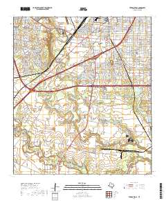
Layered geospatial PDF 7.5 Minute Quadrangle Map. Layers of geospatial data include orthoimagery, roads, grids, geographic names, elevation contours, hydrography, and other selected map features. This map is derived from GIS (geospatial information system) data. It represents a repackaging of GIS data in traditional map form, not creation of new information. The geospatial data in this map are from selected National Map data holdings and other government sources.
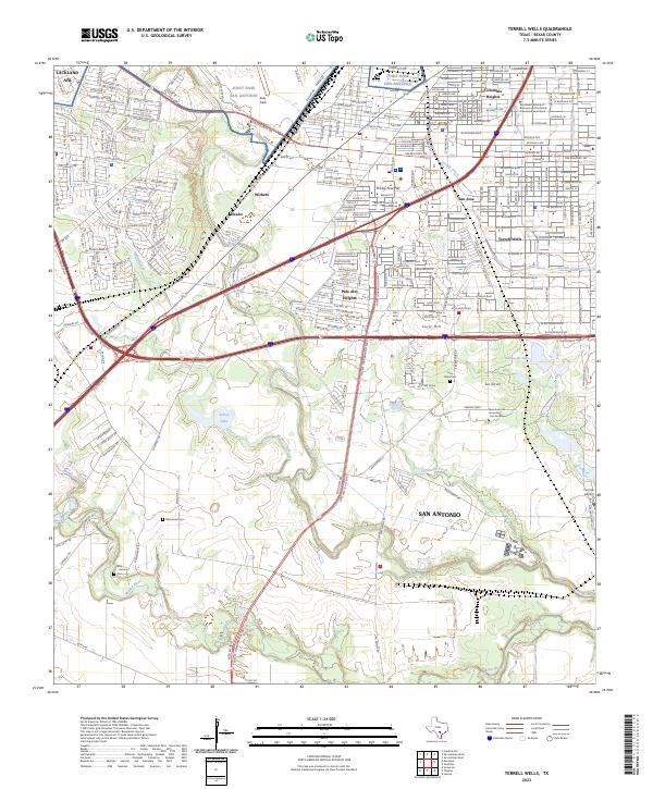
Layered geospatial PDF 7.5 Minute Quadrangle Map. Layers of geospatial data include orthoimagery, roads, grids, geographic names, elevation contours, hydrography, and other selected map features. This map is derived from GIS (geospatial information system) data. It represents a repackaging of GIS data in traditional map form, not creation of new information. The geospatial data in this map are from selected National Map data holdings and other government sources.
This data release includes two digital orthomosaic images produced from uncrewed aerial system (UAS) imagery surveys conducted on August 14, 2019, and July 8, 2022 at an edge-of-field site north of Medina River Natural Area near San Antonio, Texas. These images were compiled from sets of aerial imagery included in this data release. Orthomosaic images can be used for visual reference but do not contain elevation data.
Categories: Data;
Types: Downloadable,
Map Service,
OGC WFS Layer,
OGC WMS Layer,
Shapefile;
Tags: 3DR Solo,
Bexar County,
Medina Natural Area,
Medina River,
San Antonio,
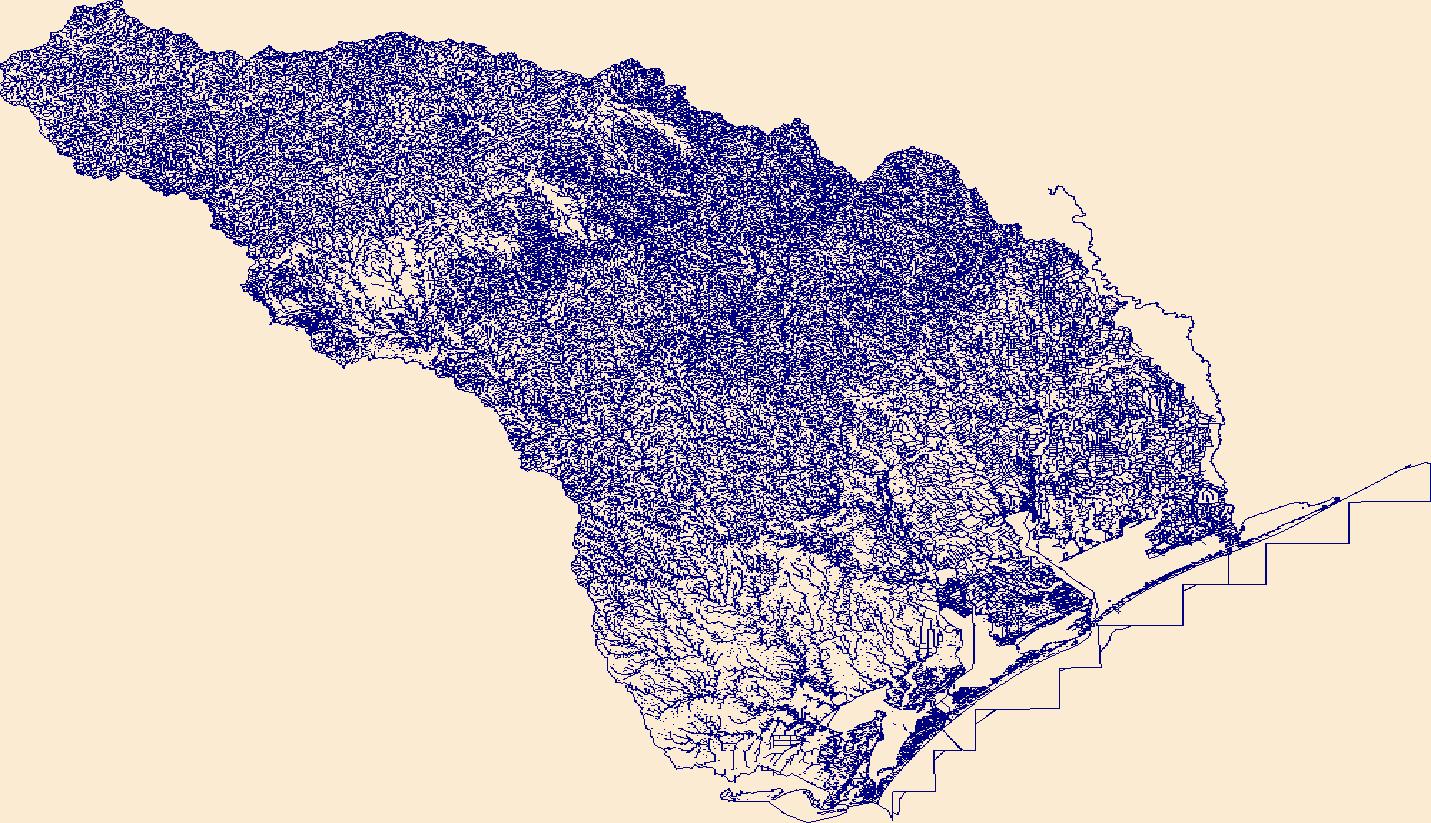
The Edwards aquifer in south-central Texas is one of the most permeable and productive aquifers in the United States and is the major source of public water supply for Bexar, Comal, Hays, Medina, and Uvalde Counties. The Edwards aquifer also supplies large quantities of water for use in agriculture, business, and industry in the region. The major artesian springs of the Edwards aquifer provide water for recreational activities, businesses, and downstream users, and provide habitat for several threatened or endangered species. The areas pertinent to the recharge process are the catchment area and the recharge zone. The catchment area consists of the parts of river basins upstream from the recharge zone. Streams...
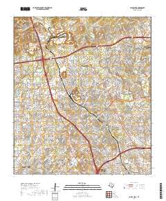
Layered geospatial PDF 7.5 Minute Quadrangle Map. Layers of geospatial data include orthoimagery, roads, grids, geographic names, elevation contours, hydrography, and other selected map features. This map is derived from GIS (geospatial information system) data. It represents a repackaging of GIS data in traditional map form, not creation of new information. The geospatial data in this map are from selected National Map data holdings and other government sources.
The Edwards and Trinity aquifers are major sources of water for agriculture, industry, and urban and rural communities in south-central Texas. Both the Edwards and Trinity aquifers are classified as major aquifers by the State of Texas. The dissolution of the carbonate rocks composing the Edwards and Trinity aquifers results in distinctive landforms rich in both springs and karst features (caves, sinkholes, and other visible areas of solution-enlarged porosity). Previous studies such as those by the U.S. Geological Survey (USGS) and the Texas Bureau of Economic Geology (BEG) have mapped the geology, hydrostratigraphy, and structure in these areas at various scales. The purpose of this data release is to present...
Types: Map Service,
OGC WFS Layer,
OGC WMS Layer,
OGC WMS Service;
Tags: Balcones fault zone,
Bexar County,
Blanco River,
Bulverde,
Canyon Lake,
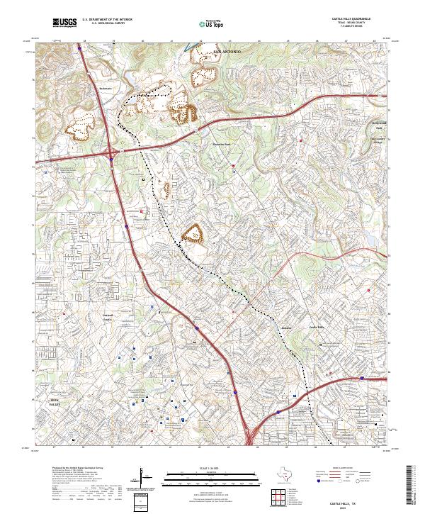
Layered geospatial PDF 7.5 Minute Quadrangle Map. Layers of geospatial data include orthoimagery, roads, grids, geographic names, elevation contours, hydrography, and other selected map features. This map is derived from GIS (geospatial information system) data. It represents a repackaging of GIS data in traditional map form, not creation of new information. The geospatial data in this map are from selected National Map data holdings and other government sources.
Data included in this release are two digital surface models (DSMs) obtained by using uncrewed aerial system (UAS) surveys conducted on August 14, 2019, and July 8, 2022, at an edge-of-field site north of the Medina River Natural Area near San Antonio, Texas.
Categories: Data;
Types: Downloadable,
Map Service,
OGC WFS Layer,
OGC WMS Layer,
Shapefile;
Tags: 3DR Solo,
Bexar County,
Medina River,
Medina River Natural Area,
San Antonio,
This data release includes two dense point clouds produced from uncrewed aerial system (UAS) imagery surveys conducted on August 14, 2019, and July 8, 2022 at an edge-of-field site north of Medina River Natural Area near San Antonio, Texas. The dense point cloud for the August 14, 2019, survey contains 166,261,373 points, and the dense point cloud for the July 8, 2022 survey contains 164,395,847 points. Points within the dense point cloud have not been classified.
Uncrewed aerial system (UAS) flights were conducted by the U.S. Geological Survey at an edge-of-field site located north of Medina River Natural Area near San Antonio, Texas on August 14, 2019, and July 8, 2022, to support efforts aimed at estimating edge-of-field erosion and potential sediment loading into the Medina River near San Antonio. Data provided here include imagery obtained during the flights, and ground control point (GCP) information. Additional products including automatically generated point clouds, digital surface models (DSMs), and orthomosaic imagery produced using structure-from-motion (SfM) techniques are part of this data release.
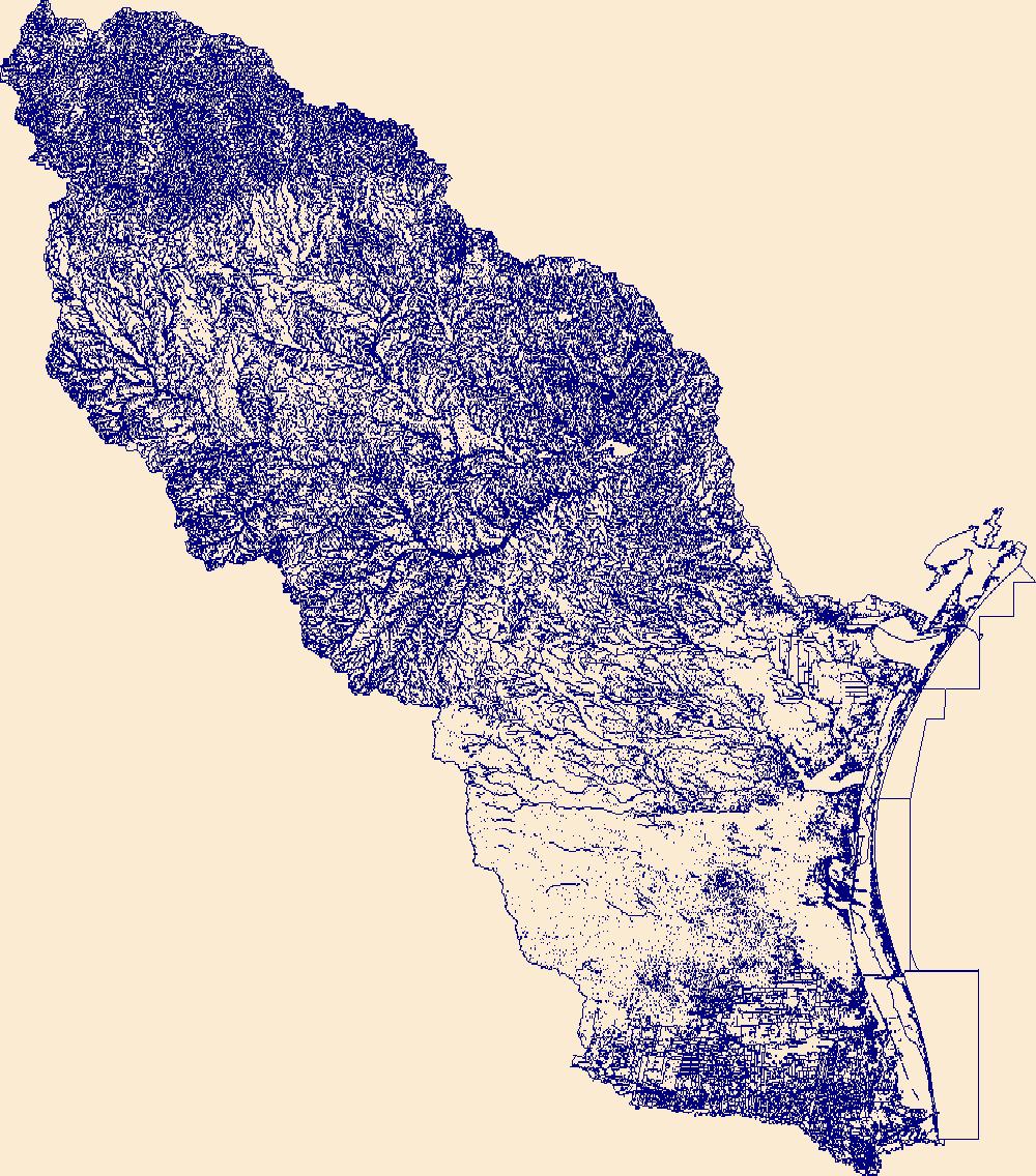
The High Resolution National Hydrography Dataset Plus (NHDPlus HR) is an integrated set of geospatial data layers, including the best available National Hydrography Dataset (NHD), the 10-meter 3D Elevation Program Digital Elevation Model (3DEP DEM), and the National Watershed Boundary Dataset (WBD). The NHDPlus HR combines the NHD, 3DEP DEMs, and WBD to create a stream network with linear referencing, feature naming, "value added attributes" (VAAs), elevation-derived catchments, and other features for hydrologic data analysis. The stream network with linear referencing is a system of data relationships applied to hydrographic systems so that one stream reach "flows" into another and "events" can be tied to and traced...
The High Resolution National Hydrography Dataset Plus (NHDPlus HR) is an integrated set of geospatial data layers, including the best available National Hydrography Dataset (NHD), the 10-meter 3D Elevation Program Digital Elevation Model (3DEP DEM), and the National Watershed Boundary Dataset (WBD). The NHDPlus HR combines the NHD, 3DEP DEMs, and WBD to create a stream network with linear referencing, feature naming, "value added attributes" (VAAs), elevation-derived catchments, and other features for hydrologic data analysis. The stream network with linear referencing is a system of data relationships applied to hydrographic systems so that one stream reach "flows" into another and "events" can be tied to and traced...
|

|
