Filters: Tags: Big Sur (X)
26 results (30ms)|
Filters
Date Range
Extensions Types Contacts
Categories Tag Types Tag Schemes |
Presented here is a point cloud collected by the U.S. Geological Survey (USGS) using an oblique plane-mounted camera system, covering the area of the Mud Creek landslide on California State Route 1 (SR1), Mud Creek, Big Sur, California. The point cloud is referenced to previously published lidar data and contains RGB information as well as XYZ. Point cloud coordinates are in NAD83 UTM Zone 10 meters. Imagery was collected with a Nikon D800 camera in RAW format and processed using structure-from-motion photogrammetry with Agisoft PhotoScan version 1.2.8 through 1.3.2. Pointclouds were clipped to an AOI using LASTools. The AOI was created from a KMZ in Google Earth and transformed to a shapefile using ArcMap 10.5.
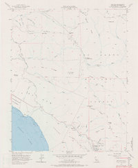
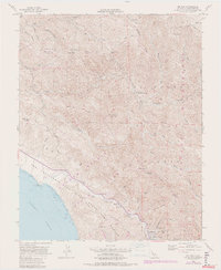
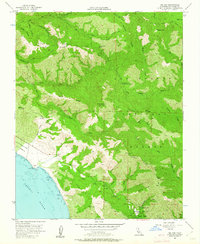
USGS Historical Quadrangle in GeoPDF.
The data support a study that surveyed the spatial distribution of Oncorhynchus mykiss and Cottus aleuticus eDNA in coastal streams of Big Sur, California, 2021-2022 following post-fire debris flows. The metadata represent qPCR quantification cycle (Cq) values for O. mykiss and C. aleuticus assays performed on water samples collected during June and July of 2021 and 2022 from the following streams: Big Creek, Mill Creek, Prewitt Creek, and Willow Creek. The metadata also includes the distance (meters) of each eDNA sample site from the stream mouth, volume of water (Liters) collected for eDNA analysis at each site, and the Y-intercept, slope, and R-squared value for each assay run.
USGS Historical Quadrangle in GeoPDF.
Presented here is a point cloud collected by the U.S. Geological Survey (USGS) using an oblique plane-mounted camera system, covering the area of the Mud Creek landslide on California State Route 1 (SR1), Mud Creek, Big Sur, California. The point cloud is referenced to previously published lidar data and contains RGB information as well as XYZ. Point cloud coordinates are in NAD83 UTM Zone 10 meters. Imagery was collected with a Nikon D800 camera in RAW format and processed using structure-from-motion photogrammetry with Agisoft PhotoScan version 1.2.8 through 1.3.2. Pointclouds were clipped to an AOI using LASTools. The AOI was created from a KMZ in Google Earth and transformed to a shapefile using ArcMap 10.5.
This data set contains imagery from the National Agriculture Imagery Program (NAIP). The NAIP program is administered by USDA FSA and has been established to support two main FSA strategic goals centered on agricultural production. These are, increase stewardship of America's natural resources while enhancing the environment, and to ensure commodities are procured and distributed effectively and efficiently to increase food security. The NAIP program supports these goals by acquiring and providing ortho imagery that has been collected during the agricultural growing season in the U.S. The NAIP ortho imagery is tailored to meet FSA requirements and is a fundamental tool used to support FSA farm and conservation programs....
This data set contains imagery from the National Agriculture Imagery Program (NAIP). The NAIP program is administered by USDA FSA and has been established to support two main FSA strategic goals centered on agricultural production. These are, increase stewardship of America's natural resources while enhancing the environment, and to ensure commodities are procured and distributed effectively and efficiently to increase food security. The NAIP program supports these goals by acquiring and providing ortho imagery that has been collected during the agricultural growing season in the U.S. The NAIP ortho imagery is tailored to meet FSA requirements and is a fundamental tool used to support FSA farm and conservation programs....
Presented here is a point cloud collected by the U.S. Geological Survey (USGS) using an oblique plane-mounted camera system, covering the area of the Mud Creek landslide on California State Route 1 (SR1), Mud Creek, Big Sur, California. Point cloud is referenced to previously published lidar data and contains RGB information as well as XYZ. Point cloud coordinates are in NAD83 UTM Zone 10 meters. Imagery was collected with a Nikon D800 camera in RAW format and processed using structure-from-motion photogrammetry with Agisoft PhotoScan version 1.2.8 through 1.3.2. Point clouds were clipped to an AOI using LASTools. The AOI was created from a KMZ in Google Earth and transformed to a shapefile using ArcMap 10.5.
Presented here is a point cloud collected by the U.S. Geological Survey (USGS) using a UAS-mounted camera system, covering the area of the Mud Creek landslide on California State Route 1 (SR1), Mud Creek, Big Sur, California. Point cloud is referenced to previously published lidar data and contains RGB information as well as XYZ. Point cloud coordinates are in NAD83 UTM Zone 10 meters. Imagery was collected with a Ricoh GR camera in DNG format and processed using structure-from-motion photogrammetry with Agisoft PhotoScan version 1.2.8 through 1.3.2. Point clouds were clipped to an AOI using LASTools. The AOI was created from a KMZ in Google Earth and transformed to a shapefile using ArcMap 10.5.
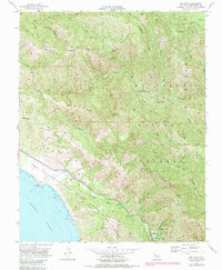
USGS Historical Quadrangle in GeoPDF.
USGS Historical Quadrangle in GeoPDF.
Presented here is a point cloud collected by the U.S. Geological Survey (USGS) using an oblique plane-mounted camera system, covering the area of the Mud Creek landslide on California State Route 1 (SR1), Mud Creek, Big Sur, California. Point cloud is referenced to previously published lidar data and contains RGB information as well as XYZ. Point cloud coordinates are in NAD83 UTM Zone 10 meters. Imagery was collected with a Nikon D800 camera in RAW format and processed using structure-from-motion photogrammetry with Agisoft PhotoScan version 1.2.8 through 1.3.2. Point clouds were clipped to an AOI using LASTools. The AOI was created from a KMZ in Google Earth and transformed to a shapefile using ArcMap 10.5.
Presented here is a point cloud produced by the U.S. Geological Survey (USGS) from historical U.S. Air Force vertical aerial imagery, covering the area of the Mud Creek landslide on California State Route 1 (SR1), Mud Creek, Big Sur, California. The point cloud is referenced to previously published lidar data and contains RGB information as well as XYZ. Point cloud coordinates are in NAD83 UTM Zone 10 meters. Imagery was downloaded from USGS Eros Data Center and processed using structure-from-motion photogrammetry with Agisoft PhotoScan version 1.2.8 through 1.3.2. Point clouds were clipped to an AOI using LASTools. The AOI was created from a KMZ in Google Earth and transformed to a shapefile using ArcMap 10.5.

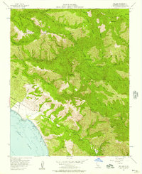
USGS Historical Quadrangle in GeoPDF.
Presented here is a point cloud collected by the U.S. Geological Survey (USGS) using an oblique plane-mounted camera system, covering the area of the Mud Creek landslide on California State Route 1 (SR1), Mud Creek, Big Sur, California. The point cloud is referenced to previously published lidar data and contains RGB information as well as XYZ. Point Cloud Coordinates are in NAD83 UTM Zone 10 meters. Imagery was collected with a Nikon D800 camera in RAW format and processed using structure-from-motion photogrammetry with Agisoft PhotoScan version 1.2.8 through 1.3.2. Pointclouds were clipped to an AOI using LASTools. The AOI was created from a KMZ in Google Earth and transformed to a shapefile using ArcMap 10.5.
Presented here is a point cloud collected by the U.S. Geological Survey (USGS) using an oblique plane-mounted camera system, covering the area of the Mud Creek landslide on California State Route 1 (SR1), Mud Creek, Big Sur, California. The point cloud is referenced to previously published lidar data and contains RGB information as well as XYZ. Point cloud coordinates are in NAD83 UTM Zone 10 meters. Imagery was collected with a Nikon D800 camera in RAW format and processed using structure-from-motion photogrammetry with Agisoft PhotoScan version 1.2.8 through 1.3.2. Point clouds were clipped to an AOI using LASTools. The AOI was created from a KMZ in Google Earth and transformed to a shapefile using ArcMap 10.5.
USGS Historical Quadrangle in GeoPDF.
This data release contains structure-from-motion (SfM) point cloud data from aerial surveys conducted over the Mud Creek landslide on Big Sur from 1967-2018. Data sources include scanned aerial photographs, digital images collected from fixed wing aircraft, and digital images collected from multirotor UAS.
This data release is comprised of sea otter capture data from the capture of wild sea otters in Big Sur and Monterey, CA between the years of 2008-2011. These sea otters were captured for tagging and tracking during a comparison study designed to examine the biology, health, and survival of sea otters in a relatively pristine habitat (Big Sur) and a highly-impacted habitat (Monterey). At the time of capture a variety of data are collected on each individual sea otter. The otter may receive multiple identifiers including an otter number, color coded flipper tags, a PIT tag, VHF radio transmitter, and archival time-depth recorder. Capture information (date, time, GPS location and general area, capture team, capture...
Categories: Data;
Tags: Big Sur,
Monterey Bay,
USGS Science Data Catalog (SDC),
Wildlife Biology,
biota,
Presented here is a point cloud collected by the U.S. Geological Survey (USGS) using a UAS-mounted camera system, covering the area of the Mud Creek landslide on California State Route 1 (SR1), Mud Creek, Big Sur, California. The point cloud is referenced to previously published lidar data and contains RGB information as well as XYZ. Point cloud coordinates are in NAD83 UTM Zone 10 meters. Imagery was collected with a Ricoh GR camera in DNG format and processed using structure-from-motion photogrammetry with Agisoft PhotoScan version 1.2.8 through 1.3.2. Pointclouds were clipped to an AOI using LASTools. The AOI was created from a KMZ in Google Earth and transformed to a shapefile using ArcMap 10.5.
|

|
