Filters: Tags: Black Mountains (X)
8 results (30ms)|
Filters
Date Range
Types Contacts
Categories Tag Types
|
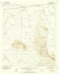
USGS Historical Quadrangle in GeoPDF.
Death Valley National Park, California. West flank of the Black Mountains north of peak 4214, just south of Sheep Canyon in the lower right. The skyline ridge dropping to Death Valley, left and center, is the approximate profile of the surface of the Copper Canyon turtle back and is underlain near the crest by broadly arched metasedimentary rocks that grade into metadiorite near Sheep Canyon. 1957. Figure 3, U.S. Geological Survey Professional paper 413.
Categories: Image;
Types: Map Service,
OGC WFS Layer,
OGC WMS Layer,
OGC WMS Service;
Tags: Black Mountains,
California,
Death Valley National Park,
National Parks,
photo print
This data set contains imagery from the National Agriculture Imagery Program (NAIP). The NAIP program is administered by USDA FSA and has been established to support two main FSA strategic goals centered on agricultural production. These are increase stewardship of America's natural resources while enhancing the environment, and to ensure commodities are procured and distributed effectively and efficiently to increase food security. The NAIP program supports these goals by acquiring and providing ortho imagery that has been collected during the agricultural growing season in the U.S. The NAIP ortho imagery is tailored to meet FSA requirements and is a fundamental tool used to support FSA farm and conservation programs....
This data set contains imagery from the National Agriculture Imagery Program (NAIP). The NAIP program is administered by USDA FSA and has been established to support two main FSA strategic goals centered on agricultural production. These are increase stewardship of America's natural resources while enhancing the environment, and to ensure commodities are procured and distributed effectively and efficiently to increase food security. The NAIP program supports these goals by acquiring and providing ortho imagery that has been collected during the agricultural growing season in the U.S. The NAIP ortho imagery is tailored to meet FSA requirements and is a fundamental tool used to support FSA farm and conservation programs....
This geodatabase contains all of the map information used to publish the Surficial Geologic Map of the Owlshead Mountains 30’ X 60’ Quadrangle,Inyo and San Bernardino Counties, California: U.S. Geological Survey Scientific Investigations Map SIM-3496. The geodatabase and associated map delineate primarily surficial geology and neotectonics structure across the entire extent of this quadrangle, which includes 32 complete 7.5’ quadrangles located in the Owlshead Mountains, southern Death Valley, and adjoining basins and highlands in the southwestern section of Inyo County and the northeastern part of San Bernardino County in eastern California. The datasets contained in this Scientific Investigation Map describe the...
This data set contains imagery from the National Agriculture Imagery Program (NAIP). The NAIP program is administered by USDA FSA and has been established to support two main FSA strategic goals centered on agricultural production. These are increase stewardship of America's natural resources while enhancing the environment, and to ensure commodities are procured and distributed effectively and efficiently to increase food security. The NAIP program supports these goals by acquiring and providing ortho imagery that has been collected during the agricultural growing season in the U.S. The NAIP ortho imagery is tailored to meet FSA requirements and is a fundamental tool used to support FSA farm and conservation programs....
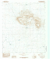
USGS Historical Quadrangle in GeoPDF.
This data set contains imagery from the National Agriculture Imagery Program (NAIP). The NAIP program is administered by USDA FSA and has been established to support two main FSA strategic goals centered on agricultural production. These are increase stewardship of America's natural resources while enhancing the environment, and to ensure commodities are procured and distributed effectively and efficiently to increase food security. The NAIP program supports these goals by acquiring and providing ortho imagery that has been collected during the agricultural growing season in the U.S. The NAIP ortho imagery is tailored to meet FSA requirements and is a fundamental tool used to support FSA farm and conservation programs....
|

|
