Filters: Tags: Black River (X)
55 results (50ms)|
Filters
Date Range
Extensions Types Contacts
Categories Tag Types
|
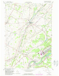
USGS Historical Quadrangle in GeoPDF.
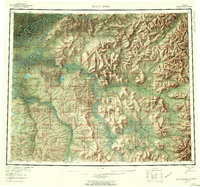
USGS Historical Quadrangle in GeoPDF.
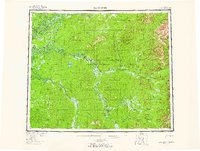
USGS Historical Quadrangle in GeoPDF.
This data release has three components for each of the eight surveys that were conducted in 2018: 1) a geospatial dataset of the processed data; 2) tabular data of the processed waterborne resistivity profiling data and associated water-quality data; 3) tabular data of the raw waterborne resistivity data and associated water-quality data. In addition to the newly collected data from 2018, the waterborne resistivity data from 2016 (Miller and others, 2016) is included and has been re-processed to be consistent with the processing steps currently utilized and described herein. In fresh water aquifers, the geoelectric resistivity of earth materials commonly has a positive correlation with hydraulic conductivity (Faye...
Categories: Data;
Types: ArcGIS REST Map Service,
ArcGIS Service Definition,
Downloadable,
Map Service;
Tags: Apparent resistivity,
Arkansas,
Black River,
Cache River,
Continuous resistivity profiling,
This content represents a map displaying the vector data corresponding to the processed datasets for the waterborne resistivity profiling surveys of streams in the Mississippi Alluvial Plain. The .sd file is an ESRI service definition file containing all the data (capatible for use in ESRI ArcDesktop). This file bundle contains 8 shapefiles, each representing an individual stream. These are all displayed in the map service definition. Users can also download the .sd file and extract the content (using 7zip, winzip, etc.) on their local machine to obtain all the stand-alone shapefiles.
Categories: Data;
Types: ArcGIS REST Map Service,
ArcGIS Service Definition,
Downloadable,
Map Service;
Tags: Apparent resistivity,
Arkansas,
Black River,
Bogue Phalia,
Continuous resistivity profiling,
This data set contains imagery from the National Agriculture Imagery Program (NAIP). The NAIP program is administered by USDA FSA and has been established to support two main FSA strategic goals centered on agricultural production. These are, increase stewardship of America's natural resources while enhancing the environment, and to ensure commodities are procured and distributed effectively and efficiently to increase food security. The NAIP program supports these goals by acquiring and providing ortho imagery that has been collected during the agricultural growing season in the U.S. The NAIP ortho imagery is tailored to meet FSA requirements and is a fundamental tool used to support FSA farm and conservation programs....
Because surface water can be a source of undesirable water quality in a drinking water well, an understanding of the amount of surface water and its travel time to the well is needed to assess a well's vulnerability. Stable isotope ratios of oxygen in river water at the City of La Crosse, Wisconsin, show peak-to-peak seasonal variation greater than 4‰ in 2001 and 2002. This seasonal signal was identified in 7 of 13 city municipal wells, indicating that these 7 wells have appreciable surface water contributions and are potentially vulnerable to contaminants in the surface water. When looking at wells with more than 6 sampling events, a larger variation in δ18O compositions correlated with a larger fraction of surface...
Categories: Publication;
Types: Citation;
Tags: Age dating,
Bank filtration,
Black River,
Drinking wa
The Lake Erie Ecological Investigations (LEEI) dataset contains data collected on contaminants in sediments, benthic invertebrate populations, fish populations and abnormalities, and fish health of primarily brown bullhead in Areas of Concerns (AOCs) on Lake Erie. A subset of the larger dataset, this section specifically handles reference tables, used in database design in order to standardize often used values and to make the data file efficient, for the main tables of the LEEI dataset. The reference tables include: site.csv, site_date.csv, and species.csv.
Assessment of sugar maple health and associated soil conditions in the Adirondack Region of New York
This project provides a regional assessment of sugar maple health and associated soil conditions in the Adirondack Region of New York, where sugar maple are a major component of the forest. The focus of the study is to develop an improved understanding of relationships among watershed characteristics, soil chemistry, and acidic deposition effects on sugar maple trees and other tree species that grow in association with sugar maple, which are one of the most highly valued tree species in the northeast. Project results are therefore important for the management of sugar maple in the Adirondack region where acidic deposition has lowered the nutritional status of soils by depleting calcium, a key nutrient for trees.Purpose...
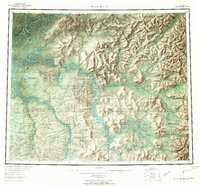
USGS Historical Quadrangle in GeoPDF.
These geospatial data were collected during the September 20-21, 2016, topographic and hydrographic survey of Black River in the vicinity of U.S. Highway 52 at Kingstree, SC.
This part of the data release contains the geospatial data collected by the USGS during the Pecos River salinity assessment. The data includes a feature class of the study area boundary and the Pecos River Basin boundary, the picks that were used to develop the depth to the base of the 16 geologic units, a feature class of springs, seeps and sinkholes compiled in the study area, a feature class of the USGS streamflow-gaging stations locations in the study area, a feature class of the locations of the saltwater disposal wells in the study area, and a feature class of areas of interest with respect to salinity. These digital data accompany Houston, N.A., Thomas, J.V., Ging, P.B., Teeple, A.P., Pedraza, D.E., and...
Types: Map Service,
OGC WFS Layer,
OGC WMS Layer,
OGC WMS Service;
Tags: Andrews County,
Avalon Lake,
Black River,
Blue Hole,
Brantley Lake,
This Fish Health Evaluation dataset, a conceptual subgroup of the Lake Erie Ecological Investigations (LEEI) dataset, focuses on the health of fish—primarily brown bullhead—sampled at Areas of Concern (AOCs) on Lake Erie, as measured by anomalies, tumors, biomarkers, and other heath indicators. The focus of the data in the Fish Health dataset is from the 1998-2000 study, which reevaluated fish health in comparison to data from various historical studies also in the dataset. All of the data from the 1998-2000 evaluation and the data used for comparison from historical studies are in the main FISH_HEALTH table; additional historical data, which presumably fell out of scope for comparison, is also in the OLDFISHDATA_NOTERIE...
This data set contains imagery from the National Agriculture Imagery Program (NAIP). The NAIP program is administered by USDA FSA and has been established to support two main FSA strategic goals centered on agricultural production. These are, increase stewardship of America's natural resources while enhancing the environment, and to ensure commodities are procured and distributed effectively and efficiently to increase food security. The NAIP program supports these goals by acquiring and providing ortho imagery that has been collected during the agricultural growing season in the U.S. The NAIP ortho imagery is tailored to meet FSA requirements and is a fundamental tool used to support FSA farm and conservation programs....
This data release has three components for each of the eight stream lengths: 1) a geospatial dataset of the processed data; 2) tabular data of the processed waterborne resistivity profiling data and associated water-quality data; 3) tabular data of the raw waterborne resistivity data and associated water-quality data. In fresh water aquifers, the geoelectric resistivity of earth materials commonly has a positive correlation with hydraulic conductivity (Faye and Smith, 1994). Throughout 2017, continuous resistivity profiling data were collected, as a proxy for streambed hydraulic conductivity, along reaches of eight streams in the Mississippi Alluvial Plain of Mississippi, Arkansas, and Missouri. A total of...
Categories: Data;
Types: ArcGIS REST Map Service,
ArcGIS Service Definition,
Downloadable,
Map Service;
Tags: Apparent resistivity,
Arkansas,
Black River,
Bogue Phalia,
Continuous resistivity profiling,
|

|
