Filters: Tags: Blue Ridge (X)
38 results (30ms)|
Filters
Date Range
Extensions Types
Contacts
Categories Tag Types
|
This data set contains imagery from the National Agriculture Imagery Program (NAIP). The NAIP program is administered by USDA FSA and has been established to support two main FSA strategic goals centered on agricultural production. These are, increase stewardship of America's natural resources while enhancing the environment, and to ensure commodities are procured and distributed effectively and efficiently to increase food security. The NAIP program supports these goals by acquiring and providing ortho imagery that has been collected during the agricultural growing season in the U.S. The NAIP ortho imagery is tailored to meet FSA requirements and is a fundamental tool used to support FSA farm and conservation programs....
This data set contains imagery from the National Agriculture Imagery Program (NAIP). The NAIP program is administered by USDA FSA and has been established to support two main FSA strategic goals centered on agricultural production. These are, increase stewardship of America's natural resources while enhancing the environment, and to ensure commodities are procured and distributed effectively and efficiently to increase food security. The NAIP program supports these goals by acquiring and providing ortho imagery that has been collected during the agricultural growing season in the U.S. The NAIP ortho imagery is tailored to meet FSA requirements and is a fundamental tool used to support FSA farm and conservation programs....

Historic image BR�005 is part of the 'Historic photolab Images' collection; the topic area is 'Blue Ridge'. Location is Roanoke Co. (estimated). The image has the following description: 'In the Blue Ridge near Roanoke .' The image was scanned from a photo as part of the USGS NGGDPP deliverable for 2016-2017. The physical location is 900 Natural Resources Dr., Ste 400, Charlottesville, VA 22903. Room 1093 (photolab) The author is unknown. The image is dated unknown.
The geology of an area of 660 square miles mostly in the northeastern corner of Tennessee and small adjacent areas in Virginia and North Carolina is the subject of this report. The region lies principally in the Unaka province, with extensions northwestward into the Appalachian Valley and southwestward into the Blue Ridge province. The report combines results of surveys made between 1941 and 1953 by the U. S. Geological Survey, the Tennessee Division of Geology, and the Tennessee Valley Authority, and is published in cooperation with the Tennessee Division of Geology. Northeasternmost Tennessee is a region of widespread mineralization and was formerly important for mineral production. Iron, manganese, and bauxite...

Historic image BR�007 is part of the 'Historic photolab Images' collection; the topic area is 'Blue Ridge'. Location is Virginia (estimated). The image has the following description: 'Stony Man cliffs .' The image was scanned from a photo as part of the USGS NGGDPP deliverable for 2016-2017. The physical location is 900 Natural Resources Dr., Ste 400, Charlottesville, VA 22903. Room 1093 (photolab) The author is unknown. The image is dated unknown.
This data set contains imagery from the National Agriculture Imagery Program (NAIP). The NAIP program is administered by USDA FSA and has been established to support two main FSA strategic goals centered on agricultural production. These are, increase stewardship of America's natural resources while enhancing the environment, and to ensure commodities are procured and distributed effectively and efficiently to increase food security. The NAIP program supports these goals by acquiring and providing ortho imagery that has been collected during the agricultural growing season in the U.S. The NAIP ortho imagery is tailored to meet FSA requirements and is a fundamental tool used to support FSA farm and conservation programs....
This folder contains unpublished and georeferenced hand drawn geologic maps of five 7.5-minute quadrangles: Grayson, Konnarock, Whitetop Mountain, Park, and Troutdale. Geology was mapped by Douglas W. Rankin from 1962-1969 and compiled thereafter. The maps were scanned in 2016. Data from these maps were compiled in ArcGIS and incorporated into an in progress geologic map of the Mount Rogers area, VA-NC-TN. Please contact the Eastern Geology and Paleoclimate Science Center for additional information and access to original copies.

Historic image BR�009 is part of the 'Historic photolab Images' collection; the topic area is 'Blue Ridge'. Location is Virginia (estimated). The image has the following description: 'Blue Ridge Parkway Tourist handout .' The image was scanned from a photo as part of the USGS NGGDPP deliverable for 2016-2017. The physical location is 900 Natural Resources Dr., Ste 400, Charlottesville, VA 22903. Room 1093 (photolab) The author is unknown. The image is dated 19410101.
This data set contains imagery from the National Agriculture Imagery Program (NAIP). The NAIP program is administered by USDA FSA and has been established to support two main FSA strategic goals centered on agricultural production. These are increase stewardship of America's natural resources while enhancing the environment, and to ensure commodities are procured and distributed effectively and efficiently to increase food security. The NAIP program supports these goals by acquiring and providing ortho imagery that has been collected during the agricultural growing season in the U.S. The NAIP ortho imagery is tailored to meet FSA requirements and is a fundamental tool used to support FSA farm and conservation programs....
This data set contains imagery from the National Agriculture Imagery Program (NAIP). The NAIP program is administered by USDA FSA and has been established to support two main FSA strategic goals centered on agricultural production. These are, increase stewardship of America's natural resources while enhancing the environment, and to ensure commodities are procured and distributed effectively and efficiently to increase food security. The NAIP program supports these goals by acquiring and providing ortho imagery that has been collected during the agricultural growing season in the U.S. The NAIP ortho imagery is tailored to meet FSA requirements and is a fundamental tool used to support FSA farm and conservation programs....
This data set contains imagery from the National Agriculture Imagery Program (NAIP). The NAIP program is administered by USDA FSA and has been established to support two main FSA strategic goals centered on agricultural production. These are, increase stewardship of America's natural resources while enhancing the environment, and to ensure commodities are procured and distributed effectively and efficiently to increase food security. The NAIP program supports these goals by acquiring and providing ortho imagery that has been collected during the agricultural growing season in the U.S. The NAIP ortho imagery is tailored to meet FSA requirements and is a fundamental tool used to support FSA farm and conservation programs....
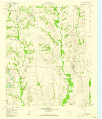
USGS Historical Quadrangle in GeoPDF.
Dependable access to critical minerals information is vital to ensuring the continued domestic security and economic prosperity of the United States. At present, Alabama has known deposits, prospects, and occurrences of at least 21 of these commodities, including aluminum, arsenic, barium, beryllium, chromium, cobalt, fluorite, graphite, lithium, magnesium, manganese, platinum group metals (PGMs), rare earth elements (REEs), tantalum, tin, thorium, titanium, uranium, vanadium, zinc, and zirconium; but may have as many 31, including potential occurrences of gallium, germanium, hafnium, indium, lanthanum, nickel, niobium, rhenium, selenium, and yttrium. Although none of these commodities are currently being produced...
Categories: Data;
Types: Collection,
Map Service,
OGC WFS Layer,
OGC WMS Layer,
OGC WMS Service;
Tags: Alabama,
Alabama graphite belt,
Alabama graphite-V belt,
Alabama pegmatite zone,
Alleghanian-Neoacadian regolith,

Historic image BR�004 is part of the 'Historic photolab Images' collection; the topic area is 'Blue Ridge'. Location is Bedford Co. (estimated). The image has the following description: '22. From the summits of Peaks of Otter, near Bedford� magnificent and far-reaching views found in all directions .' The image was scanned from a photo as part of the USGS NGGDPP deliverable for 2016-2017. The physical location is 900 Natural Resources Dr., Ste 400, Charlottesville, VA 22903. Room 1093 (photolab) The author is unknown. The image is dated unknown.
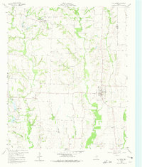
USGS Historical Quadrangle in GeoPDF.

USGS Historical Quadrangle in GeoPDF.
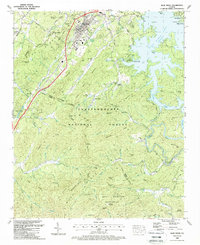
USGS Historical Quadrangle in GeoPDF.
This data set contains imagery from the National Agriculture Imagery Program (NAIP). The NAIP program is administered by USDA FSA and has been established to support two main FSA strategic goals centered on agricultural production. These are increase stewardship of America's natural resources while enhancing the environment, and to ensure commodities are procured and distributed effectively and efficiently to increase food security. The NAIP program supports these goals by acquiring and providing ortho imagery that has been collected during the agricultural growing season in the U.S. The NAIP ortho imagery is tailored to meet FSA requirements and is a fundamental tool used to support FSA farm and conservation programs....
This data set contains imagery from the National Agriculture Imagery Program (NAIP). The NAIP program is administered by USDA FSA and has been established to support two main FSA strategic goals centered on agricultural production. These are, increase stewardship of America's natural resources while enhancing the environment, and to ensure commodities are procured and distributed effectively and efficiently to increase food security. The NAIP program supports these goals by acquiring and providing ortho imagery that has been collected during the agricultural growing season in the U.S. The NAIP ortho imagery is tailored to meet FSA requirements and is a fundamental tool used to support FSA farm and conservation programs....

Historic image BR�008 is part of the 'Historic photolab Images' collection; the topic area is 'Blue Ridge'. Location is Virginia (estimated). The image has the following description: 'Cliff .' The image was scanned from a photo as part of the USGS NGGDPP deliverable for 2016-2017. The physical location is 900 Natural Resources Dr., Ste 400, Charlottesville, VA 22903. Room 1093 (photolab) The author is unknown. The image is dated unknown.
|

|
