Filters: Tags: Bonanza (X)
214 results (63ms)|
Filters
Date Range
Extensions Types Contacts
Categories Tag Types
|
Database for the Geologic Map of the Bonanza Caldera Area, Northeastern San Juan Mountains, Colorado
The San Juan Mountains in southwestern Colorado have long been recognized as a site of exceptionally voluminous mid-Tertiary volcanism, including at least 24 major ignimbrite sheets (each 150-5,000 km3) and associated caldera structures active at 33-23 Ma. More recent volcanologic and petrologic studies in the San Juan region have focused mainly on several ignimbrite-caldera systems: the southeastern area (Platoro complex), western calderas (Uncompahgre-Silverton-Lake City), the central cluster (La Garita-Creede calderas). The northeast San Juan region that was far less studied until recently occupies a transition between earlier volcanism in central Colorado and the larger-volume younger ignimbrite-caldera foci...
Categories: Data;
Types: ArcGIS REST Map Service,
ArcGIS Service Definition,
Downloadable,
Map Service;
Tags: Bonanza,
Colorado,
North America,
Saguache,
USGS Science Data Catalog (SDC),
ADMMR map collection: Bonanza Mine Map; 1 in. to 20 feet; 18 x 11 in.
ADMMR map collection: Bonanza Sect. N475 Map; 1 in. to 40 feet; 13 x 15 in.
This location is part of the Arizona Mineral Industry Location System (AzMILS), an inventory of mineral occurences, prospects and mine locations in Arizona. Mohave139 is located in T27N R20W Sec 11 SE in the White Hills - 15 Min quad. This collection consists of various reports, maps, records and related materials acquired by the Arizona Department of Mines and Mineral Resources regarding mining properties in Arizona. Information was obtained by various means, including the property owners, exploration companies, consultants, verbal interviews, field visits, newspapers and publications. Some sections may be redacted for copyright. Please see the access statement.
ADMMR map collection: Bonanza Mine Surface Map; 1 in. to 40 feet; 24 x 14 in.
Heinrichs Geoexploration Co. Maps: Harquahala, I.P. Traverse Line No. Baseline Sheet 1, 2, 3, 4, and 5; 1 in. to 500 feet; 53 x 21 in.
Heinrichs Geoexploration Co. Maps: Congress Cross Section (19-51); 24 x 10 in.
Heinrichs Geoexploration Co. Maps: Harquahala, I.P. Traverse Line No. E Sheet 1 and 2; 1 in. to 400 feet; 32 x 21 in.
ADMMR map collection: Octave Mine Dumps, Surface Map Draft; 1 in. to 20 feet; 42 x 29 in.
ADMMR map collection: Bonanza Mine Assay Data; 1 in. to 40 feet; 15 x 22 in.
ADMMR map collection: Bonanza 535 Level; 1 in. to 20 feet; 9 x 12 in.
ADMMR map collection: Bonanza - Royal Map; 1 in. to 100 feet; 11 x 9 in.
ADMMR map collection: Bonanza 226 Stope 3rd Floor; 1 in. to 40 feet; 8 x 11 in.
ADMMR map collection: Bonanza 280 INT.; 1 in. to 40 feet; 8 x 11 in.
This data set contains imagery from the National Agriculture Imagery Program (NAIP). The NAIP program is administered by USDA FSA and has been established to support two main FSA strategic goals centered on agricultural production. These are, increase stewardship of America's natural resources while enhancing the environment, and to ensure commodities are procured and distributed effectively and efficiently to increase food security. The NAIP program supports these goals by acquiring and providing ortho imagery that has been collected during the agricultural growing season in the U.S. The NAIP ortho imagery is tailored to meet FSA requirements and is a fundamental tool used to support FSA farm and conservation programs....
ADMMR map collection: Bonanza Elayer Stope; 1 in. to 40 feet; 8 x 11 in.
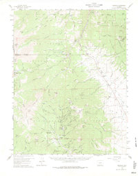
USGS Historical Quadrangle in GeoPDF.
A view of the tailings dump at the Octave mine.
A water resevoir at the White Hills mine, 20 feet deep, 50 feet wide, and 200 feet long.
This data set contains imagery from the National Agriculture Imagery Program (NAIP). The NAIP program is administered by USDA FSA and has been established to support two main FSA strategic goals centered on agricultural production. These are, increase stewardship of America's natural resources while enhancing the environment, and to ensure commodities are procured and distributed effectively and efficiently to increase food security. The NAIP program supports these goals by acquiring and providing ortho imagery that has been collected during the agricultural growing season in the U.S. The NAIP ortho imagery is tailored to meet FSA requirements and is a fundamental tool used to support FSA farm and conservation programs....
|

|
