Filters: Tags: Bonners Ferry (X)
38 results (55ms)|
Filters
Date Range
Extensions (Less) Types (Less)
Contacts (Less)
Categories (Less) Tag Types Tag Schemes
|

These data were released prior to the October 1, 2016 effective date for the USGS’s policy dictating the review, approval, and release of scientific data as referenced in USGS Survey Manual Chapter 502.8 Fundamental Science Practices: Review and Approval of Scientific Data for Release. The elevation contour data was created based on bathymetry obtained in the meander reach collected in about a one month period extending from 6/3/2010 - 6/19/2010. This subset data extends from river kilometer designator 228 upstream to 237. Similar methods used to collect and process the bathymetry are described in Fosness (2013). The contours were created from a surface raster (also referred to as digital elevation model) of the...
Discharge measurements and velocity mapping surveys were completed at select tie channels located at Nimz Ranch, on the main-stem Kootenai River. Tie channels convey water and sediments between the main river channel and river floodplain waterbodies. The velocity mapping surveys are used to document how the tie channels interact with the main-stem Kootenai River. Similar surveys will be conducted following project construction completion (after 2021). Velocity mapping provides data to support the flow split estimates in the tie channel reconnection. These mapping efforts are a quantitative assessment of the the tie channels role in altering drift, temperature, and floodplain storage. An acoustic Doppler current...
In 2009, the Kootenai Tribe of Idaho released and implemented the Kootenai River Habitat Restoration Master Plan. This plan aimed to restore, enhance, and maintain the Kootenai River habitat and landscape to support and sustain habitat conditions for aquatic species and animal populations. In support of these restoration efforts, the U.S. Geological Survey, in cooperation with the Kootenai Tribe of Idaho, conducted high-resolution multibeam echosounder bathymetric surveys as a baseline bathymetric monitoring survey on the Kootenai River near Bonners Ferry, Idaho. Three channel patterns or reaches exist in the study area: braided, meander, and a transitional zone connecting the braided and meander reaches. Bathymetric...
In 2009, the Kootenai Tribe of Idaho released and implemented the Kootenai River Habitat Restoration Master Plan. This plan aimed to restore, enhance, and maintain the Kootenai River habitat and landscape to support and sustain habitat conditions for aquatic species and animal populations. In support of these restoration efforts, the U.S. Geological Survey, in cooperation with the Kootenai Tribe of Idaho, conducted high-resolution multibeam echosounder bathymetric surveys as a baseline bathymetric monitoring survey on the Kootenai River near Bonners Ferry, Idaho. Three channel patterns or reaches exist in the study area: braided, meander, and a transitional zone connecting the braided and meander reaches. Bathymetric...
Categories: Data;
Types: Downloadable,
Map Service,
OGC WFS Layer,
OGC WMS Layer,
Shapefile;
Tags: ASCII,
Bathymetry,
Bonners Ferry,
Geology,
Hypack,

These data were released prior to the October 1, 2016 effective date for the USGS’s policy dictating the review, approval, and release of scientific data as referenced in USGS Survey Manual Chapter 502.8 Fundamental Science Practices: Review and Approval of Scientific Data for Release. In 2009, the Kootenai Tribe of Idaho released and implemented the Kootenai River Habitat Restoration Master Plan. This plan aimed to restore, enhance, and maintain the Kootenai River habitat and landscape to support and sustain habitat conditions for aquatic species and animal populations. In support of these restoration efforts, the U.S. Geological Survey, in cooperation with the Kootenai Tribe of Idaho, conducted high-resolution...

These data were released prior to the October 1, 2016 effective date for the USGS’s policy dictating the review, approval, and release of scientific data as referenced in USGS Survey Manual Chapter 502.8 Fundamental Science Practices: Review and Approval of Scientific Data for Release. The surficial bed-sediment facies, herein after referred to as the sediment facies, quantitatively describes the dominant sediment substrate on the surface of the river bed. Sediment facies categories were based on the grain size distribution of Wentworth (1922) which included the following ranges or combination of ranges: gravel (2-64mm), sand (0.063-2mm) and silt/clay (less than 0.063mm). An underwater video monitoring system UVMS...

These data were released prior to the October 1, 2016 effective date for the USGS’s policy dictating the review, approval, and release of scientific data as referenced in USGS Survey Manual Chapter 502.8 Fundamental Science Practices: Review and Approval of Scientific Data for Release. The substrate enhancement pilot project (SEPP) extent GIS layer represents an area where an artificial substrate will be placed. The artificial substrate, consisting of a mixed size class of gravel, is aimed at providing a more suitable substrate for sturgeon eggs and early-life rearing habitat. The location of the SEPP extent was created by analyzing the egg-mat network, bathymetric features, surficial sediment facies, and streamflow...
U.S. Geological Survey (USGS) scientists conducted field data collection efforts during the week of September 25 – 29, 2017, using a combination of conventional surveying technologies, for a large stretch of the Kootenai River near Bonners Ferry, Idaho. The work was initiated as an effort to validate commercially acquired topobathymetric light detection and ranging (lidar) data. The goal was to compare the airborne lidar data to topographic and bathymetric data collected through more traditional means (e.g. waded Real-Time Kinematic Global Navigation Satellite System (RTK-GNSS) surveys). The validated topobathymetric lidar data will be used for hydrologic modeling, assessment and restoration of aquatic habitat,...
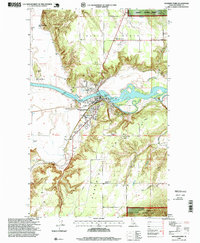
USGS Historical Quadrangle in GeoPDF.

These data were released prior to the October 1, 2016 effective date for the USGS’s policy dictating the review, approval, and release of scientific data as referenced in USGS Survey Manual Chapter 502.8 Fundamental Science Practices: Review and Approval of Scientific Data for Release. The major clay step features are defined as having a vertical face that is greater than 1.5 meters. The clay step features were qualitately identified using an underwater video monitoring sysyem. The extent and magnitude of the clay steps were mapped using a muliteam bathymetric echosounder system.
This data set contains imagery from the National Agriculture Imagery Program (NAIP). The NAIP program is administered by USDA FSA and has been established to support two main FSA strategic goals centered on agricultural production. These are, increase stewardship of America's natural resources while enhancing the environment, and to ensure commodities are procured and distributed effectively and efficiently to increase food security. The NAIP program supports these goals by acquiring and providing ortho imagery that has been collected during the agricultural growing season in the U.S. The NAIP ortho imagery is tailored to meet FSA requirements and is a fundamental tool used to support FSA farm and conservation programs....
This data set contains imagery from the National Agriculture Imagery Program (NAIP). The NAIP program is administered by USDA FSA and has been established to support two main FSA strategic goals centered on agricultural production. These are, increase stewardship of America's natural resources while enhancing the environment, and to ensure commodities are procured and distributed effectively and efficiently to increase food security. The NAIP program supports these goals by acquiring and providing ortho imagery that has been collected during the agricultural growing season in the U.S. The NAIP ortho imagery is tailored to meet FSA requirements and is a fundamental tool used to support FSA farm and conservation programs....
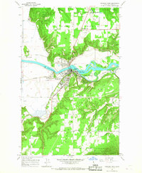
USGS Historical Quadrangle in GeoPDF.

These data were released prior to the October 1, 2016 effective date for the USGS’s policy dictating the review, approval, and release of scientific data as referenced in USGS Survey Manual Chapter 502.8 Fundamental Science Practices: Review and Approval of Scientific Data for Release. In 2009, the Kootenai Tribe of Idaho released and implemented the Kootenai River Habitat Restoration Master Plan. This plan aimed to restore, enhance, and maintain the Kootenai River habitat and landscape to support and sustain habitat conditions for aquatic species and animal populations. In support of these restoration efforts, the U.S. Geological Survey, in cooperation with the Kootenai Tribe of Idaho, conducted high-resolution...

Surficial Sediment Facies features near Shorty's Island on the Kootenai River near Bonners Ferry, ID
These data were released prior to the October 1, 2016 effective date for the USGS’s policy dictating the review, approval, and release of scientific data as referenced in USGS Survey Manual Chapter 502.8 Fundamental Science Practices: Review and Approval of Scientific Data for Release. The surficial bed-sediment facies, herein after referred to as the sediment facies, quantitatively describes the dominant sediment substrate on the surface of the river bed. Sediment facies categories were based on the grain size distribution of Wentworth (1922) which included the following ranges or combination of ranges: gravel (2-64mm), sand (0.063-2mm) and silt/clay (less than 0.063mm). An underwater video monitoring system UVMS...

These data were released prior to the October 1, 2016 effective date for the USGS’s policy dictating the review, approval, and release of scientific data as referenced in USGS Survey Manual Chapter 502.8 Fundamental Science Practices: Review and Approval of Scientific Data for Release. An Acoustic Doppler Current Profiler (ADCP) was used to survey streamflow characteristics including total streamflow, velocity magnitude and secondary flow structure, and backscatter intensity at 29 cross-sections at the Myrtle Creek Bend on the Kootenai River on June 1, 2012. Each of the 29 cross-sections consisted of 4 transects or bank-to-bank coverage to obtain a representative velocity pattern. The mean daily streamflow was...

These data were released prior to the October 1, 2016 effective date for the USGS’s policy dictating the review, approval, and release of scientific data as referenced in USGS Survey Manual Chapter 502.8 Fundamental Science Practices: Review and Approval of Scientific Data for Release. The major clay step features are defined as having a vertical face that is greater than 1.5 meters. The clay step features were qualitately identified using an underwater video monitoring sysyem. The extent and magnitude of the clay steps were mapped using a muliteam bathymetric echosounder system.
To support research on dispersion in river channels, a tracer dye experiment was performed on the Kootenai River in northern Idaho, September 25-27, 2017. This data release provides access to hyperspectral image acquired during the experiment and the supporting field-based measurements of reflectance and dye concentration are available through related data releases. The hyperspectral image data were acquired by Quantum Spatial Inc. (QSI) using the ITRES CASI 1500H imaging system deployed from a Cessna Caravan manned aircraft from a flying height of 1000 m above ground level. Initial geometric and radiometric data processing was performed by ITRES and yielded images with 0.5 m pixels for each of 48 spectral bands...
Categories: Data,
Data Release - In Progress;
Types: Downloadable,
Map Service,
OGC WFS Layer,
OGC WMS Layer,
OGC WMS Service,
Shapefile;
Tags: Bonners Ferry,
Idaho,
Kootenai River,
channel,
concentration,
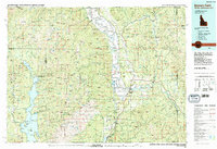
USGS Historical Quadrangle in GeoPDF.
In 2009, the Kootenai Tribe of Idaho released and implemented the Kootenai River Habitat Restoration Master Plan. This plan aimed to restore, enhance, and maintain the Kootenai River habitat and landscape to support and sustain habitat conditions for aquatic species and animal populations. In support of these restoration efforts, the U.S. Geological Survey, in cooperation with the Kootenai Tribe of Idaho, conducted high-resolution multibeam echosounder bathymetric surveys, velocity surveys, and collected images of substrate in the Lower Meander Reach (RM 143 - 145.5) and Straight Reach (RM 151 - 152). This data release contains bathymetry, velocity, and substrate data from surveys performed on the Kootenai River...
Categories: Data Release - Revised;
Types: Map Service,
OGC WFS Layer,
OGC WMS Layer,
OGC WMS Service;
Tags: ASCII,
Bathymetry,
Bonners Ferry,
Doppler,
Geology,
|

|
