Filters: Tags: Bottom (X)
12 results (37ms)|
Filters
Date Range
Extensions Types Contacts
Categories Tag Types Tag Schemes |
The purpose of the Coral Reef Evaluation and Monitoring Project (CREMP) is to monitor the status and trends of selected reefs in the Florida Keys National Marine Sanctuary(FKNMS). CREMP assessments have been conducted annually at fixed sites since 1996 and data collected provides information on the temporal changes in benthic cover and diversity of stony corals and associated marine flora and fauna. The core field methods continue to be underwater videography and timed coral species inventories. Findings presented in this report include data from 109 stations at 37 sites sampled from 1996 through 2008 in the Florida Keys and 1999 through 2008 in the Dry Tortugas. The report describes the annual differences (between...
Categories: Data;
Types: NetCDF OPeNDAP Service;
Tags: Florida Keys Coral Reef Monitoring Project1998,
absence,
aphia,
area,
array,
The purpose of the Coral Reef Evaluation and Monitoring Project (CREMP) is to monitor the status and trends of selected reefs in the Florida Keys National Marine Sanctuary(FKNMS). CREMP assessments have been conducted annually at fixed sites since 1996 and data collected provides information on the temporal changes in benthic cover and diversity of stony corals and associated marine flora and fauna. The core field methods continue to be underwater videography and timed coral species inventories. Findings presented in this report include data from 109 stations at 37 sites sampled from 1996 through 2008 in the Florida Keys and 1999 through 2008 in the Dry Tortugas. The report describes the annual differences (between...
This data set contains imagery from the National Agriculture Imagery Program (NAIP). The NAIP program is administered by USDA FSA and has been established to support two main FSA strategic goals centered on agricultural production. These are increase stewardship of America's natural resources while enhancing the environment, and to ensure commodities are procured and distributed effectively and efficiently to increase food security. The NAIP program supports these goals by acquiring and providing ortho imagery that has been collected during the agricultural growing season in the U.S. The NAIP ortho imagery is tailored to meet FSA requirements and is a fundamental tool used to support FSA farm and conservation programs....
In 1998, the Florida Fish and Wildlife Conservation Commission's (FWC) Fisheries Independent Monitoring (FIM) program began a long-term monitoring effort of key reef fish populations in the Florida Keys National Marine Sanctuary. This effort was aimed at evaluating the relative abundance, size structure, and habitat utilization of specific reef fish species that are targeted by commercial and recreational fisheries.; Smith,S.G., et al. 2011,Multispecies survey design for assessing reef-fish stocks, spatially explicit management performance, and ecosystem condition. Fisheries Research 109(2011)25-41; Brandt,M.E., et. al. 2009,A Cooperative Multi-agency Reef Fish Monitoring Protocol for the Florida Keys Coral Reef...
Categories: Data;
Types: NetCDF OPeNDAP Service;
Tags: Atmosphere > Air Quality > Visibility,
Dry Tortugas Reef Visual Census 2016,
absence,
air,
aphia,
This data set contains imagery from the National Agriculture Imagery Program (NAIP). The NAIP program is administered by USDA FSA and has been established to support two main FSA strategic goals centered on agricultural production. These are increase stewardship of America's natural resources while enhancing the environment, and to ensure commodities are procured and distributed effectively and efficiently to increase food security. The NAIP program supports these goals by acquiring and providing ortho imagery that has been collected during the agricultural growing season in the U.S. The NAIP ortho imagery is tailored to meet FSA requirements and is a fundamental tool used to support FSA farm and conservation programs....
This data set contains imagery from the National Agriculture Imagery Program (NAIP). The NAIP program is administered by USDA FSA and has been established to support two main FSA strategic goals centered on agricultural production. These are increase stewardship of America's natural resources while enhancing the environment, and to ensure commodities are procured and distributed effectively and efficiently to increase food security. The NAIP program supports these goals by acquiring and providing ortho imagery that has been collected during the agricultural growing season in the U.S. The NAIP ortho imagery is tailored to meet FSA requirements and is a fundamental tool used to support FSA farm and conservation programs....

Utah Oil and Gas Well Horizontal drill paths. From the Utah Department of Natural Resources, Oil Gas and Mining Division.ArcSDE content updated nightly. File and Folder system dates indicate date of export from SDE.More information at: http://gis.utah.gov/data/energy/oil-gas/
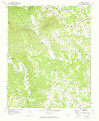
USGS Historical Quadrangle in GeoPDF.
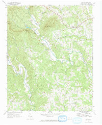
USGS Historical Quadrangle in GeoPDF.
This data set contains imagery from the National Agriculture Imagery Program (NAIP). The NAIP program is administered by USDA FSA and has been established to support two main FSA strategic goals centered on agricultural production. These are increase stewardship of America's natural resources while enhancing the environment, and to ensure commodities are procured and distributed effectively and efficiently to increase food security. The NAIP program supports these goals by acquiring and providing ortho imagery that has been collected during the agricultural growing season in the U.S. The NAIP ortho imagery is tailored to meet FSA requirements and is a fundamental tool used to support FSA farm and conservation programs....
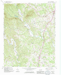
USGS Historical Quadrangle in GeoPDF.
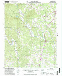
USGS Historical Quadrangle in GeoPDF.
|

|
