Filters: Tags: Bourne (X)
12 results (29ms)|
Filters
Date Range
Extensions Types
Contacts
Categories Tag Types Tag Schemes |
This data set contains imagery from the National Agriculture Imagery Program (NAIP). The NAIP program is administered by USDA FSA and has been established to support two main FSA strategic goals centered on agricultural production. These are, increase stewardship of America's natural resources while enhancing the environment, and to ensure commodities are procured and distributed effectively and efficiently to increase food security. The NAIP program supports these goals by acquiring and providing ortho imagery that has been collected during the agricultural growing season in the U.S. The NAIP ortho imagery is tailored to meet FSA requirements and is a fundamental tool used to support FSA farm and conservation programs....
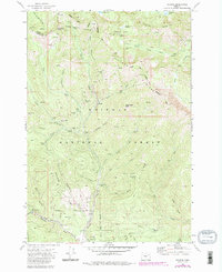
USGS Historical Quadrangle in GeoPDF.
This U.S. Geological Survey data release provides a comprehensive dataset of water-quality data and sampling-site characteristics collected in 1978–2018 during a study of the effects of land disposal of treated wastewater on groundwater quality in an unconsolidated sand and gravel aquifer on Cape Cod, Massachusetts. Treated sewage-derived wastewater was discharged to rapid-infiltration beds at Joint Base Cape Cod for nearly 60 years before the disposal was moved to a different location in December 1995. The discharge formed a plume of contaminated groundwater that partly discharges to a glacial kettle lake about 1,600 feet from the beds and extends about 4.5 miles toward coastal saltwater bodies at Vineyard Sound....
Categories: Data;
Types: Map Service,
OGC WFS Layer,
OGC WMS Layer,
OGC WMS Service;
Tags: Barnstable County,
Bourne,
Cape Cod,
Falmouth,
Mashpee,
This U.S. Geological Survey (USGS) data release provides a comprehensive dataset of water-quality results, physical-parameter measurements, hydrologic measurements, and site information collected to study the nature and extent of water quality along groundwater flow paths adjacent to glacial-kettle lakes on Cape Cod, Massachusetts. Water-quality samples were collected in 2003, 2005, and 2012 through 2018 in and near seven kettle lakes located on western Cape Cod, with most of the data collected in 2015-2017 from Ashumet Pond, which is located in the towns of Falmouth and Mashpee. Data were also collected at other lakes to compare the lake-specific influences of geochemistry and hydrology on the downgradient groundwater...
This data set contains imagery from the National Agriculture Imagery Program (NAIP). The NAIP program is administered by USDA FSA and has been established to support two main FSA strategic goals centered on agricultural production. These are, increase stewardship of America's natural resources while enhancing the environment, and to ensure commodities are procured and distributed effectively and efficiently to increase food security. The NAIP program supports these goals by acquiring and providing ortho imagery that has been collected during the agricultural growing season in the U.S. The NAIP ortho imagery is tailored to meet FSA requirements and is a fundamental tool used to support FSA farm and conservation programs....
The Massachusetts Office of Coastal Zone Management (CZM) launched the Shoreline Change Project in 1989 to identify erosion-prone areas of the Massachusetts coast. Seventy-six maps were produced in 1997 depicting a statistical analysis of shoreline change on ocean-facing shorelines from the mid-1800s to 1978 using multiple data sources. In 2001, a 1994 shoreline was added. More recently, in cooperation with CZM, the U.S. Geological Survey (USGS) delineated a new shoreline for Massachusetts using color aerial ortho-imagery from 2008 to 2009 and topographic lidar data collected in 2007. This update included a marsh shoreline, which was defined to be the tonal difference between low- and high-marsh seen in ortho-photos....
Categories: Data;
Types: Downloadable,
Map Service,
OGC WFS Layer,
OGC WMS Layer,
Shapefile;
Tags: Bourne,
CMGP,
Chatham,
Coastal and Marine Geology Program,
Duxbury,

The U.S. Geological Survey, in cooperation with the Town of Barnstable, Massachusetts, modified an existing numerical, steady-state regional MODFLOW-2005 groundwater-flow model to evaluate changes in water levels from a reference condition (2015) for nine pumping and wastewater return flow scenarios prepared by the Hyannis Water System. The three-dimensional, steady-state groundwater-flow model used to simulate water level changes is a modified and recalibrated version of an existing model that was used to simulate the potential effects of sea-level rise on groundwater levels of the Sagamore and Monomoy freshwater lenses of the Cape Cod aquifer (Walter and others, 2016) (https://doi.org/10.3133/sir20165058). Two...
This data set contains imagery from the National Agriculture Imagery Program (NAIP). The NAIP program is administered by USDA FSA and has been established to support two main FSA strategic goals centered on agricultural production. These are, increase stewardship of America's natural resources while enhancing the environment, and to ensure commodities are procured and distributed effectively and efficiently to increase food security. The NAIP program supports these goals by acquiring and providing ortho imagery that has been collected during the agricultural growing season in the U.S. The NAIP ortho imagery is tailored to meet FSA requirements and is a fundamental tool used to support FSA farm and conservation programs....

The U.S. Geological Survey, in cooperation with the Air Force Civil Engineer Center, developed a numerical, steady-state regional model, using MODFLOW-2005, to evaluate current (2010) conditions and the potential effects of future (2030) groundwater withdrawals on water levels, streamflows, hydraulic gradients, and advective transport near the Joint Base Cape Cod (JBCC). Two numerical models were used in this analysis. An existing two-dimensional (one layer) model (termed the “coast model”), developed as part of a previous investigation of the potential effects of sea-level rise on the Cape Cod aquifer system (https://doi.org/10.3133/sir20165058), simulates the position of the freshwater/saltwater interface by using...
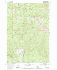
USGS Historical Quadrangle in GeoPDF.
This data set contains imagery from the National Agriculture Imagery Program (NAIP). The NAIP program is administered by USDA FSA and has been established to support two main FSA strategic goals centered on agricultural production. These are, increase stewardship of America's natural resources while enhancing the environment, and to ensure commodities are procured and distributed effectively and efficiently to increase food security. The NAIP program supports these goals by acquiring and providing ortho imagery that has been collected during the agricultural growing season in the U.S. The NAIP ortho imagery is tailored to meet FSA requirements and is a fundamental tool used to support FSA farm and conservation programs....
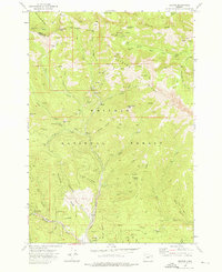
USGS Historical Quadrangle in GeoPDF.
|

|
