Filters
Date Range
Types
Contacts
Tag Types
Tag Schemes
|
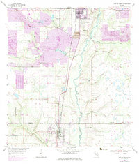
This data set contains imagery from the National Agriculture Imagery Program (NAIP). The NAIP program is administered by USDA FSA and has been established to support two main FSA strategic goals centered on agricultural production. These are increase stewardship of America's natural resources while enhancing the environment, and to ensure commodities are procured and distributed effectively and efficiently to increase food security. The NAIP program supports these goals by acquiring and providing ortho imagery that has been collected during the agricultural growing season in the U.S. The NAIP ortho imagery is tailored to meet FSA requirements and is a fundamental tool used to support FSA farm and conservation programs....
Types: Citation;
Tags: 29163,
3.75 x 3.75 minute,
3909147,
Aerial Compliance,
BOWLING GREEN, All tags...
BOWLING GREEN, SW,
Compliance,
Digital Ortho rectified Image,
Downloadable Data,
JPEG 2000,
JPEG2000,
MO,
MO163,
NAIP,
Ortho Rectification,
Orthoimagery,
PIKE CO MO FSA,
Pike,
Quarter Quadrangle,
USDA National Agriculture Imagery Program (NAIP),
farming,
imageryBaseMapsEarthCover, Fewer tags
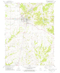
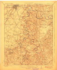
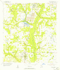
USGS Historical Quadrangle in GeoPDF.
Tags: 7.5 x 7.5 minute,
Bowling Green,
Downloadable Data,
GeoPDF,
GeoTIFF, All tags...
Historical Topographic Maps,
Historical Topographic Maps 7.5 x 7.5 Minute Map Series,
MO,
Map,
imageryBaseMapsEarthCover, Fewer tags
USGS Historical Quadrangle in GeoPDF.
Tags: 15 x 15 minute,
Bowling Green,
Downloadable Data,
GeoPDF,
GeoTIFF, All tags...
Historical Topographic Maps,
Historical Topographic Maps 15 x 15 Minute Map Series,
MO,
Map,
imageryBaseMapsEarthCover, Fewer tags
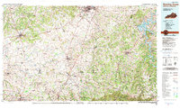
USGS Historical Quadrangle in GeoPDF.
Tags: 30 x 60 minute,
Bowling Green,
Downloadable Data,
GeoPDF,
GeoTIFF, All tags...
Historical Topographic Maps,
Historical Topographic Maps 30 x 60 Minute Map Series,
KY,
Map,
imageryBaseMapsEarthCover, Fewer tags
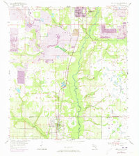
USGS Historical Quadrangle in GeoPDF.
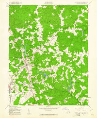
Tags: 7.5 x 7.5 minute,
Bowling Green,
Downloadable Data,
FL,
GeoPDF, All tags...
GeoTIFF,
Historical Topographic Maps,
Historical Topographic Maps 7.5 x 7.5 Minute Map Series,
Map,
imageryBaseMapsEarthCover, Fewer tags

Water supply lakes are the primary source of water for many communities in northern and western Missouri. Therefore, accurate and up-to-date estimates of lake capacity are important for managing and predicting adequate water supply. Many of the water supply lakes in Missouri were previously surveyed by the U.S. Geological Survey in the early 2000s (Richards, 2013) and in 2013 (Huizinga, 2014); however, years of potential sedimentation may have resulted in reduced water storage capacity. Periodic bathymetric surveys are useful to update the area/capacity table and to determine changes in the bathymetric surface. Old Lake (locally known as Bowling Green West) is a water supply lake used by the city of Bowling Green...
Tags: Bathymetry,
Bathymetry and Elevation,
Bowling Green,
Bowling Green West,
Missouri, All tags...
Missouri,
Multibeam,
Old Lake,
Pike County,
U.S. Geological Survey,
USGS,
bathymetry,
multibeam sonar, Fewer tags
This data set contains imagery from the National Agriculture Imagery Program (NAIP). The NAIP program is administered by USDA FSA and has been established to support two main FSA strategic goals centered on agricultural production. These are increase stewardship of America's natural resources while enhancing the environment, and to ensure commodities are procured and distributed effectively and efficiently to increase food security. The NAIP program supports these goals by acquiring and providing ortho imagery that has been collected during the agricultural growing season in the U.S. The NAIP ortho imagery is tailored to meet FSA requirements and is a fundamental tool used to support FSA farm and conservation programs....
Types: Citation;
Tags: 28051,
3.75 x 3.75 minute,
3308949,
Aerial Compliance,
BOWLING GREEN, All tags...
BOWLING GREEN, SE,
Compliance,
Digital Ortho rectified Image,
Downloadable Data,
HOLMES CO MS FSA,
Holmes,
JPEG 2000,
JPEG2000,
MS,
MS051,
NAIP,
Ortho Rectification,
Orthoimagery,
Quarter Quadrangle,
USDA National Agriculture Imagery Program (NAIP),
farming,
imageryBaseMapsEarthCover, Fewer tags

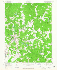
USGS Historical Quadrangle in GeoPDF.
Tags: 7.5 x 7.5 minute,
Bowling Green,
Downloadable Data,
GeoPDF,
GeoTIFF, All tags...
Historical Topographic Maps,
Historical Topographic Maps 7.5 x 7.5 Minute Map Series,
Map,
VA,
imageryBaseMapsEarthCover, Fewer tags
USGS Historical Quadrangle in GeoPDF.
Tags: 15 x 15 minute,
Bowling Green,
Downloadable Data,
GeoPDF,
GeoTIFF, All tags...
Historical Topographic Maps,
Historical Topographic Maps 15 x 15 Minute Map Series,
KY,
Map,
imageryBaseMapsEarthCover, Fewer tags

USGS Historical Quadrangle in GeoPDF.
Tags: 30 x 60 minute,
Bowling Green,
Downloadable Data,
GeoPDF,
GeoTIFF, All tags...
Historical Topographic Maps,
Historical Topographic Maps 30 x 60 Minute Map Series,
KY,
Map,
Planimetric,
imageryBaseMapsEarthCover, Fewer tags
USGS Historical Quadrangle in GeoPDF.
Tags: 15 x 15 minute,
Bowling Green,
Downloadable Data,
GeoPDF,
GeoTIFF, All tags...
Historical Topographic Maps,
Historical Topographic Maps 15 x 15 Minute Map Series,
MO,
Map,
Preliminary,
imageryBaseMapsEarthCover, Fewer tags

This data set contains imagery from the National Agriculture Imagery Program (NAIP). The NAIP program is administered by USDA FSA and has been established to support two main FSA strategic goals centered on agricultural production. These are, increase stewardship of America's natural resources while enhancing the environment, and to ensure commodities are procured and distributed effectively and efficiently to increase food security. The NAIP program supports these goals by acquiring and providing ortho imagery that has been collected during the agricultural growing season in the U.S. The NAIP ortho imagery is tailored to meet FSA requirements and is a fundamental tool used to support FSA farm and conservation programs....
Types: Citation;
Tags: 3.75 x 3.75 minute,
3807762,
51033,
Aerial Compliance,
BOWLING GREEN, All tags...
BOWLING GREEN, SW,
CAROLINE CO VA FSA,
Caroline,
Compliance,
Digital Ortho rectified Image,
Downloadable Data,
JPEG2000,
NAIP,
Ortho Rectification,
Orthoimagery,
Quarter Quadrangle,
USDA National Agriculture Imagery Program (NAIP),
VA,
VA033,
farming, Fewer tags
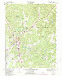
USGS Historical Quadrangle in GeoPDF.
Tags: 7.5 x 7.5 minute,
Bowling Green,
Downloadable Data,
GeoPDF,
GeoTIFF, All tags...
Historical Topographic Maps,
Historical Topographic Maps 7.5 x 7.5 Minute Map Series,
Map,
VA,
imageryBaseMapsEarthCover, Fewer tags
USGS Historical Quadrangle in GeoPDF.
Tags: 7.5 x 7.5 minute,
Bowling Green,
Downloadable Data,
GeoPDF,
GeoTIFF, All tags...
Historical Topographic Maps,
Historical Topographic Maps 7.5 x 7.5 Minute Map Series,
Map,
VA,
imageryBaseMapsEarthCover, Fewer tags
USGS Historical Quadrangle in GeoPDF.
Tags: 7.5 x 7.5 minute,
Bowling Green,
Downloadable Data,
FL,
GeoPDF, All tags...
GeoTIFF,
Historical Topographic Maps,
Historical Topographic Maps 7.5 x 7.5 Minute Map Series,
Map,
imageryBaseMapsEarthCover, Fewer tags
USGS Historical Quadrangle in GeoPDF.
Tags: 15 x 15 minute,
Bowling Green,
Downloadable Data,
GeoPDF,
GeoTIFF, All tags...
Historical Topographic Maps,
Historical Topographic Maps 15 x 15 Minute Map Series,
MO,
Map,
imageryBaseMapsEarthCover, Fewer tags

This data set contains imagery from the National Agriculture Imagery Program (NAIP). The NAIP program is administered by USDA FSA and has been established to support two main FSA strategic goals centered on agricultural production. These are, increase stewardship of America's natural resources while enhancing the environment, and to ensure commodities are procured and distributed effectively and efficiently to increase food security. The NAIP program supports these goals by acquiring and providing ortho imagery that has been collected during the agricultural growing season in the U.S. The NAIP ortho imagery is tailored to meet FSA requirements and is a fundamental tool used to support FSA farm and conservation programs....
Types: Citation;
Tags: 12105,
2708118,
3.75 x 3.75 minute,
Aerial Compliance,
BOWLING GREEN, All tags...
BOWLING GREEN, NE,
Compliance,
Digital Ortho rectified Image,
Downloadable Data,
FL,
FL105,
JPEG2000,
NAIP,
Ortho Rectification,
Orthoimagery,
POLK CO FL FSA,
Polk,
Quarter Quadrangle,
USDA National Agriculture Imagery Program (NAIP),
farming, Fewer tags

This data set contains imagery from the National Agriculture Imagery Program (NAIP). The NAIP program is administered by USDA FSA and has been established to support two main FSA strategic goals centered on agricultural production. These are, increase stewardship of America's natural resources while enhancing the environment, and to ensure commodities are procured and distributed effectively and efficiently to increase food security. The NAIP program supports these goals by acquiring and providing ortho imagery that has been collected during the agricultural growing season in the U.S. The NAIP ortho imagery is tailored to meet FSA requirements and is a fundamental tool used to support FSA farm and conservation programs....
Types: Citation;
Tags: 12105,
2708118,
3.75 x 3.75 minute,
Aerial Compliance,
BOWLING GREEN, All tags...
BOWLING GREEN, SW,
Compliance,
Digital Ortho rectified Image,
Downloadable Data,
FL,
FL105,
JPEG2000,
NAIP,
Ortho Rectification,
Orthoimagery,
POLK CO FL FSA,
Polk,
Quarter Quadrangle,
USDA National Agriculture Imagery Program (NAIP),
farming, Fewer tags
USGS Historical Quadrangle in GeoPDF.
Tags: 7.5 x 7.5 minute,
Bowling Green,
Downloadable Data,
FL,
GeoPDF, All tags...
GeoTIFF,
Historical Topographic Maps,
Historical Topographic Maps 7.5 x 7.5 Minute Map Series,
Map,
imageryBaseMapsEarthCover, Fewer tags
USGS Historical Quadrangle in GeoPDF.
Tags: 7.5 x 7.5 minute,
Bowling Green,
Downloadable Data,
GeoPDF,
GeoTIFF, All tags...
Historical Topographic Maps,
Historical Topographic Maps 7.5 x 7.5 Minute Map Series,
Map,
VA,
imageryBaseMapsEarthCover, Fewer tags
|
|

