Filters: Tags: Bristol Bay (X)
52 results (14ms)|
Filters
Date Range
Extensions Types
Contacts
Categories Tag Types Tag Schemes |
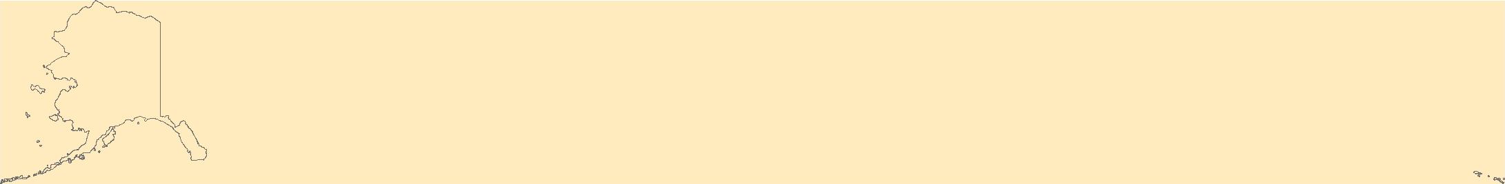
This report presents information about subsistence uses of fish, wildlife, and plant resources in Lime Village, Interior Alaska. This is the first harvest assessment survey for this community since a compilation of qualitative harvest data was completed in 1983. The Alaska Department of Fish and Game Division of Subsistence conducted the project in collaboration with Stephen R. Braund & Associates as part of a multiyear, multiphase study in a region of Southwest Alaska being considered for the development of a large scale mine. The Pebble Project is a mineral deposit in an advanced exploration stage located near Frying Pan Lake, which is 100 miles south of Lime Village. The Pebble Project requires updated baseline...

Geospatial data includes structures and other selected map features.

The Watershed Boundary Dataset (WBD) is a comprehensive aggregated collection of hydrologic unit data consistent with the national criteria for delineation and resolution. It defines the areal extent of surface water drainage to a point except in coastal or lake front areas where there could be multiple outlets as stated by the "Federal Standards and Procedures for the National Watershed Boundary Dataset (WBD)" "Standard" (https://pubs.usgs.gov/tm/11/a3/). Watershed boundaries are determined solely upon science-based hydrologic principles, not favoring any administrative boundaries or special projects, nor particular program or agency. This dataset represents the hydrologic unit boundaries to the 12-digit (6th level)...
OBIS-USA brings together marine biological occurrence data – recorded observations of identifiable marine species at a known time and place, collected primarily from U.S. Waters or with U.S. funding. Coordinated by the Science Analytics and Synthesis (SAS) Program of the United States Geological Survey (USGS), OBIS-USA, strives to meet national data integration and dissemination needs for marine data about organisms and ecosystems. OBIS-USA is part of an international data sharing network (Ocean Biodiversity Information System, OBIS) coordinated by the Intergovernmental Oceanographic Commission, of UNESCO (United Nations Educational, Science and Cultural Organization) International Oceanographic Data and Information...

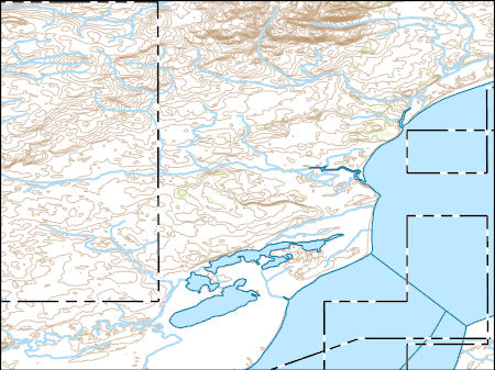
USGS Historical Quadrangle in GeoPDF.
This report presents information about subsistence uses of fish, wildlife, and plant resources in Lime Village, Interior Alaska. This is the first harvest assessment survey for this community since a compilation of qualitative harvest data was completed in 1983. The Alaska Department of Fish and Game Division of Subsistence conducted the project in collaboration with Stephen R. Braund & Associates as part of a multiyear, multiphase study in a region of Southwest Alaska being considered for the development of a large scale mine. The Pebble Project is a mineral deposit in an advanced exploration stage located near Frying Pan Lake, which is 100 miles south of Lime Village. The Pebble Project requires updated baseline...
This report presents information about subsistence uses of fish, wildlife, and plant resources in Lime Village, Interior Alaska. This is the first harvest assessment survey for this community since a compilation of qualitative harvest data was completed in 1983. The Alaska Department of Fish and Game Division of Subsistence conducted the project in collaboration with Stephen R. Braund & Associates as part of a multiyear, multiphase study in a region of Southwest Alaska being considered for the development of a large scale mine. The Pebble Project is a mineral deposit in an advanced exploration stage located near Frying Pan Lake, which is 100 miles south of Lime Village. The Pebble Project requires updated baseline...

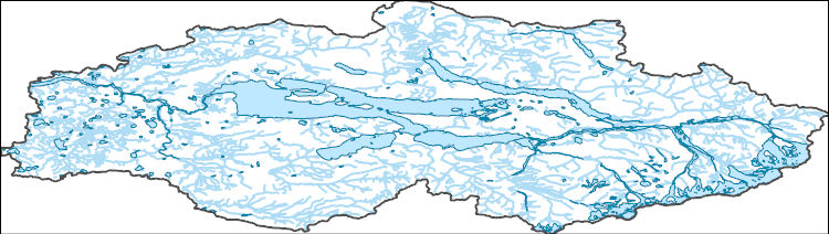
The National Hydrography Dataset (NHD) is a feature-based database that interconnects and uniquely identifies the stream segments or reaches that make up the nation's surface water drainage system. NHD data was originally developed at 1:100,000-scale and exists at that scale for the whole country. This high-resolution NHD, generally developed at 1:24,000/1:12,000 scale, adds detail to the original 1:100,000-scale NHD. (Data for Alaska, Puerto Rico and the Virgin Islands was developed at high-resolution, not 1:100,000 scale.) Local resolution NHD is being developed where partners and data exist. The NHD contains reach codes for networked features, flow direction, names, and centerline representations for areal water...

Geospatial data includes structures and other selected map features.

Geospatial data includes structures and other selected map features.
Layers of geospatial data include contours, boundaries, land cover, hydrography, roads, transportation, geographic names, structures, and other selected map features.

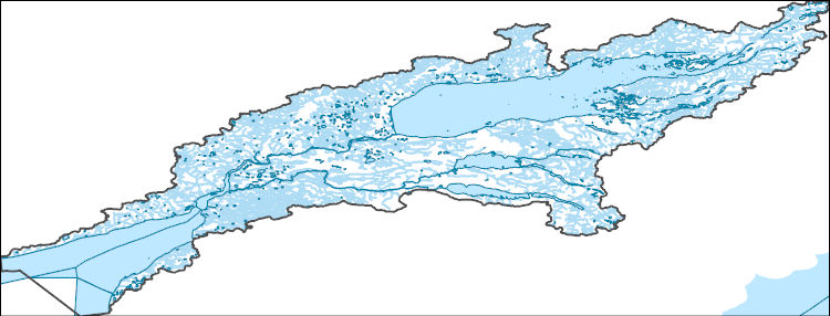
The National Hydrography Dataset (NHD) is a feature-based database that interconnects and uniquely identifies the stream segments or reaches that make up the nation's surface water drainage system. NHD data was originally developed at 1:100,000-scale and exists at that scale for the whole country. This high-resolution NHD, generally developed at 1:24,000/1:12,000 scale, adds detail to the original 1:100,000-scale NHD. (Data for Alaska, Puerto Rico and the Virgin Islands was developed at high-resolution, not 1:100,000 scale.) Local resolution NHD is being developed where partners and data exist. The NHD contains reach codes for networked features, flow direction, names, and centerline representations for areal water...
The National Hydrography Dataset (NHD) is a feature-based database that interconnects and uniquely identifies the stream segments or reaches that make up the nation's surface water drainage system. NHD data was originally developed at 1:100,000-scale and exists at that scale for the whole country. This high-resolution NHD, generally developed at 1:24,000/1:12,000 scale, adds detail to the original 1:100,000-scale NHD. (Data for Alaska, Puerto Rico and the Virgin Islands was developed at high-resolution, not 1:100,000 scale.) Local resolution NHD is being developed where partners and data exist. The NHD contains reach codes for networked features, flow direction, names, and centerline representations for areal water...
The National Hydrography Dataset (NHD) is a feature-based database that interconnects and uniquely identifies the stream segments or reaches that make up the nation's surface water drainage system. NHD data was originally developed at 1:100,000-scale and exists at that scale for the whole country. This high-resolution NHD, generally developed at 1:24,000/1:12,000 scale, adds detail to the original 1:100,000-scale NHD. (Data for Alaska, Puerto Rico and the Virgin Islands was developed at high-resolution, not 1:100,000 scale.) Local resolution NHD is being developed where partners and data exist. The NHD contains reach codes for networked features, flow direction, names, and centerline representations for areal water...
In August 2013, a helicopter-based crew photographed approximately 52 miles (84 km) of shoreline near Port Heiden, Alaska, from 7 miles (11 km) northeast of Reindeer Creek, known locally as North Creek, to 10 miles (16 km) southwest of Strogonof Point. During this flight, 1,441 oblique aerial photographs were collected and were spatially referenced using a Garmin Dakota 20 handheld GPS. For a complete description of the image collection and file organization process please see the detailed metadata associated with this Raw Data File.
This report presents information about subsistence uses of fish, wildlife, and plant resources in Lime Village, Interior Alaska. This is the first harvest assessment survey for this community since a compilation of qualitative harvest data was completed in 1983. The Alaska Department of Fish and Game Division of Subsistence conducted the project in collaboration with Stephen R. Braund & Associates as part of a multiyear, multiphase study in a region of Southwest Alaska being considered for the development of a large scale mine. The Pebble Project is a mineral deposit in an advanced exploration stage located near Frying Pan Lake, which is 100 miles south of Lime Village. The Pebble Project requires updated baseline...

The National Hydrography Dataset (NHD) is a feature-based database that interconnects and uniquely identifies the stream segments or reaches that make up the nation's surface water drainage system. NHD data was originally developed at 1:100,000-scale and exists at that scale for the whole country. This high-resolution NHD, generally developed at 1:24,000/1:12,000 scale, adds detail to the original 1:100,000-scale NHD. (Data for Alaska, Puerto Rico and the Virgin Islands was developed at high-resolution, not 1:100,000 scale.) Local resolution NHD is being developed where partners and data exist. The NHD contains reach codes for networked features, flow direction, names, and centerline representations for areal water...

Layers of geospatial data include roads, airports, trails, and railroads.
This report presents information about subsistence uses of fish, wildlife, and plant resources in Lime Village, Interior Alaska. This is the first harvest assessment survey for this community since a compilation of qualitative harvest data was completed in 1983. The Alaska Department of Fish and Game Division of Subsistence conducted the project in collaboration with Stephen R. Braund & Associates as part of a multiyear, multiphase study in a region of Southwest Alaska being considered for the development of a large scale mine. The Pebble Project is a mineral deposit in an advanced exploration stage located near Frying Pan Lake, which is 100 miles south of Lime Village. The Pebble Project requires updated baseline...
The Geographic Names Information System (GNIS) is the Federal standard for geographic nomenclature. The U.S. Geological Survey developed the GNIS for the U.S. Board on Geographic Names, a Federal inter-agency body chartered by public law to maintain uniform feature name usage throughout the Government and to promulgate standard names to the public. The GNIS is the official repository of domestic geographic names data; the official vehicle for geographic names use by all departments of the Federal Government; and the source for applying geographic names to Federal electronic and printed products of all types.
|

|
