Filters
Date Range
Extensions
Types
Contacts
Categories
Tag Types
Tag Schemes
|

Geospatial data includes structures and other selected map features.
Tags: AK,
Alaska,
Aleutians East,
Aleutians West,
Anchorage, All tags...
Bethel,
Bristol Bay,
Campground,
Chugach,
College / University,
Copper River,
Courthouse,
Denali,
Dillingham,
Downloadable Data,
Esri File GeoDatabase 10,
Fairbanks North Star,
FileGDB,
Fire Station/ EMS Station,
Haines,
Hoonah-Angoon,
Hospital/Medical Center,
Information Center,
Juneau,
Kenai Peninsula,
Ketchikan Gateway,
Kodiak Island,
Kusilvak,
Lake and Peninsula,
Law Enforcement,
Matanuska-Susitna,
National Structures Dataset (NSD),
National Structures Dataset (NSD),
Nome,
North Slope,
Northwest Arctic,
Petersburg,
Post Office,
Prince of Wales-Hyder,
Prison/ Correctional Facility,
School,
School:Elementary,
School:High School,
School:Middle School,
Sitka,
Skagway,
Southeast Fairbanks,
State,
State,
State Capitol,
Structures,
Technical School,
Town Hall,
Trade School,
Trailhead,
US,
United States,
Visitor Center,
Wrangell,
Yakutat,
Yukon-Koyukuk,
structure, Fewer tags

OBIS-USA brings together marine biological occurrence data – recorded observations of identifiable marine species at a known time and place, collected primarily from U.S. Waters or with U.S. funding. Coordinated by the Science Analytics and Synthesis (SAS) Program of the United States Geological Survey (USGS), OBIS-USA, strives to meet national data integration and dissemination needs for marine data about organisms and ecosystems. OBIS-USA is part of an international data sharing network (Ocean Biodiversity Information System, OBIS) coordinated by the Intergovernmental Oceanographic Commission, of UNESCO (United Nations Educational, Science and Cultural Organization) International Oceanographic Data and Information...
Tags: Arctic Ocean,
Atlantic Ocean,
Bay of Fundy,
Beaufort Sea,
Bering Sea, All tags...
Bering Strait,
Biodiversity,
Biological Production,
Birds,
Bristol Bay,
Canada,
Caribbean Sea,
Census of Marine Life,
Chukchi Sea,
Commericial Leases,
Cook Inlet,
Cruise Ships,
Distributions,
Fishes,
Flora,
Great Lakes,
Gulf of Alaska,
Gulf of California,
Gulf of Maine,
Gulf of Mexico,
Habitat,
Harvesting Living Resources,
Invasive Species,
Invertebrates,
Kotzebue Sound,
Kuskokwim Bay,
Mammals,
Marine Protected Areas (MPAs),
North America,
Norton Sound,
OBIS,
Ocean Biogeographic Information System,
Offshore Oil and Gas Production,
Pacific Ocean,
Puget Sound,
Reptiles,
Sargasso Sea,
Shelikof Strait,
South Atlantic Bight,
Southern Ocean,
Straits of Florida,
United States,
Wind Energy Production,
Yucatan Channel,
abundance,
algae,
animal and plant census,
aquatic biology,
aquatic ecosystems,
benthic ecosystems,
benthic habitat,
benthos,
biodiversity,
biogeography,
biological productivity,
biology,
biota,
biota,
coastal habitat,
consumers (organisms),
coral reefs,
decomposers,
ecosystem diversity,
ecosystem functions,
endemic species,
estuarine ecosystems,
fisheries management,
fishery resources,
invasive species,
macroinvertebrates,
marine animals,
marine biology,
marine ecosystems,
marine mammals,
microbes,
migratory species,
native species,
nekton,
nonindigenous species,
oceans,
pelagic habitat,
phytoplankton,
plankton,
plants,
plants (organisms),
producers (organisms),
protected species,
reef ecosystems,
reef habitat,
sea birds,
sea turtles,
shellfish,
species diversity,
vegetation,
vertebrates,
wildlife,
zooplankton, Fewer tags

USGS Historical Quadrangle in GeoPDF.
Tags: 1 x 2 degree,
AK,
Bristol Bay,
Downloadable Data,
GeoPDF, All tags...
GeoTIFF,
Historical Topographic Maps,
Historical Topographic Maps Alaska Map Series,
Map,
imageryBaseMapsEarthCover, Fewer tags

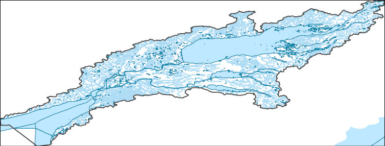
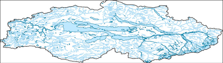
The National Hydrography Dataset (NHD) is a feature-based database that interconnects and uniquely identifies the stream segments or reaches that make up the nation's surface water drainage system. NHD data was originally developed at 1:100,000-scale and exists at that scale for the whole country. This high-resolution NHD, generally developed at 1:24,000/1:12,000 scale, adds detail to the original 1:100,000-scale NHD. (Data for Alaska, Puerto Rico and the Virgin Islands was developed at high-resolution, not 1:100,000 scale.) Local resolution NHD is being developed where partners and data exist. The NHD contains reach codes for networked features, flow direction, names, and centerline representations for areal water...
Tags: AK,
Administrative watershed units,
Administrative watershed units,
Alaska,
Area of Complex Channels, All tags...
Area to be submerged,
Basin,
Basin,
Bay/Inlet,
Boundaries,
Boundary,
Bridge,
Bristol Bay,
Canal/Ditch,
Coastline,
Connector,
Dam/Weir,
Dillingham,
Downloadable Data,
Drainage areas for surface water,
Drainageway,
Estuary,
Flow direction network,
Flume,
ForeShore,
Gaging Station,
Gate,
GeoPackage,
HU-8,
HU-8 Subbasin,
HU10,
HU12,
HU14,
HU16,
HU2,
HU4,
HU6,
HU8,
HU8_19030206,
HUC,
Hazard Zone,
Hydrographic,
Hydrography,
Hydrography,
Hydrography,
Hydrologic Unit Code,
Hydrologic Units,
Ice mass,
Inundation Area,
Kenai Peninsula,
Lake and Peninsula,
Levee,
Line,
Lock Chamber,
Marsh,
National Hydrography Dataset (NHD),
National Hydrography Dataset (NHD) Best Resolution,
National Hydrography Dataset (NHD) Best Resolution,
Nonearthen Shore,
Open Geospatial Consortium GeoPackage 1.2,
Orthoimage,
Playa,
Point,
PointEvent,
Pond,
Rapids,
Rapids,
Reach,
Reach code,
Reef,
Region,
Reservoir,
Rock,
Sea/Ocean,
Sink/Rise,
Sounding Datum Line,
Special Use Zone,
Special Use Zone Limit,
Spillway,
Stream,
Stream/River,
Sub-basin,
Sub-region,
Subbasin,
Submerged Stream,
Subregion,
Subwatershed,
Surface water systems,
Swamp,
Topographic,
Tunnel,
US,
Underground Conduit,
United States,
WBD,
WBD,
Wall,
Wash,
Water Intake Outflow,
Waterfall,
Watershed,
Watershed Boundaries,
Watershed Boundary Dataset,
Watershed Boundary Dataset,
Well,
artificial path,
boundaries,
dams,
drainage systems and characteristics,
inlandWaters,
lakes,
ngda,
rivers, Fewer tags

Geospatial data includes structures and other selected map features.
Tags: AK,
Alaska,
Aleutians East,
Aleutians West,
Anchorage, All tags...
Bethel,
Bristol Bay,
Campground,
Chugach,
College / University,
Copper River,
Courthouse,
Denali,
Dillingham,
Downloadable Data,
Fairbanks North Star,
Fire Station/ EMS Station,
GeoPackage,
Haines,
Hoonah-Angoon,
Hospital/Medical Center,
Information Center,
Juneau,
Kenai Peninsula,
Ketchikan Gateway,
Kodiak Island,
Kusilvak,
Lake and Peninsula,
Law Enforcement,
Matanuska-Susitna,
National Structures Dataset (NSD),
National Structures Dataset (NSD),
Nome,
North Slope,
Northwest Arctic,
Open Geospatial Consortium GeoPackage 1.2,
Petersburg,
Post Office,
Prince of Wales-Hyder,
Prison/ Correctional Facility,
School,
School:Elementary,
School:High School,
School:Middle School,
Sitka,
Skagway,
Southeast Fairbanks,
State,
State,
State Capitol,
Structures,
Technical School,
Town Hall,
Trade School,
Trailhead,
US,
United States,
Visitor Center,
Wrangell,
Yakutat,
Yukon-Koyukuk,
structure, Fewer tags

Geospatial data includes structures and other selected map features.
Tags: AK,
Alaska,
Aleutians East,
Aleutians West,
Anchorage, All tags...
Bethel,
Bristol Bay,
Campground,
Chugach,
College / University,
Copper River,
Courthouse,
Denali,
Dillingham,
Downloadable Data,
Esri Shapefile nan,
Fairbanks North Star,
Fire Station/ EMS Station,
Haines,
Hoonah-Angoon,
Hospital/Medical Center,
Information Center,
Juneau,
Kenai Peninsula,
Ketchikan Gateway,
Kodiak Island,
Kusilvak,
Lake and Peninsula,
Law Enforcement,
Matanuska-Susitna,
National Structures Dataset (NSD),
National Structures Dataset (NSD),
Nome,
North Slope,
Northwest Arctic,
Petersburg,
Post Office,
Prince of Wales-Hyder,
Prison/ Correctional Facility,
School,
School:Elementary,
School:High School,
School:Middle School,
Shapefile,
Sitka,
Skagway,
Southeast Fairbanks,
State,
State,
State Capitol,
Structures,
Technical School,
Town Hall,
Trade School,
Trailhead,
US,
United States,
Visitor Center,
Wrangell,
Yakutat,
Yukon-Koyukuk,
structure, Fewer tags
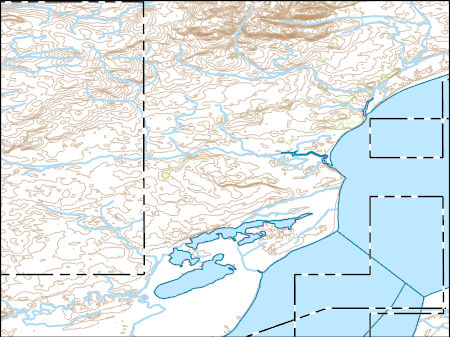
Layers of geospatial data include contours, boundaries, land cover, hydrography, roads, transportation, geographic names, structures, and other selected map features.
Types: Citation;
Tags: 7.5 x 7.5 minute,
7_5_Min,
AK,
Alaska,
Bristol Bay, All tags...
Combined Vector,
Combined Vector,
Combined Vector,
Downloadable Data,
Esri File GeoDatabase 10,
FileGDB,
Lake and Peninsula,
Public Land Survey System,
Topo Map Vector Data,
US,
United States,
boundary,
contours,
geographic names,
hydrography,
structures,
transportation,
woodland, Fewer tags

The National Hydrography Dataset (NHD) is a feature-based database that interconnects and uniquely identifies the stream segments or reaches that make up the nation's surface water drainage system. NHD data was originally developed at 1:100,000-scale and exists at that scale for the whole country. This high-resolution NHD, generally developed at 1:24,000/1:12,000 scale, adds detail to the original 1:100,000-scale NHD. (Data for Alaska, Puerto Rico and the Virgin Islands was developed at high-resolution, not 1:100,000 scale.) Local resolution NHD is being developed where partners and data exist. The NHD contains reach codes for networked features, flow direction, names, and centerline representations for areal water...
Tags: AK,
Administrative watershed units,
Administrative watershed units,
Alaska,
Aleutians East, All tags...
Aleutians West,
Area of Complex Channels,
Area to be submerged,
Basin,
Basin,
Bay/Inlet,
Bethel,
Boundaries,
Boundary,
Bridge,
Bristol Bay,
Canal/Ditch,
Coastline,
Connector,
Dam/Weir,
Denali,
Dillingham,
Downloadable Data,
Drainage areas for surface water,
Drainageway,
Esri Shapefile nan,
Estuary,
Flow direction network,
Flume,
ForeShore,
Gaging Station,
Gate,
HU-4,
HU-4 Subregion,
HU10,
HU12,
HU14,
HU16,
HU2,
HU4,
HU4_1903,
HU6,
HU8,
HUC,
Hazard Zone,
Hydrographic,
Hydrography,
Hydrography,
Hydrography,
Hydrologic Unit Code,
Hydrologic Units,
Ice mass,
Inundation Area,
Kenai Peninsula,
Kodiak Island,
Kusilvak,
Lake and Peninsula,
Levee,
Line,
Lock Chamber,
Marsh,
Matanuska-Susitna,
National Hydrography Dataset (NHD),
National Hydrography Dataset (NHD) Best Resolution,
National Hydrography Dataset (NHD) Best Resolution,
Nonearthen Shore,
Orthoimage,
Playa,
Point,
PointEvent,
Pond,
Rapids,
Rapids,
Reach,
Reach code,
Reef,
Region,
Reservoir,
Rock,
Sea/Ocean,
Shapefile,
Sink/Rise,
Sounding Datum Line,
Special Use Zone,
Special Use Zone Limit,
Spillway,
Stream,
Stream/River,
Sub-basin,
Sub-region,
Subbasin,
Submerged Stream,
Subregion,
Subwatershed,
Surface water systems,
Swamp,
Topographic,
Tunnel,
US,
Underground Conduit,
United States,
WBD,
WBD,
Wall,
Wash,
Water Intake Outflow,
Waterfall,
Watershed,
Watershed Boundaries,
Watershed Boundary Dataset,
Watershed Boundary Dataset,
Well,
Yukon-Koyukuk,
artificial path,
boundaries,
dams,
drainage systems and characteristics,
inlandWaters,
lakes,
ngda,
rivers, Fewer tags

The National Hydrography Dataset (NHD) is a feature-based database that interconnects and uniquely identifies the stream segments or reaches that make up the nation's surface water drainage system. NHD data was originally developed at 1:100,000-scale and exists at that scale for the whole country. This high-resolution NHD, generally developed at 1:24,000/1:12,000 scale, adds detail to the original 1:100,000-scale NHD. (Data for Alaska, Puerto Rico and the Virgin Islands was developed at high-resolution, not 1:100,000 scale.) Local resolution NHD is being developed where partners and data exist. The NHD contains reach codes for networked features, flow direction, names, and centerline representations for areal water...
Tags: AK,
Administrative watershed units,
Administrative watershed units,
Alaska,
Area of Complex Channels, All tags...
Area to be submerged,
Basin,
Basin,
Bay/Inlet,
Boundaries,
Boundary,
Bridge,
Bristol Bay,
Canal/Ditch,
Coastline,
Connector,
Dam/Weir,
Downloadable Data,
Drainage areas for surface water,
Drainageway,
Esri File GeoDatabase 10,
Estuary,
FileGDB,
Flow direction network,
Flume,
ForeShore,
Gaging Station,
Gate,
HU-8,
HU-8 Subbasin,
HU10,
HU12,
HU14,
HU16,
HU2,
HU4,
HU6,
HU8,
HU8_19030204,
HUC,
Hazard Zone,
Hydrographic,
Hydrography,
Hydrography,
Hydrography,
Hydrologic Unit Code,
Hydrologic Units,
Ice mass,
Inundation Area,
Kenai Peninsula,
Kodiak Island,
Lake and Peninsula,
Levee,
Line,
Lock Chamber,
Marsh,
National Hydrography Dataset (NHD),
National Hydrography Dataset (NHD) Best Resolution,
National Hydrography Dataset (NHD) Best Resolution,
Nonearthen Shore,
Orthoimage,
Playa,
Point,
PointEvent,
Pond,
Rapids,
Rapids,
Reach,
Reach code,
Reef,
Region,
Reservoir,
Rock,
Sea/Ocean,
Sink/Rise,
Sounding Datum Line,
Special Use Zone,
Special Use Zone Limit,
Spillway,
Stream,
Stream/River,
Sub-basin,
Sub-region,
Subbasin,
Submerged Stream,
Subregion,
Subwatershed,
Surface water systems,
Swamp,
Topographic,
Tunnel,
US,
Underground Conduit,
United States,
WBD,
WBD,
Wall,
Wash,
Water Intake Outflow,
Waterfall,
Watershed,
Watershed Boundaries,
Watershed Boundary Dataset,
Watershed Boundary Dataset,
Well,
artificial path,
boundaries,
dams,
drainage systems and characteristics,
inlandWaters,
lakes,
ngda,
rivers, Fewer tags
The National Hydrography Dataset (NHD) is a feature-based database that interconnects and uniquely identifies the stream segments or reaches that make up the nation's surface water drainage system. NHD data was originally developed at 1:100,000-scale and exists at that scale for the whole country. This high-resolution NHD, generally developed at 1:24,000/1:12,000 scale, adds detail to the original 1:100,000-scale NHD. (Data for Alaska, Puerto Rico and the Virgin Islands was developed at high-resolution, not 1:100,000 scale.) Local resolution NHD is being developed where partners and data exist. The NHD contains reach codes for networked features, flow direction, names, and centerline representations for areal water...
Tags: AK,
Administrative watershed units,
Administrative watershed units,
Alaska,
Area of Complex Channels, All tags...
Area to be submerged,
Basin,
Basin,
Bay/Inlet,
Boundaries,
Boundary,
Bridge,
Bristol Bay,
Canal/Ditch,
Coastline,
Connector,
Dam/Weir,
Dillingham,
Downloadable Data,
Drainage areas for surface water,
Drainageway,
Esri Shapefile nan,
Estuary,
Flow direction network,
Flume,
ForeShore,
Gaging Station,
Gate,
HU-8,
HU-8 Subbasin,
HU10,
HU12,
HU14,
HU16,
HU2,
HU4,
HU6,
HU8,
HU8_19030206,
HUC,
Hazard Zone,
Hydrographic,
Hydrography,
Hydrography,
Hydrography,
Hydrologic Unit Code,
Hydrologic Units,
Ice mass,
Inundation Area,
Kenai Peninsula,
Lake and Peninsula,
Levee,
Line,
Lock Chamber,
Marsh,
National Hydrography Dataset (NHD),
National Hydrography Dataset (NHD) Best Resolution,
National Hydrography Dataset (NHD) Best Resolution,
Nonearthen Shore,
Orthoimage,
Playa,
Point,
PointEvent,
Pond,
Rapids,
Rapids,
Reach,
Reach code,
Reef,
Region,
Reservoir,
Rock,
Sea/Ocean,
Shapefile,
Sink/Rise,
Sounding Datum Line,
Special Use Zone,
Special Use Zone Limit,
Spillway,
Stream,
Stream/River,
Sub-basin,
Sub-region,
Subbasin,
Submerged Stream,
Subregion,
Subwatershed,
Surface water systems,
Swamp,
Topographic,
Tunnel,
US,
Underground Conduit,
United States,
WBD,
WBD,
Wall,
Wash,
Water Intake Outflow,
Waterfall,
Watershed,
Watershed Boundaries,
Watershed Boundary Dataset,
Watershed Boundary Dataset,
Well,
artificial path,
boundaries,
dams,
drainage systems and characteristics,
inlandWaters,
lakes,
ngda,
rivers, Fewer tags

The National Hydrography Dataset (NHD) is a feature-based database that interconnects and uniquely identifies the stream segments or reaches that make up the nation's surface water drainage system. NHD data was originally developed at 1:100,000-scale and exists at that scale for the whole country. This high-resolution NHD, generally developed at 1:24,000/1:12,000 scale, adds detail to the original 1:100,000-scale NHD. (Data for Alaska, Puerto Rico and the Virgin Islands was developed at high-resolution, not 1:100,000 scale.) Local resolution NHD is being developed where partners and data exist. The NHD contains reach codes for networked features, flow direction, names, and centerline representations for areal water...
Tags: AK,
Administrative watershed units,
Administrative watershed units,
Alaska,
Area of Complex Channels, All tags...
Area to be submerged,
Basin,
Basin,
Bay/Inlet,
Boundaries,
Boundary,
Bridge,
Bristol Bay,
Canal/Ditch,
Coastline,
Connector,
Dam/Weir,
Downloadable Data,
Drainage areas for surface water,
Drainageway,
Estuary,
Flow direction network,
Flume,
ForeShore,
Gaging Station,
Gate,
GeoPackage,
HU-8,
HU-8 Subbasin,
HU10,
HU12,
HU14,
HU16,
HU2,
HU4,
HU6,
HU8,
HU8_19030204,
HUC,
Hazard Zone,
Hydrographic,
Hydrography,
Hydrography,
Hydrography,
Hydrologic Unit Code,
Hydrologic Units,
Ice mass,
Inundation Area,
Kenai Peninsula,
Kodiak Island,
Lake and Peninsula,
Levee,
Line,
Lock Chamber,
Marsh,
National Hydrography Dataset (NHD),
National Hydrography Dataset (NHD) Best Resolution,
National Hydrography Dataset (NHD) Best Resolution,
Nonearthen Shore,
Open Geospatial Consortium GeoPackage 1.2,
Orthoimage,
Playa,
Point,
PointEvent,
Pond,
Rapids,
Rapids,
Reach,
Reach code,
Reef,
Region,
Reservoir,
Rock,
Sea/Ocean,
Sink/Rise,
Sounding Datum Line,
Special Use Zone,
Special Use Zone Limit,
Spillway,
Stream,
Stream/River,
Sub-basin,
Sub-region,
Subbasin,
Submerged Stream,
Subregion,
Subwatershed,
Surface water systems,
Swamp,
Topographic,
Tunnel,
US,
Underground Conduit,
United States,
WBD,
WBD,
Wall,
Wash,
Water Intake Outflow,
Waterfall,
Watershed,
Watershed Boundaries,
Watershed Boundary Dataset,
Watershed Boundary Dataset,
Well,
artificial path,
boundaries,
dams,
drainage systems and characteristics,
inlandWaters,
lakes,
ngda,
rivers, Fewer tags

Layers of geospatial data include roads, airports, trails, and railroads.
Tags: AK,
Airport Complex,
Airport Point,
Airport Runway,
Airports, All tags...
Airstrips,
Alaska,
Aleutians East,
Aleutians West,
Anchorage,
Bethel,
Bristol Bay,
Chugach,
Copper River,
Denali,
Dillingham,
Downloadable Data,
Esri File GeoDatabase 10,
Fairbanks North Star,
FileGDB,
Geographic names,
Haines,
Hoonah-Angoon,
Juneau,
Kenai Peninsula,
Ketchikan Gateway,
Kodiak Island,
Kusilvak,
Lake and Peninsula,
Matanuska-Susitna,
National Transportation Dataset (NTD),
National Transportation Dataset (NTD),
Nome,
North Slope,
Northwest Arctic,
Petersburg,
Prince of Wales-Hyder,
Railways,
Roads,
Sitka,
Skagway,
Southeast Fairbanks,
State,
State,
Trail,
Trails,
Transportation,
Transportation,
US,
United States,
Waterway,
Wrangell,
Yakutat,
Yukon-Koyukuk,
transportation, Fewer tags

The Geographic Names Information System (GNIS) is the Federal standard for geographic nomenclature. The U.S. Geological Survey developed the GNIS for the U.S. Board on Geographic Names, a Federal inter-agency body chartered by public law to maintain uniform feature name usage throughout the Government and to promulgate standard names to the public. The GNIS is the official repository of domestic geographic names data; the official vehicle for geographic names use by all departments of the Federal Government; and the source for applying geographic names to Federal electronic and printed products of all types.
Tags: AK,
Alaska,
Aleutians East,
Aleutians West,
Anchorage, All tags...
Antarctica,
Antarctica,
BGN,
Bethel,
Board on Geographic Names,
Borough,
Bristol Bay,
Census Area,
Chugach,
Commonwealth,
Copper River,
County,
Denali,
Dillingham,
District,
Downloadable Data,
Esri File GeoDatabase 10,
Fairbanks North Star,
Feature class,
Feature coordinates,
Feature county,
Feature description,
Feature designation,
Feature history,
Feature indentification,
Feature name,
Feature state,
FileGDB,
GNIS,
Geographic Names,
Geographic Names Full Model,
Geographic Names Information System,
Geographic feature,
Geographic name,
Geographical feature,
Geographical name,
Haines,
Hoonah-Angoon,
Juneau,
Kenai Peninsula,
Ketchikan Gateway,
Kodiak Island,
Kusilvak,
Lake and Peninsula,
Matanuska-Susitna,
Municipio,
National Geographic Names Information System (GNIS),
National Geographic Names Information System (GNIS),
Nome,
North Slope,
Northwest Arctic,
Official feature name,
Outlying Area,
Parish,
Petersburg,
Place name,
Populated Place,
Prince of Wales-Hyder,
Sitka,
Skagway,
Southeast Fairbanks,
State,
Territories,
Territory,
Topographic Map,
U.S. Board on Geographic Names,
U.S. Geological Survey,
US,
USA,
USBGN,
USGS,
United States,
United States,
United States,
Variant name,
Wrangell,
Yakutat,
Yukon-Koyukuk,
antarctic,
database,
economy,
environment,
feature,
gazetteer,
geographic,
geographic names,
geographical,
geography,
geospatial,
imageryBaseMapsEarthCover,
inlandWaters,
location,
map,
name,
place,
placename,
society,
structure,
topographic map,
toponymy, Fewer tags
The Geographic Names Information System (GNIS) is the Federal standard for geographic nomenclature. The U.S. Geological Survey developed the GNIS for the U.S. Board on Geographic Names, a Federal inter-agency body chartered by public law to maintain uniform feature name usage throughout the Government and to promulgate standard names to the public. The GNIS is the official repository of domestic geographic names data; the official vehicle for geographic names use by all departments of the Federal Government; and the source for applying geographic names to Federal electronic and printed products of all types.
Tags: AK,
Alaska,
Aleutians East,
Aleutians West,
Anchorage, All tags...
Antarctica,
Antarctica,
BGN,
Bethel,
Board on Geographic Names,
Borough,
Bristol Bay,
Census Area,
Chugach,
Commonwealth,
Copper River,
County,
Denali,
Dillingham,
District,
Downloadable Data,
Fairbanks North Star,
Feature class,
Feature coordinates,
Feature county,
Feature description,
Feature designation,
Feature history,
Feature indentification,
Feature name,
Feature state,
GNIS,
GeoPackage,
Geographic Names,
Geographic Names Full Model,
Geographic Names Information System,
Geographic feature,
Geographic name,
Geographical feature,
Geographical name,
Haines,
Hoonah-Angoon,
Juneau,
Kenai Peninsula,
Ketchikan Gateway,
Kodiak Island,
Kusilvak,
Lake and Peninsula,
Matanuska-Susitna,
Municipio,
National Geographic Names Information System (GNIS),
National Geographic Names Information System (GNIS),
Nome,
North Slope,
Northwest Arctic,
Official feature name,
Open Geospatial Consortium GeoPackage 1.2,
Outlying Area,
Parish,
Petersburg,
Place name,
Populated Place,
Prince of Wales-Hyder,
Sitka,
Skagway,
Southeast Fairbanks,
State,
Territories,
Territory,
Topographic Map,
U.S. Board on Geographic Names,
U.S. Geological Survey,
US,
USA,
USBGN,
USGS,
United States,
United States,
United States,
Variant name,
Wrangell,
Yakutat,
Yukon-Koyukuk,
antarctic,
database,
economy,
environment,
feature,
gazetteer,
geographic,
geographic names,
geographical,
geography,
geospatial,
imageryBaseMapsEarthCover,
inlandWaters,
location,
map,
name,
place,
placename,
society,
structure,
topographic map,
toponymy, Fewer tags

USGS Historical Quadrangle in GeoPDF.
Tags: 1 x 2 degree,
AK,
Bristol Bay,
Downloadable Data,
GeoPDF, All tags...
GeoTIFF,
Historical Topographic Maps,
Historical Topographic Maps Alaska Map Series,
Map,
imageryBaseMapsEarthCover, Fewer tags
The National Hydrography Dataset (NHD) is a feature-based database that interconnects and uniquely identifies the stream segments or reaches that make up the nation's surface water drainage system. NHD data was originally developed at 1:100,000-scale and exists at that scale for the whole country. This high-resolution NHD, generally developed at 1:24,000/1:12,000 scale, adds detail to the original 1:100,000-scale NHD. (Data for Alaska, Puerto Rico and the Virgin Islands was developed at high-resolution, not 1:100,000 scale.) Local resolution NHD is being developed where partners and data exist. The NHD contains reach codes for networked features, flow direction, names, and centerline representations for areal water...
Tags: AK,
Administrative watershed units,
Administrative watershed units,
Alaska,
Area of Complex Channels, All tags...
Area to be submerged,
Basin,
Basin,
Bay/Inlet,
Boundaries,
Boundary,
Bridge,
Bristol Bay,
Canal/Ditch,
Coastline,
Connector,
Dam/Weir,
Downloadable Data,
Drainage areas for surface water,
Drainageway,
Esri Shapefile nan,
Estuary,
Flow direction network,
Flume,
ForeShore,
Gaging Station,
Gate,
HU-8,
HU-8 Subbasin,
HU10,
HU12,
HU14,
HU16,
HU2,
HU4,
HU6,
HU8,
HU8_19030204,
HUC,
Hazard Zone,
Hydrographic,
Hydrography,
Hydrography,
Hydrography,
Hydrologic Unit Code,
Hydrologic Units,
Ice mass,
Inundation Area,
Kenai Peninsula,
Kodiak Island,
Lake and Peninsula,
Levee,
Line,
Lock Chamber,
Marsh,
National Hydrography Dataset (NHD),
National Hydrography Dataset (NHD) Best Resolution,
National Hydrography Dataset (NHD) Best Resolution,
Nonearthen Shore,
Orthoimage,
Playa,
Point,
PointEvent,
Pond,
Rapids,
Rapids,
Reach,
Reach code,
Reef,
Region,
Reservoir,
Rock,
Sea/Ocean,
Shapefile,
Sink/Rise,
Sounding Datum Line,
Special Use Zone,
Special Use Zone Limit,
Spillway,
Stream,
Stream/River,
Sub-basin,
Sub-region,
Subbasin,
Submerged Stream,
Subregion,
Subwatershed,
Surface water systems,
Swamp,
Topographic,
Tunnel,
US,
Underground Conduit,
United States,
WBD,
WBD,
Wall,
Wash,
Water Intake Outflow,
Waterfall,
Watershed,
Watershed Boundaries,
Watershed Boundary Dataset,
Watershed Boundary Dataset,
Well,
artificial path,
boundaries,
dams,
drainage systems and characteristics,
inlandWaters,
lakes,
ngda,
rivers, Fewer tags

Geospatial data is comprised of government boundaries.
Types: Citation;
Tags: AK,
Alaska,
Aleutians East,
Aleutians West,
Anchorage, All tags...
Bethel,
Boundaries,
Bristol Bay,
Chugach,
Copper River,
County or Equivalent,
Denali,
Dillingham,
Downloadable Data,
Esri Shapefile nan,
Fairbanks North Star,
Haines,
Hoonah-Angoon,
Incorporated Place,
Juneau,
Jurisdictional,
Kenai Peninsula,
Ketchikan Gateway,
Kodiak Island,
Kusilvak,
Lake and Peninsula,
Matanuska-Susitna,
Minor Civil Division,
National Boundary Dataset (NBD),
National Boundary Dataset (NBD),
Native American Area,
Nome,
North Slope,
Northwest Arctic,
PLSS First Division,
PLSS Special Survey,
PLSS Township,
Petersburg,
Prince of Wales-Hyder,
Public Land Survey System,
Reserve,
Shapefile,
Sitka,
Skagway,
Southeast Fairbanks,
State,
State,
State or Territory,
U.S. National Grid,
US,
Unincorporated Place,
United States,
Wrangell,
Yakutat,
Yukon-Koyukuk,
boundaries,
boundary,
cadastral surveys,
geographic names,
land ownership,
land use maps,
legal land descriptions,
political and administrative boundaries,
zoning maps, Fewer tags

This data represents the map extent for current and historical USGS topographic maps for the United States and Territories, including 1 X 2 Degree, 1 X 1 Degree, 30 X 60 Minute, 15 X 15 Minute, 7.5 X 7.5 Minute, and 3.75 X 3.75 Minute. The grid was generated using ESRI ArcInfo GIS software.
Types: Citation;
Tags: AK,
Alaska,
Aleutians East,
Aleutians West,
Anchorage, All tags...
Bethel,
Boundaries,
Bristol Bay,
Chugach,
Copper River,
Denali,
Dillingham,
Downloadable Data,
Esri Shapefile nan,
Fairbanks North Star,
Haines,
Hoonah-Angoon,
Juneau,
Kenai Peninsula,
Ketchikan Gateway,
Kodiak Island,
Kusilvak,
Lake and Peninsula,
Map Indices,
Map Indices,
Map Indices,
Matanuska-Susitna,
Nome,
North Slope,
Northwest Arctic,
Petersburg,
Prince of Wales-Hyder,
Shapefile,
Sitka,
Skagway,
Southeast Fairbanks,
State,
State,
US,
United States,
United States of America,
Wrangell,
Yakutat,
Yukon-Koyukuk,
cells,
map indices,
polygon grid, Fewer tags

Layers of geospatial data include contours, boundaries, land cover, hydrography, roads, transportation, geographic names, structures, and other selected map features.
Tags: 7.5 x 7.5 minute,
7_5_Min,
AK,
Alaska,
Bristol Bay, All tags...
Combined Vector,
Combined Vector,
Combined Vector,
Downloadable Data,
GeoPackage,
Lake and Peninsula,
Open Geospatial Consortium GeoPackage 1.2,
Public Land Survey System,
Topo Map Vector Data,
US,
United States,
boundary,
contours,
geographic names,
hydrography,
structures,
transportation,
woodland, Fewer tags

USGS Historical Quadrangle in GeoPDF.
Tags: 1 x 2 degree,
AK,
Bristol Bay,
Downloadable Data,
GeoPDF, All tags...
GeoTIFF,
Historical Topographic Maps,
Historical Topographic Maps Alaska Map Series,
Map,
imageryBaseMapsEarthCover, Fewer tags
|
|

