Filters: Tags: Burns (X) > partyWithName: U.S. Geological Survey (X)
24 results (243ms)|
Filters
Date Range
Extensions Types Contacts
Categories Tag Types Tag Schemes |
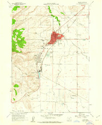
USGS Historical Quadrangle in GeoPDF.
USGS Historical Quadrangle in GeoPDF.
USGS Historical Quadrangle in GeoPDF.
USGS Historical Quadrangle in GeoPDF.
USGS Historical Quadrangle in GeoPDF.
USGS Historical Quadrangle in GeoPDF.
USGS Historical Quadrangle in GeoPDF.
USGS Historical Quadrangle in GeoPDF.
USGS Historical Quadrangle in GeoPDF.
USGS Historical Quadrangle in GeoPDF.

USGS Historical Quadrangle in GeoPDF.
With 204 GPS-collared mule deer, the Beulah-Malheur herd is one of the most extensively recorded mule deer herds in Oregon. Mule deer primarily winter along the Malheur River and the Stinkingwater Mountains, with some as far south as the Owyhee River. Winter ranges are covered by Artemisia tridentata (big sagebrush), grassland, and encroaching Juniperus occidentalis (western juniper). Although spatially dispersed, much of the Beulah-Malheur herd collectively migrates northwest to reach summer ranges across the upper elevations of the Malheur National Forest, Pedro Mountain, and Cottonwood Mountain. Primary summer range vegetation includes A. t. vaseyana (mountain big sagebrush), Pinus ponderosa (ponderosa pine),...
Categories: Data;
Types: Downloadable,
Map Service,
OGC WFS Layer,
OGC WMS Layer,
Shapefile;
Tags: Burns,
Oregon,
United States,
animal behavior,
biota,
USGS Historical Quadrangle in GeoPDF.
USGS Historical Quadrangle in GeoPDF.

USGS Historical Quadrangle in GeoPDF.
USGS Historical Quadrangle in GeoPDF.
With 204 GPS-collared mule deer, the Beulah-Malheur herd is one of the most extensively recorded mule deer herds in Oregon. Mule deer primarily winter along the Malheur River and the Stinkingwater Mountains, with some as far south as the Owyhee River. Winter ranges are covered by Artemisia tridentata (big sagebrush), grassland, and encroaching Juniperus occidentalis (western juniper). Although spatially dispersed, much of the Beulah-Malheur herd collectively migrates northwest to reach summer ranges across the upper elevations of the Malheur National Forest, Pedro Mountain, and Cottonwood Mountain. Primary summer range vegetation includes A. t. vaseyana (mountain big sagebrush), Pinus ponderosa (ponderosa pine),...
Categories: Data;
Types: Downloadable,
Map Service,
OGC WFS Layer,
OGC WMS Layer,
Shapefile;
Tags: Burns,
Oregon,
United States,
animal behavior,
biota,
A summary data set of all fire polygons we could locate as of December 2007. We used multiple datasets to develop this layer, including data gathered from the internet, publically available databases, and personal contacts with dozens of agency personnel throught the western U.S. Data were assessed for utility (but not accuracy) and formatted for consistency. Each source data set was then attributed consistently with fields for record number and year (of fire). Because various resource management entities map fires somewhat independently (especially in more recent years) we merged overlapping polygons for each year. Users are encouraged to understand the contents of this data file before using it.
Categories: Data;
Types: Downloadable,
Map Service,
OGC WFS Layer,
OGC WMS Layer,
Shapefile;
Tags: Alberta,
Arizona,
British Columbia,
Burns,
California,
With 204 GPS-collared mule deer, the Beulah-Malheur herd is one of the most extensively recorded mule deer herds in Oregon. Mule deer primarily winter along the Malheur River and the Stinkingwater Mountains, with some as far south as the Owyhee River. Winter ranges are covered by Artemisia tridentata (big sagebrush), grassland, and encroaching Juniperus occidentalis (western juniper). Although spatially dispersed, much of the Beulah-Malheur herd collectively migrates northwest to reach summer ranges across the upper elevations of the Malheur National Forest, Pedro Mountain, and Cottonwood Mountain. Primary summer range vegetation includes A. t. vaseyana (mountain big sagebrush), Pinus ponderosa (ponderosa pine),...
Categories: Data;
Types: Downloadable,
Map Service,
OGC WFS Layer,
OGC WMS Layer,
Shapefile;
Tags: Burns,
Oregon,
United States,
animal behavior,
biota,

USGS Historical Quadrangle in GeoPDF.
|

|
