Filters: Tags: Burns (X)
49 results (58ms)|
Filters
Date Range
Extensions Types
Contacts
Categories Tag Types Tag Schemes |
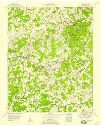
USGS Historical Quadrangle in GeoPDF.
This data set contains imagery from the National Agriculture Imagery Program (NAIP). The NAIP program is administered by USDA FSA and has been established to support two main FSA strategic goals centered on agricultural production. These are, increase stewardship of America's natural resources while enhancing the environment, and to ensure commodities are procured and distributed effectively and efficiently to increase food security. The NAIP program supports these goals by acquiring and providing ortho imagery that has been collected during the agricultural growing season in the U.S. The NAIP ortho imagery is tailored to meet FSA requirements and is a fundamental tool used to support FSA farm and conservation programs....

USGS Historical Quadrangle in GeoPDF.
With 204 GPS-collared mule deer, the Beulah-Malheur herd is one of the most extensively recorded mule deer herds in Oregon. Mule deer primarily winter along the Malheur River and the Stinkingwater Mountains, with some as far south as the Owyhee River. Winter ranges are covered by Artemisia tridentata (big sagebrush), grassland, and encroaching Juniperus occidentalis (western juniper). Although spatially dispersed, much of the Beulah-Malheur herd collectively migrates northwest to reach summer ranges across the upper elevations of the Malheur National Forest, Pedro Mountain, and Cottonwood Mountain. Primary summer range vegetation includes A. t. vaseyana (mountain big sagebrush), Pinus ponderosa (ponderosa pine),...
Categories: Data;
Types: Downloadable,
Map Service,
OGC WFS Layer,
OGC WMS Layer,
Shapefile;
Tags: Burns,
Oregon,
United States,
animal behavior,
biota,
A three-dimensional groundwater flow model, MODFLOW 6, was developed to provide a better understanding of the hydrogeology of the Harney Basin, southeastern Oregon. The model was used to investigate the historical groundwater-level decline and storage loss associated with anthropogenic groundwater demands. The model was calibrated to 1930 through 2018 conditions. This USGS data release contains all of the input and output files for the simulation described in the associated model documentation report (https://doi.org/10.3133/sir20241518)
Types: Map Service,
OGC WFS Layer,
OGC WMS Layer,
OGC WMS Service;
Tags: Burns,
Groundwater Model,
Harney Basin,
Harney County,
Harney Lake,
This data set contains imagery from the National Agriculture Imagery Program (NAIP). The NAIP program is administered by USDA FSA and has been established to support two main FSA strategic goals centered on agricultural production. These are, increase stewardship of America's natural resources while enhancing the environment, and to ensure commodities are procured and distributed effectively and efficiently to increase food security. The NAIP program supports these goals by acquiring and providing ortho imagery that has been collected during the agricultural growing season in the U.S. The NAIP ortho imagery is tailored to meet FSA requirements and is a fundamental tool used to support FSA farm and conservation programs....
This data set contains imagery from the National Agriculture Imagery Program (NAIP). The NAIP program is administered by USDA FSA and has been established to support two main FSA strategic goals centered on agricultural production. These are, increase stewardship of America's natural resources while enhancing the environment, and to ensure commodities are procured and distributed effectively and efficiently to increase food security. The NAIP program supports these goals by acquiring and providing ortho imagery that has been collected during the agricultural growing season in the U.S. The NAIP ortho imagery is tailored to meet FSA requirements and is a fundamental tool used to support FSA farm and conservation programs....
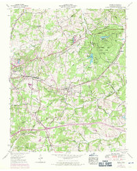
USGS Historical Quadrangle in GeoPDF.
USGS Historical Quadrangle in GeoPDF.

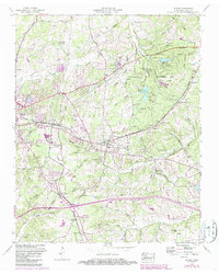
USGS Historical Quadrangle in GeoPDF.
USGS Historical Quadrangle in GeoPDF.
This data set contains imagery from the National Agriculture Imagery Program (NAIP). The NAIP program is administered by USDA FSA and has been established to support two main FSA strategic goals centered on agricultural production. These are, increase stewardship of America's natural resources while enhancing the environment, and to ensure commodities are procured and distributed effectively and efficiently to increase food security. The NAIP program supports these goals by acquiring and providing ortho imagery that has been collected during the agricultural growing season in the U.S. The NAIP ortho imagery is tailored to meet FSA requirements and is a fundamental tool used to support FSA farm and conservation programs....
This location is part of the Arizona Mineral Industry Location System (AzMILS), an inventory of mineral occurences, prospects and mine locations in Arizona. Yavapai362A is located in T8N R3W Sec 3 SE in the Morgan Butte - 7.5 Min quad. This collection consists of various reports, maps, records and related materials acquired by the Arizona Department of Mines and Mineral Resources regarding mining properties in Arizona. Information was obtained by various means, including the property owners, exploration companies, consultants, verbal interviews, field visits, newspapers and publications. Some sections may be redacted for copyright. Please see the access statement.
With 204 GPS-collared mule deer, the Beulah-Malheur herd is one of the most extensively recorded mule deer herds in Oregon. Mule deer primarily winter along the Malheur River and the Stinkingwater Mountains, with some as far south as the Owyhee River. Winter ranges are covered by Artemisia tridentata (big sagebrush), grassland, and encroaching Juniperus occidentalis (western juniper). Although spatially dispersed, much of the Beulah-Malheur herd collectively migrates northwest to reach summer ranges across the upper elevations of the Malheur National Forest, Pedro Mountain, and Cottonwood Mountain. Primary summer range vegetation includes A. t. vaseyana (mountain big sagebrush), Pinus ponderosa (ponderosa pine),...
Categories: Data;
Types: Downloadable,
Map Service,
OGC WFS Layer,
OGC WMS Layer,
Shapefile;
Tags: Burns,
Oregon,
United States,
animal behavior,
biota,
A summary data set of all fire polygons we could locate as of December 2007. We used multiple datasets to develop this layer, including data gathered from the internet, publically available databases, and personal contacts with dozens of agency personnel throught the western U.S. Data were assessed for utility (but not accuracy) and formatted for consistency. Each source data set was then attributed consistently with fields for record number and year (of fire). Because various resource management entities map fires somewhat independently (especially in more recent years) we merged overlapping polygons for each year. Users are encouraged to understand the contents of this data file before using it.
Categories: Data;
Types: Downloadable,
Map Service,
OGC WFS Layer,
OGC WMS Layer,
Shapefile;
Tags: Alberta,
Arizona,
British Columbia,
Burns,
California,
This data set contains imagery from the National Agriculture Imagery Program (NAIP). The NAIP program is administered by USDA FSA and has been established to support two main FSA strategic goals centered on agricultural production. These are, increase stewardship of America's natural resources while enhancing the environment, and to ensure commodities are procured and distributed effectively and efficiently to increase food security. The NAIP program supports these goals by acquiring and providing ortho imagery that has been collected during the agricultural growing season in the U.S. The NAIP ortho imagery is tailored to meet FSA requirements and is a fundamental tool used to support FSA farm and conservation programs....
This data set contains imagery from the National Agriculture Imagery Program (NAIP). The NAIP program is administered by USDA FSA and has been established to support two main FSA strategic goals centered on agricultural production. These are, increase stewardship of America's natural resources while enhancing the environment, and to ensure commodities are procured and distributed effectively and efficiently to increase food security. The NAIP program supports these goals by acquiring and providing ortho imagery that has been collected during the agricultural growing season in the U.S. The NAIP ortho imagery is tailored to meet FSA requirements and is a fundamental tool used to support FSA farm and conservation programs....
This data set contains imagery from the National Agriculture Imagery Program (NAIP). The NAIP program is administered by USDA FSA and has been established to support two main FSA strategic goals centered on agricultural production. These are increase stewardship of America's natural resources while enhancing the environment, and to ensure commodities are procured and distributed effectively and efficiently to increase food security. The NAIP program supports these goals by acquiring and providing ortho imagery that has been collected during the agricultural growing season in the U.S. The NAIP ortho imagery is tailored to meet FSA requirements and is a fundamental tool used to support FSA farm and conservation programs....
REQUIRED: A brief narrative summary of the data set.
Categories: Data;
Types: Downloadable,
Map Service,
OGC WFS Layer,
OGC WMS Layer,
Shapefile;
Tags: Alberta,
Arizona,
British Columbia,
Burns,
California,
|

|
