Filters: Tags: CEDAR RAPIDS (X)
19 results (81ms)|
Filters
Date Range
Types Contacts
Categories Tag Types Tag Schemes |
This data set contains imagery from the National Agriculture Imagery Program (NAIP). The NAIP program is administered by USDA FSA and has been established to support two main FSA strategic goals centered on agricultural production. These are, increase stewardship of America's natural resources while enhancing the environment, and to ensure commodities are procured and distributed effectively and efficiently to increase food security. The NAIP program supports these goals by acquiring and providing ortho imagery that has been collected during the agricultural growing season in the U.S. The NAIP ortho imagery is tailored to meet FSA requirements and is a fundamental tool used to support FSA farm and conservation programs....
This data set contains imagery from the National Agriculture Imagery Program (NAIP). The NAIP program is administered by USDA FSA and has been established to support two main FSA strategic goals centered on agricultural production. These are, increase stewardship of America's natural resources while enhancing the environment, and to ensure commodities are procured and distributed effectively and efficiently to increase food security. The NAIP program supports these goals by acquiring and providing ortho imagery that has been collected during the agricultural growing season in the U.S. The NAIP ortho imagery is tailored to meet FSA requirements and is a fundamental tool used to support FSA farm and conservation programs....
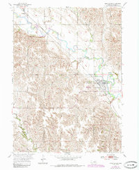
USGS Historical Quadrangle in GeoPDF.
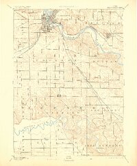
USGS Historical Quadrangle in GeoPDF.

USGS Historical Quadrangle in GeoPDF.

A three-dimensional MODFLOW-NWT model was constructed to better understand the effects of drought stress on the Cedar River alluvial aquifer, the principal source of municipal water for the City of Cedar Rapids, Iowa. Historically, the aquifer supported the production needs of the City of Cedar Rapids and surrounding area but between July 2011 and February 2013, Iowa experienced severe drought conditions that affected water availability for communities that relied on alluvial aquifers for their production needs. During that time, the City of Cedar Rapids observed water level declines in their horizontal collector wells (HCW) of as much as about 11 meters. Pumping from affected production wells had to be halted to...
A suite of geophysical methods was used along the Cedar River in Cedar Rapids, Iowa to support the hydrogeologic characterization of the alluvial aquifer associated with the river and to assess the area for suitability for larger-scale airborne geophysics. The aquifer is comprised of sand and gravel, interbedded with finer sediments, and underlain by carbonate-dominated bedrock. The aquifer is the principal source of municipal drinking water for the City of Cedar Rapids. The raw data provided here includes waterborne continuous resistivity profiling (CRP) and continuous seismic profiling (CSP) data (collected at the same time), electrical resistivity tomography (ERT) profiles, and horizontal-to-vertical spectral...
In June 2017, the U.S. Geological Survey (USGS)collected borehole geophysical logs to characterize the shallow alluvial aquifer in and near Cedar Rapids, Iowa. Borehole geophysical logs were collected from nine shallow boreholes to identify geophysical properties of the aquifer in the area surrounding the boreholes. Electromagnetic induction logs were used to determine the electrical properties of the fluid and formation surrounding the borehole. A natural gamma tool was used to identify the naturally occurring gamma radiation that is emitted from the earth materials. Nuclear magnetic resonance (NMR) tools were used to measure the water content and estimate the pore-size distribution and hydraulic conductivity (K)...
This data set contains imagery from the National Agriculture Imagery Program (NAIP). The NAIP program is administered by USDA FSA and has been established to support two main FSA strategic goals centered on agricultural production. These are, increase stewardship of America's natural resources while enhancing the environment, and to ensure commodities are procured and distributed effectively and efficiently to increase food security. The NAIP program supports these goals by acquiring and providing ortho imagery that has been collected during the agricultural growing season in the U.S. The NAIP ortho imagery is tailored to meet FSA requirements and is a fundamental tool used to support FSA farm and conservation programs....
In April 2015, approximately 19 miles of continuous resistivity profiling (CRP) surveys were collected on the Cedar River in Cedar Rapids, Iowa. The CRP method was used to characterize the resistivity of the water column and subbottom materials. Five CRP profiles were collected concurrently with the continuous seismic methods. For this investigation, 11 electrodes spaced 10 m apart and mounted in a streamer were towed behind the boat and data were collected using the dipole-dipole array type. The first two electrodes, closest to the boat, were used to inject current into the water and subbottom materials, and eight electrical potential measurements were made using the remaining nine electrodes. With this system,...

USGS Historical Quadrangle in GeoPDF.
This data release contains a set of permeameter test data collected in February and March of 2014 on the Cedar River near Cedar Rapids, Iowa. The permeameter tests were performed in proximity to five horizontal collector wells (HCs) 1, 2, 3, 4, and 6, and three vertical wells that are operated by the City of Cedar Rapids. Each dataset represents groundwater levels over time while individual HC and a few selected vertical wells (S10, S18, S23) had pumps turned on or off to look at the response of the streambed sediments as it relates to the operations of HCs and vertical wells. Three permeameter test locations at the HC2 site and four at the HC1, 3, 4, and 6 were selected across the Cedar River for permeability tests....
Surface and groundwater samples were collected, processed, and analyzed for pesticides, nutrients, organic carbon, and inorganics as part of a cooperative study with the City of Cedar Rapids, Iowa. Filtered and whole water samples were sent to the National Water Quality Laboratory in Denver, Colorado. U.S. Geological Survey staff collected field properties and discharge measurements in-situ. Discrete nitrate plus nitrite nitrogen samples were collected by the Cedar Rapids Utilities Water Department, the Iowa Department of Natural Resources, and the U.S. Geological Survey.
In April 2015, approximately 22 miles of continuous seismic profiling (CSP) surveys were collected on the Cedar River in Iowa. The swept frequency (chirp) CSP subbottom profiler was used to characterize the unconsolidated materials above the bedrock. The CSP subbottom profiler is an acoustic sound source that travels through the water column and reflects off the bottom and sub-bottom layers and is received at the transducer. (see Collecting resistivity and seismic data Cedar River IA 2.JPG. Applying a water column velocity, the two-way travel time can be converted to distance. CSP methods provide the depth to water bottom, and when sufficient signal penetration is achieved, CSP can be used to delineate the depth...
Electrical resistivity tomography (ERT) surveys were collected in April 2015 to support hydrogeologic characterization of the alluvial aquifer and to assess the suitability of larger-scale airborne geophysics. For this investigation, five sites were surveyed with ERT methods. At each site three surveys were collected, including dipole-dipole, Schlumberger, and inverse Schlumberger configurations. For each survey a total of 56 electrodes spaced 5-meters (m) apart were used. During the ERT measurement, current is injected through two current electrodes and voltage is measured sequentially across multiple pairs of potential electrodes, which is used to determine the apparent resistivity of the subsurface. Results were...
In April 2015, a total of 34 passive seismic surveys were conducted in the Cedar River Floodplain. The horizontal-to-vertical spectral ratio (HVSR) method is a passive seismic technique that uses a three-component seismometer to measure the vertical and horizontal components of ambient seismic noise. Seismic noise in the range of approximately 0.1 to 1 Hertz (Hz) is caused by ocean waves, large regional storms, and tectonic sources. A resonance frequency (f0) is induced in the unconsolidated deposits when there is a substantial contrast (greater than 2:1) in shear-wave acoustic impedance between the overburden and the bedrock. The f0 is determined from the analysis of the spectral ratio of the horizontal and vertical...
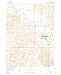
USGS Historical Quadrangle in GeoPDF.
This data set contains imagery from the National Agriculture Imagery Program (NAIP). The NAIP program is administered by USDA FSA and has been established to support two main FSA strategic goals centered on agricultural production. These are, increase stewardship of America's natural resources while enhancing the environment, and to ensure commodities are procured and distributed effectively and efficiently to increase food security. The NAIP program supports these goals by acquiring and providing ortho imagery that has been collected during the agricultural growing season in the U.S. The NAIP ortho imagery is tailored to meet FSA requirements and is a fundamental tool used to support FSA farm and conservation programs....
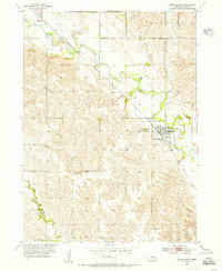
USGS Historical Quadrangle in GeoPDF.
|

|
