Filters: Tags: CEERT (X)
9 results (34ms)|
Filters
Date Range
Contacts Tag Schemes |

Description and data downloaded from DRECP Website: http://www.drecp.org/meetings/2012-07-25-26_workshop/background/Department_of_Defense_Materials/This information and data is provided in support of the Desert Renewable Energy Conservation Plan. Attachment 1 provides a Department of Defense (DoD) comprehensive matrix detailing potential military operational constraints by Development Focus Area. Attachment 2 provides associated conflict maps by renewable energy technology. Regarding the color coding:·        The red areas represent locations where there is a high likelihood of unacceptable risk to national security, and then technology identified might impact military operations, testing and training.Â...

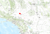
This dataset, dated July 2012, represents a more refined and reduced proposal than the March 2012 proposal that the Center for Energy Efficiency and Renewable Technologies (CEERT) considered the highest priority for inclusion in the Development Focus Areas in the Desert Renewable Energy Conservation Plan (DRECP). They were included in this proposal because they represent land with access to high levels of solar resources but exclude lands with identifiable and significant levels of environmental value. Â The constraints in development areas, requested by the Governorâs office, was accomplished with feedback and input from the industry. Â Especially critical was the new input from specialists on solar insolation...
Tags: CEERT
Description and data downloaded from DRECP Website: http://www.drecp.org/meetings/2012-07-25-26_workshop/background/Department_of_Defense_Materials/This information and data is provided in support of the Desert Renewable Energy Conservation Plan. Attachment 1 provides a Department of Defense (DoD) comprehensive matrix detailing potential military operational constraints by Development Focus Area. Attachment 2 provides associated conflict maps by renewable energy technology. Regarding the color coding:·        The red areas represent locations where there is a high likelihood of unacceptable risk to national security, and then technology identified might impact military operations, testing and training.Â...

Description and data downloaded from DRECP Website: http://www.drecp.org/meetings/2012-07-25-26_workshop/background/Department_of_Defense_Materials/This information and data is provided in support of the Desert Renewable Energy Conservation Plan. Attachment 1 provides a Department of Defense (DoD) comprehensive matrix detailing potential military operational constraints by Development Focus Area. Attachment 2 provides associated conflict maps by renewable energy technology. Regarding the color coding:·        The red areas represent locations where there is a high likelihood of unacceptable risk to national security, and then technology identified might impact military operations, testing and training.Â...

Priority Solar Areas created in 2011 by the Center for Energy Efficiency and Renewable Technologies (CEERT) and the Large Scale Solar Association (LSA).No description provided with data. This dataset will be updated when a complete description is provided.Please contact Mike Howard at mhoward@dudek.com for more information.Original dataset named: Â SDP8_3_11

This dataset shows land in the DRECP area with less than 10 percent slope. Slope (along with insolation, proximity to existing infrastructure, and land use/restrictions) dictates the siting for solar power generation. Most solar generating technologies must be sited on relatively flat ground to ensure that the solar collectors can utilize the solar resource effectively. Typically, solar facilities must be sited on land that has less than 5% slope. This dataset was created by mosaicing multiple 30 m DEMs from the NED into a single raster and deriving slope from that layer. (The National Elevation Dataset (NED) provides the best available public domain raster elevation data of the United States.) Slope values were...

This dataset shows land in the DRECP area with less than 5 percent slope. Slope (along with insolation, proximity to existing infrastructure, and land use/restrictions) dictates the siting for solar power generation. Most solar generating technologies must be sited on relatively flat ground to ensure that the solar collectors can utilize the solar resource effectively. Typically, solar facilities must be sited on land that has less than 5% slope.This dataset was created by mosaicing multiple 30 m DEMs from the NED into a single raster and deriving slope from that layer. (The National Elevation Dataset (NED) provides the best available public domain raster elevation data of the United States.) Slope values were...

Priority Solar Areas created in 2012 by the Center for Energy Efficiency and Renewable Technologies (CEERT) and the Large Scale Solar Association (LSA).No description provided with data. This dataset will be updated when a complete description is provided. Please contact Mike Howard at mhoward@dudek.com for more information.Original dataset named: Â Mar_prop_DFA_final_3_27_12

This dataset represents proposed areas that the Center for Energy Efficiency and Renewable Technologies (CEERT) and Large-Scale Solar Alliance (LSA) consider to be priority Development Focus Areas. They were included because they represent access to high-value resources for solar development but exclude lands that have been identified to have significant environmental value. Â The constraints placed on the development areas, requested by the Governorâs office, were determined with feedback and input from the industry. Â CEERT and LSA used a number of factors to highlight the best development areas at the time, including but not limited to: conflicting land use (environmental, military, and existing development),...
Tags: CEERT
|

|
