Filters: Tags: CONCRETE (X)
22 results (52ms)|
Filters
Date Range
Extensions Types Contacts
Categories Tag Types Tag Schemes |
This data set contains imagery from the National Agriculture Imagery Program (NAIP). The NAIP program is administered by USDA FSA and has been established to support two main FSA strategic goals centered on agricultural production. These are, increase stewardship of America's natural resources while enhancing the environment, and to ensure commodities are procured and distributed effectively and efficiently to increase food security. The NAIP program supports these goals by acquiring and providing ortho imagery that has been collected during the agricultural growing season in the U.S. The NAIP ortho imagery is tailored to meet FSA requirements and is a fundamental tool used to support FSA farm and conservation programs....
This data set contains imagery from the National Agriculture Imagery Program (NAIP). The NAIP program is administered by USDA FSA and has been established to support two main FSA strategic goals centered on agricultural production. These are increase stewardship of America's natural resources while enhancing the environment, and to ensure commodities are procured and distributed effectively and efficiently to increase food security. The NAIP program supports these goals by acquiring and providing ortho imagery that has been collected during the agricultural growing season in the U.S. The NAIP ortho imagery is tailored to meet FSA requirements and is a fundamental tool used to support FSA farm and conservation programs....

Historic image HHW�460 is part of the 'Historic photolab Images' collection; the topic area is 'Concrete'. Location is Prince William Co. (estimated). The image has the following description: 'Roll 15-25. Smith-Medlin, concrete cattle guards, feeders, & water troughs .' The image was scanned from a photo as part of the USGS NGGDPP deliverable for 2016-2017. The physical location is 900 Natural Resources Dr., Ste 400, Charlottesville, VA 22903. Room 1093 (photolab) The author is HHW. The image is dated unknown.
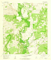
USGS Historical Quadrangle in GeoPDF.

USGS Historical Quadrangle in GeoPDF.

USGS Historical Quadrangle in GeoPDF.
This data set contains imagery from the National Agriculture Imagery Program (NAIP). The NAIP program is administered by USDA FSA and has been established to support two main FSA strategic goals centered on agricultural production. These are increase stewardship of America's natural resources while enhancing the environment, and to ensure commodities are procured and distributed effectively and efficiently to increase food security. The NAIP program supports these goals by acquiring and providing ortho imagery that has been collected during the agricultural growing season in the U.S. The NAIP ortho imagery is tailored to meet FSA requirements and is a fundamental tool used to support FSA farm and conservation programs....
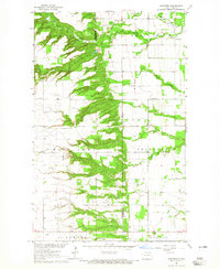
USGS Historical Quadrangle in GeoPDF.
This data set contains imagery from the National Agriculture Imagery Program (NAIP). The NAIP program is administered by USDA FSA and has been established to support two main FSA strategic goals centered on agricultural production. These are, increase stewardship of America's natural resources while enhancing the environment, and to ensure commodities are procured and distributed effectively and efficiently to increase food security. The NAIP program supports these goals by acquiring and providing ortho imagery that has been collected during the agricultural growing season in the U.S. The NAIP ortho imagery is tailored to meet FSA requirements and is a fundamental tool used to support FSA farm and conservation programs....
This data set contains imagery from the National Agriculture Imagery Program (NAIP). The NAIP program is administered by USDA FSA and has been established to support two main FSA strategic goals centered on agricultural production. These are increase stewardship of America's natural resources while enhancing the environment, and to ensure commodities are procured and distributed effectively and efficiently to increase food security. The NAIP program supports these goals by acquiring and providing ortho imagery that has been collected during the agricultural growing season in the U.S. The NAIP ortho imagery is tailored to meet FSA requirements and is a fundamental tool used to support FSA farm and conservation programs....
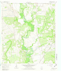
USGS Historical Quadrangle in GeoPDF.

USGS Historical Quadrangle in GeoPDF.
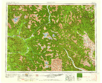
USGS Historical Quadrangle in GeoPDF.

Historic image HHW�461 is part of the 'Historic photolab Images' collection; the topic area is 'Concrete'. Location is Prince William Co. (estimated). The image has the following description: 'Roll 15-26. Smith-Medlin, concrete panel display .' The image was scanned from a photo as part of the USGS NGGDPP deliverable for 2016-2017. The physical location is 900 Natural Resources Dr., Ste 400, Charlottesville, VA 22903. Room 1093 (photolab) The author is HHW. The image is dated unknown.

Historic image HHW�457 is part of the 'Historic photolab Images' collection; the topic area is 'Concrete'. Location is Prince William Co. (estimated). The image has the following description: 'Roll 15-22. Smith-Medlin concrete products .' The image was scanned from a photo as part of the USGS NGGDPP deliverable for 2016-2017. The physical location is 900 Natural Resources Dr., Ste 400, Charlottesville, VA 22903. Room 1093 (photolab) The author is HHW. The image is dated unknown.
This data set contains imagery from the National Agriculture Imagery Program (NAIP). The NAIP program is administered by USDA FSA and has been established to support two main FSA strategic goals centered on agricultural production. These are, increase stewardship of America's natural resources while enhancing the environment, and to ensure commodities are procured and distributed effectively and efficiently to increase food security. The NAIP program supports these goals by acquiring and providing ortho imagery that has been collected during the agricultural growing season in the U.S. The NAIP ortho imagery is tailored to meet FSA requirements and is a fundamental tool used to support FSA farm and conservation programs....
This data set contains imagery from the National Agriculture Imagery Program (NAIP). The NAIP program is administered by USDA FSA and has been established to support two main FSA strategic goals centered on agricultural production. These are increase stewardship of America's natural resources while enhancing the environment, and to ensure commodities are procured and distributed effectively and efficiently to increase food security. The NAIP program supports these goals by acquiring and providing ortho imagery that has been collected during the agricultural growing season in the U.S. The NAIP ortho imagery is tailored to meet FSA requirements and is a fundamental tool used to support FSA farm and conservation programs....
This data set contains imagery from the National Agriculture Imagery Program (NAIP). The NAIP program is administered by USDA FSA and has been established to support two main FSA strategic goals centered on agricultural production. These are, increase stewardship of America's natural resources while enhancing the environment, and to ensure commodities are procured and distributed effectively and efficiently to increase food security. The NAIP program supports these goals by acquiring and providing ortho imagery that has been collected during the agricultural growing season in the U.S. The NAIP ortho imagery is tailored to meet FSA requirements and is a fundamental tool used to support FSA farm and conservation programs....

Historic image HHW�465 is part of the 'Historic photolab Images' collection; the topic area is 'Concrete'. Location is Wythe Co. (estimated). The image has the following description: 'Roll 15-30. Concrete cribbing for bank control .' The image was scanned from a photo as part of the USGS NGGDPP deliverable for 2016-2017. The physical location is 900 Natural Resources Dr., Ste 400, Charlottesville, VA 22903. Room 1093 (photolab) The author is HHW. The image is dated unknown.

Historic image HHW�468 is part of the 'Historic photolab Images' collection; the topic area is 'Concrete'. Location is Russell Co. (estimated). The image has the following description: 'Roll 15-33. Concrete block display, Rosedale .' The image was scanned from a photo as part of the USGS NGGDPP deliverable for 2016-2017. The physical location is 900 Natural Resources Dr., Ste 400, Charlottesville, VA 22903. Room 1093 (photolab) The author is HHW. The image is dated unknown.
|

|
