Filters: Tags: CONTENT (X)
12 results (111ms)|
Filters
Date Range
Extensions Types Contacts
Categories Tag Types Tag Schemes |
This data set contains imagery from the National Agriculture Imagery Program (NAIP). The NAIP program is administered by USDA FSA and has been established to support two main FSA strategic goals centered on agricultural production. These are, increase stewardship of America's natural resources while enhancing the environment, and to ensure commodities are procured and distributed effectively and efficiently to increase food security. The NAIP program supports these goals by acquiring and providing ortho imagery that has been collected during the agricultural growing season in the U.S. The NAIP ortho imagery is tailored to meet FSA requirements and is a fundamental tool used to support FSA farm and conservation programs....
Regional economic impact assessment (REIA) and social impact assessment (SIA) are methodologically close, since REIA provides predictions of change in employment both directly and indirectly resulting from a project, thereby giving some indication of future population changes, derived demand for social services and infrastructure, and the likely regional social mix. There are, however, a number of theoretical difficulties with conventional REIAs. As extrapolations they normally avoid discussion of processes of structural change, which could result in substantial changes within the time horizon of a project. Another issue is the justification for including secondary project impacts in assessing a project's worth....
Community energy initiatives offer a potentially important means for reshaping the electrical system in a manner compatible with emissions reduction goals. Many such initiatives, however, focus upon top-down, institutionally structured approaches that understand community residents as atomistic, economically motivated, and minimally engaged. This paper examines a number of case studies that are based upon a bottom-up approach rooted in a civic culture that seeks to maximize the capacities of an active and engaged citizenry. The paper focuses upon two mutually dependent issues: first, recruiting community members, and second, sustaining their participation.
This data set contains imagery from the National Agriculture Imagery Program (NAIP). The NAIP program is administered by USDA FSA and has been established to support two main FSA strategic goals centered on agricultural production. These are, increase stewardship of America's natural resources while enhancing the environment, and to ensure commodities are procured and distributed effectively and efficiently to increase food security. The NAIP program supports these goals by acquiring and providing ortho imagery that has been collected during the agricultural growing season in the U.S. The NAIP ortho imagery is tailored to meet FSA requirements and is a fundamental tool used to support FSA farm and conservation programs....
Community energy initiatives offer a potentially important means for reshaping the electrical system in a manner compatible with emissions reduction goals. Many such initiatives, however, focus upon top-down, institutionally structured approaches that understand community residents as atomistic, economically motivated, and minimally engaged. This paper examines a number of case studies that are based upon a bottom-up approach rooted in a civic culture that seeks to maximize the capacities of an active and engaged citizenry. The paper focuses upon two mutually dependent issues: first, recruiting community members, and second, sustaining their participation.
Changes in continental water stores, largely human-induced, affect sea level. Better hydrological models and observations could clarify the land's role in sea-level variations.
This data set contains imagery from the National Agriculture Imagery Program (NAIP). The NAIP program is administered by USDA FSA and has been established to support two main FSA strategic goals centered on agricultural production. These are, increase stewardship of America's natural resources while enhancing the environment, and to ensure commodities are procured and distributed effectively and efficiently to increase food security. The NAIP program supports these goals by acquiring and providing ortho imagery that has been collected during the agricultural growing season in the U.S. The NAIP ortho imagery is tailored to meet FSA requirements and is a fundamental tool used to support FSA farm and conservation programs....
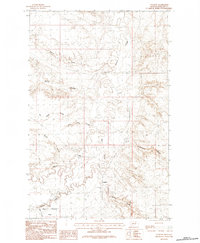
USGS Historical Quadrangle in GeoPDF.
Community energy initiatives offer a potentially important means for reshaping the electrical system in a manner compatible with emissions reduction goals. Many such initiatives, however, focus upon top-down, institutionally structured approaches that understand community residents as atomistic, economically motivated, and minimally engaged. This paper examines a number of case studies that are based upon a bottom-up approach rooted in a civic culture that seeks to maximize the capacities of an active and engaged citizenry. The paper focuses upon two mutually dependent issues: first, recruiting community members, and second, sustaining their participation.
Shallow groundwater, the primary water source in the Bengal Basin, contains up to 100 times the World Health Organization (WHO) drinking-water guideline of 10 μg l−1 arsenic (As), threatening the health of 70 million people. Groundwater from a depth greater than 150 m, which almost uniformly meets the WHO guideline, has become the preferred alternative source. The vulnerability of deep wells to contamination by As is governed by the geometry of induced groundwater flow paths and the geochemical conditions encountered between the shallow and deep regions of the aquifer. Stratification of flow separates deep groundwater from shallow sources of As in some areas. Oxidized sediments also protect deep groundwater through...
In this paper, we derive a simultaneous system of equations which aims at analysing the uranium supply and demand. In addition to reviewing and updating previous studies dealing with the uranium market analysis, in particular Amavilah (1995), the contribution of the paper lies in putting attention to some questions which are still either controversial or unanswered. They are especially related to the controversial hypothesis of the interdependence between uranium market and other commodities markets, both, with respect to the demand side, i.e. oil and coal markets, and the supply side, i.e. gold market. The paper also casts lights on electricity and uranium price effects on uranium demand as well as on the simultaneous...
This data set contains imagery from the National Agriculture Imagery Program (NAIP). The NAIP program is administered by USDA FSA and has been established to support two main FSA strategic goals centered on agricultural production. These are, increase stewardship of America's natural resources while enhancing the environment, and to ensure commodities are procured and distributed effectively and efficiently to increase food security. The NAIP program supports these goals by acquiring and providing ortho imagery that has been collected during the agricultural growing season in the U.S. The NAIP ortho imagery is tailored to meet FSA requirements and is a fundamental tool used to support FSA farm and conservation programs....
|

|
