Filters: Tags: COUNCIL GROVE (X)
26 results (133ms)|
Filters
Date Range
Types Contacts
Categories Tag Types Tag Schemes |
Core Research Center, core B285, from well operated by AMOCO PRODUCTIONRaw Properties from download, web scrape, MapServer, and Macrostrat API{"Lib Num": "B285", "API Num": "1518720227", "Operator": "AMOCO PRODUCTION", "Well Name": "1 H L CULLERS", "Field": "PANOMA GAS AREA", "State": "KS", "County": "STANTON", "Type": "SLABBED", "Photos": "T", "Thin Sec": "F", "Analysis": "F", "Latitude": "37.481194", "Longitude": "-101.768575", "coordinates_geohash": "9wxthpnru2fr", "Source": "FROM STATE RECORDS", "Security Flag": "NO SPECIAL RESTRICTIONS", "crc_collection_name": "core", "sb_parent_id": "4f4e49dae4b07f02db5e0486", "intervals": [{"Formation": "COUNCIL GROVE", "Age": "PERM", "Min Depth": "2610", "Max Depth": "2730"}],...
Core Research Center, core E070, from well operated by TRUE OILRaw Properties from download, web scrape, MapServer, and Macrostrat API{"Lib Num": "E070", "API Num": "2616521144", "Operator": "TRUE OIL", "Well Name": "24-10 WATSON", "Field": "WILDCAT", "State": "NE", "County": "SIOUX", "Type": "SLABBED", "Photos": "T", "Thin Sec": "F", "Analysis": "T", "Latitude": "42.237105", "Longitude": "-103.613431", "coordinates_geohash": "9xw261p0bp41", "Source": "FROM STATE RECORDS", "Security Flag": "NO SPECIAL RESTRICTIONS", "crc_collection_name": "core", "sb_parent_id": "4f4e49dae4b07f02db5e0486", "intervals": [{"Formation": "COUNCIL GROVE", "Age": "PERM", "Min Depth": "6494", "Max Depth": "6527"}, {"Formation": "ADMIRE",...
Categories: Physical Item;
Tags: ADMIRE,
Arikaree Group,
Arikaree Group,
COUNCIL GROVE,
Chattian - Miocene,
Core Research Center, core S925, from well operated by AMOCO PRODUCTIONRaw Properties from download, web scrape, MapServer, and Macrostrat API{"Lib Num": "S925", "API Num": "1518720147", "Operator": "AMOCO PRODUCTION", "Well Name": "2 LUKE GAS UNIT", "Field": "PANOMA GAS AREA ", "State": "KS", "County": "STANTON", "Type": "SLABBED", "Photos": "F", "Thin Sec": "F", "Analysis": "F", "Latitude": "37.457542", "Longitude": "-101.60717", "coordinates_geohash": "9wxtpfgvvrft", "Source": "FROM STATE RECORDS", "Security Flag": "NO SPECIAL RESTRICTIONS", "crc_collection_name": "core", "sb_parent_id": "4f4e49dae4b07f02db5e0486", "intervals": [{"Formation": "COUNCIL GROVE", "Age": "PERM", "Min Depth": "2588", "Max Depth": "2871"}],...
Core Research Center, core A696, from well operated by AMOCO PRODUCTIONRaw Properties from download, web scrape, MapServer, and Macrostrat API{"Lib Num": "A696", "API Num": "1509320242", "Operator": "AMOCO PRODUCTION", "Well Name": "B-3 DOTSON GAS UNIT", "Field": "PANOMA", "State": "KS", "County": "KEARNY", "Type": "SLABBED", "Photos": "T", "Thin Sec": "F", "Analysis": "F", "Latitude": "37.966351", "Longitude": "-101.362496", "coordinates_geohash": "9wxzvrw448uc", "Source": "FROM STATE RECORDS", "Security Flag": "NO SPECIAL RESTRICTIONS", "crc_collection_name": "core", "sb_parent_id": "4f4e49dae4b07f02db5e0486", "intervals": [{"Formation": "COUNCIL GROVE", "Age": "PERM", "Min Depth": "2754", "Max Depth": "2878"}],...
Core Research Center, core B068, from well operated by AMOCO PRODUCTIONRaw Properties from download, web scrape, MapServer, and Macrostrat API{"Lib Num": "B068", "API Num": "3513921008", "Operator": "AMOCO PRODUCTION", "Well Name": "2 BURROWS GAS UNIT D", "Field": "GUYMON-HUGOTON", "State": "OK", "County": "TEXAS", "Type": "SLABBED", "Photos": "T", "Thin Sec": "F", "Analysis": "F", "Latitude": "36.540677", "Longitude": "-101.676904", "coordinates_geohash": "9wrxyk10u7vk", "Source": "FROM STATE RECORDS", "Security Flag": "NO SPECIAL RESTRICTIONS", "crc_collection_name": "core", "sb_parent_id": "4f4e49dae4b07f02db5e0486", "intervals": [{"Formation": "COUNCIL GROVE", "Age": "PERM", "Min Depth": "3064", "Max Depth":...
Categories: Physical Item;
Tags: COUNCIL GROVE,
PERM,
Pleistocene and Pliocene deposits, undifferentiated,
Pliocene - Pleistocene,
alluvium,
This data set contains imagery from the National Agriculture Imagery Program (NAIP). The NAIP program is administered by USDA FSA and has been established to support two main FSA strategic goals centered on agricultural production. These are, increase stewardship of America's natural resources while enhancing the environment, and to ensure commodities are procured and distributed effectively and efficiently to increase food security. The NAIP program supports these goals by acquiring and providing ortho imagery that has been collected during the agricultural growing season in the U.S. The NAIP ortho imagery is tailored to meet FSA requirements and is a fundamental tool used to support FSA farm and conservation programs....
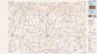
USGS Historical Quadrangle in GeoPDF.
This data set contains imagery from the National Agriculture Imagery Program (NAIP). The NAIP program is administered by USDA FSA and has been established to support two main FSA strategic goals centered on agricultural production. These are, increase stewardship of America's natural resources while enhancing the environment, and to ensure commodities are procured and distributed effectively and efficiently to increase food security. The NAIP program supports these goals by acquiring and providing ortho imagery that has been collected during the agricultural growing season in the U.S. The NAIP ortho imagery is tailored to meet FSA requirements and is a fundamental tool used to support FSA farm and conservation programs....
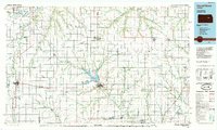
USGS Historical Quadrangle in GeoPDF.
Core Research Center, core F055, from well operated by TRUE OILRaw Properties from download, web scrape, MapServer, and Macrostrat API{"Lib Num": "F055", "API Num": "2616521143", "Operator": "TRUE OIL", "Well Name": "31-12 HODGES", "Field": "WILDCAT", "State": "NE", "County": "SIOUX", "Type": "SLABBED", "Photos": "T", "Thin Sec": "T", "Analysis": "T", "Latitude": "42.247184", "Longitude": "-103.570976", "coordinates_geohash": "9xw274vgtmfu", "Source": "FROM STATE RECORDS", "Security Flag": "NO SPECIAL RESTRICTIONS", "crc_collection_name": "core", "sb_parent_id": "4f4e49dae4b07f02db5e0486", "intervals": [{"Formation": "MISSOURI", "Age": "PENN", "Min Depth": "6809", "Max Depth": "6869"}, {"Formation": "COUNCIL GROVE",...
Categories: Physical Item;
Tags: Arikaree Group,
Arikaree Group,
COUNCIL GROVE,
Chattian - Miocene,
DESMOINES /SERIES/,
Core Research Center, core B197, from well operated by AMOCO PRODUCTIONRaw Properties from download, web scrape, MapServer, and Macrostrat API{"Lib Num": "B197", "API Num": "4235730400", "Operator": "AMOCO PRODUCTION", "Well Name": "3 D SELL", "Field": "ELLIS RANCH", "State": "TX", "County": "OCHILTREE", "Type": "SLABBED", "Photos": "T", "Thin Sec": "F", "Analysis": "F", "Latitude": "36.3147", "Longitude": "-100.60506", "coordinates_geohash": "9y2qwdvsknwp", "Source": "FROM STATE RECORDS", "Security Flag": "NO SPECIAL RESTRICTIONS", "crc_collection_name": "core", "sb_parent_id": "4f4e49dae4b07f02db5e0486", "intervals": [{"Formation": "COUNCIL GROVE", "Age": "PERM", "Min Depth": "3936", "Max Depth": "4046"}], "crcwc_url":...
Categories: Physical Item;
Tags: COUNCIL GROVE,
Late Miocene - Pliocene,
Ogallala Formation,
Ogallala Formation,
PERM,
Core Research Center, core S701, from well operated by TRUE OILRaw Properties from download, web scrape, MapServer, and Macrostrat API{"Lib Num": "S701", "API Num": "2616521149", "Operator": "TRUE OIL", "Well Name": "11-17 MORRISON", "Field": "WILDCAT", "State": "NE", "County": "SIOUX", "Type": "SLABBED", "Photos": "T", "Thin Sec": "F", "Analysis": "T", "Latitude": "42.058431", "Longitude": "-103.614177", "coordinates_geohash": "9xqr60w2nevc", "Source": "FROM STATE RECORDS", "Security Flag": "NO SPECIAL RESTRICTIONS", "crc_collection_name": "core", "sb_parent_id": "4f4e49dae4b07f02db5e0486", "intervals": [{"Formation": "VIRGIL /VIRGILIAN/", "Age": "PENN", "Min Depth": "7125", "Max Depth": "7237"}, {"Formation":...
Categories: Physical Item;
Tags: ADMIRE,
Arikaree Group,
Arikaree Group,
COUNCIL GROVE,
Chattian - Miocene,
Core Research Center, core B110, from well operated by AMOCO PRODUCTIONRaw Properties from download, web scrape, MapServer, and Macrostrat API{"Lib Num": "B110", "API Num": "1509320134", "Operator": "AMOCO PRODUCTION", "Well Name": "E-2 EDNA MAY BEATTY", "Field": "PANOMA GAS AREA", "State": "KS", "County": "KEARNY", "Type": "SLABBED", "Photos": "T", "Thin Sec": "F", "Analysis": "F", "Latitude": "37.859831", "Longitude": "-101.514617", "coordinates_geohash": "9wxz3upm9bp2", "Source": "FROM STATE RECORDS", "Security Flag": "NO SPECIAL RESTRICTIONS", "crc_collection_name": "core", "sb_parent_id": "4f4e49dae4b07f02db5e0486", "intervals": [{"Formation": "COUNCIL GROVE", "Age": "PERM", "Min Depth": "2608", "Max Depth":...
Core Research Center, core A683, from well operated by AMOCO PRODUCTIONRaw Properties from download, web scrape, MapServer, and Macrostrat API{"Lib Num": "A683", "API Num": "1509320243", "Operator": "AMOCO PRODUCTION", "Well Name": "2 MILES GAS UNIT", "Field": "PANOMA GAS AREA", "State": "KS", "County": "KEARNY", "Type": "SLABBED", "Photos": "T", "Thin Sec": "F", "Analysis": "F", "Latitude": "38.027771", "Longitude": "-101.404437", "coordinates_geohash": "9wzbk6xxc673", "Source": "FROM STATE RECORDS", "Security Flag": "NO SPECIAL RESTRICTIONS", "crc_collection_name": "core", "sb_parent_id": "4f4e49dae4b07f02db5e0486", "intervals": [{"Formation": "COUNCIL GROVE", "Age": "PERM", "Min Depth": "2885", "Max Depth": "3109"}],...
This data set contains imagery from the National Agriculture Imagery Program (NAIP). The NAIP program is administered by USDA FSA and has been established to support two main FSA strategic goals centered on agricultural production. These are, increase stewardship of America's natural resources while enhancing the environment, and to ensure commodities are procured and distributed effectively and efficiently to increase food security. The NAIP program supports these goals by acquiring and providing ortho imagery that has been collected during the agricultural growing season in the U.S. The NAIP ortho imagery is tailored to meet FSA requirements and is a fundamental tool used to support FSA farm and conservation programs....
Core Research Center, core S923, from well operated by AMOCO PRODUCTIONRaw Properties from download, web scrape, MapServer, and Macrostrat API{"Lib Num": "S923", "API Num": "1507520066", "Operator": "AMOCO PRODUCTION", "Well Name": "2 R B FEGAN B", "Field": "PANOMA GAS AREA", "State": "KS", "County": "HAMILTON", "Type": "FULL", "Photos": "F", "Thin Sec": "F", "Analysis": "F", "Latitude": "37.739866", "Longitude": "-101.572144", "coordinates_geohash": "9wxy8wm6tsbj", "Source": "FROM STATE RECORDS", "Security Flag": "NO SPECIAL RESTRICTIONS", "crc_collection_name": "core", "sb_parent_id": "4f4e49dae4b07f02db5e0486", "intervals": [{"Formation": "COUNCIL GROVE", "Age": "PERM", "Min Depth": "2631", "Max Depth": "2831"}],...
Core Research Center, core S650, from well operated by TRUE OILRaw Properties from download, web scrape, MapServer, and Macrostrat API{"Lib Num": "S650", "API Num": "2616521145", "Operator": "TRUE OIL", "Well Name": "32-9 SPEER DIAMOND RANCH", "Field": "WILDCAT", "State": "NE", "County": "SIOUX", "Type": "SLABBED", "Photos": "T", "Thin Sec": "T", "Analysis": "T", "Latitude": "42.157765", "Longitude": "-103.628065", "coordinates_geohash": "9xqrcfs6g0fp", "Source": "FROM STATE RECORDS", "Security Flag": "NO SPECIAL RESTRICTIONS", "crc_collection_name": "core", "sb_parent_id": "4f4e49dae4b07f02db5e0486", "intervals": [{"Formation": "COUNCIL GROVE", "Age": "PERM", "Min Depth": "6667", "Max Depth": "6722"}, {"Formation":...
Categories: Physical Item;
Tags: ADMIRE,
Arikaree Group,
Arikaree Group,
COUNCIL GROVE,
Chattian - Miocene,
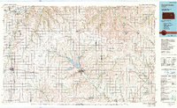
USGS Historical Quadrangle in GeoPDF.
Core Research Center, core B128, from well operated by AMOCO PRODUCTIONRaw Properties from download, web scrape, MapServer, and Macrostrat API{"Lib Num": "B128", "API Num": "1518720231", "Operator": "AMOCO PRODUCTION", "Well Name": "2 L R-C E CROSS", "Field": "HUGOTON GAS AREA", "State": "KS", "County": "STANTON", "Type": "SLABBED", "Photos": "T", "Thin Sec": "F", "Analysis": "F", "Latitude": "37.661002", "Longitude": "-101.756643", "coordinates_geohash": "9wxwhrzp4ree", "Source": "FROM STATE RECORDS", "Security Flag": "NO SPECIAL RESTRICTIONS", "crc_collection_name": "core", "sb_parent_id": "4f4e49dae4b07f02db5e0486", "intervals": [{"Formation": "COUNCIL GROVE", "Age": "PERM", "Min Depth": "2431", "Max Depth":...
This data set contains imagery from the National Agriculture Imagery Program (NAIP). The NAIP program is administered by USDA FSA and has been established to support two main FSA strategic goals centered on agricultural production. These are, increase stewardship of America's natural resources while enhancing the environment, and to ensure commodities are procured and distributed effectively and efficiently to increase food security. The NAIP program supports these goals by acquiring and providing ortho imagery that has been collected during the agricultural growing season in the U.S. The NAIP ortho imagery is tailored to meet FSA requirements and is a fundamental tool used to support FSA farm and conservation programs....
|

|
