Filters: Tags: CUT BANK (X)
47 results (27ms)|
Filters
Date Range
Types Contacts
Categories Tag Types Tag Schemes |
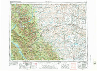
This data set contains imagery from the National Agriculture Imagery Program (NAIP). The NAIP program is administered by USDA FSA and has been established to support two main FSA strategic goals centered on agricultural production. These are, increase stewardship of America's natural resources while enhancing the environment, and to ensure commodities are procured and distributed effectively and efficiently to increase food security. The NAIP program supports these goals by acquiring and providing ortho imagery that has been collected during the agricultural growing season in the U.S. The NAIP ortho imagery is tailored to meet FSA requirements and is a fundamental tool used to support FSA farm and conservation programs....
Core Research Center, core T044, from well operated by SEELIGSON A ARaw Properties from download, web scrape, MapServer, and Macrostrat API{"Lib Num": "T044", "API Num": "2503506004", "Operator": "SEELIGSON A A", "Well Name": "5 YUNCK", "Field": "CUTBANK", "State": "MT", "County": "GLACIER", "Type": "CHIPS", "Photos": "T", "Thin Sec": "F", "Analysis": "F", "Latitude": "48.687867", "Longitude": "-112.361142", "coordinates_geohash": "c88hgpm57shp", "Source": "FROM STATE RECORDS", "Security Flag": "NO SPECIAL RESTRICTIONS", "crc_collection_name": "core", "sb_parent_id": "4f4e49dae4b07f02db5e0486", "intervals": [{"Formation": "CUT BANK", "Age": "CRET", "Min Depth": "2950", "Max Depth": "2985"}], "crcwc_url": "https://my.usgs.gov/crcwc/core/report/16111",...
Categories: Physical Item;
Tags: CRET,
CUT BANK,
Campanian - Maastrichtian,
Two Medicine Formation,
Two Medicine Formation,
Core Research Center, core T641, from well operated by SUMMIT RESOURCES LTDRaw Properties from download, web scrape, MapServer, and Macrostrat API{"Lib Num": "T641", "API Num": "2503521908", "Operator": "SUMMIT RESOURCES LTD", "Well Name": "2C-11 RED CREEK", "Field": "RED CREEK", "State": "MT", "County": "GLACIER", "Type": "FULL", "Photos": "F", "Thin Sec": "T", "Analysis": "F", "Latitude": "48.984508", "Longitude": "-112.223629", "coordinates_geohash": "c88nwm35ryjh", "Source": "FROM STATE RECORDS", "Security Flag": "NO SPECIAL RESTRICTIONS", "crc_collection_name": "core", "sb_parent_id": "4f4e49dae4b07f02db5e0486", "intervals": [{"Formation": "CUT BANK", "Age": "CRET", "Min Depth": "2668", "Max Depth": "2699"}],...
Categories: Physical Item;
Tags: CRET,
CUT BANK,
Campanian - Maastrichtian,
Two Medicine Formation,
Two Medicine Formation,
Core Research Center, core R869, from well operated by ALBERMONT PETROLEUMRaw Properties from download, web scrape, MapServer, and Macrostrat API{"Lib Num": "R869", "API Num": "2510107549", "Operator": "ALBERMONT PETROLEUM", "Well Name": "1 PUGH", "Field": "CUTBANK", "State": "MT", "County": "TOOLE", "Type": "FULL", "Photos": "F", "Thin Sec": "T", "Analysis": "F", "Latitude": "48.981032", "Longitude": "-112.141008", "coordinates_geohash": "c88q8htrjn5u", "Source": "FROM STATE RECORDS", "Security Flag": "NO SPECIAL RESTRICTIONS", "crc_collection_name": "core", "sb_parent_id": "4f4e49dae4b07f02db5e0486", "intervals": [{"Formation": "MOULTON", "Age": "CRET", "Min Depth": "2557", "Max Depth": "2577"}, {"Formation":...
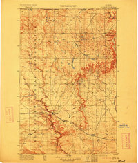
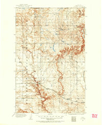
USGS Historical Quadrangle in GeoPDF.
Core Research Center, core D052, from well operated by CARTER OILRaw Properties from download, web scrape, MapServer, and Macrostrat API{"Lib Num": "D052", "API Num": "2507305573", "Operator": "CARTER OIL", "Well Name": "1-B TRIBAL", "Field": "CUTBANK", "State": "MT", "County": "PONDERA", "Type": "SLABBED", "Photos": "F", "Thin Sec": "T", "Analysis": "F", "Latitude": "48.482715", "Longitude": "-112.328999", "coordinates_geohash": "c885gfh8295s", "Source": "FROM STATE RECORDS", "Security Flag": "NO SPECIAL RESTRICTIONS", "crc_collection_name": "core", "sb_parent_id": "4f4e49dae4b07f02db5e0486", "intervals": [{"Formation": "SUNBURST", "Age": "CRET", "Min Depth": "3070", "Max Depth": "3139"}, {"Formation": "CUT BANK",...
Core Research Center, core A704, from well operated by PHILLIPS PETROLEUMRaw Properties from download, web scrape, MapServer, and Macrostrat API{"Lib Num": "A704", "API Num": "2503505154", "Operator": "PHILLIPS PETROLEUM", "Well Name": "84-6 SWCBSU", "Field": "CUTBANK", "State": "MT", "County": "GLACIER", "Type": "SLABBED", "Photos": "T", "Thin Sec": "F", "Analysis": "F", "Latitude": "48.506791", "Longitude": "-112.310017", "coordinates_geohash": "c885uq6kdcjx", "Source": "FROM STATE RECORDS", "Security Flag": "NO SPECIAL RESTRICTIONS", "crc_collection_name": "core", "sb_parent_id": "4f4e49dae4b07f02db5e0486", "intervals": [{"Formation": "CUT BANK", "Age": "CRET", "Min Depth": "2910", "Max Depth": "2956"}], "crcwc_url":...
Categories: Physical Item;
Tags: CRET,
CUT BANK,
Campanian - Maastrichtian,
Two Medicine Formation,
Two Medicine Formation,
Core Research Center, core R862, from well operated by ALBERMONT PETROLEUMRaw Properties from download, web scrape, MapServer, and Macrostrat API{"Lib Num": "R862", "API Num": "2510107538", "Operator": "ALBERMONT PETROLEUM", "Well Name": "2 WILCOX", "Field": "CUTBANK", "State": "MT", "County": "TOOLE", "Type": "FULL", "Photos": "F", "Thin Sec": "F", "Analysis": "F", "Latitude": "48.977214", "Longitude": "-112.146498", "coordinates_geohash": "c88q8h12vnqj", "Source": "FROM STATE RECORDS", "Security Flag": "NO SPECIAL RESTRICTIONS", "crc_collection_name": "core", "sb_parent_id": "4f4e49dae4b07f02db5e0486", "intervals": [{"Formation": "KOOTENAI", "Age": "CRET", "Min Depth": "2546", "Max Depth": "2591"}, {"Formation":...
Core Research Center, core D028, from well operated by DAMSON OILRaw Properties from download, web scrape, MapServer, and Macrostrat API{"Lib Num": "D028", "API Num": "2503521269", "Operator": "DAMSON OIL", "Well Name": "2-1 BLACKFEET TRIBAL", "Field": "WILDCAT", "State": "MT", "County": "GLACIER", "Type": "SLABBED", "Photos": "F", "Thin Sec": "F", "Analysis": "F", "Latitude": "48.814195", "Longitude": "-112.431529", "coordinates_geohash": "c88j9w3g73rx", "Source": "FROM STATE RECORDS", "Security Flag": "NO SPECIAL RESTRICTIONS", "crc_collection_name": "core", "sb_parent_id": "4f4e49dae4b07f02db5e0486", "intervals": [{"Formation": "CUT BANK", "Age": "CRET", "Min Depth": "3178", "Max Depth": "3221"}], "crcwc_url":...
Categories: Physical Item;
Tags: CRET,
CUT BANK,
Campanian - Maastrichtian,
Two Medicine Formation,
Two Medicine Formation,
This data set contains imagery from the National Agriculture Imagery Program (NAIP). The NAIP program is administered by USDA FSA and has been established to support two main FSA strategic goals centered on agricultural production. These are, increase stewardship of America's natural resources while enhancing the environment, and to ensure commodities are procured and distributed effectively and efficiently to increase food security. The NAIP program supports these goals by acquiring and providing ortho imagery that has been collected during the agricultural growing season in the U.S. The NAIP ortho imagery is tailored to meet FSA requirements and is a fundamental tool used to support FSA farm and conservation programs....
Core Research Center, core T046, from well operated by MCSHANE C RRaw Properties from download, web scrape, MapServer, and Macrostrat API{"Lib Num": "T046", "API Num": "2503505064", "Operator": "MCSHANE C R", "Well Name": "1-1099 TRIBAL", "Field": "CUTBANK", "State": "MT", "County": "GLACIER", "Type": "FULL - DISCONTINUOUS SEGMENTS", "Photos": "T", "Thin Sec": "F", "Analysis": "T", "Latitude": "48.492621", "Longitude": "-112.384679", "coordinates_geohash": "c885fegczptx", "Source": "FROM STATE RECORDS", "Security Flag": "NO SPECIAL RESTRICTIONS", "crc_collection_name": "core", "sb_parent_id": "4f4e49dae4b07f02db5e0486", "intervals": [{"Formation": "CUT BANK", "Age": "CRET", "Min Depth": "3538", "Max Depth": "3572"}],...
Categories: Physical Item;
Tags: CRET,
CUT BANK,
Campanian - Maastrichtian,
Two Medicine Formation,
Two Medicine Formation,
USGS Historical Quadrangle in GeoPDF.
Core Research Center, core C442, from well operated by STANOLIND OIL & GASRaw Properties from download, web scrape, MapServer, and Macrostrat API{"Lib Num": "C442", "API Num": "2507305506", "Operator": "STANOLIND OIL & GAS", "Well Name": "1-E RUTHERFORD", "Field": "CUTBANK", "State": "MT", "County": "PONDERA", "Type": "CHIPS", "Photos": "T", "Thin Sec": "F", "Analysis": "F", "Latitude": "48.445726", "Longitude": "-112.357587", "coordinates_geohash": "c885e5r8y3yu", "Source": "FROM STATE RECORDS", "Security Flag": "NO SPECIAL RESTRICTIONS", "crc_collection_name": "core", "sb_parent_id": "4f4e49dae4b07f02db5e0486", "intervals": [{"Formation": "SUNBURST", "Age": "CRET", "Min Depth": "3215", "Max Depth": "3233"}, {"Formation":...
Core Research Center, core D018, from well operated by CARTER OILRaw Properties from download, web scrape, MapServer, and Macrostrat API{"Lib Num": "D018", "API Num": "2503505995", "Operator": "CARTER OIL", "Well Name": "7 HALVERSON", "Field": "CUTBANK", "State": "MT", "County": "GLACIER", "Type": "SLABBED", "Photos": "F", "Thin Sec": "T", "Analysis": "F", "Latitude": "48.684228", "Longitude": "-112.322982", "coordinates_geohash": "c88hun8yhvfh", "Source": "FROM STATE RECORDS", "Security Flag": "NO SPECIAL RESTRICTIONS", "crc_collection_name": "core", "sb_parent_id": "4f4e49dae4b07f02db5e0486", "intervals": [{"Formation": "CUT BANK", "Age": "CRET", "Min Depth": "2806", "Max Depth": "2872"}, {"Formation": "KOOTENAI",...
Core Research Center, core D872, from well operated by CARTER OILRaw Properties from download, web scrape, MapServer, and Macrostrat API{"Lib Num": "D872", "API Num": "2503505743", "Operator": "CARTER OIL", "Well Name": "7 JACOBSON-THERRIAN", "Field": "CUTBANK", "State": "MT", "County": "GLACIER", "Type": "SLABBED", "Photos": "F", "Thin Sec": "F", "Analysis": "T", "Latitude": "48.619045", "Longitude": "-112.295255", "coordinates_geohash": "c88hsdv46yuu", "Source": "FROM STATE RECORDS", "Security Flag": "NO SPECIAL RESTRICTIONS", "crc_collection_name": "core", "sb_parent_id": "4f4e49dae4b07f02db5e0486", "intervals": [{"Formation": "SUNBURST", "Age": "CRET", "Min Depth": "2892", "Max Depth": "2907"}, {"Formation":...
Core Research Center, core R379, from well operated by UNION OILRaw Properties from download, web scrape, MapServer, and Macrostrat API{"Lib Num": "R379", "API Num": "2503521530", "Operator": "UNION OIL", "Well Name": "39-1X SECBSU", "Field": "CUTBANK", "State": "MT", "County": "GLACIER", "Type": "CHIPS", "Photos": "F", "Thin Sec": "F", "Analysis": "F", "Latitude": "48.626287", "Longitude": "-112.301239", "coordinates_geohash": "c88hss0sxkyu", "Source": "FROM STATE RECORDS", "Security Flag": "NO SPECIAL RESTRICTIONS", "crc_collection_name": "core", "sb_parent_id": "4f4e49dae4b07f02db5e0486", "intervals": [{"Formation": "CUT BANK", "Age": "CRET", "Min Depth": "2922", "Max Depth": "2959"}], "crcwc_url": "https://my.usgs.gov/crcwc/core/report/12646",...
Categories: Physical Item;
Tags: CRET,
CUT BANK,
Campanian - Maastrichtian,
Two Medicine Formation,
Two Medicine Formation,
Core Research Center, core T045, from well operated by GOODSTEIN FREDRaw Properties from download, web scrape, MapServer, and Macrostrat API{"Lib Num": "T045", "API Num": "2503505539", "Operator": "GOODSTEIN FRED", "Well Name": "1-1026 TRIBAL", "Field": "CUTBANK", "State": "MT", "County": "GLACIER", "Type": "FULL - DISCONTINUOUS SEGMENTS", "Photos": "T", "Thin Sec": "F", "Analysis": "F", "Latitude": "48.571905", "Longitude": "-112.371855", "coordinates_geohash": "c88h6fjrcgrg", "Source": "FROM STATE RECORDS", "Security Flag": "NO SPECIAL RESTRICTIONS", "crc_collection_name": "core", "sb_parent_id": "4f4e49dae4b07f02db5e0486", "intervals": [{"Formation": "CUT BANK", "Age": "CRET", "Min Depth": "3222", "Max Depth":...
Categories: Physical Item;
Tags: CRET,
CUT BANK,
Campanian - Maastrichtian,
Two Medicine Formation,
Two Medicine Formation,
Core Research Center, core R962, from well operated by UNION OILRaw Properties from download, web scrape, MapServer, and Macrostrat API{"Lib Num": "R962", "API Num": "2503521534", "Operator": "UNION OIL", "Well Name": "22-6 SECBSU", "Field": "CUTBANK", "State": "MT", "County": "GLACIER", "Type": "CHIPS", "Photos": "F", "Thin Sec": "F", "Analysis": "F", "Latitude": "48.641629", "Longitude": "-112.28572", "coordinates_geohash": "c88hsyun10fe", "Source": "FROM STATE RECORDS", "Security Flag": "NO SPECIAL RESTRICTIONS", "crc_collection_name": "core", "sb_parent_id": "4f4e49dae4b07f02db5e0486", "intervals": [{"Formation": "CUT BANK", "Age": "CRET", "Min Depth": "2784", "Max Depth": "2810"}], "crcwc_url": "https://my.usgs.gov/crcwc/core/report/13296",...
Categories: Physical Item;
Tags: CRET,
CUT BANK,
Campanian - Maastrichtian,
Two Medicine Formation,
Two Medicine Formation,
USGS Historical Quadrangle in GeoPDF.
This data set contains imagery from the National Agriculture Imagery Program (NAIP). The NAIP program is administered by USDA FSA and has been established to support two main FSA strategic goals centered on agricultural production. These are, increase stewardship of America's natural resources while enhancing the environment, and to ensure commodities are procured and distributed effectively and efficiently to increase food security. The NAIP program supports these goals by acquiring and providing ortho imagery that has been collected during the agricultural growing season in the U.S. The NAIP ortho imagery is tailored to meet FSA requirements and is a fundamental tool used to support FSA farm and conservation programs....
|

|
