Filters: Tags: Cañon City (X)
30 results (41ms)|
Filters
Date Range
Extensions Types Contacts
Categories Tag Types Tag Schemes |
Aerial images in the vicinity of USGS gaging station #07094500 Arkansas River at Parkdale, Colorado were collected on March 20-22, 2018, using Unmanned Aircraft Systems (UAS, or "drones"). Data were processed using structure-from-motion analysis to generate a three-dimensional point cloud that identifies pixels from multiple images representing the same object and calculates the x, y, and z coordinates of that object/pixel. The point cloud was processed to create a digital surface model of the site. Finally, source images were stitched together based on shared pixels and orthogonally adjusted to create a high resolution (approximately 2 cm pixel size) orthoimage for the study area. The orthomosaic image captures...
Categories: Data;
Types: Downloadable,
GeoTIFF,
Map Service,
OGC WFS Layer,
OGC WMS Layer,
OGC WMS Service,
Raster;
Tags: Arkansas River,
Canon City,
Colorado,
Colorado,
North America,
This data release provides digital flight-line and gridded data for a high-resolution airborne magnetic and radiometric survey over the region surrounding the Wet Mountains of southern Colorado, including parts of Custer and Fremont Counties. Data for this survey were collected by Sander Geophysics Limited International (SGL) under contract with the USGS. The survey was flown in June and July of 2021 using a helicopter equipped with a magnetometer mounted in a stinger extending from the nose of the aircraft and a gamma-ray spectrometer stowed onboard. The helicopter pilots followed pre-planned flight paths in a grid-like pattern, with east-west lines spaced 150 meters apart and north-south lines spaced 1,000 meters...
Categories: Data;
Types: Downloadable,
Map Service,
OGC WFS Layer,
OGC WMS Layer,
Shapefile;
Tags: "Mineral Resources"],
AASG,
Antelope Creek,
Arkansas River,
Association of State Geologists,
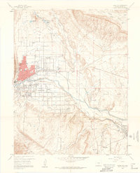
USGS Historical Quadrangle in GeoPDF.
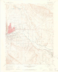
USGS Historical Quadrangle in GeoPDF.

USGS Historical Quadrangle in GeoPDF.
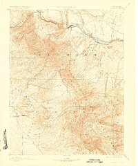
USGS Historical Quadrangle in GeoPDF.
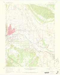
USGS Historical Quadrangle in GeoPDF.
This data set contains imagery from the National Agriculture Imagery Program (NAIP). The NAIP program is administered by USDA FSA and has been established to support two main FSA strategic goals centered on agricultural production. These are, increase stewardship of America's natural resources while enhancing the environment, and to ensure commodities are procured and distributed effectively and efficiently to increase food security. The NAIP program supports these goals by acquiring and providing ortho imagery that has been collected during the agricultural growing season in the U.S. The NAIP ortho imagery is tailored to meet FSA requirements and is a fundamental tool used to support FSA farm and conservation programs....
This dataset includes vertical velocity profiles and river discharge at cross section of interest where velocity measurements were taken on the Arkansas River at Parkdale, Colorado. Each profile contains measurements at various depths at the y-axis, which is the vertical in the cross-sectional profile where the maximum velocity (umax) occurs. These measurements were taken using a FlowTracker, FlowTracker2 ® instrument (FlowTracker2, 2020) when wading was possible; if wading was not possible, measurements were taken from a boat using an acoustic Doppler current profiler (ADCP) under stationary bed conditions. Data are presented in a comma separated value (CSV) file.
This Data Release provides tabular and geospatial data digitized by the U.S. Geological Survey (USGS) from a U.S. Bureau of Mines (USBoM) report titled Mineral Investigation of Sangre de Cristo Wilderness Study Area, Alamosa, Custer, Fremont, Huerfano, and Saguache Counties, Colorado. The original preliminary paper report, numbered Mineral Land Assessment 65-83 (MLA 65-83; Ellis and others, 1983), presented the results of a mineral resource potential survey of areas in and around the Sangre de Cristo Range flanking the northeastern extent of San Luis Valley in south-central Colorado. Included in this Data Release are georeferenced scans of the regional plate maps, digitized sample site locations, analytical...
Categories: Data;
Types: ArcGIS REST Map Service,
ArcGIS Service Definition,
Downloadable,
Map Service;
Tags: Alamosa County,
Alamosa County,
Baca National Wildlife Refuge,
Blanca Peak,
Cañon City,
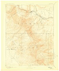
USGS Historical Quadrangle in GeoPDF.
The U.S. Geological Survey deployed eight submersible pressure transducers in the Arkansas River at Parkdale, Colorado on March 19, 2018. An additional transducer was left out of the water to correct for barometric pressure fluctuations. At the time of deployment and recovery, the coordinates of the top of the post to which the transducer was secured were surveyed with real-time kinematic Global Navigation Satellite System surveying equipment. Also at the time of deployment and recovery, the offset between the location on the transducer that records stage and the top of the post to which the transducer was secured was measured with an engineering ruler. The transducers collected a depth measurement every 1-min until...
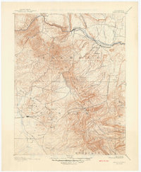
USGS Historical Quadrangle in GeoPDF.
This dataset contains data collected during science flights using the drone-based QCam, which is a Doppler (velocity) radar designed to measure surface velocity and compute river discharge when channel bathymetry is known. Five science flights were conducted on the Arkansas River in Colorado and are presented as comma separated values (CSV) files.
Categories: Data;
Types: Map Service,
OGC WFS Layer,
OGC WMS Layer,
OGC WMS Service;
Tags: Canon City,
drone,
hydrographic datasets,
remote sensing,
sUAS,

USGS Historical Quadrangle in GeoPDF.
Magnetic data collected as part of a high-resolution airborne magnetic and radiometric survey over the region surrounding the Wet Mountains of southern Colorado, including parts of Custer and Fremont Counties, are provided as digital flight-line and grid files. Magnetic surveys measure subtle variations in the Earth’s magnetic field and are sensitive to differences in the magnetic properties of rocks from ground level to many kilometers below. Data for this survey were collected by Sander Geophysics Limited International (SGL) under contract with the USGS. The survey was flown in June and July of 2021 using a helicopter equipped with a magnetometer mounted in a stinger extending from the nose of the aircraft. The...
Categories: Data;
Types: Downloadable,
GeoTIFF,
Map Service,
Raster;
Tags: AASG,
Antelope Creek,
Arkansas River,
Association of State Geologists,
Canon City,
Radiometric data collected as part of a high-resolution airborne magnetic and radiometric survey over the region surrounding the Wet Mountains of southern Colorado, including parts of Custer and Fremont Counties, are provided as digital flight-line and grid files. Radiometric (or gamma-ray) surveys measure naturally occurring low-level radiation and are sensitive to the presence of rocks near the surface that are enriched in uranium, thorium, or potassium. Data for this survey were collected by Sander Geophysics Limited International (SGL) under contract with the USGS. The survey was flown in June and July of 2021 using a helicopter equipped with a gamma-ray spectrometer stowed onboard. The helicopter pilots followed...
Categories: Data;
Types: Downloadable,
GeoTIFF,
Map Service,
Raster;
Tags: AASG,
Aeroradiometric survey,
Antelope Creek,
Arkansas River,
Association of State Geologists,
This data set contains imagery from the National Agriculture Imagery Program (NAIP). The NAIP program is administered by USDA FSA and has been established to support two main FSA strategic goals centered on agricultural production. These are, increase stewardship of America's natural resources while enhancing the environment, and to ensure commodities are procured and distributed effectively and efficiently to increase food security. The NAIP program supports these goals by acquiring and providing ortho imagery that has been collected during the agricultural growing season in the U.S. The NAIP ortho imagery is tailored to meet FSA requirements and is a fundamental tool used to support FSA farm and conservation programs....
A USGS Unoccupied Aircraft Systems (UAS) Aquatic Airshow field testing and demonstration event occurred March 20–21, 2018, on the Arkansas River at Parkdale, CO, USA. At the airshow, a group of USGS scientists and technicians gathered to test non-contact sensors for measuring stream discharge using UAS and a sensor mounted on a tag line. Scientists at the event performed a series of tests to measure river discharge with experimental non-contact techniques. USGS scientists and field personnel traditionally conduct a discharge measurement either by wading or working from a boat. Due to the potential danger and high risk to personnel safety, hydrologic measurement work is limited during very high flow events, ice break-up,...
Categories: Data;
Tags: Canon City,
Geomorphology,
Remote Sensing,
USGS Science Data Catalog (SDC),
Water Resources,
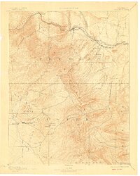
USGS Historical Quadrangle in GeoPDF.
|

|
