Filters
Date Range
Extensions
Types
Contacts
Categories
Tag Types
Tag Schemes
|
USGS Historical Quadrangle in GeoPDF.
Tags: 7.5 x 7.5 minute,
Cabo Rojo,
Downloadable Data,
GeoPDF,
GeoTIFF, All tags...
Historical Topographic Maps,
Historical Topographic Maps 7.5 x 7.5 Minute Map Series,
Map,
PR,
imageryBaseMapsEarthCover, Fewer tags
Layers of geospatial data include roads, airports, trails, and railroads.
Tags: Adjuntas,
Aguada,
Aguadilla,
Aguas Buenas,
Aibonito, All tags...
Airport Complex,
Airport Point,
Airport Runway,
Airports,
Airstrips,
Arecibo,
Arroyo,
Añasco,
Barceloneta,
Barranquitas,
Bayamón,
Cabo Rojo,
Caguas,
Camuy,
Canóvanas,
Carolina,
Cataño,
Cayey,
Ceiba,
Ciales,
Cidra,
Coamo,
Comerío,
Corozal,
Culebra,
Dorado,
Downloadable Data,
Esri Shapefile nan,
Fajardo,
Florida,
Geographic names,
Guayama,
Guayanilla,
Guaynabo,
Gurabo,
Guánica,
Hatillo,
Hormigueros,
Humacao,
Isabela,
Jayuya,
Juana Díaz,
Juncos,
Lajas,
Lares,
Las Marías,
Las Piedras,
Loíza,
Luquillo,
Manatí,
Maricao,
Maunabo,
Mayagüez,
Moca,
Morovis,
Naguabo,
Naranjito,
National Transportation Dataset (NTD),
National Transportation Dataset (NTD),
Orocovis,
PR,
Patillas,
Peñuelas,
Ponce,
Puerto Rico,
Quebradillas,
Railways,
Rincón,
Roads,
Río Grande,
Sabana Grande,
Salinas,
San Germán,
San Juan,
San Lorenzo,
San Sebastián,
Santa Isabel,
Shapefile,
State,
State,
Toa Alta,
Toa Baja,
Trail,
Trails,
Transportation,
Transportation,
Trujillo Alto,
US,
United States,
Utuado,
Vega Alta,
Vega Baja,
Vieques,
Villalba,
Waterway,
Yabucoa,
Yauco,
transportation, Fewer tags
This data represents the map extent for current and historical USGS topographic maps for the United States and Territories, including 1 X 2 Degree, 1 X 1 Degree, 30 X 60 Minute, 15 X 15 Minute, 7.5 X 7.5 Minute, and 3.75 X 3.75 Minute. The grid was generated using ESRI ArcInfo GIS software.
Tags: Adjuntas,
Aguada,
Aguadilla,
Aguas Buenas,
Aibonito, All tags...
Arecibo,
Arroyo,
Añasco,
Barceloneta,
Barranquitas,
Bayamón,
Boundaries,
Cabo Rojo,
Caguas,
Camuy,
Canóvanas,
Carolina,
Cataño,
Cayey,
Ceiba,
Ciales,
Cidra,
Coamo,
Comerío,
Corozal,
Culebra,
Dorado,
Downloadable Data,
Esri Shapefile nan,
Fajardo,
Florida,
Guayama,
Guayanilla,
Guaynabo,
Gurabo,
Guánica,
Hatillo,
Hormigueros,
Humacao,
Isabela,
Jayuya,
Juana Díaz,
Juncos,
Lajas,
Lares,
Las Marías,
Las Piedras,
Loíza,
Luquillo,
Manatí,
Map Indices,
Map Indices,
Map Indices,
Maricao,
Maunabo,
Mayagüez,
Moca,
Morovis,
Naguabo,
Naranjito,
Orocovis,
PR,
Patillas,
Peñuelas,
Ponce,
Puerto Rico,
Quebradillas,
Rincón,
Río Grande,
Sabana Grande,
Salinas,
San Germán,
San Juan,
San Lorenzo,
San Sebastián,
Santa Isabel,
Shapefile,
State,
State,
Toa Alta,
Toa Baja,
Trujillo Alto,
US,
United States,
United States of America,
Utuado,
Vega Alta,
Vega Baja,
Vieques,
Villalba,
Yabucoa,
Yauco,
cells,
map indices,
polygon grid, Fewer tags

The dataset contains the selected physical properties and chemical constituents that were measured at Caño Boquerón, Cabo Rojo, and Puerto Mosquito, Isla de Vieques, Puerto Rico during a diurnal cycle. Two diel studies were conducted per lagoon to determine the community primary productivity. Photosynthesis creates oxygen which enhances microbiological activity and results in the production of organic matter. Primary productivity is important for supporting the food web in aquatic ecosystems. The field data collection included the measurement of temperature, dissolved oxygen, and percent of oxygen saturation. Measurements were obtained at about 1 hour intervals. Diel studies were conducted on October 29, 2015 and...
Categories: Data;
Tags: Bahía de Boquerón,
Cabo Rojo,
Puerto Mosquito,
Vieques,
aquatic ecosystems, All tags...
biological production,
coastal ecosystems,
ecology,
lagoon,
oceans,
productivity (ecotsystems),
water-quality data, Fewer tags
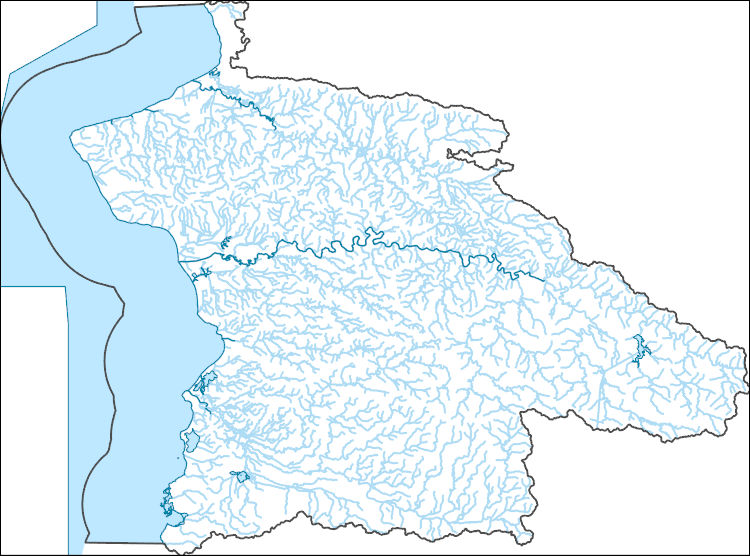
The National Hydrography Dataset (NHD) is a feature-based database that interconnects and uniquely identifies the stream segments or reaches that make up the nation's surface water drainage system. NHD data was originally developed at 1:100,000-scale and exists at that scale for the whole country. This high-resolution NHD, generally developed at 1:24,000/1:12,000 scale, adds detail to the original 1:100,000-scale NHD. (Data for Alaska, Puerto Rico and the Virgin Islands was developed at high-resolution, not 1:100,000 scale.) Local resolution NHD is being developed where partners and data exist. The NHD contains reach codes for networked features, flow direction, names, and centerline representations for areal water...
Tags: Adjuntas,
Administrative watershed units,
Administrative watershed units,
Aguada,
Aguadilla, All tags...
Area of Complex Channels,
Area to be submerged,
Añasco,
Basin,
Basin,
Bay/Inlet,
Boundaries,
Boundary,
Bridge,
Cabo Rojo,
Canal/Ditch,
Coastline,
Connector,
Dam/Weir,
Downloadable Data,
Drainage areas for surface water,
Drainageway,
Esri Shapefile nan,
Estuary,
Flow direction network,
Flume,
ForeShore,
Gaging Station,
Gate,
Guayanilla,
HU-8,
HU-8 Subbasin,
HU10,
HU12,
HU14,
HU16,
HU2,
HU4,
HU6,
HU8,
HU8_21010003,
HUC,
Hazard Zone,
Hormigueros,
Hydrographic,
Hydrography,
Hydrography,
Hydrography,
Hydrologic Unit Code,
Hydrologic Units,
Ice mass,
Inundation Area,
Isabela,
Lajas,
Lares,
Las Marías,
Levee,
Line,
Lock Chamber,
Maricao,
Marsh,
Mayagüez,
Moca,
National Hydrography Dataset (NHD),
National Hydrography Dataset (NHD) Best Resolution,
National Hydrography Dataset (NHD) Best Resolution,
Nonearthen Shore,
Orthoimage,
PR,
Playa,
Point,
PointEvent,
Pond,
Puerto Rico,
Rapids,
Rapids,
Reach,
Reach code,
Reef,
Region,
Reservoir,
Rincón,
Rock,
Sabana Grande,
San Germán,
San Sebastián,
Sea/Ocean,
Shapefile,
Sink/Rise,
Sounding Datum Line,
Special Use Zone,
Special Use Zone Limit,
Spillway,
Stream,
Stream/River,
Sub-basin,
Sub-region,
Subbasin,
Submerged Stream,
Subregion,
Subwatershed,
Surface water systems,
Swamp,
Topographic,
Tunnel,
US,
Underground Conduit,
United States,
Utuado,
WBD,
WBD,
Wall,
Wash,
Water Intake Outflow,
Waterfall,
Watershed,
Watershed Boundaries,
Watershed Boundary Dataset,
Watershed Boundary Dataset,
Well,
Yauco,
artificial path,
boundaries,
dams,
drainage systems and characteristics,
inlandWaters,
lakes,
ngda,
rivers, Fewer tags
Geospatial data is comprised of government boundaries.
Types: Citation;
Tags: Adjuntas,
Aguada,
Aguadilla,
Aguas Buenas,
Aibonito, All tags...
Arecibo,
Arroyo,
Añasco,
Barceloneta,
Barranquitas,
Bayamón,
Boundaries,
Cabo Rojo,
Caguas,
Camuy,
Canóvanas,
Carolina,
Cataño,
Cayey,
Ceiba,
Ciales,
Cidra,
Coamo,
Comerío,
Corozal,
County or Equivalent,
Culebra,
Dorado,
Downloadable Data,
Esri File GeoDatabase 10,
Fajardo,
FileGDB,
Florida,
Guayama,
Guayanilla,
Guaynabo,
Gurabo,
Guánica,
Hatillo,
Hormigueros,
Humacao,
Incorporated Place,
Isabela,
Jayuya,
Juana Díaz,
Juncos,
Jurisdictional,
Lajas,
Lares,
Las Marías,
Las Piedras,
Loíza,
Luquillo,
Manatí,
Maricao,
Maunabo,
Mayagüez,
Minor Civil Division,
Moca,
Morovis,
Naguabo,
Naranjito,
National Boundary Dataset (NBD),
National Boundary Dataset (NBD),
Native American Area,
Orocovis,
PLSS First Division,
PLSS Special Survey,
PLSS Township,
PR,
Patillas,
Peñuelas,
Ponce,
Public Land Survey System,
Puerto Rico,
Quebradillas,
Reserve,
Rincón,
Río Grande,
Sabana Grande,
Salinas,
San Germán,
San Juan,
San Lorenzo,
San Sebastián,
Santa Isabel,
State,
State,
State or Territory,
Toa Alta,
Toa Baja,
Trujillo Alto,
U.S. National Grid,
US,
Unincorporated Place,
United States,
Utuado,
Vega Alta,
Vega Baja,
Vieques,
Villalba,
Yabucoa,
Yauco,
boundaries,
boundary,
cadastral surveys,
geographic names,
land ownership,
land use maps,
legal land descriptions,
political and administrative boundaries,
zoning maps, Fewer tags

The National Hydrography Dataset (NHD) is a feature-based database that interconnects and uniquely identifies the stream segments or reaches that make up the nation's surface water drainage system. NHD data was originally developed at 1:100,000-scale and exists at that scale for the whole country. This high-resolution NHD, generally developed at 1:24,000/1:12,000 scale, adds detail to the original 1:100,000-scale NHD. (Data for Alaska, Puerto Rico and the Virgin Islands was developed at high-resolution, not 1:100,000 scale.) Local resolution NHD is being developed where partners and data exist. The NHD contains reach codes for networked features, flow direction, names, and centerline representations for areal water...
Tags: Adjuntas,
Administrative watershed units,
Administrative watershed units,
Aguada,
Aguadilla, All tags...
Aguas Buenas,
Aibonito,
Area of Complex Channels,
Area to be submerged,
Arecibo,
Arroyo,
Añasco,
Barceloneta,
Barranquitas,
Basin,
Basin,
Bay/Inlet,
Bayamón,
Boundaries,
Boundary,
Bridge,
Cabo Rojo,
Caguas,
Camuy,
Canal/Ditch,
Canóvanas,
Carolina,
Cataño,
Cayey,
Ceiba,
Ciales,
Cidra,
Coamo,
Coastline,
Comerío,
Connector,
Corozal,
Culebra,
Dam/Weir,
Dorado,
Downloadable Data,
Drainage areas for surface water,
Drainageway,
Estuary,
Fajardo,
Florida,
Flow direction network,
Flume,
ForeShore,
Gaging Station,
Gate,
GeoPackage,
Guayama,
Guayanilla,
Guaynabo,
Gurabo,
Guánica,
HU-4,
HU-4 Subregion,
HU10,
HU12,
HU14,
HU16,
HU2,
HU4,
HU4_2101,
HU6,
HU8,
HUC,
Hatillo,
Hazard Zone,
Hormigueros,
Humacao,
Hydrographic,
Hydrography,
Hydrography,
Hydrography,
Hydrologic Unit Code,
Hydrologic Units,
Ice mass,
Inundation Area,
Isabela,
Jayuya,
Juana Díaz,
Juncos,
Lajas,
Lares,
Las Marías,
Las Piedras,
Levee,
Line,
Lock Chamber,
Loíza,
Luquillo,
Manatí,
Maricao,
Marsh,
Maunabo,
Mayagüez,
Moca,
Morovis,
Naguabo,
Naranjito,
National Hydrography Dataset (NHD),
National Hydrography Dataset (NHD) Best Resolution,
National Hydrography Dataset (NHD) Best Resolution,
Nonearthen Shore,
Open Geospatial Consortium GeoPackage 1.2,
Orocovis,
Orthoimage,
PR,
Patillas,
Peñuelas,
Playa,
Point,
PointEvent,
Ponce,
Pond,
Puerto Rico,
Quebradillas,
Rapids,
Rapids,
Reach,
Reach code,
Reef,
Region,
Reservoir,
Rincón,
Rock,
Río Grande,
Sabana Grande,
Salinas,
San Germán,
San Juan,
San Lorenzo,
San Sebastián,
Santa Isabel,
Sea/Ocean,
Sink/Rise,
Sounding Datum Line,
Special Use Zone,
Special Use Zone Limit,
Spillway,
Stream,
Stream/River,
Sub-basin,
Sub-region,
Subbasin,
Submerged Stream,
Subregion,
Subwatershed,
Surface water systems,
Swamp,
Toa Alta,
Toa Baja,
Topographic,
Trujillo Alto,
Tunnel,
US,
Underground Conduit,
United States,
Utuado,
Vega Alta,
Vega Baja,
Vieques,
Villalba,
WBD,
WBD,
Wall,
Wash,
Water Intake Outflow,
Waterfall,
Watershed,
Watershed Boundaries,
Watershed Boundary Dataset,
Watershed Boundary Dataset,
Well,
Yabucoa,
Yauco,
artificial path,
boundaries,
dams,
drainage systems and characteristics,
inlandWaters,
lakes,
ngda,
rivers, Fewer tags

The dataset includes daily rainfall collected at Puerto Mosquito, Isla de Vieques and Caño Boquerón, Cabo Rojo, Puerto Rico from July 1, 2015 to July 28, 2016. Two rain gages were installed at: 1) USGS stations: 50129935 - Caño Boquerón No. 3, and 2) 50231500 - Laguna Bahía Puerto Mosquito No. 1. Site inspections of both rain gages occurred at 6-weeks intervals. Further details regarding the calibration, equipment, and data processing are available in the USGS National Information System (NWIS).

The Geographic Names Information System (GNIS) is the Federal standard for geographic nomenclature. The U.S. Geological Survey developed the GNIS for the U.S. Board on Geographic Names, a Federal inter-agency body chartered by public law to maintain uniform feature name usage throughout the Government and to promulgate standard names to the public. The GNIS is the official repository of domestic geographic names data; the official vehicle for geographic names use by all departments of the Federal Government; and the source for applying geographic names to Federal electronic and printed products of all types.
Tags: Adjuntas,
Aguada,
Aguadilla,
Aguas Buenas,
Aibonito, All tags...
Antarctica,
Antarctica,
Arecibo,
Arroyo,
Añasco,
BGN,
Barceloneta,
Barranquitas,
Bayamón,
Board on Geographic Names,
Borough,
Cabo Rojo,
Caguas,
Camuy,
Canóvanas,
Carolina,
Cataño,
Cayey,
Ceiba,
Census Area,
Ciales,
Cidra,
Coamo,
Comerío,
Commonwealth,
Corozal,
County,
Culebra,
District,
Dorado,
Downloadable Data,
Fajardo,
Feature class,
Feature coordinates,
Feature county,
Feature description,
Feature designation,
Feature history,
Feature indentification,
Feature name,
Feature state,
Florida,
GNIS,
Geographic Names,
Geographic Names Federal Codes,
Geographic Names Information System,
Geographic feature,
Geographic name,
Geographical feature,
Geographical name,
Guayama,
Guayanilla,
Guaynabo,
Gurabo,
Guánica,
Hatillo,
Hormigueros,
Humacao,
Isabela,
Jayuya,
Juana Díaz,
Juncos,
Lajas,
Lares,
Las Marías,
Las Piedras,
Loíza,
Luquillo,
Manatí,
Maricao,
Maunabo,
Mayagüez,
Moca,
Morovis,
Municipio,
Naguabo,
Naranjito,
National Geographic Names Information System (GNIS),
National Geographic Names Information System (GNIS),
Official feature name,
Orocovis,
Outlying Area,
PR,
Parish,
Patillas,
Peñuelas,
Place name,
Ponce,
Populated Place,
Puerto Rico,
Quebradillas,
Rincón,
Río Grande,
Sabana Grande,
Salinas,
San Germán,
San Juan,
San Lorenzo,
San Sebastián,
Santa Isabel,
State,
TXT (pipes),
Territories,
Territory,
Toa Alta,
Toa Baja,
Topographic Map,
Trujillo Alto,
U.S. Board on Geographic Names,
U.S. Geological Survey,
US,
USA,
USBGN,
USGS,
UTF-8 Pipe Delimited Text File nan,
United States,
United States,
United States,
Utuado,
Variant name,
Vega Alta,
Vega Baja,
Vieques,
Villalba,
Yabucoa,
Yauco,
antarctic,
database,
economy,
environment,
feature,
gazetteer,
geographic,
geographic names,
geographical,
geography,
geospatial,
imageryBaseMapsEarthCover,
inlandWaters,
location,
map,
name,
place,
placename,
society,
structure,
topographic map,
toponymy, Fewer tags
USGS Historical Quadrangle in GeoPDF.
Tags: 7.5 x 7.5 minute,
Cabo Rojo,
Downloadable Data,
GeoPDF,
GeoTIFF, All tags...
Historical Topographic Maps,
Historical Topographic Maps 7.5 x 7.5 Minute Map Series,
Map,
PR,
imageryBaseMapsEarthCover, Fewer tags
USGS Historical Quadrangle in GeoPDF.
Tags: 7.5 x 7.5 minute,
Cabo Rojo,
Downloadable Data,
GeoPDF,
GeoTIFF, All tags...
Historical Topographic Maps,
Historical Topographic Maps 7.5 x 7.5 Minute Map Series,
Map,
PR,
imageryBaseMapsEarthCover, Fewer tags
The National Hydrography Dataset (NHD) is a feature-based database that interconnects and uniquely identifies the stream segments or reaches that make up the nation's surface water drainage system. NHD data was originally developed at 1:100,000-scale and exists at that scale for the whole country. This high-resolution NHD, generally developed at 1:24,000/1:12,000 scale, adds detail to the original 1:100,000-scale NHD. (Data for Alaska, Puerto Rico and the Virgin Islands was developed at high-resolution, not 1:100,000 scale.) Local resolution NHD is being developed where partners and data exist. The NHD contains reach codes for networked features, flow direction, names, and centerline representations for areal water...
Tags: Adjuntas,
Administrative watershed units,
Administrative watershed units,
Aguada,
Aguadilla, All tags...
Aguas Buenas,
Aibonito,
Area of Complex Channels,
Area to be submerged,
Arecibo,
Arroyo,
Añasco,
Barceloneta,
Barranquitas,
Basin,
Basin,
Bay/Inlet,
Bayamón,
Boundaries,
Boundary,
Bridge,
Cabo Rojo,
Caguas,
Camuy,
Canal/Ditch,
Canóvanas,
Carolina,
Cataño,
Cayey,
Ceiba,
Ciales,
Cidra,
Coamo,
Coastline,
Comerío,
Connector,
Corozal,
Culebra,
Dam/Weir,
Dorado,
Downloadable Data,
Drainage areas for surface water,
Drainageway,
Esri File GeoDatabase 10,
Estuary,
Fajardo,
FileGDB,
Florida,
Flow direction network,
Flume,
ForeShore,
Gaging Station,
Gate,
Guayama,
Guayanilla,
Guaynabo,
Gurabo,
Guánica,
HU-4,
HU-4 Subregion,
HU10,
HU12,
HU14,
HU16,
HU2,
HU4,
HU4_2101,
HU6,
HU8,
HUC,
Hatillo,
Hazard Zone,
Hormigueros,
Humacao,
Hydrographic,
Hydrography,
Hydrography,
Hydrography,
Hydrologic Unit Code,
Hydrologic Units,
Ice mass,
Inundation Area,
Isabela,
Jayuya,
Juana Díaz,
Juncos,
Lajas,
Lares,
Las Marías,
Las Piedras,
Levee,
Line,
Lock Chamber,
Loíza,
Luquillo,
Manatí,
Maricao,
Marsh,
Maunabo,
Mayagüez,
Moca,
Morovis,
Naguabo,
Naranjito,
National Hydrography Dataset (NHD),
National Hydrography Dataset (NHD) Best Resolution,
National Hydrography Dataset (NHD) Best Resolution,
Nonearthen Shore,
Orocovis,
Orthoimage,
PR,
Patillas,
Peñuelas,
Playa,
Point,
PointEvent,
Ponce,
Pond,
Puerto Rico,
Quebradillas,
Rapids,
Rapids,
Reach,
Reach code,
Reef,
Region,
Reservoir,
Rincón,
Rock,
Río Grande,
Sabana Grande,
Salinas,
San Germán,
San Juan,
San Lorenzo,
San Sebastián,
Santa Isabel,
Sea/Ocean,
Sink/Rise,
Sounding Datum Line,
Special Use Zone,
Special Use Zone Limit,
Spillway,
Stream,
Stream/River,
Sub-basin,
Sub-region,
Subbasin,
Submerged Stream,
Subregion,
Subwatershed,
Surface water systems,
Swamp,
Toa Alta,
Toa Baja,
Topographic,
Trujillo Alto,
Tunnel,
US,
Underground Conduit,
United States,
Utuado,
Vega Alta,
Vega Baja,
Vieques,
Villalba,
WBD,
WBD,
Wall,
Wash,
Water Intake Outflow,
Waterfall,
Watershed,
Watershed Boundaries,
Watershed Boundary Dataset,
Watershed Boundary Dataset,
Well,
Yabucoa,
Yauco,
artificial path,
boundaries,
dams,
drainage systems and characteristics,
inlandWaters,
lakes,
ngda,
rivers, Fewer tags
The Geographic Names Information System (GNIS) is the Federal standard for geographic nomenclature. The U.S. Geological Survey developed the GNIS for the U.S. Board on Geographic Names, a Federal inter-agency body chartered by public law to maintain uniform feature name usage throughout the Government and to promulgate standard names to the public. The GNIS is the official repository of domestic geographic names data; the official vehicle for geographic names use by all departments of the Federal Government; and the source for applying geographic names to Federal electronic and printed products of all types.
Tags: Adjuntas,
Aguada,
Aguadilla,
Aguas Buenas,
Aibonito, All tags...
Antarctica,
Antarctica,
Arecibo,
Arroyo,
Añasco,
BGN,
Barceloneta,
Barranquitas,
Bayamón,
Board on Geographic Names,
Borough,
Cabo Rojo,
Caguas,
Camuy,
Canóvanas,
Carolina,
Cataño,
Cayey,
Ceiba,
Census Area,
Ciales,
Cidra,
Coamo,
Comerío,
Commonwealth,
Corozal,
County,
Culebra,
District,
Dorado,
Downloadable Data,
Esri File GeoDatabase 10,
Fajardo,
Feature class,
Feature coordinates,
Feature county,
Feature description,
Feature designation,
Feature history,
Feature indentification,
Feature name,
Feature state,
FileGDB,
Florida,
GNIS,
Geographic Names,
Geographic Names Full Model,
Geographic Names Information System,
Geographic feature,
Geographic name,
Geographical feature,
Geographical name,
Guayama,
Guayanilla,
Guaynabo,
Gurabo,
Guánica,
Hatillo,
Hormigueros,
Humacao,
Isabela,
Jayuya,
Juana Díaz,
Juncos,
Lajas,
Lares,
Las Marías,
Las Piedras,
Loíza,
Luquillo,
Manatí,
Maricao,
Maunabo,
Mayagüez,
Moca,
Morovis,
Municipio,
Naguabo,
Naranjito,
National Geographic Names Information System (GNIS),
National Geographic Names Information System (GNIS),
Official feature name,
Orocovis,
Outlying Area,
PR,
Parish,
Patillas,
Peñuelas,
Place name,
Ponce,
Populated Place,
Puerto Rico,
Quebradillas,
Rincón,
Río Grande,
Sabana Grande,
Salinas,
San Germán,
San Juan,
San Lorenzo,
San Sebastián,
Santa Isabel,
State,
Territories,
Territory,
Toa Alta,
Toa Baja,
Topographic Map,
Trujillo Alto,
U.S. Board on Geographic Names,
U.S. Geological Survey,
US,
USA,
USBGN,
USGS,
United States,
United States,
United States,
Utuado,
Variant name,
Vega Alta,
Vega Baja,
Vieques,
Villalba,
Yabucoa,
Yauco,
antarctic,
database,
economy,
environment,
feature,
gazetteer,
geographic,
geographic names,
geographical,
geography,
geospatial,
imageryBaseMapsEarthCover,
inlandWaters,
location,
map,
name,
place,
placename,
society,
structure,
topographic map,
toponymy, Fewer tags
The National Hydrography Dataset (NHD) is a feature-based database that interconnects and uniquely identifies the stream segments or reaches that make up the nation's surface water drainage system. NHD data was originally developed at 1:100,000-scale and exists at that scale for the whole country. This high-resolution NHD, generally developed at 1:24,000/1:12,000 scale, adds detail to the original 1:100,000-scale NHD. (Data for Alaska, Puerto Rico and the Virgin Islands was developed at high-resolution, not 1:100,000 scale.) Local resolution NHD is being developed where partners and data exist. The NHD contains reach codes for networked features, flow direction, names, and centerline representations for areal water...
Tags: Adjuntas,
Administrative watershed units,
Administrative watershed units,
Aibonito,
Area of Complex Channels, All tags...
Area to be submerged,
Arroyo,
Barranquitas,
Basin,
Basin,
Bay/Inlet,
Boundaries,
Boundary,
Bridge,
Cabo Rojo,
Canal/Ditch,
Cayey,
Coamo,
Coastline,
Connector,
Dam/Weir,
Downloadable Data,
Drainage areas for surface water,
Drainageway,
Esri Shapefile nan,
Estuary,
Flow direction network,
Flume,
ForeShore,
Gaging Station,
Gate,
Guayama,
Guayanilla,
Guánica,
HU-8,
HU-8 Subbasin,
HU10,
HU12,
HU14,
HU16,
HU2,
HU4,
HU6,
HU8,
HU8_21010004,
HUC,
Hazard Zone,
Hydrographic,
Hydrography,
Hydrography,
Hydrography,
Hydrologic Unit Code,
Hydrologic Units,
Ice mass,
Inundation Area,
Jayuya,
Juana Díaz,
Lajas,
Levee,
Line,
Lock Chamber,
Maricao,
Marsh,
Maunabo,
National Hydrography Dataset (NHD),
National Hydrography Dataset (NHD) Best Resolution,
National Hydrography Dataset (NHD) Best Resolution,
Nonearthen Shore,
Orocovis,
Orthoimage,
PR,
Patillas,
Peñuelas,
Playa,
Point,
PointEvent,
Ponce,
Pond,
Puerto Rico,
Rapids,
Rapids,
Reach,
Reach code,
Reef,
Region,
Reservoir,
Rock,
Sabana Grande,
Salinas,
San Germán,
San Lorenzo,
Santa Isabel,
Sea/Ocean,
Shapefile,
Sink/Rise,
Sounding Datum Line,
Special Use Zone,
Special Use Zone Limit,
Spillway,
Stream,
Stream/River,
Sub-basin,
Sub-region,
Subbasin,
Submerged Stream,
Subregion,
Subwatershed,
Surface water systems,
Swamp,
Topographic,
Tunnel,
US,
Underground Conduit,
United States,
Utuado,
Villalba,
WBD,
WBD,
Wall,
Wash,
Water Intake Outflow,
Waterfall,
Watershed,
Watershed Boundaries,
Watershed Boundary Dataset,
Watershed Boundary Dataset,
Well,
Yabucoa,
Yauco,
artificial path,
boundaries,
dams,
drainage systems and characteristics,
inlandWaters,
lakes,
ngda,
rivers, Fewer tags
Layered GeoPDF Quadrangle Map. Layers of geospatial data include orthoimagery, roads, grids, geographic names, elevation contours, hydrography, and other selected map features.
Tags: 7.5 x 7.5 minute,
Cabo Rojo,
Downloadable Data,
EarthCover,
GeoPDF, All tags...
Imagery and Base Maps,
Lajas,
Map,
Parguera, PR,
Public Land Survey System,
Puerto Rico,
U.S. National Grid,
US,
US Topo,
US Topo Historical,
United States,
boundary,
contour,
geographic names,
hydrography,
imageryBaseMapsEarthCover,
orthoimage,
structures,
topographic,
transportation,
woodland, Fewer tags
Layered GeoPDF Quadrangle Map. Layers of geospatial data include orthoimagery, roads, grids, geographic names, elevation contours, hydrography, and other selected map features.
Tags: 7.5 x 7.5 minute,
Cabo Rojo,
Downloadable Data,
EarthCover,
GeoPDF, All tags...
Hormigueros,
Imagery and Base Maps,
Lajas,
Map,
Public Land Survey System,
Puerto Rico,
San Germán,
San Germán, PR,
U.S. National Grid,
US,
US Topo,
US Topo Historical,
United States,
boundary,
contour,
geographic names,
hydrography,
imageryBaseMapsEarthCover,
orthoimage,
structures,
topographic,
transportation,
woodland, Fewer tags
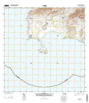
Layered GeoPDF Quadrangle Map. Layers of geospatial data include orthoimagery, roads, grids, geographic names, elevation contours, hydrography, and other selected map features.
Tags: 7.5 x 7.5 minute,
Cabo Rojo,
Cabo Rojo, PR,
Downloadable Data,
EarthCover, All tags...
GeoPDF,
Imagery and Base Maps,
Map,
Public Land Survey System,
Puerto Rico,
U.S. National Grid,
US,
US Topo,
US Topo Historical,
United States,
boundary,
contour,
geographic names,
hydrography,
imageryBaseMapsEarthCover,
orthoimage,
structures,
topographic,
transportation,
woodland, Fewer tags

The dataset includes estimates of salinity using specific conductance measurements at 1) Caño Boquerón, Cabo Rojo, and 2) Puerto Mosquito, Isla de Vieques; Puerto Rico for the period from July 2015 to July 2016. This dataset is part of a limnological analysis at Caño Boquerón and Puerto Mosquito to assess the principal factors affecting the hydrology and water-quality conditions. In addition, the study provides baseline information to regulatory agencies responsible for the management and conservation of coastal waters in Puerto Rico. The investigation focused on Caño Boquerón (disturbed conditions); and Puerto Mosquito (undisturbed conditions). Monthly measurements of specific conductance were collected at both...
Categories: Data;
Tags: Bahía de Boquerón,
Cabo Rojo,
Puerto Mosquito,
Vieques,
aquatic ecosystems, All tags...
biotic,
coastal ecosystems,
ecology,
lagoon,
oceans,
productivity (ecotsystems),
salinity,
water quality, Fewer tags

This data release contains the shapefiles and data associated with the assessment of the principal mechanisms affecting the hydrology and water-quality characteristics at Caño Boquerón in Cabo Rojo and at Puerto Mosquito on Isla de Vieques, Puerto Rico. The U.S. Geological Survey, in cooperation with the Puerto Rico Environmental Quality Board (PREQB), conducted a limnological study of these coastal waters to provide baseline information to the regulatory agencies responsible for the management and conservation of these coastal waters and the preservation of their aquatic life. Field measurements and water samples were collected and processed during July 2015–July 2016 for analysis of physical, chemical, biological,...
Types: Map Service,
OGC WFS Layer,
OGC WMS Layer,
OGC WMS Service;
Tags: Cabo Rojo,
Caño Boquerón,
Puerto Rico,
USGS Science Data Catalog (SDC),
bathymetry, All tags...
limnology,
ocean sciences,
storage volume, Fewer tags

The Geographic Names Information System (GNIS) is the Federal standard for geographic nomenclature. The U.S. Geological Survey developed the GNIS for the U.S. Board on Geographic Names, a Federal inter-agency body chartered by public law to maintain uniform feature name usage throughout the Government and to promulgate standard names to the public. The GNIS is the official repository of domestic geographic names data; the official vehicle for geographic names use by all departments of the Federal Government; and the source for applying geographic names to Federal electronic and printed products of all types.
Tags: Adjuntas,
Aguada,
Aguadilla,
Aguas Buenas,
Aibonito, All tags...
Antarctica,
Antarctica,
Arecibo,
Arroyo,
Añasco,
BGN,
Barceloneta,
Barranquitas,
Bayamón,
Board on Geographic Names,
Borough,
Cabo Rojo,
Caguas,
Camuy,
Canóvanas,
Carolina,
Cataño,
Cayey,
Ceiba,
Census Area,
Ciales,
Cidra,
Coamo,
Comerío,
Commonwealth,
Corozal,
County,
Culebra,
District,
Dorado,
Downloadable Data,
Fajardo,
Feature class,
Feature coordinates,
Feature county,
Feature description,
Feature designation,
Feature history,
Feature indentification,
Feature name,
Feature state,
Florida,
GNIS,
Geographic Names,
Geographic Names Domestic Names,
Geographic Names Information System,
Geographic feature,
Geographic name,
Geographical feature,
Geographical name,
Guayama,
Guayanilla,
Guaynabo,
Gurabo,
Guánica,
Hatillo,
Hormigueros,
Humacao,
Isabela,
Jayuya,
Juana Díaz,
Juncos,
Lajas,
Lares,
Las Marías,
Las Piedras,
Loíza,
Luquillo,
Manatí,
Maricao,
Maunabo,
Mayagüez,
Moca,
Morovis,
Municipio,
Naguabo,
Naranjito,
National Geographic Names Information System (GNIS),
National Geographic Names Information System (GNIS),
Official feature name,
Orocovis,
Outlying Area,
PR,
Parish,
Patillas,
Peñuelas,
Place name,
Ponce,
Populated Place,
Puerto Rico,
Quebradillas,
Rincón,
Río Grande,
Sabana Grande,
Salinas,
San Germán,
San Juan,
San Lorenzo,
San Sebastián,
Santa Isabel,
State,
TXT (pipes),
Territories,
Territory,
Toa Alta,
Toa Baja,
Topographic Map,
Trujillo Alto,
U.S. Board on Geographic Names,
U.S. Geological Survey,
US,
USA,
USBGN,
USGS,
UTF-8 Pipe Delimited Text File nan,
United States,
United States,
United States,
Utuado,
Variant name,
Vega Alta,
Vega Baja,
Vieques,
Villalba,
Yabucoa,
Yauco,
antarctic,
database,
economy,
environment,
feature,
gazetteer,
geographic,
geographic names,
geographical,
geography,
geospatial,
imageryBaseMapsEarthCover,
inlandWaters,
location,
map,
name,
place,
placename,
society,
structure,
topographic map,
toponymy, Fewer tags
|
|

