Filters: Tags: Campbell County (X)
1,031 results (66ms)|
Filters
Date Range
Extensions Types
Contacts
Categories Tag Types
|
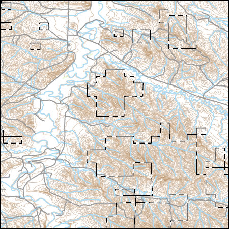
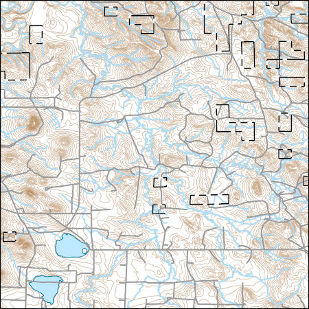
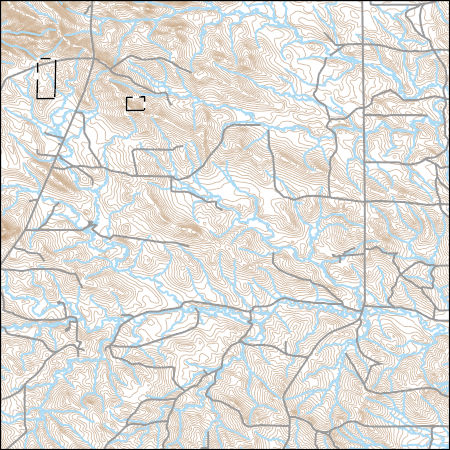
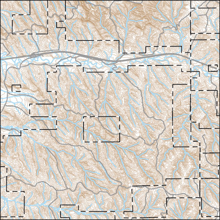
Layers of geospatial data include contours, boundaries, land cover, hydrography, roads, transportation, geographic names, structures, and other selected map features.
Types: Citation;
Tags: 7.5 x 7.5 minute,
7.5 x 7.5 minute,
Campbell County,
Combined Vector,
Combined Vector,
LITTLE POWDER RIVER AB DRY CREEK, NEAR WESTON, WY
LITTLE POWDER RIVER AB DRY CREEK, NEAR WESTON, WY
LITTLE POWDER RIVER AB DRY CREEK, NEAR WESTON, WY
LITTLE POWDER RIVER AB DRY CREEK, NEAR WESTON, WY
LITTLE POWDER RIVER AB DRY CREEK, NEAR WESTON, WY
LITTLE POWDER RIVER AB DRY CREEK, NEAR WESTON, WY
LITTLE POWDER RIVER AB DRY CREEK, NEAR WESTON, WY
LITTLE POWDER RIVER AB DRY CREEK, NEAR WESTON, WY
LITTLE POWDER RIVER AB DRY CREEK, NEAR WESTON, WY
LITTLE POWDER RIVER AB DRY CREEK, NEAR WESTON, WY
LITTLE POWDER RIVER AB DRY CREEK, NEAR WESTON, WY
Layers of geospatial data include contours, boundaries, land cover, hydrography, roads, transportation, geographic names, structures, and other selected map features.
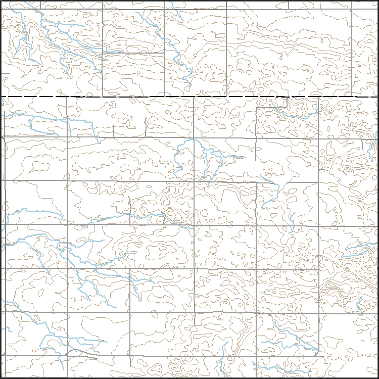
Layers of geospatial data include contours, boundaries, land cover, hydrography, roads, transportation, geographic names, structures, and other selected map features.
Tax district mapping is an important function of the Property Tax Division - Technical Services Group. The identification of tax districts aids in the mill levy process and helps counties redistribute tax funds more effectively.
Categories: Data;
Types: Downloadable;
Tags: Campbell County,
Counties,
Tax Districts,
Tax Entities,
United States,
Little Powder River Ab Dry Creek nr Weston
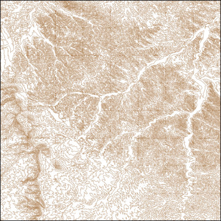
These vector contour lines are derived from the 3D Elevation Program using automated and semi-automated processes. They were created to support 1:24,000-scale CONUS and Hawaii, 1:25,000-scale Alaska, and 1:20,000-scale Puerto Rico / US Virgin Island topographic map products, but are also published in this GIS vector format. Contour intervals are assigned by 7.5-minute quadrangle, so this vector dataset is not visually seamless across quadrangle boundaries. The vector lines have elevation attributes (in feet above mean sea level on NAVD88), but this dataset does not carry line symbols or annotation.
USGS Topo Map Vector Data (Vector) 31518 Neil Butte, Wyoming 20210915 for 7.5 x 7.5 minute Shapefile
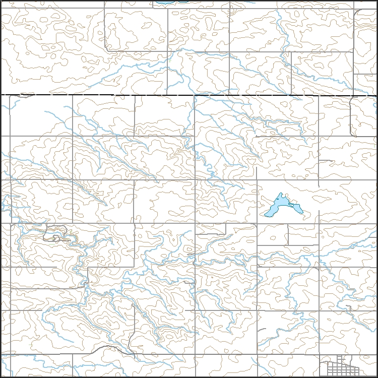
Layers of geospatial data include contours, boundaries, land cover, hydrography, roads, transportation, geographic names, structures, and other selected map features.
Layers of geospatial data include contours, boundaries, land cover, hydrography, roads, transportation, geographic names, structures, and other selected map features.
Layers of geospatial data include contours, boundaries, land cover, hydrography, roads, transportation, geographic names, structures, and other selected map features.
|

|
