Filters: Tags: Canada (X)
898 results (49ms)|
Filters
Date Range
Extensions (Less)
Types (Less)
Contacts (Less)
Categories (Less)
Tag Types
|
The Geologic Map Index of Alaska (Map Index) is an online, interactive web mapping application that provides access to an actively growing geographic index of geology-related maps of Alaska and adjacent areas. This online research tool provides the locations and outlines of most DGGS and U.S. Geological Survey (USGS) geologic and geophysical maps of Alaska in a single, interactive web map. It allows searches of the map database by geographic area of interest, keywords, themes, publishing agency, dates, and other criteria. The search results provide links to DGGS's comprehensive, multi-agency publications database, where users may view and download publications for free. No other geographic index of Alaska geologic...
During 2009, the Alaska Division of Geological & Geophysical Surveys continued a program, begun in 2006, of reconnaissance mapping of surficial geology in the proposed natural-gas pipeline corridor through the upper Tanana River valley. The study area is a 12-mi-wide (19.3-km-wide) area that straddles the Alaska Highway from the western boundaries of the Tanacross B-3 and A-3 quadrangles near Tetlin Junction eastward to the eastern boundaries of the Nabesna D-1 and C-1 quadrangles along the Canada border. Mapping during 2008-2009 in the Tanacross and Nabesna quadrangles linked with the mapping completed in the Tanacross, Big Delta and Mt. Hayes quadrangles in 2006-2008. Surficial geology was initially mapped in...

MC1 is a dynamic vegetation model for estimating the distribution of vegetation and associated ecosystem fluxes of carbon, nutrients, and water. It was created to assess the potential impacts of global climate change on ecosystem structure and function at a wide range of spatial scales from landscape to global. The model incorporates transient dynamics to make predictions about the patterns of ecological change. MC1 was created by combining physiologically based biogeographic rules defined in the MAPSS model with a modified version of the biogeochemical model, CENTURY. MC1 includes a fire module, MCFIRE, that mechanistically simulates the occurrence and impacts of fire events. Climate input data sources for this...

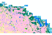
This dataset contains Canada's national forest inventory (CanFI) 2001 data for plots within the boreal region of the province of Quebec, Canada. The attribute displayed is percent forested. Refer to the "attributes" tab to view other attributes contained in this dataset. For more information, refer to the CanFI 2001 document at: http://dsp-psd.pwgsc.gc.ca/collection_2007/nrcan-rncan/Fo143-2-408E.pdf From CanFI: Canada's existing national forest inventory (CanFI) is compiled about every five years by aggregating provincial and territorial forest management inventories and reconnaissance level information. Stand-level data provided by the provincial and territorial management agencies are converted to a national...

This dataset contains Canada's national forest inventory (CanFI) 2001 data for plots within the boreal region of the province of Ontario, Canada. The attribute displayed is percent forested. Refer to the "attributes" tab to view other attributes contained in this dataset. For more information, refer to the CanFI 2001 document at: http://dsp-psd.pwgsc.gc.ca/collection_2007/nrcan-rncan/Fo143-2-408E.pdf From CanFI: Canada's existing national forest inventory (CanFI) is compiled about every five years by aggregating provincial and territorial forest management inventories and reconnaissance level information. Stand-level data provided by the provincial and territorial management agencies are converted to a national...

This dataset depicts the Level I ecological regions of North America, as compiled by the Commission for Environmental Cooperation (CEC). These draft files of of Level I, II, and III ecological regions of North America are an update and revision of files developed by Canada, the United States, and Mexico in the late 1990's in a cooperative project for the Commission for Environmental Cooperation (CEC 1997). The CEC was created under the North American Agreement on Environmental Cooperation (NAAEC) to address regional environmental concerns, help prevent potential trade and environmental conflicts and promote the effective enforcement of environmental law. The Agreement complements the environmental provisions established...

These results come from the VINCERA version of MC1. MC1 is a dynamic vegetation model for estimating the distribution of vegetation and associated ecosystem fluxes of carbon, nutrients, and water. It was created to assess the potential impacts of global climate change on ecosystem structure and function at a wide range of spatial scales from landscape to global. The model incorporates transient dynamics to make predictions about the patterns of ecological change. MC1 was created by combining physiologically based biogeographic rules defined in the MAPSS model with a modified version of the biogeochemical model, CENTURY. MC1 includes a fire module, MCFIRE, that mechanistically simulates the occurrence and impacts...

These results come from the VINCERA version of MC1. MC1 is a dynamic vegetation model for estimating the distribution of vegetation and associated ecosystem fluxes of carbon, nutrients, and water. It was created to assess the potential impacts of global climate change on ecosystem structure and function at a wide range of spatial scales from landscape to global. The model incorporates transient dynamics to make predictions about the patterns of ecological change. MC1 was created by combining physiologically based biogeographic rules defined in the MAPSS model with a modified version of the biogeochemical model, CENTURY. MC1 includes a fire module, MCFIRE, that mechanistically simulates the occurrence and impacts...
Since the 1970s, Canada has formulated various strategy measures to accelerate the development of energy efficiency systems and renewable energy technologies and has made significant progress. "From 1990 to 2003, Canada's energy efficiency improved by an estimated 13%, or 883.3 petajoules, saving Canadians almost $13.4 billion in 2003 alone and reducing annual greenhouse gas emissions by 52.3 megatonnes". In 2000, about 17% of Canadian primary energy supply came from renewable sources (with hydroelectric, combustible renewables and waste). Canada is a leader in devising and implementing energy options for sustainable development. However, the nation still has great scope for furthering energy efficiency and more...
Categories: Publication;
Types: Citation;
Tags: Canada,
Energy efficiency,
Renewable energy,
Sustainable energy strategies

MC1 is a dynamic vegetation model for estimating the distribution of vegetation and associated ecosystem fluxes of carbon, nutrients, and water. It was created to assess the potential impacts of global climate change on ecosystem structure and function at a wide range of spatial scales from landscape to global. The model incorporates transient dynamics to make predictions about the patterns of ecological change. MC1 was created by combining physiologically based biogeographic rules defined in the MAPSS model with a modified version of the biogeochemical model, CENTURY. MC1 includes a fire module, MCFIRE, that mechanistically simulates the occurrence and impacts of fire events. Climate input data sources for this...
This dataset contains generalized landcover data for the Prairie Farm Rehabilitation Administration (PFRA) determined agricultural extent of Manitoba and Saskatchewan. This dataset was subset into two shapefiles. The other half of this dataset covers PFRA agricultural areas of Alberta and British Columbia. The Landcover Generalization process was undertaken to solve rendering problems of the original vectorized landcover data due to its unwieldy/overwhelming size. LANDSAT 7 imagery used in the process was collected during the WGTPP. This landcover imagery has a 30 meter resolution and is stored in over 1,100 vectorized 1:50,000 map sheet tiles. The data requires over seven gigabytes of disc space. If the user wishes...

The mapping of land capability for forestry is based on a national classification system comparable with the other Canada Land Inventory sectors. Land is rated according to seven classes on its capability to grow commercial timber in areas stocked with the optimum number and species of trees. This rating considers the land in its natural state, without improvements such as fertilization, drainage, or amelioration practices. This dataset contains Land Capability Ratings for the surveyed portions of the province of Alberta, for areas south of 56 degrees N latitude (Alberta is divided into two datasets due to file size constraints). Land ratings and classes may change, however, significant changes will only be achieved...
The NABat sampling frame is a grid-based finite-area frame spanning Canada, the United States, and Mexico consisting of N total number of 10- by 10-km (100-km2) grid cell sample units for the continental United States, Canada, and Alaska and 5- by 5-km (25km2) for Hawaii and Puerto Rico. This grain size is biologically appropriate given the scale of movement of most bat species, which routinely travel many kilometers each night between roosts and foraging areas and along foraging routes. A Generalized Random-Tessellation Stratified (GRTS) Survey Design draw was added to the sample units from the raw sampling grids (https://doi.org/10.5066/P9M00P17). This sampling design produces an ordered list of units such that...
Corescan© Hyperspectral Core Imager Mark III (HCI-III) system data were acquired for hand samples, and subsequent billets made from the hand samples, collected during the U.S. Geological Survey (USGS) 2014, 2015, and 2016 field seasons in the Nabesna area of the eastern Alaska Range. This area contains exposed porphyry deposits and hand samples were collected throughout the region in support of the HyMap imaging spectrometer survey (https://doi.org/10.5066/F7DN435W) (Kokaly and others, 2017a). The HCI-III system consists of three different components. The first is an imaging spectrometer which collects reflectance data with a spatial resolution of approximately 500 nanometers (nm) for 514 spectral channels covering...

Digital polling division boundaries for 2008 were compared to polling division boundaries for 2006 and 2004 for select federal electoral districts. Polling divisions were identified by change type: larger than the comparison year, smaller than the comparison year, no change, and new division. Original polling division data was downloaded in December of 2009 from: http://geogratis.cgdi.gc.ca/geogratis/en/option/select.do?id=1169 NOTES: Be aware that polygons marked as no change that show boundary changes between the two comparison years can be 1) subdivided in one year and not the other, or 2) have an area difference of less than 1000 square meters. Polling divisions were identified based on the federal electoral...

A coal/CBM database was implemented by the Alberta Geological Survey to capture and manage information related to coalbed methane (CBM). The database is a compilation of data from many different sources and contains information on 7923 wells (15,200 formation picks; 37,357 coal picks; 495 coal analyses; and 363 vitrinite reflectance measurements). This is a subset of those wells that fall inside the coal zone.

A nationally compiled dataset containing provincial Forest Tenures/Forest Management Areas and other administrative areas where rights to establish, grow, harvest or remove timber from a particular area of land has been granted. Each province has different boundary definitions and/or harvesting practices which prevents this dataset from having a standard defined tenure unit for all of Canada (See data sources in metadata). British Columbia was the only province where tenure boundaries had to be complied from several different sources in order to have a definable tenure unit comparable to other provinces (see NOTES in metadata).

A nationally compiled dataset containing provincial Forest Tenures/Forest Management Areas and other administrative areas where rights to establish, grow, harvest or remove timber from a particular area of land has been granted. Each province has different boundary definitions and/or harvesting practices which prevents this dataset from having a standard defined tenure unit for all of Canada (See data sources in metadata). British Columbia was the only province where tenure boundaries had to be complied from several different sources in order to have a definable tenure unit comparable to other provinces (see NOTES in metadata).

Extent of disturbance directly related to oil sands surface mining activity up to 2008.

The datatset is a compilation of all permanent (legally established) protected areas in Ontario, Canada.
|

|
