Filters: Tags: Cane Creek (X)
12 results (10ms)|
Filters
Date Range
Extensions Types
Contacts
Categories Tag Types Tag Schemes |
This data set contains imagery from the National Agriculture Imagery Program (NAIP). The NAIP program is administered by USDA FSA and has been established to support two main FSA strategic goals centered on agricultural production. These are, increase stewardship of America's natural resources while enhancing the environment, and to ensure commodities are procured and distributed effectively and efficiently to increase food security. The NAIP program supports these goals by acquiring and providing ortho imagery that has been collected during the agricultural growing season in the U.S. The NAIP ortho imagery is tailored to meet FSA requirements and is a fundamental tool used to support FSA farm and conservation programs....
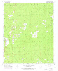
USGS Historical Quadrangle in GeoPDF.
This data set contains imagery from the National Agriculture Imagery Program (NAIP). The NAIP program is administered by USDA FSA and has been established to support two main FSA strategic goals centered on agricultural production. These are, increase stewardship of America's natural resources while enhancing the environment, and to ensure commodities are procured and distributed effectively and efficiently to increase food security. The NAIP program supports these goals by acquiring and providing ortho imagery that has been collected during the agricultural growing season in the U.S. The NAIP ortho imagery is tailored to meet FSA requirements and is a fundamental tool used to support FSA farm and conservation programs....
This data set contains imagery from the National Agriculture Imagery Program (NAIP). The NAIP program is administered by USDA FSA and has been established to support two main FSA strategic goals centered on agricultural production. These are, increase stewardship of America's natural resources while enhancing the environment, and to ensure commodities are procured and distributed effectively and efficiently to increase food security. The NAIP program supports these goals by acquiring and providing ortho imagery that has been collected during the agricultural growing season in the U.S. The NAIP ortho imagery is tailored to meet FSA requirements and is a fundamental tool used to support FSA farm and conservation programs....
Core Research Center, core E966, from well operated by DAVIS OIL COMPANYRaw Properties from download, web scrape, MapServer, and Macrostrat API{"Lib Num": "E966", "API Num": "4301930796", "Operator": "DAVIS OIL COMPANY", "Well Name": "1 SKYLINE", "Field": "WILDCAT", "State": "UT", "County": "GRAND", "Type": "SLABBED", "Photos": "T", "Thin Sec": "T", "Analysis": "T", "Latitude": "38.56852", "Longitude": "-109.73384", "coordinates_geohash": "9wcgqvnmbjnr", "Source": "FROM STATE RECORDS", "Security Flag": "NO SPECIAL RESTRICTIONS", "crc_collection_name": "core", "sb_parent_id": "4f4e49dae4b07f02db5e0486", "intervals": [{"Formation": "CANE CREEK", "Age": "PENN", "Min Depth": "7500", "Max Depth": "7520"}], "crcwc_url":...
Categories: Physical Item;
Tags: CANE CREEK,
Kayenta Formation,
Kayenta Formation,
Lower Jurassic,
PENN,
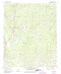
USGS Historical Quadrangle in GeoPDF.
This data set contains imagery from the National Agriculture Imagery Program (NAIP). The NAIP program is administered by USDA FSA and has been established to support two main FSA strategic goals centered on agricultural production. These are, increase stewardship of America's natural resources while enhancing the environment, and to ensure commodities are procured and distributed effectively and efficiently to increase food security. The NAIP program supports these goals by acquiring and providing ortho imagery that has been collected during the agricultural growing season in the U.S. The NAIP ortho imagery is tailored to meet FSA requirements and is a fundamental tool used to support FSA farm and conservation programs....
This data release is a geochemical data set from the reanalysis of 23 rock and 85 sediment samples collected between 1966 and 1970 by the U.S. Geological Survey (USGS) for a series of studies investigating the mineral resources of the Idaho Primitive Area (Cater et al., 1973). The samples are from the upper Middle Fork Salmon River and the South Fork Salmon River, including the tributaries of East Fork of the South Fork and Porphyry Creek. The overall objective of this study is to characterize the regional impact of legacy mining for the Frank Church - River of No Return Wilderness Area. In 1980 the U. S. Congress passed the Central Idaho Wilderness Act which combined the Idaho Primitive Area, the Salmon Rivers...
Categories: Data;
Types: Downloadable,
Map Service,
OGC WFS Layer,
OGC WMS Layer,
Shapefile;
Tags: Automatic Creek,
Beansnapper Creek,
Bear Creek,
Big Chief Creek,
Big Cottonwood Creek,
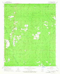
USGS Historical Quadrangle in GeoPDF.
This data set summarizes electrofishing effort, observations, and tissue sampling of aquatic vertebrates near Yellow Pine, Idaho. Sampling was conducted using a backpack electrofishing unit at two reference sites including Cane Creek and Sugar Creek, and at three mine impact sites including Sugar Creek and Cinnabar Creek. Juvenile Bull Trout (Salvelinus confluentus) were present at all five sites and were the primary species targeted during our sampling effort. Additional tissue samples of Sculpin, and amphibians were taken when available. Where possible, a two pass (quantitative depletion) electrofishing survey was conducted at each site for non-USGS stakeholders (Nez Perce Tribe and Idaho Department of Fish and...
Categories: Data;
Types: Citation,
Map Service,
OGC WFS Layer,
OGC WMS Layer,
OGC WMS Service;
Tags: Aquatic Biology,
Biota,
Bull Trout,
Cane Creek,
Cinnabar Creek,
The USGS examined mercury (Hg) concentrations in fish populations inhabiting impacted and reference streams as part of an investigation into the transport of trace metals in a watershed impacted by legacy mercury mining downstream from the Cinnabar mine site, Valley County, ID. Fish were sampled through an electrofishing survey utilizing a two-pass quantitative depletion approach where possible. Five reaches were selected in the Sugar Creek/Cinnabar Creek watershed, including two background reaches (ID020; ID021) with negligible mining impacts, Cinnabar Creek above the confluence with Sugar Creek (ID019), and two sites on Sugar Creek below the confluence with Cinnabar Creek (ID018 and ID010). Juvenile Bull trout...
Categories: Data;
Tags: Abandoned Mines and Quarries,
Aquatic Biology,
Aquatic Biology,
Atomic Absorption Analysis,
Bull Trout,
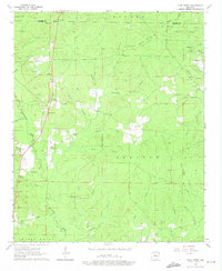
USGS Historical Quadrangle in GeoPDF.
|

|
