Filters: Tags: Cape Blanco (X)
13 results (71ms)|
Filters
Contacts
(Less)
|
Note: This data release has been superseded, available here: https://doi.org/10.5066/P9MYL7WJ This data release contains processed high-resolution multichannel sparker seismic-reflection (MCS) data that were collected aboard Humboldt State University’s R/V Coral Sea in October of 2018 on U.S. Geological Survey cruise 2018-658-FA on the shelf and slope between Cape Blanco, Oregon, and Cape Mendocino, California. MCS data were collected to characterize quaternary deformation and sediment dynamics along the southern Cascadia margin.
This data set contains imagery from the National Agriculture Imagery Program (NAIP). The NAIP program is administered by USDA FSA and has been established to support two main FSA strategic goals centered on agricultural production. These are, increase stewardship of America's natural resources while enhancing the environment, and to ensure commodities are procured and distributed effectively and efficiently to increase food security. The NAIP program supports these goals by acquiring and providing ortho imagery that has been collected during the agricultural growing season in the U.S. The NAIP ortho imagery is tailored to meet FSA requirements and is a fundamental tool used to support FSA farm and conservation programs....
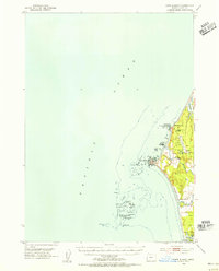
USGS Historical Quadrangle in GeoPDF.
USGS Historical Quadrangle in GeoPDF.
This data set contains imagery from the National Agriculture Imagery Program (NAIP). The NAIP program is administered by USDA FSA and has been established to support two main FSA strategic goals centered on agricultural production. These are, increase stewardship of America's natural resources while enhancing the environment, and to ensure commodities are procured and distributed effectively and efficiently to increase food security. The NAIP program supports these goals by acquiring and providing ortho imagery that has been collected during the agricultural growing season in the U.S. The NAIP ortho imagery is tailored to meet FSA requirements and is a fundamental tool used to support FSA farm and conservation programs....
USGS Historical Quadrangle in GeoPDF.
This publication releases single-beam bathymetry and backscatter datasets acquired by the U.S. Geological Survey (USGS) during surveys performed on Floras Lake, Oregon, in June 2018. Bathymetry and backscatter data were collected using two personal watercraft (PWCs) equipped with single-beam sonar systems, sidescan sonar systems, and global navigation satellite system (GNSS) receivers. Bathymetry data are provided as point data in a comma-separated text file and are projected in cartesian coordinates using the Universal Transverse Mercator (UTM), Zone 10 North, meters coordinate system, with elevations relative to the NAVD88 vertical datum. Acoustic-backscatter data are provided as a GeoTIFF file also projected...
Categories: Data;
Tags: Bathymetry and Elevation,
CMHRP,
Cape Blanco,
Coastal and Marine Hazards and Resources Program,
Curry County,
USGS Historical Quadrangle in GeoPDF.
USGS Historical Quadrangle in GeoPDF.
This data set contains imagery from the National Agriculture Imagery Program (NAIP). The NAIP program is administered by USDA FSA and has been established to support two main FSA strategic goals centered on agricultural production. These are, increase stewardship of America's natural resources while enhancing the environment, and to ensure commodities are procured and distributed effectively and efficiently to increase food security. The NAIP program supports these goals by acquiring and providing ortho imagery that has been collected during the agricultural growing season in the U.S. The NAIP ortho imagery is tailored to meet FSA requirements and is a fundamental tool used to support FSA farm and conservation programs....
This data set contains imagery from the National Agriculture Imagery Program (NAIP). The NAIP program is administered by USDA FSA and has been established to support two main FSA strategic goals centered on agricultural production. These are, increase stewardship of America's natural resources while enhancing the environment, and to ensure commodities are procured and distributed effectively and efficiently to increase food security. The NAIP program supports these goals by acquiring and providing ortho imagery that has been collected during the agricultural growing season in the U.S. The NAIP ortho imagery is tailored to meet FSA requirements and is a fundamental tool used to support FSA farm and conservation programs....
This portion of the USGS data release presents bathymetry data collected during surveys performed in Floras Lake, Oregon in June 2018 (USGS Field Activity Number 2018-636-FA). Floras Lake is a coastal lake in southern Oregon that is separated from the Pacific Ocean by sand dunes. It is not influenced by tides, although water levels fluctuate seasonally. Lake bed bathymetry data were collected using two personal watercraft (PWCs) equipped with single-beam sonar systems and global navigation satellite system (GNSS) receivers. The sonar systems consisted of an Odom Echotrac CV-100 single-beam echosounder and 200 kHz transducer with a 9-degree beam angle. Depths from the lakebed to the echosounder were calculated using...
Categories: Data;
Types: Map Service,
OGC WFS Layer,
OGC WMS Layer,
OGC WMS Service;
Tags: Bathymetry and Elevation,
CMHRP,
Cape Blanco,
Coastal and Marine Hazards and Resources Program,
Curry County,
This portion of the USGS data release presents acoustic-backscatter data collected during surveys performed in Floras Lake, Oregon in June 2018 (USGS Field Activity Number 2018-636-FA). Lake bed backscatter data were collected using a personal watercraft (PWC) equipped with a sidescan sonar system and global navigation satellite system (GNSS) receivers. The sonar system consisted of a Tritech Starfish 990F with a 1-MHz transducer and a 0.3-degree horizontal beam width. Output from the GNSS receivers and sonar system were combined in real time on the PWC by a computer running HYPACK hydrographic survey software. Navigation information was displayed on a video monitor, allowing PWC operators to navigate along survey...
Categories: Data;
Types: Downloadable,
GeoTIFF,
Map Service,
Raster;
Tags: CMHRP,
Cape Blanco,
Coastal and Marine Hazards and Resources Program,
Curry County,
Echo Sounders,
|

|
