Filters: Tags: Cape San Martin (X)
33 results (11ms)|
Filters
Date Range
Types Contacts
Tag Types Tag Schemes |
Presented here is a point cloud collected by the U.S. Geological Survey (USGS) using an oblique plane-mounted camera system, covering the area of the Mud Creek landslide on California State Route 1 (SR1), Mud Creek, Big Sur, California. The point cloud is referenced to previously published lidar data and contains RGB information as well as XYZ. Point cloud coordinates are in NAD83 UTM Zone 10 meters. Imagery was collected with a Nikon D800 camera in RAW format and processed using structure-from-motion photogrammetry with Agisoft PhotoScan version 1.2.8 through 1.3.2. Pointclouds were clipped to an AOI using LASTools. The AOI was created from a KMZ in Google Earth and transformed to a shapefile using ArcMap 10.5.

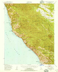
USGS Historical Quadrangle in GeoPDF.
This data set contains imagery from the National Agriculture Imagery Program (NAIP). The NAIP program is administered by USDA FSA and has been established to support two main FSA strategic goals centered on agricultural production. These are, increase stewardship of America's natural resources while enhancing the environment, and to ensure commodities are procured and distributed effectively and efficiently to increase food security. The NAIP program supports these goals by acquiring and providing ortho imagery that has been collected during the agricultural growing season in the U.S. The NAIP ortho imagery is tailored to meet FSA requirements and is a fundamental tool used to support FSA farm and conservation programs....
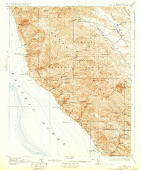
USGS Historical Quadrangle in GeoPDF.

USGS Historical Quadrangle in GeoPDF.
Presented here is a point cloud collected by the U.S. Geological Survey (USGS) using an oblique plane-mounted camera system, covering the area of the Mud Creek landslide on California State Route 1 (SR1), Mud Creek, Big Sur, California. The point cloud is referenced to previously published lidar data and contains RGB information as well as XYZ. Point cloud coordinates are in NAD83 UTM Zone 10 meters. Imagery was collected with a Nikon D800 camera in RAW format and processed using structure-from-motion photogrammetry with Agisoft PhotoScan version 1.2.8 through 1.3.2. Pointclouds were clipped to an AOI using LASTools. The AOI was created from a KMZ in Google Earth and transformed to a shapefile using ArcMap 10.5.

USGS Historical Quadrangle in GeoPDF.
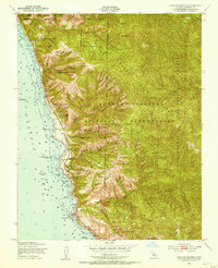
USGS Historical Quadrangle in GeoPDF.
Presented here is a point cloud collected by the U.S. Geological Survey (USGS) using an oblique plane-mounted camera system, covering the area of the Mud Creek landslide on California State Route 1 (SR1), Mud Creek, Big Sur, California. Point cloud is referenced to previously published lidar data and contains RGB information as well as XYZ. Point cloud coordinates are in NAD83 UTM Zone 10 meters. Imagery was collected with a Nikon D800 camera in RAW format and processed using structure-from-motion photogrammetry with Agisoft PhotoScan version 1.2.8 through 1.3.2. Point clouds were clipped to an AOI using LASTools. The AOI was created from a KMZ in Google Earth and transformed to a shapefile using ArcMap 10.5.
Presented here is a point cloud collected by the U.S. Geological Survey (USGS) using a UAS-mounted camera system, covering the area of the Mud Creek landslide on California State Route 1 (SR1), Mud Creek, Big Sur, California. Point cloud is referenced to previously published lidar data and contains RGB information as well as XYZ. Point cloud coordinates are in NAD83 UTM Zone 10 meters. Imagery was collected with a Ricoh GR camera in DNG format and processed using structure-from-motion photogrammetry with Agisoft PhotoScan version 1.2.8 through 1.3.2. Point clouds were clipped to an AOI using LASTools. The AOI was created from a KMZ in Google Earth and transformed to a shapefile using ArcMap 10.5.
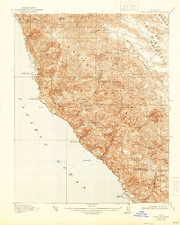
USGS Historical Quadrangle in GeoPDF.
This data set contains imagery from the National Agriculture Imagery Program (NAIP). The NAIP program is administered by USDA FSA and has been established to support two main FSA strategic goals centered on agricultural production. These are, increase stewardship of America's natural resources while enhancing the environment, and to ensure commodities are procured and distributed effectively and efficiently to increase food security. The NAIP program supports these goals by acquiring and providing ortho imagery that has been collected during the agricultural growing season in the U.S. The NAIP ortho imagery is tailored to meet FSA requirements and is a fundamental tool used to support FSA farm and conservation programs....

USGS Historical Quadrangle in GeoPDF.
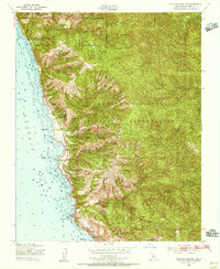
USGS Historical Quadrangle in GeoPDF.
Presented here is a point cloud collected by the U.S. Geological Survey (USGS) using an oblique plane-mounted camera system, covering the area of the Mud Creek landslide on California State Route 1 (SR1), Mud Creek, Big Sur, California. Point cloud is referenced to previously published lidar data and contains RGB information as well as XYZ. Point cloud coordinates are in NAD83 UTM Zone 10 meters. Imagery was collected with a Nikon D800 camera in RAW format and processed using structure-from-motion photogrammetry with Agisoft PhotoScan version 1.2.8 through 1.3.2. Point clouds were clipped to an AOI using LASTools. The AOI was created from a KMZ in Google Earth and transformed to a shapefile using ArcMap 10.5.
Presented here is a point cloud produced by the U.S. Geological Survey (USGS) from historical U.S. Air Force vertical aerial imagery, covering the area of the Mud Creek landslide on California State Route 1 (SR1), Mud Creek, Big Sur, California. The point cloud is referenced to previously published lidar data and contains RGB information as well as XYZ. Point cloud coordinates are in NAD83 UTM Zone 10 meters. Imagery was downloaded from USGS Eros Data Center and processed using structure-from-motion photogrammetry with Agisoft PhotoScan version 1.2.8 through 1.3.2. Point clouds were clipped to an AOI using LASTools. The AOI was created from a KMZ in Google Earth and transformed to a shapefile using ArcMap 10.5.
This data set contains imagery from the National Agriculture Imagery Program (NAIP). The NAIP program is administered by USDA FSA and has been established to support two main FSA strategic goals centered on agricultural production. These are, increase stewardship of America's natural resources while enhancing the environment, and to ensure commodities are procured and distributed effectively and efficiently to increase food security. The NAIP program supports these goals by acquiring and providing ortho imagery that has been collected during the agricultural growing season in the U.S. The NAIP ortho imagery is tailored to meet FSA requirements and is a fundamental tool used to support FSA farm and conservation programs....
USGS Historical Quadrangle in GeoPDF.
Presented here is a point cloud collected by the U.S. Geological Survey (USGS) using an oblique plane-mounted camera system, covering the area of the Mud Creek landslide on California State Route 1 (SR1), Mud Creek, Big Sur, California. The point cloud is referenced to previously published lidar data and contains RGB information as well as XYZ. Point Cloud Coordinates are in NAD83 UTM Zone 10 meters. Imagery was collected with a Nikon D800 camera in RAW format and processed using structure-from-motion photogrammetry with Agisoft PhotoScan version 1.2.8 through 1.3.2. Pointclouds were clipped to an AOI using LASTools. The AOI was created from a KMZ in Google Earth and transformed to a shapefile using ArcMap 10.5.
Presented here is a point cloud collected by the U.S. Geological Survey (USGS) using an oblique plane-mounted camera system, covering the area of the Mud Creek landslide on California State Route 1 (SR1), Mud Creek, Big Sur, California. The point cloud is referenced to previously published lidar data and contains RGB information as well as XYZ. Point cloud coordinates are in NAD83 UTM Zone 10 meters. Imagery was collected with a Nikon D800 camera in RAW format and processed using structure-from-motion photogrammetry with Agisoft PhotoScan version 1.2.8 through 1.3.2. Point clouds were clipped to an AOI using LASTools. The AOI was created from a KMZ in Google Earth and transformed to a shapefile using ArcMap 10.5.
|

|
