Filters: Tags: Carter County (X) > Date Range: {"choice":"year"} (X)
11 results (60ms)|
Filters
Date Types (for Date Range)
Contacts
Categories Tag Types Tag Schemes |
This file (wymt_ffa_2022B_WATSTORE.txt) contains peak-flow input data for PeakFQ for peak-flow frequency analyses for selected streamgages based on data through water year 2022. The file format is called WATSTORE (National Water Data Storage and Retrieval System) available from NWISWeb (http://nwis.waterdata.usgs.gov/usa/nwis/peak).
Types: Map Service,
OGC WFS Layer,
OGC WMS Layer,
OGC WMS Service;
Tags: Boxelder,
Carter County,
Custer County,
Fallon County,
Little Powder,

The High Resolution National Hydrography Dataset Plus (NHDPlus HR) is an integrated set of geospatial data layers, including the best available National Hydrography Dataset (NHD), the 10-meter 3D Elevation Program Digital Elevation Model (3DEP DEM), and the National Watershed Boundary Dataset (WBD). The NHDPlus HR combines the NHD, 3DEP DEMs, and WBD to create a stream network with linear referencing, feature naming, "value added attributes" (VAAs), elevation-derived catchments, and other features for hydrologic data analysis. The stream network with linear referencing is a system of data relationships applied to hydrographic systems so that one stream reach "flows" into another and "events" can be tied to and traced...

The High Resolution National Hydrography Dataset Plus (NHDPlus HR) is an integrated set of geospatial data layers, including the best available National Hydrography Dataset (NHD), the 10-meter 3D Elevation Program Digital Elevation Model (3DEP DEM), and the National Watershed Boundary Dataset (WBD). The NHDPlus HR combines the NHD, 3DEP DEMs, and WBD to create a stream network with linear referencing, feature naming, "value added attributes" (VAAs), elevation-derived catchments, and other features for hydrologic data analysis. The stream network with linear referencing is a system of data relationships applied to hydrographic systems so that one stream reach "flows" into another and "events" can be tied to and traced...
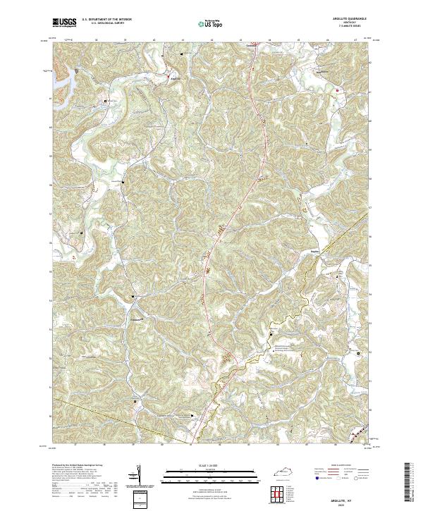
Layered geospatial PDF 7.5 Minute Quadrangle Map. Layers of geospatial data include orthoimagery, roads, grids, geographic names, elevation contours, hydrography, and other selected map features. This map is derived from GIS (geospatial information system) data. It represents a repackaging of GIS data in traditional map form, not creation of new information. The geospatial data in this map are from selected National Map data holdings and other government sources.
The USGS Wyoming-Montana Water Science Center (WY–MT WSC) completed a report (Sando and McCarthy, 2018) documenting methods for peak-flow frequency analysis following implementation of the Bulletin 17C guidelines (England and others, 2019). The methods are used to provide estimates of peak-flow quantiles for 66.7-, 50-, 42.9-, 20-, 10-, 4-, 2-, 1-, 0.5-, and 0.2-percent annual exceedance probabilities (AEPs) for selected USGS streamgages. This data release presents peak-flow frequency analyses for selected streamgages in Carter, Custer, Fallon, Powder River, and Prairie Counties, and the Powder River Basin, based on data through water year 2022, using methods described by Sando and McCarthy (2018).
Categories: Data;
Types: Map Service,
OGC WFS Layer,
OGC WMS Layer,
OGC WMS Service;
Tags: Boxelder,
Carter County,
Custer County,
Data,
Fallon County,
The USGS Wyoming-Montana Water Science Center (WY–MT WSC) completed a report (Sando and McCarthy, 2018) documenting methods for peak-flow frequency analysis following implementation of the Bulletin 17C guidelines (England and others, 2019). The methods are used to provide estimates of peak-flow quantiles for 66.7-, 50-, 42.9-, 20-, 10-, 4-, 2-, 1-, 0.5-, and 0.2-percent annual exceedance probabilities (AEPs) for selected USGS streamgages. This data release presents peak-flow frequency analyses based on methods described by Sando and McCarthy (2018), for selected streamgages in Carter, Custer, Fallon, Powder River, and Prairie Counties, and the Powder River Basin, based on data through water year 2022.
Types: Map Service,
OGC WFS Layer,
OGC WMS Layer,
OGC WMS Service;
Tags: Boxelder,
Carter County,
Custer County,
Fallon County,
Hydrology,

The High Resolution National Hydrography Dataset Plus (NHDPlus HR) is an integrated set of geospatial data layers, including the best available National Hydrography Dataset (NHD), the 10-meter 3D Elevation Program Digital Elevation Model (3DEP DEM), and the National Watershed Boundary Dataset (WBD). The NHDPlus HR combines the NHD, 3DEP DEMs, and WBD to create a stream network with linear referencing, feature naming, "value added attributes" (VAAs), elevation-derived catchments, and other features for hydrologic data analysis. The stream network with linear referencing is a system of data relationships applied to hydrographic systems so that one stream reach "flows" into another and "events" can be tied to and traced...

The High Resolution National Hydrography Dataset Plus (NHDPlus HR) is an integrated set of geospatial data layers, including the best available National Hydrography Dataset (NHD), the 10-meter 3D Elevation Program Digital Elevation Model (3DEP DEM), and the National Watershed Boundary Dataset (WBD). The NHDPlus HR combines the NHD, 3DEP DEMs, and WBD to create a stream network with linear referencing, feature naming, "value added attributes" (VAAs), elevation-derived catchments, and other features for hydrologic data analysis. The stream network with linear referencing is a system of data relationships applied to hydrographic systems so that one stream reach "flows" into another and "events" can be tied to and traced...
This file (wymt_ffa_2022B.psf) contains specifications to run PeakFQ version 7.4 for peak-flow frequency analyses for selected streamgages based on data through water year 2022.
Types: Map Service,
OGC WFS Layer,
OGC WMS Layer,
OGC WMS Service;
Tags: Boxelder,
Carter County,
Custer County,
Fallon County,
Little Powder,
Layered geospatial PDF 7.5 Minute Quadrangle Map. Layers of geospatial data include orthoimagery, roads, grids, geographic names, elevation contours, hydrography, and other selected map features. This map is derived from GIS (geospatial information system) data. It represents a repackaging of GIS data in traditional map form, not creation of new information. The geospatial data in this map are from selected National Map data holdings and other government sources.
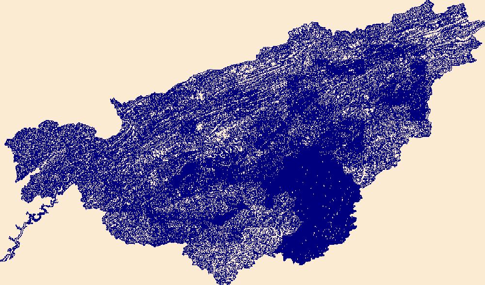
The High Resolution National Hydrography Dataset Plus (NHDPlus HR) is an integrated set of geospatial data layers, including the National Hydrography Dataset (NHD), National Watershed Boundary Dataset (WBD), and 3D Elevation Program Digital Elevation Model (3DEP DEM). The NHDPlus HR combines the NHD, 3DEP DEMs, and WBD to a data suite that includes the NHD stream network with linear referencing functionality, the WBD hydrologic units, elevation-derived catchment areas for each stream segment, "value added attributes" (VAAs), and other features that enhance hydrologic data analysis and routing.
|

|
