Filters: Tags: Castle Mountain (X)
14 results (37ms)|
Filters
Date Range
Types Contacts
Tag Types Tag Schemes |
This data set contains imagery from the National Agriculture Imagery Program (NAIP). The NAIP program is administered by USDA FSA and has been established to support two main FSA strategic goals centered on agricultural production. These are, increase stewardship of America's natural resources while enhancing the environment, and to ensure commodities are procured and distributed effectively and efficiently to increase food security. The NAIP program supports these goals by acquiring and providing ortho imagery that has been collected during the agricultural growing season in the U.S. The NAIP ortho imagery is tailored to meet FSA requirements and is a fundamental tool used to support FSA farm and conservation programs....
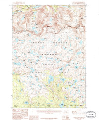
USGS Historical Quadrangle in GeoPDF.
This map is one of a series of four 1:25,000-scale quadrangle maps (Anchorage C-8 NE Quadrangle) intended to provide information on the geology and construction materials along the southern margin of the Talkeetna Mountains between Little Susitna River and Nancy Lake, Alaska. Additionally, the geologic map portrays faults, if present, as well as other lineaments that represent either faults or erosional features.

USGS Historical Quadrangle in GeoPDF.
This map is one of a series of four 1:25,000-scale quadrangle maps (Anchorage C-8 NW Quadrangle) intended to provide information on the geology and construction materials along the southern margin of the Talkeetna Mountains between Little Susitna River and Nancy Lake, Alaska. Additionally, the geologic map portrays faults, if present, as well as other lineaments that represent either faults or erosional features.
This data set contains imagery from the National Agriculture Imagery Program (NAIP). The NAIP program is administered by USDA FSA and has been established to support two main FSA strategic goals centered on agricultural production. These are, increase stewardship of America's natural resources while enhancing the environment, and to ensure commodities are procured and distributed effectively and efficiently to increase food security. The NAIP program supports these goals by acquiring and providing ortho imagery that has been collected during the agricultural growing season in the U.S. The NAIP ortho imagery is tailored to meet FSA requirements and is a fundamental tool used to support FSA farm and conservation programs....
This map is one of a series of four 1:25,000-scale quadrangle maps (Anchorage C-8 NE Quadrangle) intended to provide information on the geology and construction materials along the southern margin of the Talkeetna Mountains between Little Susitna River and Nancy Lake, Alaska. Additionally, the geologic map portrays faults, if present, as well as other lineaments that represent either faults or erosional features.
This map is one of a series of four 1:25,000-scale quadrangle maps (Anchorage C-7 NW Quadrangle) intended to provide information on the geology and construction materials along the southern margin of the Talkeetna Mountains between Little Susitna River and Nancy Lake, Alaska. Additionally, the geologic map portrays faults, if present, as well as other lineaments that represent either faults or erosional features.
This map is one of a series of four 1:25,000-scale quadrangle maps (Anchorage C-7 NW Quadrangle) intended to provide information on the geology and construction materials along the southern margin of the Talkeetna Mountains between Little Susitna River and Nancy Lake, Alaska. Additionally, the geologic map portrays faults, if present, as well as other lineaments that represent either faults or erosional features.
This data set contains imagery from the National Agriculture Imagery Program (NAIP). The NAIP program is administered by USDA FSA and has been established to support two main FSA strategic goals centered on agricultural production. These are, increase stewardship of America's natural resources while enhancing the environment, and to ensure commodities are procured and distributed effectively and efficiently to increase food security. The NAIP program supports these goals by acquiring and providing ortho imagery that has been collected during the agricultural growing season in the U.S. The NAIP ortho imagery is tailored to meet FSA requirements and is a fundamental tool used to support FSA farm and conservation programs....
This map is one of a series of four 1:25,000-scale quadrangle maps (Anchorage C-7 NE Quadrangle) intended to provide information on the geology and construction materials along the southern margin of the Talkeetna Mountains between Little Susitna River and Nancy Lake, Alaska. Additionally, the geologic map portrays faults, if present, as well as other lineaments that represent either faults or erosional features.
This data set contains imagery from the National Agriculture Imagery Program (NAIP). The NAIP program is administered by USDA FSA and has been established to support two main FSA strategic goals centered on agricultural production. These are, increase stewardship of America's natural resources while enhancing the environment, and to ensure commodities are procured and distributed effectively and efficiently to increase food security. The NAIP program supports these goals by acquiring and providing ortho imagery that has been collected during the agricultural growing season in the U.S. The NAIP ortho imagery is tailored to meet FSA requirements and is a fundamental tool used to support FSA farm and conservation programs....
This data set contains imagery from the National Agriculture Imagery Program (NAIP). The NAIP program is administered by USDA FSA and has been established to support two main FSA strategic goals centered on agricultural production. These are, increase stewardship of America's natural resources while enhancing the environment, and to ensure commodities are procured and distributed effectively and efficiently to increase food security. The NAIP program supports these goals by acquiring and providing ortho imagery that has been collected during the agricultural growing season in the U.S. The NAIP ortho imagery is tailored to meet FSA requirements and is a fundamental tool used to support FSA farm and conservation programs....

USGS Historical Quadrangle in GeoPDF.
|

|
