Filters: Tags: Castlegate (X)
17 results (57ms)|
Filters
Date Range
Extensions Types Contacts Categories Tag Types Tag Schemes |
Core Research Center, core W183, from well operated by LOCIN OIL CORPRaw Properties from download, web scrape, MapServer, and Macrostrat API{"Lib Num": "W183", "API Num": "0510309474", "Operator": "LOCIN OIL CORP", "Well Name": "1-7-1-2", "Field": "RANGELY", "State": "CO", "County": "RIO BLANCO", "Type": "SLABBED", "Photos": "T", "Thin Sec": "F", "Analysis": "F", "Latitude": "39.982247", "Longitude": "-108.878135", "coordinates_geohash": "9x4e6qt37x43", "Source": "FROM STATE RECORDS", "Security Flag": "NO SPECIAL RESTRICTIONS", "crc_collection_name": "core", "sb_parent_id": "4f4e49dae4b07f02db5e0486", "intervals": [{"Formation": "CASTLEGATE", "Age": "CRETACEOUS", "Min Depth": "2935", "Max Depth": "3050"}], "crcwc_url":...
Categories: Physical Item;
Tags: CASTLEGATE,
CRETACEOUS,
Cretaceous,
Mesaverde Group,
Upper part of the Mesaverde Group,
Core Research Center, core D326, from well operated by COSEKA RESOURCESRaw Properties from download, web scrape, MapServer, and Macrostrat API{"Lib Num": "D326", "API Num": "0510307517", "Operator": "COSEKA RESOURCES", "Well Name": "14-3 FEDERAL", "Field": "BANTA RIDGE", "State": "CO", "County": "RIO BLANCO", "Type": "SLABBED", "Photos": "F", "Thin Sec": "F", "Analysis": "T", "Latitude": "40.003776", "Longitude": "-108.945167", "coordinates_geohash": "9x4e8fkwcs7d", "Source": "FROM STATE RECORDS", "Security Flag": "NO SPECIAL RESTRICTIONS", "crc_collection_name": "core", "sb_parent_id": "4f4e49dae4b07f02db5e0486", "intervals": [{"Formation": "CASTLEGATE", "Age": "CRET", "Min Depth": "3111", "Max Depth": "3167"}],...
Categories: Physical Item;
Tags: CASTLEGATE,
CRET,
Eocene,
Green River Fm--Lower Part,
Green River Formation,
Core Research Center, core T294, from well operated by AMER ELEC POWERRaw Properties from download, web scrape, MapServer, and Macrostrat API{"Lib Num": "T294", "API Num": null, "Operator": "AMER ELEC POWER", "Well Name": "MC-172", "Field": null, "State": "UT", "County": "CARBON", "Type": "FULL", "Photos": "F", "Thin Sec": "T", "Analysis": "T", "Latitude": "39.75404", "Longitude": "-110.91943", "coordinates_geohash": "9x145vnbjfnm", "Source": "CENTER OF SECTION", "Security Flag": "NO SPECIAL RESTRICTIONS", "crc_collection_name": "core", "sb_parent_id": "4f4e49dae4b07f02db5e0486", "intervals": [{"Formation": "PRICE RIVER", "Age": "CRET", "Min Depth": "412", "Max Depth": "1033"}, {"Formation": "CASTLEGATE", "Age":...
The lower part of the Campanian Castlegate Formation, one of the best known fluvial sheet sands of the Western Interior seaway, combines with an overlying finer grained unit (middle member of the Castlegate Formation) to form an unconformity-bounded, third-order stratigraphic sequence ([~]3 m.y. duration). This sequence contains a mappable muddy zone along the western Book Cliffs of Utah now mapped as contiguous with the open-marine parts of the succession (Buck Tongue, Sego Sandstone, Anchor Mine Tongue) to the east. The correlation within the middle Castlegate has been refined and the nature of the link between tidally influenced fluvial strata in the west and marine strata in the east has been remapped. Five...
Categories: Publication;
Types: Citation,
Journal Citation;
Tags: Book Cliffs,
Castlegate,
Geology,
nonmarine,
sequence stratigraphy
Core Research Center, core D363, from well operated by COSEKA RESOURCESRaw Properties from download, web scrape, MapServer, and Macrostrat API{"Lib Num": "D363", "API Num": "0510309230", "Operator": "COSEKA RESOURCES", "Well Name": "5-24-1S-104 FEDERAL", "Field": "WHITE FACE BUTTE", "State": "CO", "County": "RIO BLANCO", "Type": "SLABBED", "Photos": "F", "Thin Sec": "F", "Analysis": "T", "Latitude": "39.944837", "Longitude": "-109.023629", "coordinates_geohash": "9x47ppert364", "Source": "FROM STATE RECORDS", "Security Flag": "NO SPECIAL RESTRICTIONS", "crc_collection_name": "core", "sb_parent_id": "4f4e49dae4b07f02db5e0486", "intervals": [{"Formation": "BUCK TONGUE", "Age": "CRET", "Min Depth": "3599", "Max Depth":...
Core Research Center, core D514, from well operated by COSEKA RESOURCESRaw Properties from download, web scrape, MapServer, and Macrostrat API{"Lib Num": "D514", "API Num": "0510309227", "Operator": "COSEKA RESOURCES", "Well Name": "6-1-1S-104 COSEKA", "Field": "WILDCAT", "State": "CO", "County": "RIO BLANCO", "Type": "SLABBED", "Photos": "T", "Thin Sec": "F", "Analysis": "T", "Latitude": "39.988426", "Longitude": "-109.020969", "coordinates_geohash": "9x47rptm7qcs", "Source": "FROM STATE RECORDS", "Security Flag": "NO SPECIAL RESTRICTIONS", "crc_collection_name": "core", "sb_parent_id": "4f4e49dae4b07f02db5e0486", "intervals": [{"Formation": "CASTLEGATE", "Age": "CRET", "Min Depth": "4283", "Max Depth": "4342"}],...
Categories: Physical Item;
Tags: CASTLEGATE,
CRET,
Parachute Creek Member,
Parachute Creek Member of the Green River Formation,
Tertiary,
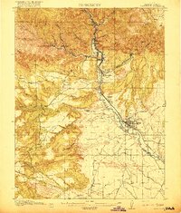
USGS Historical Quadrangle in GeoPDF.
Core Research Center, core S180, from well operated by USGSRaw Properties from download, web scrape, MapServer, and Macrostrat API{"Lib Num": "S180", "API Num": null, "Operator": "USGS", "Well Name": "BC-6-W", "Field": null, "State": "UT", "County": "EMERY", "Type": "FULL", "Photos": "T", "Thin Sec": "F", "Analysis": "T", "Latitude": "39.3317", "Longitude": "-110.2905", "coordinates_geohash": "9wcxf20gv069", "Source": "CENTER OF SECTION", "Security Flag": "NO SPECIAL RESTRICTIONS", "crc_collection_name": "core", "sb_parent_id": "4f4e49dae4b07f02db5e0486", "intervals": [{"Formation": "CASTLEGATE", "Age": "CRETACEOUS", "Min Depth": "759", "Max Depth": "772"}, {"Formation": "BLACKHAWK", "Age": "CRETACEOUS", "Min Depth":...
Core Research Center, core B606, from well operated by ENSERCH EXPLORATIONRaw Properties from download, web scrape, MapServer, and Macrostrat API{"Lib Num": "B606", "API Num": "4304730558", "Operator": "ENSERCH EXPLORATION", "Well Name": "1-1 PETE'S FLAT", "Field": "BONANZA", "State": "UT", "County": "UINTAH", "Type": "SLABBED", "Photos": "T", "Thin Sec": "T", "Analysis": "F", "Latitude": "39.97526", "Longitude": "-109.26978", "coordinates_geohash": "9x473t20v8dd", "Source": "FROM STATE RECORDS", "Security Flag": "NO SPECIAL RESTRICTIONS", "crc_collection_name": "core", "sb_parent_id": "4f4e49dae4b07f02db5e0486", "intervals": [{"Formation": "CASTLEGATE", "Age": "CRET", "Min Depth": "8152", "Max Depth": "8210"}],...
Categories: Physical Item;
Tags: CASTLEGATE,
CRET,
Eocene, Uintan,
Uinta Formation,
member B of Uinta Formation
Core Research Center, core C047, from well operated by COASTAL OIL & GASRaw Properties from download, web scrape, MapServer, and Macrostrat API{"Lib Num": "C047", "API Num": "4304730255", "Operator": "COASTAL OIL & GAS", "Well Name": "21 15-10-22 NATURAL BUTTES", "Field": "NATURAL BUTTES", "State": "UT", "County": "UINTAH", "Type": "SLABBED", "Photos": "T", "Thin Sec": "T", "Analysis": "T", "Latitude": "39.95337", "Longitude": "-109.41962", "coordinates_geohash": "9x45q1714pcz", "Source": "FROM STATE RECORDS", "Security Flag": "NO SPECIAL RESTRICTIONS", "crc_collection_name": "core", "sb_parent_id": "4f4e49dae4b07f02db5e0486", "intervals": [{"Formation": "WASATCH", "Age": "TERT", "Min Depth": "4389", "Max Depth":...
Core Research Center, core D323, from well operated by COSEKA RESOURCESRaw Properties from download, web scrape, MapServer, and Macrostrat API{"Lib Num": "D323", "API Num": "0510308243", "Operator": "COSEKA RESOURCES", "Well Name": "16-09 FEDERAL", "Field": "WILDCAT", "State": "CO", "County": "RIO BLANCO", "Type": "SLABBED", "Photos": "T", "Thin Sec": "F", "Analysis": "T", "Latitude": "39.7214", "Longitude": "-108.958664", "coordinates_geohash": "9x49bx49zjes", "Source": "FROM STATE RECORDS", "Security Flag": "NO SPECIAL RESTRICTIONS", "crc_collection_name": "core", "sb_parent_id": "4f4e49dae4b07f02db5e0486", "intervals": [{"Formation": "MANCOS B", "Age": "CRET", "Min Depth": "3251", "Max Depth": "3277"}, {"Formation":...
Core Research Center, core S168, from well operated by USGSRaw Properties from download, web scrape, MapServer, and Macrostrat API{"Lib Num": "S168", "API Num": null, "Operator": "USGS", "Well Name": "BC-3-W", "Field": null, "State": "UT", "County": "EMERY", "Type": "FULL", "Photos": "T", "Thin Sec": "F", "Analysis": "T", "Latitude": "39.3461", "Longitude": "-110.2718", "coordinates_geohash": "9wcxfdwx8udk", "Source": "CENTER OF SECTION", "Security Flag": "NO SPECIAL RESTRICTIONS", "crc_collection_name": "core", "sb_parent_id": "4f4e49dae4b07f02db5e0486", "intervals": [{"Formation": "CASTLEGATE", "Age": null, "Min Depth": "955", "Max Depth": "1024"}, {"Formation": "BLACKHAWK", "Age": null, "Min Depth": "1024", "Max...
Categories: Physical Item;
Tags: BLACKHAWK,
CASTLEGATE,
Price River Formation,
Upper Cretaceous,
Upper part of Price River Formation,
Core Research Center, core D370, from well operated by COSEKA RESOURCESRaw Properties from download, web scrape, MapServer, and Macrostrat API{"Lib Num": "D370", "API Num": "4304730708", "Operator": "COSEKA RESOURCES", "Well Name": "10-10-14-23 CROOKED CANYON", "Field": "WILDCAT", "State": "UT", "County": "UINTAH", "Type": "SLABBED", "Photos": "T", "Thin Sec": "F", "Analysis": "T", "Latitude": "39.61612", "Longitude": "-109.32679", "coordinates_geohash": "9x4325ysthhb", "Source": "FROM STATE RECORDS", "Security Flag": "NO SPECIAL RESTRICTIONS", "crc_collection_name": "core", "sb_parent_id": "4f4e49dae4b07f02db5e0486", "intervals": [{"Formation": "CASTLEGATE", "Age": "CRET", "Min Depth": "6100", "Max Depth": "6217"},...
Core Research Center, core T293, from well operated by AMER ELEC POWERRaw Properties from download, web scrape, MapServer, and Macrostrat API{"Lib Num": "T293", "API Num": null, "Operator": "AMER ELEC POWER", "Well Name": "MC-167", "Field": null, "State": "UT", "County": "CARBON", "Type": "FULL", "Photos": "F", "Thin Sec": "T", "Analysis": "T", "Latitude": "39.75393", "Longitude": "-110.78846", "coordinates_geohash": "9x14nuyr3v8t", "Source": "CENTER OF SECTION", "Security Flag": "NO SPECIAL RESTRICTIONS", "crc_collection_name": "core", "sb_parent_id": "4f4e49dae4b07f02db5e0486", "intervals": [{"Formation": "CASTLEGATE", "Age": "CRET", "Min Depth": "0", "Max Depth": "1340"}, {"Formation": "NORTH HORN", "Age": "CRET",...
Core Research Center, core B465, from well operated by FUEL RESOURCES DEVRaw Properties from download, web scrape, MapServer, and Macrostrat API{"Lib Num": "B465", "API Num": "0510308269", "Operator": "FUEL RESOURCES DEV", "Well Name": "0-28-3-101-5 FEDERAL", "Field": "CATHEDRAL", "State": "CO", "County": "RIO BLANCO", "Type": "SLABBED", "Photos": "T", "Thin Sec": "F", "Analysis": "T", "Latitude": "39.753891", "Longitude": "-108.732148", "coordinates_geohash": "9x4djszxjq6h", "Source": "FROM STATE RECORDS", "Security Flag": "NO SPECIAL RESTRICTIONS", "crc_collection_name": "core", "sb_parent_id": "4f4e49dae4b07f02db5e0486", "intervals": [{"Formation": "CASTLEGATE", "Age": "CRET", "Min Depth": "1504", "Max Depth":...
Core Research Center, core D344, from well operated by COSEKA RESOURCESRaw Properties from download, web scrape, MapServer, and Macrostrat API{"Lib Num": "D344", "API Num": "0510308749", "Operator": "COSEKA RESOURCES", "Well Name": "9-17-1-103 FEDERAL", "Field": "BANTA RIDGE", "State": "CO", "County": "RIO BLANCO", "Type": "SLABBED", "Photos": "T", "Thin Sec": "T", "Analysis": "T", "Latitude": "39.962477", "Longitude": "-108.972507", "coordinates_geohash": "9x4e26bwk99k", "Source": "FROM STATE RECORDS", "Security Flag": "NO SPECIAL RESTRICTIONS", "crc_collection_name": "core", "sb_parent_id": "4f4e49dae4b07f02db5e0486", "intervals": [{"Formation": "CASTLEGATE", "Age": "CRET", "Min Depth": "3767", "Max Depth": "3824"},...
Core Research Center, core R999, from well operated by CHAMPLIN PETROLEUMRaw Properties from download, web scrape, MapServer, and Macrostrat API{"Lib Num": "R999", "API Num": "4304730860", "Operator": "CHAMPLIN PETROLEUM", "Well Name": "3-24 US LAMCO", "Field": "WILDCAT", "State": "UT", "County": "UINTAH", "Type": "SLABBED", "Photos": "T", "Thin Sec": "F", "Analysis": "T", "Latitude": "39.66891", "Longitude": "-109.62245", "coordinates_geohash": "9x419mx25ubc", "Source": "FROM STATE RECORDS", "Security Flag": "NO SPECIAL RESTRICTIONS", "crc_collection_name": "core", "sb_parent_id": "4f4e49dae4b07f02db5e0486", "intervals": [{"Formation": "CASTLEGATE", "Age": "CRET", "Min Depth": "6805", "Max Depth": "6858"}, {"Formation":...
|

|
