Filters: Tags: Castroville (X)
10 results (2.4s)|
Filters
Date Range
Extensions Types Contacts
Categories Tag Types Tag Schemes |
This data set contains imagery from the National Agriculture Imagery Program (NAIP). The NAIP program is administered by USDA FSA and has been established to support two main FSA strategic goals centered on agricultural production. These are increase stewardship of America's natural resources while enhancing the environment, and to ensure commodities are procured and distributed effectively and efficiently to increase food security. The NAIP program supports these goals by acquiring and providing ortho imagery that has been collected during the agricultural growing season in the U.S. The NAIP ortho imagery is tailored to meet FSA requirements and is a fundamental tool used to support FSA farm and conservation programs....
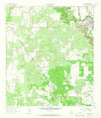
USGS Historical Quadrangle in GeoPDF.
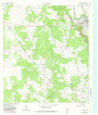
USGS Historical Quadrangle in GeoPDF.
This data set contains imagery from the National Agriculture Imagery Program (NAIP). The NAIP program is administered by USDA FSA and has been established to support two main FSA strategic goals centered on agricultural production. These are increase stewardship of America's natural resources while enhancing the environment, and to ensure commodities are procured and distributed effectively and efficiently to increase food security. The NAIP program supports these goals by acquiring and providing ortho imagery that has been collected during the agricultural growing season in the U.S. The NAIP ortho imagery is tailored to meet FSA requirements and is a fundamental tool used to support FSA farm and conservation programs....

This part of DS 781 presents fold data for the geologic and geomorphic map of the Monterey Canyon and Vicinity map area, California. The vector data file is included in "Folds_MontereyCanyon.zip," which is accessible from http://pubs.usgs.gov/ds/781/MontereyCanyon/data_catalog_MontereyCanyon.html. These data accompany the pamphlet and map sheets of Dartnell, P., Maier, K.L., Erdey, M.D., Dieter, B.E., Golden, N.E., Johnson, S.Y., Hartwell, S.R., Cochrane, G.R., Ritchie, A.C., Finlayson, D.P., Kvitek, R.G., Sliter, R.W., Greene, H.G., Davenport, C.W., Endris, C.A., and Krigsman, L.M. (P. Dartnell and S.A. Cochran, eds.), 2016, California State Waters Map Series—Monterey Canyon and Vicinity, California: U.S. Geological...
Categories: Data;
Types: Downloadable,
Map Service,
OGC WFS Layer,
OGC WMS Layer,
Shapefile;
Tags: Castroville,
Continental/Island Shelf,
Marina,
Marine Nearshore Subtidal,
Marine Offshore Subtidal,

This part of DS 781 presents data for the paleoshorelines for the geologic and geomorphic map of Monterey Canyon and Vicinity, California. The vector data file is included in "Paleoshorelines_MontereyCanyon.zip," which is accessible from http://dx.doi.org/10.3133/ofr20161072. These data accompany the pamphlet and map sheets of Dartnell, P., Maier, K.L., Erdey, M.D., Dieter, B.E., Golden, N.E., Johnson, S.Y., Hartwell, S.R., Cochrane, G.R., Ritchie, A.C., Finlayson, D.P., Kvitek, R.G., Sliter, R.W., Greene, H.G., Davenport, C.W., Endris, C.A., and Krigsman, L.M. (P. Dartnell and S.A. Cochran, eds.), 2016, California State Waters Map Series—Monterey Canyon and Vicinity, California: U.S. Geological Survey Open-File...
Categories: Data;
Types: Downloadable,
Map Service,
OGC WFS Layer,
OGC WMS Layer,
Shapefile;
Tags: Bathymetry,
Castroville,
Marina,
Monterey County,
Moss Landing,

This part of DS 781 presents data for the geologic and geomorphic map of Monterey Canyon and Vicinity, California. The vector data file is included in "Geology_MontereyCanyon.zip," which is accessible from http://pubs.usgs.gov/ds/781/MontereyCanyon/data_catalog_MontereyCanyon.html. These data accompany the pamphlet and map sheets of Dartnell, P., Maier, K.L., Erdey, M.D., Dieter, B.E., Golden, N.E., Johnson, S.Y., Hartwell, S.R., Cochrane, G.R., Ritchie, A.C., Finlayson, D.P., Kvitek, R.G., Sliter, R.W., Greene, H.G., Davenport, C.W., Endris, C.A., and Krigsman, L.M. (P. Dartnell and S.A. Cochran, eds.), 2016, California State Waters Map Series—Monterey Canyon and Vicinity, California: U.S. Geological Survey Open-File...
Categories: Data;
Types: Downloadable,
Map Service,
OGC WFS Layer,
OGC WMS Layer,
Shapefile;
Tags: Bathymetry,
Castroville,
Marina,
Monterey County,
Moss Landing,
This data set contains imagery from the National Agriculture Imagery Program (NAIP). The NAIP program is administered by USDA FSA and has been established to support two main FSA strategic goals centered on agricultural production. These are increase stewardship of America's natural resources while enhancing the environment, and to ensure commodities are procured and distributed effectively and efficiently to increase food security. The NAIP program supports these goals by acquiring and providing ortho imagery that has been collected during the agricultural growing season in the U.S. The NAIP ortho imagery is tailored to meet FSA requirements and is a fundamental tool used to support FSA farm and conservation programs....
This data set contains imagery from the National Agriculture Imagery Program (NAIP). The NAIP program is administered by USDA FSA and has been established to support two main FSA strategic goals centered on agricultural production. These are increase stewardship of America's natural resources while enhancing the environment, and to ensure commodities are procured and distributed effectively and efficiently to increase food security. The NAIP program supports these goals by acquiring and providing ortho imagery that has been collected during the agricultural growing season in the U.S. The NAIP ortho imagery is tailored to meet FSA requirements and is a fundamental tool used to support FSA farm and conservation programs....

This part of DS 781 presents fault data for the geologic and geomorphic map of the Monterey Canyon and Vicinity map area, California. The vector data file is included in "Faults_MontereyCanyon.zip," which is accessible from http://pubs.usgs.gov/ds/781/MontereyCanyon/data_catalog_MontereyCanyon.html. These data accompany the pamphlet and map sheets of Dartnell, P., Maier, K.L., Erdey, M.D., Dieter, B.E., Golden, N.E., Johnson, S.Y., Hartwell, S.R., Cochrane, G.R., Ritchie, A.C., Finlayson, D.P., Kvitek, R.G., Sliter, R.W., Greene, H.G., Davenport, C.W., Endris, C.A., and Krigsman, L.M. (P. Dartnell and S.A. Cochran, eds.), 2016, California State Waters Map Series—Monterey Canyon and Vicinity, California: U.S. Geological...
Categories: Data;
Types: Downloadable,
Map Service,
OGC WFS Layer,
OGC WMS Layer,
Shapefile;
Tags: Castroville,
Continental/Island Shelf,
Marina,
Marine Nearshore Subtidal,
Marine Offshore Subtidal,
|

|
