Filters
Date Range
Extensions
Types
Contacts
Categories
Tag Types
Tag Schemes
|
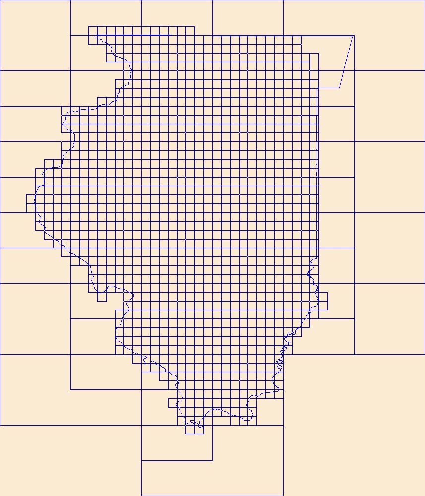
This data represents the map extent for current and historical USGS topographic maps for the United States and Territories, including 1 X 2 Degree, 1 X 1 Degree, 30 X 60 Minute, 15 X 15 Minute, 7.5 X 7.5 Minute, and 3.75 X 3.75 Minute. The grid was generated using ESRI ArcInfo GIS software.
Tags: Adams,
Alexander,
Bond,
Boone,
Boundaries, All tags...
Brown,
Bureau,
Calhoun,
Carroll,
Cass,
Champaign,
Christian,
Clark,
Clay,
Clinton,
Coles,
Cook,
Crawford,
Cumberland,
De Witt,
DeKalb,
Douglas,
Downloadable Data,
DuPage,
Edgar,
Edwards,
Effingham,
Esri File GeoDatabase 10,
Fayette,
FileGDB,
Ford,
Franklin,
Fulton,
Gallatin,
Greene,
Grundy,
Hamilton,
Hancock,
Hardin,
Henderson,
Henry,
IL,
Illinois,
Iroquois,
Jackson,
Jasper,
Jefferson,
Jersey,
Jo Daviess,
Johnson,
Kane,
Kankakee,
Kendall,
Knox,
LaSalle,
Lake,
Lawrence,
Lee,
Livingston,
Logan,
Macon,
Macoupin,
Madison,
Map Indices,
Map Indices,
Map Indices,
Marion,
Marshall,
Mason,
Massac,
McDonough,
McHenry,
McLean,
Menard,
Mercer,
Monroe,
Montgomery,
Morgan,
Moultrie,
Ogle,
Peoria,
Perry,
Piatt,
Pike,
Pope,
Pulaski,
Putnam,
Randolph,
Richland,
Rock Island,
Saline,
Sangamon,
Schuyler,
Scott,
Shelby,
St. Clair,
Stark,
State,
State,
Stephenson,
Tazewell,
US,
Union,
United States,
United States of America,
Vermilion,
Wabash,
Warren,
Washington,
Wayne,
White,
Whiteside,
Will,
Williamson,
Winnebago,
Woodford,
cells,
map indices,
polygon grid, Fewer tags

This data represents the map extent for current and historical USGS topographic maps for the United States and Territories, including 1 X 2 Degree, 1 X 1 Degree, 30 X 60 Minute, 15 X 15 Minute, 7.5 X 7.5 Minute, and 3.75 X 3.75 Minute. The grid was generated using ESRI ArcInfo GIS software.
Types: Citation;
Tags: Adair,
Adams,
Allamakee,
Appanoose,
Audubon, All tags...
Benton,
Black Hawk,
Boone,
Boundaries,
Bremer,
Buchanan,
Buena Vista,
Butler,
Calhoun,
Carroll,
Cass,
Cedar,
Cerro Gordo,
Cherokee,
Chickasaw,
Clarke,
Clay,
Clayton,
Clinton,
Crawford,
Dallas,
Davis,
Decatur,
Delaware,
Des Moines,
Dickinson,
Downloadable Data,
Dubuque,
Emmet,
Esri Shapefile nan,
Fayette,
Floyd,
Franklin,
Fremont,
Greene,
Grundy,
Guthrie,
Hamilton,
Hancock,
Hardin,
Harrison,
Henry,
Howard,
Humboldt,
IA,
Ida,
Iowa,
Iowa,
Jackson,
Jasper,
Jefferson,
Johnson,
Jones,
Keokuk,
Kossuth,
Lee,
Linn,
Louisa,
Lucas,
Lyon,
Madison,
Mahaska,
Map Indices,
Map Indices,
Map Indices,
Marion,
Marshall,
Mills,
Mitchell,
Monona,
Monroe,
Montgomery,
Muscatine,
O'Brien,
Osceola,
Page,
Palo Alto,
Plymouth,
Pocahontas,
Polk,
Pottawattamie,
Poweshiek,
Ringgold,
Sac,
Scott,
Shapefile,
Shelby,
Sioux,
State,
State,
Story,
Tama,
Taylor,
US,
Union,
United States,
United States of America,
Van Buren,
Wapello,
Warren,
Washington,
Wayne,
Webster,
Winnebago,
Winneshiek,
Woodbury,
Worth,
Wright,
cells,
map indices,
polygon grid, Fewer tags
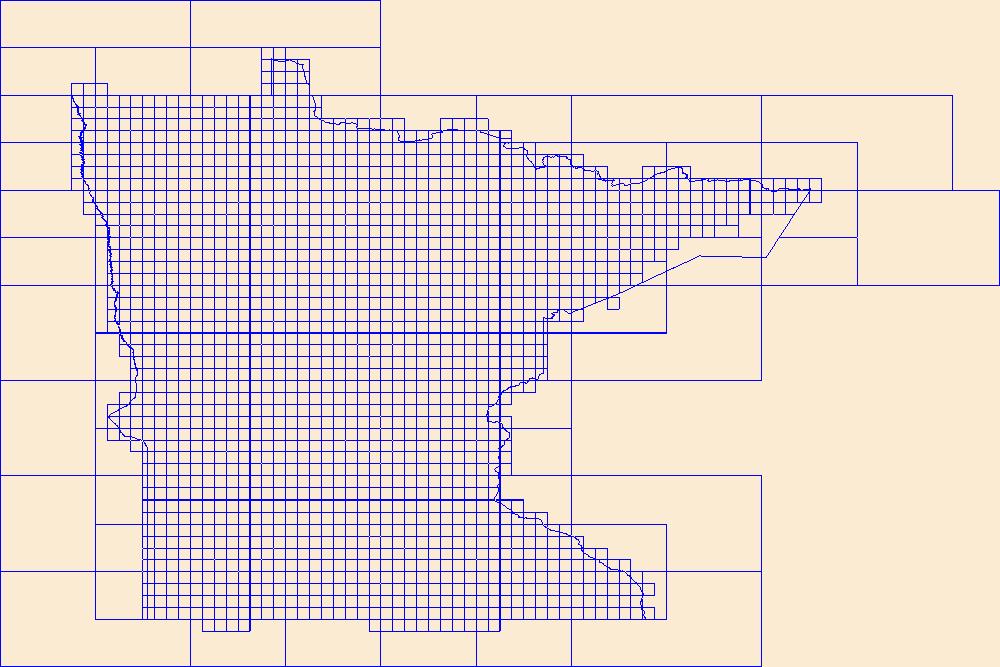
This data represents the map extent for current and historical USGS topographic maps for the United States and Territories, including 1 X 2 Degree, 1 X 1 Degree, 30 X 60 Minute, 15 X 15 Minute, 7.5 X 7.5 Minute, and 3.75 X 3.75 Minute. The grid was generated using ESRI ArcInfo GIS software.
Types: Citation;
Tags: Aitkin,
Anoka,
Becker,
Beltrami,
Benton, All tags...
Big Stone,
Blue Earth,
Boundaries,
Brown,
Carlton,
Carver,
Cass,
Chippewa,
Chisago,
Clay,
Clearwater,
Cook,
Cottonwood,
Crow Wing,
Dakota,
Dodge,
Douglas,
Downloadable Data,
Esri Shapefile nan,
Faribault,
Fillmore,
Freeborn,
Goodhue,
Grant,
Hennepin,
Houston,
Hubbard,
Isanti,
Itasca,
Jackson,
Kanabec,
Kandiyohi,
Kittson,
Koochiching,
Lac qui Parle,
Lake,
Lake of the Woods,
Le Sueur,
Lincoln,
Lyon,
MN,
Mahnomen,
Map Indices,
Map Indices,
Map Indices,
Marshall,
Martin,
McLeod,
Meeker,
Mille Lacs,
Minnesota,
Morrison,
Mower,
Murray,
Nicollet,
Nobles,
Norman,
Olmsted,
Otter Tail,
Pennington,
Pine,
Pipestone,
Polk,
Pope,
Ramsey,
Red Lake,
Redwood,
Renville,
Rice,
Rock,
Roseau,
Scott,
Shapefile,
Sherburne,
Sibley,
St. Louis,
State,
State,
Stearns,
Steele,
Stevens,
Swift,
Todd,
Traverse,
US,
United States,
United States of America,
Wabasha,
Wadena,
Waseca,
Washington,
Watonwan,
Wilkin,
Winona,
Wright,
Yellow Medicine,
cells,
map indices,
polygon grid, Fewer tags
This data represents the map extent for current and historical USGS topographic maps for the United States and Territories, including 1 X 2 Degree, 1 X 1 Degree, 30 X 60 Minute, 15 X 15 Minute, 7.5 X 7.5 Minute, and 3.75 X 3.75 Minute. The grid was generated using ESRI ArcInfo GIS software.
Types: Citation;
Tags: Adams,
Barnes,
Benson,
Billings,
Bottineau, All tags...
Boundaries,
Bowman,
Burke,
Burleigh,
Cass,
Cavalier,
Dickey,
Divide,
Downloadable Data,
Dunn,
Eddy,
Emmons,
Esri Shapefile nan,
Foster,
Golden Valley,
Grand Forks,
Grant,
Griggs,
Hettinger,
Kidder,
LaMoure,
Logan,
Map Indices,
Map Indices,
Map Indices,
McHenry,
McIntosh,
McKenzie,
McLean,
Mercer,
Morton,
Mountrail,
ND,
Nelson,
North Dakota,
Oliver,
Pembina,
Pierce,
Ramsey,
Ransom,
Renville,
Richland,
Rolette,
Sargent,
Shapefile,
Sheridan,
Sioux,
Slope,
Stark,
State,
State,
Steele,
Stutsman,
Towner,
Traill,
US,
United States,
United States of America,
Walsh,
Ward,
Wells,
Williams,
cells,
map indices,
polygon grid, Fewer tags
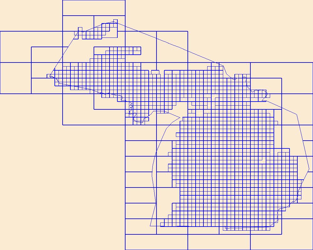
This data represents the map extent for current and historical USGS topographic maps for the United States and Territories, including 1 X 2 Degree, 1 X 1 Degree, 30 X 60 Minute, 15 X 15 Minute, 7.5 X 7.5 Minute, and 3.75 X 3.75 Minute. The grid was generated using ESRI ArcInfo GIS software.
Types: Citation;
Tags: Alcona,
Alger,
Allegan,
Alpena,
Antrim, All tags...
Arenac,
Baraga,
Barry,
Bay,
Benzie,
Berrien,
Boundaries,
Branch,
Calhoun,
Cass,
Charlevoix,
Cheboygan,
Chippewa,
Clare,
Clinton,
Crawford,
Delta,
Dickinson,
Downloadable Data,
Eaton,
Emmet,
Esri Shapefile nan,
Genesee,
Gladwin,
Gogebic,
Grand Traverse,
Gratiot,
Hillsdale,
Houghton,
Huron,
Ingham,
Ionia,
Iosco,
Iron,
Isabella,
Jackson,
Kalamazoo,
Kalkaska,
Kent,
Keweenaw,
Lake,
Lapeer,
Leelanau,
Lenawee,
Livingston,
Luce,
MI,
Mackinac,
Macomb,
Manistee,
Map Indices,
Map Indices,
Map Indices,
Marquette,
Mason,
Mecosta,
Menominee,
Michigan,
Midland,
Missaukee,
Monroe,
Montcalm,
Montmorency,
Muskegon,
Newaygo,
Oakland,
Oceana,
Ogemaw,
Ontonagon,
Osceola,
Oscoda,
Otsego,
Ottawa,
Presque Isle,
Roscommon,
Saginaw,
Sanilac,
Schoolcraft,
Shapefile,
Shiawassee,
St. Clair,
St. Joseph,
State,
State,
Tuscola,
US,
United States,
United States of America,
Van Buren,
Washtenaw,
Wayne,
Wexford,
cells,
map indices,
polygon grid, Fewer tags
This data represents the map extent for current and historical USGS topographic maps for the United States and Territories, including 1 X 2 Degree, 1 X 1 Degree, 30 X 60 Minute, 15 X 15 Minute, 7.5 X 7.5 Minute, and 3.75 X 3.75 Minute. The grid was generated using ESRI ArcInfo GIS software.
Types: Citation;
Tags: Adams,
Asotin,
Benton,
Boundaries,
Chelan, All tags...
Clallam,
Clark,
Columbia,
Cowlitz,
Douglas,
Downloadable Data,
Esri Shapefile nan,
Ferry,
Franklin,
Garfield,
Grant,
Grays Harbor,
Island,
Jefferson,
King,
Kitsap,
Kittitas,
Klickitat,
Lewis,
Lincoln,
Map Indices,
Map Indices,
Map Indices,
Mason,
Okanogan,
Pacific,
Pend Oreille,
Pierce,
San Juan,
Shapefile,
Skagit,
Skamania,
Snohomish,
Spokane,
State,
State,
Stevens,
Thurston,
US,
United States,
United States of America,
WA,
Wahkiakum,
Walla Walla,
Washington,
Whatcom,
Whitman,
Yakima,
cells,
map indices,
polygon grid, Fewer tags
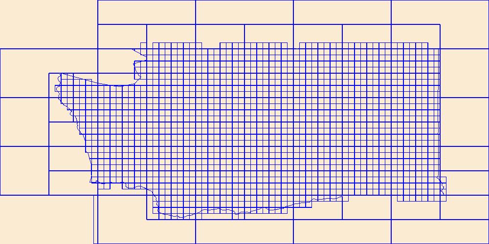
This data represents the map extent for current and historical USGS topographic maps for the United States and Territories, including 1 X 2 Degree, 1 X 1 Degree, 30 X 60 Minute, 15 X 15 Minute, 7.5 X 7.5 Minute, and 3.75 X 3.75 Minute. The grid was generated using ESRI ArcInfo GIS software.
Tags: AR,
Arkansas,
Arkansas,
Ashley,
Baxter, All tags...
Benton,
Boone,
Boundaries,
Bradley,
Calhoun,
Carroll,
Chicot,
Clark,
Clay,
Cleburne,
Cleveland,
Columbia,
Conway,
Craighead,
Crawford,
Crittenden,
Cross,
Dallas,
Desha,
Downloadable Data,
Drew,
Esri File GeoDatabase 10,
Faulkner,
FileGDB,
Franklin,
Fulton,
Garland,
Grant,
Greene,
Hempstead,
Hot Spring,
Howard,
Independence,
Izard,
Jackson,
Jefferson,
Johnson,
Lafayette,
Lawrence,
Lee,
Lincoln,
Little River,
Logan,
Lonoke,
Madison,
Map Indices,
Map Indices,
Map Indices,
Marion,
Miller,
Mississippi,
Monroe,
Montgomery,
Nevada,
Newton,
Ouachita,
Perry,
Phillips,
Pike,
Poinsett,
Polk,
Pope,
Prairie,
Pulaski,
Randolph,
Saline,
Scott,
Searcy,
Sebastian,
Sevier,
Sharp,
St. Francis,
State,
State,
Stone,
US,
Union,
United States,
United States of America,
Van Buren,
Washington,
White,
Woodruff,
Yell,
cells,
map indices,
polygon grid, Fewer tags

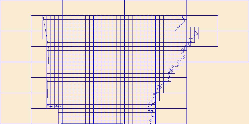
This data represents the map extent for current and historical USGS topographic maps for the United States and Territories, including 1 X 2 Degree, 1 X 1 Degree, 30 X 60 Minute, 15 X 15 Minute, 7.5 X 7.5 Minute, and 3.75 X 3.75 Minute. The grid was generated using ESRI ArcInfo GIS software.
Tags: Boundaries,
Bristol,
Downloadable Data,
Esri File GeoDatabase 10,
FileGDB, All tags...
Kent,
Map Indices,
Map Indices,
Map Indices,
Newport,
Providence,
RI,
Rhode Island,
State,
State,
US,
United States,
United States of America,
Washington,
cells,
map indices,
polygon grid, Fewer tags
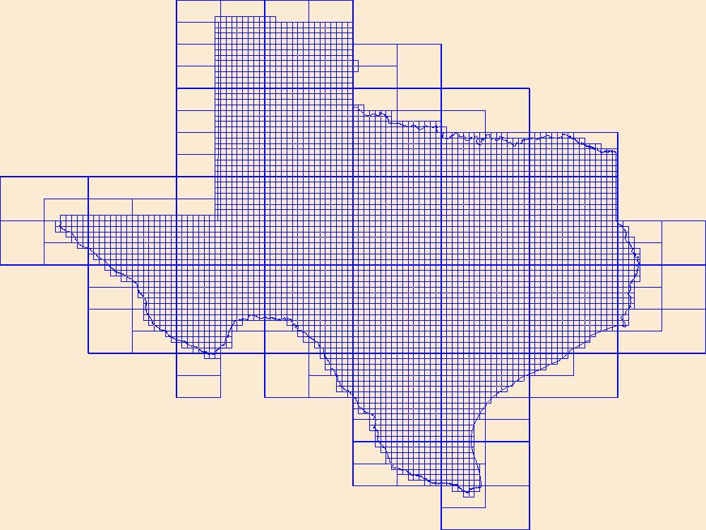
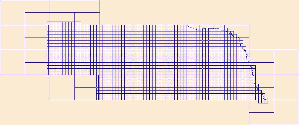
This data represents the map extent for current and historical USGS topographic maps for the United States and Territories, including 1 X 2 Degree, 1 X 1 Degree, 30 X 60 Minute, 15 X 15 Minute, 7.5 X 7.5 Minute, and 3.75 X 3.75 Minute. The grid was generated using ESRI ArcInfo GIS software.
Tags: Anderson,
Andrews,
Angelina,
Aransas,
Archer, All tags...
Armstrong,
Atascosa,
Austin,
Bailey,
Bandera,
Bastrop,
Baylor,
Bee,
Bell,
Bexar,
Blanco,
Borden,
Bosque,
Boundaries,
Bowie,
Brazoria,
Brazos,
Brewster,
Briscoe,
Brooks,
Brown,
Burleson,
Burnet,
Caldwell,
Calhoun,
Callahan,
Cameron,
Camp,
Carson,
Cass,
Castro,
Chambers,
Cherokee,
Childress,
Clay,
Cochran,
Coke,
Coleman,
Collin,
Collingsworth,
Colorado,
Comal,
Comanche,
Concho,
Cooke,
Coryell,
Cottle,
Crane,
Crockett,
Crosby,
Culberson,
Dallam,
Dallas,
Dawson,
DeWitt,
Deaf Smith,
Delta,
Denton,
Dickens,
Dimmit,
Donley,
Downloadable Data,
Duval,
Eastland,
Ector,
Edwards,
El Paso,
Ellis,
Erath,
Esri File GeoDatabase 10,
Falls,
Fannin,
Fayette,
FileGDB,
Fisher,
Floyd,
Foard,
Fort Bend,
Franklin,
Freestone,
Frio,
Gaines,
Galveston,
Garza,
Gillespie,
Glasscock,
Goliad,
Gonzales,
Gray,
Grayson,
Gregg,
Grimes,
Guadalupe,
Hale,
Hall,
Hamilton,
Hansford,
Hardeman,
Hardin,
Harris,
Harrison,
Hartley,
Haskell,
Hays,
Hemphill,
Henderson,
Hidalgo,
Hill,
Hockley,
Hood,
Hopkins,
Houston,
Howard,
Hudspeth,
Hunt,
Hutchinson,
Irion,
Jack,
Jackson,
Jasper,
Jeff Davis,
Jefferson,
Jim Hogg,
Jim Wells,
Johnson,
Jones,
Karnes,
Kaufman,
Kendall,
Kenedy,
Kent,
Kerr,
Kimble,
King,
Kinney,
Kleberg,
Knox,
La Salle,
Lamar,
Lamb,
Lampasas,
Lavaca,
Lee,
Leon,
Liberty,
Limestone,
Lipscomb,
Live Oak,
Llano,
Loving,
Lubbock,
Lynn,
Madison,
Map Indices,
Map Indices,
Map Indices,
Marion,
Martin,
Mason,
Matagorda,
Maverick,
McCulloch,
McLennan,
McMullen,
Medina,
Menard,
Midland,
Milam,
Mills,
Mitchell,
Montague,
Montgomery,
Moore,
Morris,
Motley,
Nacogdoches,
Navarro,
Newton,
Nolan,
Nueces,
Ochiltree,
Oldham,
Orange,
Palo Pinto,
Panola,
Parker,
Parmer,
Pecos,
Polk,
Potter,
Presidio,
Rains,
Randall,
Reagan,
Real,
Red River,
Reeves,
Refugio,
Roberts,
Robertson,
Rockwall,
Runnels,
Rusk,
Sabine,
San Augustine,
San Jacinto,
San Patricio,
San Saba,
Schleicher,
Scurry,
Shackelford,
Shelby,
Sherman,
Smith,
Somervell,
Starr,
State,
State,
Stephens,
Sterling,
Stonewall,
Sutton,
Swisher,
TX,
Tarrant,
Taylor,
Terrell,
Terry,
Texas,
Throckmorton,
Titus,
Tom Green,
Travis,
Trinity,
Tyler,
US,
United States,
United States of America,
Upshur,
Upton,
Uvalde,
Val Verde,
Van Zandt,
Victoria,
Walker,
Waller,
Ward,
Washington,
Webb,
Wharton,
Wheeler,
Wichita,
Wilbarger,
Willacy,
Williamson,
Wilson,
Winkler,
Wise,
Wood,
Yoakum,
Young,
Zapata,
Zavala,
cells,
map indices,
polygon grid, Fewer tags
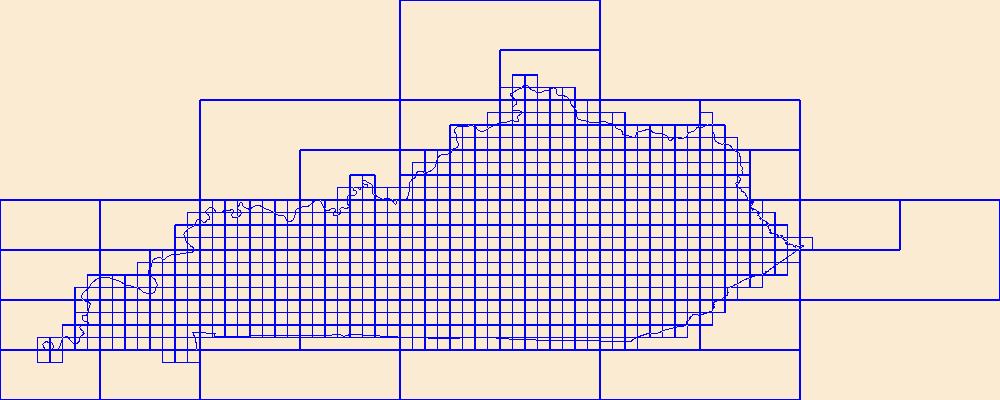
This data represents the map extent for current and historical USGS topographic maps for the United States and Territories, including 1 X 2 Degree, 1 X 1 Degree, 30 X 60 Minute, 15 X 15 Minute, 7.5 X 7.5 Minute, and 3.75 X 3.75 Minute. The grid was generated using ESRI ArcInfo GIS software.
Tags: Adair,
Allen,
Anderson,
Ballard,
Barren, All tags...
Bath,
Bell,
Boone,
Boundaries,
Bourbon,
Boyd,
Boyle,
Bracken,
Breathitt,
Breckinridge,
Bullitt,
Butler,
Caldwell,
Calloway,
Campbell,
Carlisle,
Carroll,
Carter,
Casey,
Christian,
Clark,
Clay,
Clinton,
Crittenden,
Cumberland,
Daviess,
Downloadable Data,
Edmonson,
Elliott,
Esri File GeoDatabase 10,
Estill,
Fayette,
FileGDB,
Fleming,
Floyd,
Franklin,
Fulton,
Gallatin,
Garrard,
Grant,
Graves,
Grayson,
Green,
Greenup,
Hancock,
Hardin,
Harlan,
Harrison,
Hart,
Henderson,
Henry,
Hickman,
Hopkins,
Jackson,
Jefferson,
Jessamine,
Johnson,
KY,
Kenton,
Kentucky,
Knott,
Knox,
Larue,
Laurel,
Lawrence,
Lee,
Leslie,
Letcher,
Lewis,
Lincoln,
Livingston,
Logan,
Lyon,
Madison,
Magoffin,
Map Indices,
Map Indices,
Map Indices,
Marion,
Marshall,
Martin,
Mason,
McCracken,
McCreary,
McLean,
Meade,
Menifee,
Mercer,
Metcalfe,
Monroe,
Montgomery,
Morgan,
Muhlenberg,
Nelson,
Nicholas,
Ohio,
Oldham,
Owen,
Owsley,
Pendleton,
Perry,
Pike,
Powell,
Pulaski,
Robertson,
Rockcastle,
Rowan,
Russell,
Scott,
Shelby,
Simpson,
Spencer,
State,
State,
Taylor,
Todd,
Trigg,
Trimble,
US,
Union,
United States,
United States of America,
Warren,
Washington,
Wayne,
Webster,
Whitley,
Wolfe,
Woodford,
cells,
map indices,
polygon grid, Fewer tags
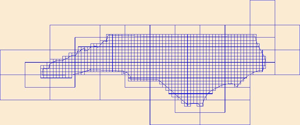
This data represents the map extent for current and historical USGS topographic maps for the United States and Territories, including 1 X 2 Degree, 1 X 1 Degree, 30 X 60 Minute, 15 X 15 Minute, 7.5 X 7.5 Minute, and 3.75 X 3.75 Minute. The grid was generated using ESRI ArcInfo GIS software.
Tags: Alamance,
Alexander,
Alleghany,
Anson,
Ashe, All tags...
Avery,
Beaufort,
Bertie,
Bladen,
Boundaries,
Brunswick,
Buncombe,
Burke,
Cabarrus,
Caldwell,
Camden,
Carteret,
Caswell,
Catawba,
Chatham,
Cherokee,
Chowan,
Clay,
Cleveland,
Columbus,
Craven,
Cumberland,
Currituck,
Dare,
Davidson,
Davie,
Downloadable Data,
Duplin,
Durham,
Edgecombe,
Esri File GeoDatabase 10,
FileGDB,
Forsyth,
Franklin,
Gaston,
Gates,
Graham,
Granville,
Greene,
Guilford,
Halifax,
Harnett,
Haywood,
Henderson,
Hertford,
Hoke,
Hyde,
Iredell,
Jackson,
Johnston,
Jones,
Lee,
Lenoir,
Lincoln,
Macon,
Madison,
Map Indices,
Map Indices,
Map Indices,
Martin,
McDowell,
Mecklenburg,
Mitchell,
Montgomery,
Moore,
NC,
Nash,
New Hanover,
North Carolina,
Northampton,
Onslow,
Orange,
Pamlico,
Pasquotank,
Pender,
Perquimans,
Person,
Pitt,
Polk,
Randolph,
Richmond,
Robeson,
Rockingham,
Rowan,
Rutherford,
Sampson,
Scotland,
Stanly,
State,
State,
Stokes,
Surry,
Swain,
Transylvania,
Tyrrell,
US,
Union,
United States,
United States of America,
Vance,
Wake,
Warren,
Washington,
Watauga,
Wayne,
Wilkes,
Wilson,
Yadkin,
Yancey,
cells,
map indices,
polygon grid, Fewer tags

This data represents the map extent for current and historical USGS topographic maps for the United States and Territories, including 1 X 2 Degree, 1 X 1 Degree, 30 X 60 Minute, 15 X 15 Minute, 7.5 X 7.5 Minute, and 3.75 X 3.75 Minute. The grid was generated using ESRI ArcInfo GIS software.
Tags: AS,
American Samoa,
Boundaries,
Downloadable Data,
Eastern, All tags...
Esri File GeoDatabase 10,
FileGDB,
Manu'a,
Map Indices,
Map Indices,
Map Indices,
Rose Island,
State,
State,
Swains Island,
US,
United States,
United States of America,
Western,
cells,
map indices,
polygon grid, Fewer tags

Cell maps for each oil and gas assessment unit were created by the USGS as a method for illustrating the degree of exploration, type of production, and distribution of production in an assessment unit or province. Each cell represents a quarter-mile square of the land surface, and the cells are coded to represent whether the wells included within the cell are predominantly oil-producing, gas-producing, both oil and gas-producing, dry, or the type of production of the wells located within the cell is unknown. The well information was initially retrieved from the IHS Energy Group, PI/Dwights PLUS Well Data on CD-ROM, which is a proprietary, commercial database containing information for most oil and gas wells in the...
Categories: Data,
pre-SM502.8;
Types: Downloadable,
Map Service,
OGC WFS Layer,
OGC WMS Layer,
Shapefile;
Tags: 501901 = Paleozoic-Tertiary Composite,
50190101 = Neogene Basins,
50190102 = Ranges and Other Structures,
50190103 = Sevier Thrust System,
AZ, All tags...
AZ,
Assessment Unit,
Cells,
Central Nevada Thrust Belt,
Coalbed methane resources,
Earth Science,
Eastern Great Basin,
Eastern Great Basin,
Economic geology,
Energy Resources,
Gas hydrate resources,
Geology,
Great Basin,
ID,
ID,
Lawrence O. Anna,
NV,
NV,
National Assessment of Oil and Gas,
Natural Gas,
Natural Resources,
Natural gas resources,
Neogene Basin,
Neogene Ranges and Structures,
Oil,
Oil sand resources,
Oil shale resources,
Resource Assessment,
Sevier Thrust Belt,
U.S. Geological Survey,
USGS,
USGS Science Data Catalog (SDC),
USGS World Energy Region 5,
USGS World Energy Region 5,
UT,
UT,
United States,
geoscientificInformation,
noga2000,
nogagreatbasin,
oilgas, Fewer tags

Cell maps for each oil and gas assessment unit were created by the USGS as a method for illustrating the degree of exploration, type of production, and distribution of production in an assessment unit or province. Each cell represents a quarter-mile square of the land surface, and the cells are coded to represent whether the wells included within the cell are predominantly oil-producing, gas-producing, both oil and gas-producing, dry, or the type of production of the wells located within the cell is unknown. The well information was initially retrieved from the IHS Energy Group, PI/Dwights PLUS Well Data on CD-ROM, which is a proprietary, commercial database containing information for most oil and gas wells in the...
Categories: Data,
pre-SM502.8;
Types: Downloadable,
Map Service,
OGC WFS Layer,
OGC WMS Layer,
Shapefile;
Tags: 39 = Denver Basin Province,
503901 = Coalbed Methane,
50390181 = Denver Formation Coals,
50390182 = Laramie Formation Coals,
503902 = Upper Cretaceous Fractured Niobrara, All tags...
50390201 = Fractured Niobrara Limestone Transitional,
50390261 = Fractured Niobrara Limestone (Silo Field Area),
503903 = Upper Cretaceous Pierre Shale,
50390361 = Fractured Pierre Shale,
503904 = Lower Cretaceous,
50390401 = Dakota Group and D Sandstone,
50390402 = Subthrust Structural,
503905 = Permian-Pennsylvanian,
50390501 = Permian-Pennsylvanian Reservoirs,
503906 = Cretaceous Composite,
50390601 = Pierre Shale Sandstones,
50390661 = Niobrara-Codell (Wattenberg Area),
50390662 = Dakota Group Basin-Center Gas,
503907 = Upper Cretaceous Niobrara Biogenic Gas,
50390761 = Niobrara Chalk,
Assessment Unit,
CO,
Cells,
Coalbed methane resources,
Colorado Front Range,
Denver Basin,
Earth Science,
Economic geology,
Energy Resources,
Gas hydrate resources,
Geology,
Higley, Debra,
KS,
NE,
National Assessment of Oil and Gas,
Natural Gas,
Natural Resources,
Natural gas resources,
Oil,
Oil sand resources,
Oil shale resources,
Resource Assessment,
SD,
U.S. Geological Survey,
US08 = Colorado,
US31 = Nebraska,
US39 = Kansas,
US46 = South Dakota,
US56 = Wyoming,
USGS,
USGS Science Data Catalog (SDC),
USGS World Energy Region 5,
USGS World Energy Region 5,
United States,
WY,
geoscientificInformation,
noga2000,
nogadbasin,
oilgas, Fewer tags

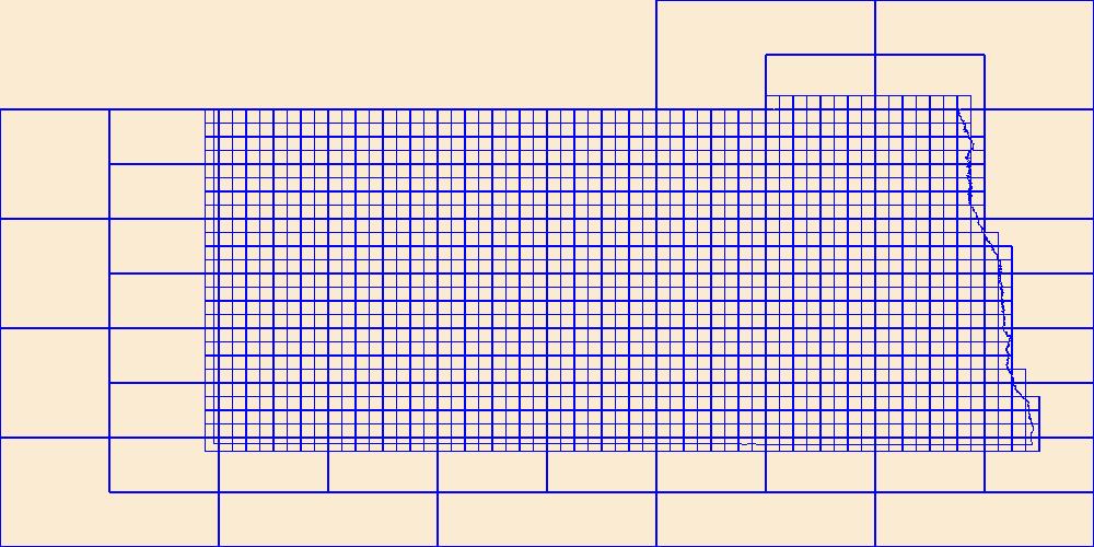
Cell maps for each Paleogene oil and gas assessment unit and each Cretaceous-Tertiary coalbed gas assessment unit were created by the USGS to illustrate the degree of exploration, type of production, and distribution of production in an assessment unit or province. Each cell represents a quarter-mile square of the land surface, and the cells are coded to represent whether the wells included within the cell are predominantly oil-producing, gas-producing, both oil and gas-producing, dry, or the type of production of the wells located within the cell is unknown. The well information was initially retrieved from the IHS Energy Group, PI/Dwights PLUS Well Data on CD-ROM, which is a proprietary, commercial database containing...
Categories: pre-SM502.8;
Tags: 47 = Western Gulf,
48 = East Texas Basin,
49 = Louisiana-Mississippi Salt Basins,
504701 = Upper Jurassic-Cretaceous-Tertiary Composite,
AL, All tags...
Anahuac Gas, Assessment Unit 50470138,
Assessment Unit,
Cells,
Coleman, J.L.,
Cretaceous Olmos Coalbed Gas, Assessment Unit 50470281,
Cretaceous-Tertiary Coal Beds,
Cretaceous-Tertiary Coalbed Gas, Assessment Unit 50470481,
Earth Science,
East Texas Basin,
Economic geology,
Energy Resources,
Frio Expanded Fault Zone Oil and Gas, Assessment Unit 50470136,
Frio Slope and Basin Floor Gas, Assessment Unit 50470137,
Frio Stable Shelf Oil, Assessment Unit 50470135,
Geology,
Gulf Coast,
Hackberry Oil and Gas, Assessment Unit 50470139,
Hackley, P.C.,
Hayba, D.O.,
Jackson Expanded Fault Zone Gas and Oil, Assessment Unit 50470128,
Jackson Louisiana-Mississippi-Alabama Area, Assessment Unit 50470130,
Jackson Slope and Basin Floor Gas, Assessment Unit 50470129,
Jackson Stable Shelf Oil and Gas, Assessment Unit 50470127,
Karlsen, A.W.,
LA,
Louisiana-Mississippi Salt Basins,
Lower Claiborne Cane River Area, Assessment Unit 50470123,
Lower Claiborne Expanded Fault Zone Gas, Assessment Unit 50470121,
Lower Claiborne Slope and Basin Floor Gas, Assessment Unit 50470122,
Lower Claiborne Stable Shelf Oil, Assessment Unit 50470120,
MS,
National Assessment of Oil and Gas,
Natural Gas,
Natural Resources,
Natural gas resources,
Oil,
Oil sand resources,
Oil shale resources,
Paleogene System,
Resource Assessment,
Rio Escondido Basin Olmos Coalbed Gas, Assessment Unit 53000281,
Swanson, S.M.,
TX,
U.S. Geological Survey,
US01 = Alabama,
US22 = Louisiana,
US28 = Mississippi,
US48 = Texas,
USGS,
USGS Science Data Catalog (SDC),
USGS World Energy Region 5,
USGS World Energy Region 5,
United States,
Upper Claiborne Expanded Fault Zonr Gas, Assessment Unit 50470125,
Upper Claiborne Slope and Basin Floor Gas, Assessment Unit 50470126,
Upper Claiborne Stable Shelf Oil, Assessment Unit 50470124,
Vicksburg Expanded Fault Zone Gas and Oil, Assessment Unit 50470132,
Vicksburg Mississippi-Alabama Area, Assessment Unit 50470134,
Vicksburg Slope and Basin Floor Gas, Assessment Unit 50470133,
Vicksburg Stable Shelf Oil and Gas, Assessment Unit 50470131,
Warwick, P.D.,
Western Gulf,
Wilcox Coalbed Gas, Assessment Unit 50470381,
Wilcox Expanded Fault Zone Gas and Oil, Assessment Unit 50470117,
Wilcox Slope and Basin Floor Gas, Assessment Unit 50470118,
Wilcox Stable Shelf Oil and Gas, Assessment Unit 50470116,
Wilcox-Lobo Slide Block Gas, Assessment Unit 50470119,
geoscientificInformation,
gulfroom,
noga2000,
nogaflorida,
nogagulf,
nogatertiary,
oilgas, Fewer tags

Cell maps for each oil and gas assessment unit were created by the USGS as a method for illustrating the degree of exploration, type of production, and distribution of production in an assessment unit or province. Each cell represents a quarter-mile square of the land surface, and the cells are coded to represent whether the wells included within the cell are predominantly oil-producing, gas-producing, both oil and gas-producing, dry, or the type of production of the wells located within the cell is unknown. The well information was initially retrieved from the IHS Energy Group, PI/Dwights PLUS Well Data on CD-ROM, which is a proprietary, commercial database containing information for most oil and gas wells in the...
Categories: Data;
Types: Downloadable,
Map Service,
OGC WFS Layer,
OGC WMS Layer,
Shapefile;
Tags: 503301 = Tertiary-Upper Cretaceous Coalbed Methane,
50330101 = Eastern Basin Margin Upper Fort Union Sandstone,
50330181 = Wasatch Formation,
50330182 = Upper Fort Union Formation,
50330183 = Lower Fort Union-Lance Formations, All tags...
503302 = Mowry,
50330261 = Mowry Continuous Oil Assessment Unit,
503303 = Niobrara,
50330361 = Niobrara Continuous Oil Assessment Unit,
503304 = Cretaceous Biogenic Gas,
50330461 = Shallow Continuous Biogenic Gas Assessment Unit,
Assessment Unit,
Cells,
Coalbed methane resources,
Earth Science,
Economic geology,
Energy Resources,
Gas hydrate resources,
Geology,
MT,
National Assessment of Oil and Gas,
Natural Gas,
Natural Resources,
Natural gas resources,
Oil,
Oil sand resources,
Oil shale resources,
Powder River Basin,
Powder River Basin,
Resource Assessment,
Rocky Mountains and Northern Great Plains,
Schenk, C. J.,
U.S. Geological Survey,
US30 = Montana,
US56 = Wyoming,
USGS,
USGS Science Data Catalog (SDC),
USGS World Energy Region 5,
USGS World Energy Region 5,
USGS:60c7aa6ad34e86b9389b2369,
United States,
WY,
geoscientificInformation,
noga2000,
nogapowder,
oilgas, Fewer tags
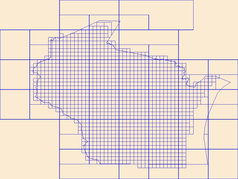
This data represents the map extent for current and historical USGS topographic maps for the United States and Territories, including 1 X 2 Degree, 1 X 1 Degree, 30 X 60 Minute, 15 X 15 Minute, 7.5 X 7.5 Minute, and 3.75 X 3.75 Minute. The grid was generated using ESRI ArcInfo GIS software.
Tags: Adams,
Ashland,
Barron,
Bayfield,
Boundaries, All tags...
Brown,
Buffalo,
Burnett,
Calumet,
Chippewa,
Clark,
Columbia,
Crawford,
Dane,
Dodge,
Door,
Douglas,
Downloadable Data,
Dunn,
Eau Claire,
Esri File GeoDatabase 10,
FileGDB,
Florence,
Fond du Lac,
Forest,
Grant,
Green,
Green Lake,
Iowa,
Iron,
Jackson,
Jefferson,
Juneau,
Kenosha,
Kewaunee,
La Crosse,
Lafayette,
Langlade,
Lincoln,
Manitowoc,
Map Indices,
Map Indices,
Map Indices,
Marathon,
Marinette,
Marquette,
Menominee,
Milwaukee,
Monroe,
Oconto,
Oneida,
Outagamie,
Ozaukee,
Pepin,
Pierce,
Polk,
Portage,
Price,
Racine,
Richland,
Rock,
Rusk,
Sauk,
Sawyer,
Shawano,
Sheboygan,
St. Croix,
State,
State,
Taylor,
Trempealeau,
US,
United States,
United States of America,
Vernon,
Vilas,
WI,
Walworth,
Washburn,
Washington,
Waukesha,
Waupaca,
Waushara,
Winnebago,
Wisconsin,
Wood,
cells,
map indices,
polygon grid, Fewer tags

This data represents the map extent for current and historical USGS topographic maps for the United States and Territories, including 1 X 2 Degree, 1 X 1 Degree, 30 X 60 Minute, 15 X 15 Minute, 7.5 X 7.5 Minute, and 3.75 X 3.75 Minute. The grid was generated using ESRI ArcInfo GIS software.
Tags: Albany,
Big Horn,
Boundaries,
Campbell,
Carbon, All tags...
Converse,
Crook,
Downloadable Data,
Esri File GeoDatabase 10,
FileGDB,
Fremont,
Goshen,
Hot Springs,
Johnson,
Laramie,
Lincoln,
Map Indices,
Map Indices,
Map Indices,
Natrona,
Niobrara,
Park,
Platte,
Sheridan,
State,
State,
Sublette,
Sweetwater,
Teton,
US,
Uinta,
United States,
United States of America,
WY,
Washakie,
Weston,
Wyoming,
cells,
map indices,
polygon grid, Fewer tags
This data represents the map extent for current and historical USGS topographic maps for the United States and Territories, including 1 X 2 Degree, 1 X 1 Degree, 30 X 60 Minute, 15 X 15 Minute, 7.5 X 7.5 Minute, and 3.75 X 3.75 Minute. The grid was generated using ESRI ArcInfo GIS software.
Tags: Adams,
Antelope,
Arthur,
Banner,
Blaine, All tags...
Boone,
Boundaries,
Box Butte,
Boyd,
Brown,
Buffalo,
Burt,
Butler,
Cass,
Cedar,
Chase,
Cherry,
Cheyenne,
Clay,
Colfax,
Cuming,
Custer,
Dakota,
Dawes,
Dawson,
Deuel,
Dixon,
Dodge,
Douglas,
Downloadable Data,
Dundy,
Esri File GeoDatabase 10,
FileGDB,
Fillmore,
Franklin,
Frontier,
Furnas,
Gage,
Garden,
Garfield,
Gosper,
Grant,
Greeley,
Hall,
Hamilton,
Harlan,
Hayes,
Hitchcock,
Holt,
Hooker,
Howard,
Jefferson,
Johnson,
Kearney,
Keith,
Keya Paha,
Kimball,
Knox,
Lancaster,
Lincoln,
Logan,
Loup,
Madison,
Map Indices,
Map Indices,
Map Indices,
McPherson,
Merrick,
Morrill,
NE,
Nance,
Nebraska,
Nemaha,
Nuckolls,
Otoe,
Pawnee,
Perkins,
Phelps,
Pierce,
Platte,
Polk,
Red Willow,
Richardson,
Rock,
Saline,
Sarpy,
Saunders,
Scotts Bluff,
Seward,
Sheridan,
Sherman,
Sioux,
Stanton,
State,
State,
Thayer,
Thomas,
Thurston,
US,
United States,
United States of America,
Valley,
Washington,
Wayne,
Webster,
Wheeler,
York,
cells,
map indices,
polygon grid, Fewer tags
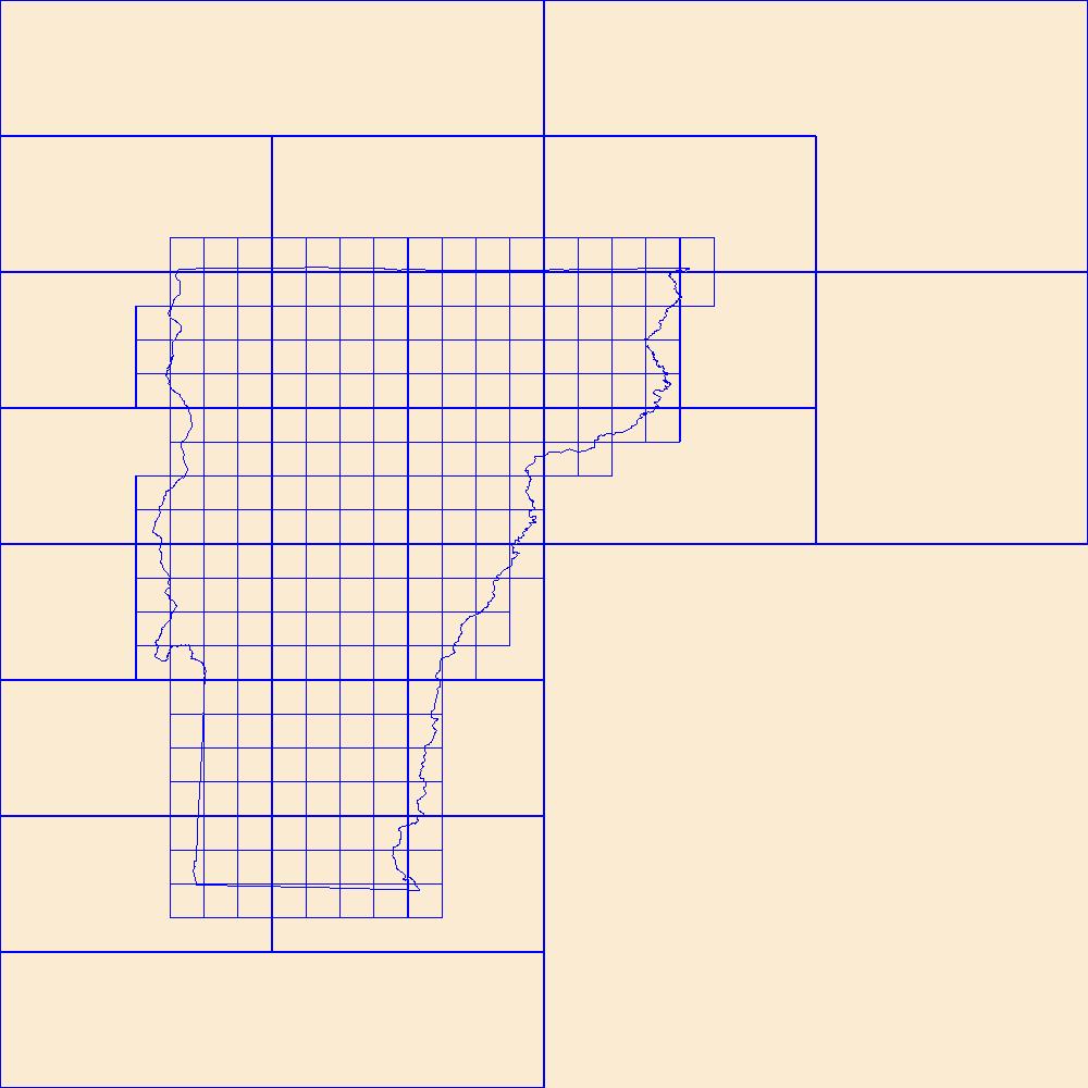
This data represents the map extent for current and historical USGS topographic maps for the United States and Territories, including 1 X 2 Degree, 1 X 1 Degree, 30 X 60 Minute, 15 X 15 Minute, 7.5 X 7.5 Minute, and 3.75 X 3.75 Minute. The grid was generated using ESRI ArcInfo GIS software.
Tags: Addison,
Bennington,
Boundaries,
Caledonia,
Chittenden, All tags...
Downloadable Data,
Esri File GeoDatabase 10,
Essex,
FileGDB,
Franklin,
Grand Isle,
Lamoille,
Map Indices,
Map Indices,
Map Indices,
Orange,
Orleans,
Rutland,
State,
State,
US,
United States,
United States of America,
VT,
Vermont,
Washington,
Windham,
Windsor,
cells,
map indices,
polygon grid, Fewer tags
|
|

