Filters: Tags: Chicago (X)
33 results (16ms)|
Filters
Date Range
Extensions Types Contacts
Categories Tag Types
|
These data represent the air-free pH and specific conductance per pore volume of effluent generated by the phosphate removal column experiment. Solid samples used for the columns are of modern and legacy iron and steel slag from the Chicago-Gary area of Illinois and Indiana, USA.
These data are high-resolution bathymetry (riverbed elevation) in compressed LAS (*.laz) format, generated from the July 17–19, 2023, hydrographic survey of Bubbly Creek and various sidings, harbors, and turning basins on the Chicago Sanitary and Ship Canal (CS&SC) in Cook County, Illinois. The survey includes all Bubbly Creek from the confluence with the CS&SC in the north to the Racine Avenue Pump station in the south; various sidings and turning basins along the CS&SC between Kedzie Avenue and South Halsted Street; and the Marine Safety Station harbor near the Chicago Harbor Lock on Lake Michigan. This survey is a continuation and enhancement of the bathymetric survey of the CS&SC in Cook County, Illinois, conducted...

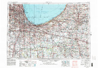
USGS Historical Quadrangle in GeoPDF.
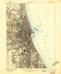
USGS Historical Quadrangle in GeoPDF.
These data represent the major, minor, and trace element compositions of effluent water samples generated by column experiments of modern and legacy iron and steel slag from the Chicago-Gary area of Illinois and Indiana. Details of the column experiments may be reviewed in the journal article listed in the cross-reference section of this data release titled, "Geochemical Characterization of Iron and Steel Slag and Its Potential to Remove Phosphate and Neutralize Acid".
This dataset contains the trace element concentration results for samples collected from tapwater sites in East Chicago, Indiana, August-September, 2017, and Chicago, Illinois, July-December, 2017. Samples were collected one time, from 45 private residences and associated drinking water plants and source water locations. Water-quality samples were analyzed at two U.S. Geological Survey laboratories: National Water Quality Laboratory, Denver, Colorado and at the Redox Chemistry Laboratory, Boulder, Colorado.
These data are high-resolution bathymetry (riverbed elevation) in compressed LAS (*.laz) format, generated from the August 22–24, 2022, hydrographic survey of the Chicago Sanitary and Ship Canal (CS&SC) and sections of the Chicago River and North Branch Chicago River in Cook County, Illinois. The survey extends from the Cook County line near Interstate 355 in the southwest upstream to the Chicago Harbor Lock on the Chicago River in the northeast, and northward on the North Branch Chicago River to the North Avenue Turning Basin in the north. Hydrographic data were collected using a high-resolution multibeam echosounder mapping system (MBMS), which consists of a multibeam echosounder (MBES) and an inertial navigation...
These data represent the acid neutralization potential and grain size analysis of 13 samples, 2 duplicate samples, of modern and legacy iron and steel slag from the Chicago-Gary area of Illinois and Indiana, USA.
This data release contains hydraulic conductivity data from single well (slug) tests conducted from the slag-filled material of the open interval of monitoring well 37N14E-13.3a1 (MW2, United States Geological Survey [USGS] site number 414121087335701), Big Marsh, Chicago, Illinois, to calculate groundwater discharge into nearby ponds. Six mechanical slug tests were conducted on October 27, 2016, in monitoring well 37N14E-13.3a1 (MW2, USGS site number 414121087335701) within the Big Marsh, in Chicago, Illinois, in the historic Calumet Area of Chicago. The tests were undertaken as part of a study to measure the horizontal hydraulic conductivity as an effort to calculate the flux and water-balance of Big Marsh. Three...
Categories: Data;
Tags: Chicago,
Hydrogeology,
USGS Science Data Catalog (SDC),
biota,
hydraulic conductivity
This paper introduces the analyses of the potential impacts of climate change on the city of Chicago and the Great Lakes region and potential response options that provide the basis for this special issue. Covering projected changes in climate and hydrology, this collection of studies first estimates the potential impacts of climate change on human health, natural ecosystems, water resources, energy, and infrastructure in the city of Chicago and the surrounding Great Lakes region. A consistent set of future climate projections have been used as the basis for each analysis, which together provide a vivid impression of the consequences likely to result under the SRES higher (A1FI) as compared to the lower (B1) emission...
Categories: Publication;
Types: Citation;
Tags: Assessment,
Chicago,
Climate change,
Data Visualization & Tools,
Great Lakes,
These data represent the major, minor, and trace element compositions of laboratory generated leachates of modern and legacy iron and steel slag from the Chicago-Gary area of Illinois and Indiana, USA using USEPA method 1312 Synthetic Precipitation Leaching Procedure.
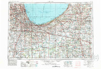
USGS Historical Quadrangle in GeoPDF.
The U.S. Geological Survey (USGS), in cooperation with the Cook County Bureau of Technology (BOT), prioritized waterbodies (lakes, rivers, and canals) of interest within Cook County to survey in 2022. These surveys describe the bathymetry and basic water-quality conditions observed, and could be used by the BOT to assist with resource management decisions and uses, as well as build an inventory that could be shared with other local governmental agencies. Waterbodies surveyed in 2022 and included in this data release are: Arrowhead Lake, Axehead Lake, Baker's Lake, Belly Deep Slough, Bode Lake North, Bode Lake South, Bull Frog Lake, Busse Lake Main Pool, Busse Lake North Pool, Busse Lake South Pool, Busse Woods...
Categories: Data;
Types: Map Service,
OGC WFS Layer,
OGC WMS Layer,
OGC WMS Service;
Tags: Chicago,
Cook County,
Environmental Health,
Geography,
Hydrology,
This location is part of the Arizona Mineral Industry Location System (AzMILS), an inventory of mineral occurences, prospects and mine locations in Arizona. Yavapai435 is located in T10N R6W Sec 11 S2 in the Congress - 7.5 Min quad. This collection consists of various reports, maps, records and related materials acquired by the Arizona Department of Mines and Mineral Resources regarding mining properties in Arizona. Information was obtained by various means, including the property owners, exploration companies, consultants, verbal interviews, field visits, newspapers and publications. Some sections may be redacted for copyright. Please see the access statement.

USGS Historical Quadrangle in GeoPDF.
USGS Historical Quadrangle in GeoPDF.
These data are high-resolution bathymetry (riverbed elevation) in compressed LAS (*.laz) format, generated from the August 1–3, 2022, hydrographic survey of the Calumet River and Calumet Sag Channel in Cook County, Illinois. The survey extends from the junction with Lake Michigan in the northeast downstream to the junction with the Chicago Sanitary and Ship Canal in the southwest. Hydrographic data were collected using a high-resolution multibeam echosounder mapping system (MBMS), which consists of a multibeam echosounder (MBES) and an inertial navigation system (INS) mounted on a marine survey vessel. Data were collected as the vessel traversed the channel along overlapping longitudinal survey lines distributed...
This text file (Reference_List_V1.txt) lists references that describe relevant characteristics for reservoir thermal energy storage (RTES) research in the United States. References are grouped by corresponding city, including: Albuquerque, New Mexico; Charleston, South Carolina; Chicago, Illinois; Decatur, Illinois; Lansing, Michigan; Memphis, Tennessee; Phoenix, Arizona; and Portland, Oregon. The document includes hyphenated lines and headers to distinguish city-specific subsections. Internet links are provided for each reference in the event that the reference was accessible online (as of January 28, 2021).
Types: Map Service,
OGC WFS Layer,
OGC WMS Layer,
OGC WMS Service;
Tags: Albuquerque,
Arizona,
Charleston,
Chicago,
Decatur,
These data are high-resolution bathymetry (riverbed elevation) in compressed LAS (*.laz) format, generated from the July 17–18, 2023, hydrographic survey of the North Branch Chicago River and North Shore Channel in Cook County, Illinois. The survey extends from near the North Avenue Turning Basin and Goose Island in the south, upstream to the Metropolitan Water Reclamation District (MWRD) Wilmette Pumping station in the north. The survey is a continuation of the bathymetric survey of the Chicago River and Chicago Sanitary and Ship Canal (CS&SC) in Cook County, Illinois, conducted August 22–24, 2022 (Huizinga and Rivers, 2023). These data also include an ultra-high resolution resurvey of a large sunken vessel discovered...

USGS Historical Quadrangle in GeoPDF.
|

|
