Filters
Date Range
Types
Contacts
Tag Types
Tag Schemes
|
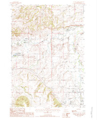
USGS Historical Quadrangle in GeoPDF.
Tags: 7.5 x 7.5 minute,
Chicken Creek,
Downloadable Data,
GeoPDF,
GeoTIFF, All tags...
Historical Topographic Maps,
Historical Topographic Maps 7.5 x 7.5 Minute Map Series,
Map,
SD,
imageryBaseMapsEarthCover, Fewer tags

This publication, GPR 2017-1, provides geophysical data produced from an airborne geophysical survey conducted in 2001 and released in 2002 for 276 sq miles of the Liberty Bell area, western Bonnifield mining district, central Alaska. Aeromagnetic and electromagnetic data were acquired during the survey. During 2016, the same digital data were reformatted for ease of use with modern processing tools; vector shapefiles and the analytic signal and calculated first vertical derivative grids were added. Other than the creation of calculated grids, no new processing was done. Data provided in GPR 2017-1 include processed (1) linedata ASCII databases, (2) gridded files of magnetic and resistivity data, (3) vector files...
Tags: Aeromagnetic,
Aeromagnetic Data,
Aeromagnetic Map,
Aeromagnetic Survey,
Airborne Geophysical Survey, All tags...
Alaska, State of,
Apparent Resistivity Data,
Apparent Resistivity Map,
Apparent Resistivity Survey,
Bonanza Creek,
Bonnifield Mining District,
Buzzard Creek,
California Creek,
Chicken Creek,
Coal Creek,
Cody Creek,
DIGHEM-V EM System,
Daniels Creek,
Digital Elevation Model,
Eagle Creek,
Electromagnetic Anomalies,
Electromagnetic Data,
Electromagnetic Survey,
Elsie Creek,
Emma Creek,
Eva Creek,
Fairbanks Quadrangle,
First Vertical Derivative,
Fourth of July Creek,
Geophysical Map,
Geophysical Survey,
Geophysics,
Geophysics Search Tag,
Homestake Creek,
Iron Creek,
Liberty Bell Mine,
Little Moose Creek,
Lynx Creek,
Magnetics,
Marguerite Creek,
McAdam Creek,
Resistivity,
Resistivity Survey,
Rex Creek,
Rex Dome,
Saint Charles Creek,
Spruce Creek,
Steep Creek,
Wilson Creek,
Winter Creek,
geoscientificInformation, Fewer tags
This data set contains imagery from the National Agriculture Imagery Program (NAIP). The NAIP program is administered by USDA FSA and has been established to support two main FSA strategic goals centered on agricultural production. These are increase stewardship of America's natural resources while enhancing the environment, and to ensure commodities are procured and distributed effectively and efficiently to increase food security. The NAIP program supports these goals by acquiring and providing ortho imagery that has been collected during the agricultural growing season in the U.S. The NAIP ortho imagery is tailored to meet FSA requirements and is a fundamental tool used to support FSA farm and conservation programs....
Types: Citation;
Tags: 3.75 x 3.75 minute,
4410325,
46081,
Aerial Compliance,
CHICKEN CREEK, All tags...
CHICKEN CREEK, NW,
Compliance,
Digital Ortho rectified Image,
Downloadable Data,
JPEG 2000,
JPEG2000,
LAWRENCE CO SD FSA,
Lawrence,
NAIP,
Ortho Rectification,
Orthoimagery,
Quarter Quadrangle,
SD,
SD081,
USDA National Agriculture Imagery Program (NAIP),
farming,
imageryBaseMapsEarthCover, Fewer tags
This data set contains imagery from the National Agriculture Imagery Program (NAIP). The NAIP program is administered by USDA FSA and has been established to support two main FSA strategic goals centered on agricultural production. These are increase stewardship of America's natural resources while enhancing the environment, and to ensure commodities are procured and distributed effectively and efficiently to increase food security. The NAIP program supports these goals by acquiring and providing ortho imagery that has been collected during the agricultural growing season in the U.S. The NAIP ortho imagery is tailored to meet FSA requirements and is a fundamental tool used to support FSA farm and conservation programs....
Types: Citation;
Tags: 3.75 x 3.75 minute,
4410325,
46081,
Aerial Compliance,
CHICKEN CREEK, All tags...
CHICKEN CREEK, NE,
Compliance,
Digital Ortho rectified Image,
Downloadable Data,
JPEG 2000,
JPEG2000,
LAWRENCE CO SD FSA,
Lawrence,
NAIP,
Ortho Rectification,
Orthoimagery,
Quarter Quadrangle,
SD,
SD081,
USDA National Agriculture Imagery Program (NAIP),
farming,
imageryBaseMapsEarthCover, Fewer tags
This data set contains imagery from the National Agriculture Imagery Program (NAIP). The NAIP program is administered by USDA FSA and has been established to support two main FSA strategic goals centered on agricultural production. These are increase stewardship of America's natural resources while enhancing the environment, and to ensure commodities are procured and distributed effectively and efficiently to increase food security. The NAIP program supports these goals by acquiring and providing ortho imagery that has been collected during the agricultural growing season in the U.S. The NAIP ortho imagery is tailored to meet FSA requirements and is a fundamental tool used to support FSA farm and conservation programs....
Types: Citation;
Tags: 3.75 x 3.75 minute,
4410325,
46081,
Aerial Compliance,
CHICKEN CREEK, All tags...
CHICKEN CREEK, SW,
Compliance,
Digital Ortho rectified Image,
Downloadable Data,
JPEG 2000,
JPEG2000,
LAWRENCE CO SD FSA,
Lawrence,
NAIP,
Ortho Rectification,
Orthoimagery,
Quarter Quadrangle,
SD,
SD081,
USDA National Agriculture Imagery Program (NAIP),
farming,
imageryBaseMapsEarthCover, Fewer tags
This data set contains imagery from the National Agriculture Imagery Program (NAIP). The NAIP program is administered by USDA FSA and has been established to support two main FSA strategic goals centered on agricultural production. These are increase stewardship of America's natural resources while enhancing the environment, and to ensure commodities are procured and distributed effectively and efficiently to increase food security. The NAIP program supports these goals by acquiring and providing ortho imagery that has been collected during the agricultural growing season in the U.S. The NAIP ortho imagery is tailored to meet FSA requirements and is a fundamental tool used to support FSA farm and conservation programs....
Types: Citation;
Tags: 3.75 x 3.75 minute,
4410325,
46081,
Aerial Compliance,
CHICKEN CREEK, All tags...
CHICKEN CREEK, SE,
Compliance,
Digital Ortho rectified Image,
Downloadable Data,
JPEG 2000,
JPEG2000,
LAWRENCE CO SD FSA,
Lawrence,
NAIP,
Ortho Rectification,
Orthoimagery,
Quarter Quadrangle,
SD,
SD081,
USDA National Agriculture Imagery Program (NAIP),
farming,
imageryBaseMapsEarthCover, Fewer tags
|
|

