Filters: Tags: Climatology (X)
1,004 results (50ms)|
Filters
Date Range
Extensions
Types
Contacts
Categories Tag Types
|
Monthly temperature and precipitation data from 41 global climate models (GCMs) of the Coupled Model Intercomparison Project Phase 5 (CMIP5) were compared to observations for the 20th century, with a focus on the U.S. Pacific Northwest (PNW) and surrounding region. A suite of statistics, or metrics, was calculated, including correlation and variance of mean seasonal spatial patterns, amplitude of seasonal cycle, diurnal temperature range, annual- to decadal-scale variance, long-term persistence, and regional teleconnections to El Niño Southern Oscillation (ENSO). Performance, or credibility, was assessed based on the GCMs' abilities to reproduce the observed metrics. GCMs were ranked in their credibility using two...
Categories: Publication;
Types: Citation;
Tags: 20th century,
CMIP5,
Climatology,
Data Visualization & Tools,
Empirical orthogonal function,
Model Inputs: Midwest Climate Change Vulnerability Assessment for the U.S. Fish and Wildlife Service
This data release contains the climate change model inputs and Soil and Water Assessment Tool (SWAT) model outputs from 360 HUC-8 watersheds in the Midwest United States (Illinois, Indiana, Iowa, Michigan, Minnesota, Ohio, and Wisconsin), that were generated using the HAWQS (Hydrologic and Water Quality System) platform (https://hawqs.tamu.edu). The summarized data for a watershed-based climate change vulnerability assessment for U.S. Fish and Wildlife Service is also provided, along with the R code used to summarize the raw outputs.
This data release contains hourly means of climatological data collected by the U.S. Geological Survey (USGS) from 10/1/1991 to 9/30/2019 at three weather stations in the Loch Vale watershed in Rocky Mountain National Park (RMNP), Colorado. In order of increasing elevation, the three weather stations are Loch Vale meteorological station at RMNP, Colo. (Main weather station, USGS station 401719105394311) at an elevation of 2,925 meters (m) above North American Vertical Datum of 1988 (NAVD 88), Andrews Creek meteorological station at RMNP, Colo. (Andrews Creek weather station, USGS station 401723105400101) at an elevation of 2,990 m above NAVD 88 and Sharkstooth meteorological station at RMNP, Colo. (Sharkstooth weather...
Categories: Data;
Types: Downloadable,
Map Service,
OGC WFS Layer,
OGC WMS Layer,
OGC WMS Service,
Shapefile;
Tags: 177847,
Climatology,
Hydrology,
Rocky Mountain National Park,
The Loch,
The RTK survey, using a Trimble unit, was conducted in August 2021 in the coastal plains region (1002 area) of the Arctic National Wildlife Refuge, as part of a landscape vulnerability assessment. A total of six transects are included in the data, including five research sites and one transect collected at the camp site. Mean horizontal precision was 0.006m, mean vertical precision was 0.011m.
Categories: Data;
Tags: Arctic,
Arctic National Wildlife Refuge,
Climatology,
Geography,
Geomorphology,
With increasing concerns about the impact of warming temperatures on water resources, more attention is being paid the relationship between runoff and precipitation, or runoff efficiency. Temperature is a key influence on Colorado River runoff efficiency, and warming temperatures are projected to reduce runoff efficiency. Here, we investigate the nature of runoff efficiency in the upper Colorado River (UCRB) basin over the past 400 years, with a specific focus on major droughts and pluvials, and to contextualize the instrumental period. We first verify the feasibility of reconstructing runoff efficiency from tree-ring data. The reconstruction is then used to evaluate variability in runoff efficiency over periods...
Categories: Data;
Tags: Climatology,
Climatology,
Colorado River,
Hydrology,
Lees Ferry (historical),
These data were compiled using a new multivariate matching algorithm that transfers simulated soil moisture conditions (Bradford et al. 2020) from an original 10-km resolution to a 30-arcsec spatial resolution. Also, these data are a supplement to a previously published journal article (Bradford et al., 2020) and USGS data release (Bradford and Schlaepfer, 2020). The objectives of our study were to (1) characterize geographic patterns in ecological drought under historical climate, (2) quantify the direction and magnitude of projected responses in ecological drought under climate change, (3) identify areas and drought metrics with projected changes that are robust across climate models for a representative set of...
These data were compiled to allow further understanding of how aboveground net primary production of different plant functional types in ecosystems along an elevation gradient in the southwestern U.S. respond to extreme changes in warm-season precipitation (drought and water addition) associated with the North American Monsoon. The objectives of the study were to 1) determine how primary production responds to warm-season precipitation extremes over time; 2) compare production sensitivities to warm-season precipitation (slopes of production – precipitation relationships) across an elevation gradient; 3) evaluate whether the sensitivity of production differed under extreme dry and wet years compared to ambient precipitation....
These data were collected from the TOPGUN-SODA10 2AK core collected in 2010 by LacCore (University of Minnesota), the USGS. and the University of California (U.C.) Berkeley. The 8.9 meter length core had stable isotopes of oxygen and carbon sampled every 10 millimeters or so, and diatoms samples at every 50 millimeters to 200 millimeters depending on the depth in the core. mineralogic data were collected using X-ray diffraction and grain-size analysis were done at various depths. These data are used to interpret the Holocene and late Pleistocene hydrology and paleoclimate of the lake and the region. The interpretation can be found in: Rosen, M.R., Reidy, L., Starratt, S., Zimmerman, S., in review, Middle Holocene...
Categories: Data;
Tags: Aquatic Biology,
Big Soda Lake,
Central Nevada Desert Basins,
Climatology,
Diatoms,
On the continental scale, climate is an important determinant of the distributions of plant taxa and ecoregions. To quantify and depict the relations between specific climate variables and these distributions, we placed modern climate and plant taxa distribution data on an approximately 25-kilometer (km) equal-area grid with 27,984 points that cover Canada and the continental United States (Thompson and others, 2015). The gridded climatic data include annual and monthly temperature and precipitation, as well as bioclimatic variables (growing degree days, mean temperatures of the coldest and warmest months, and a moisture index) based on 1961-1990 30-year mean values from the University of East Anglia (UK) Climatic...
Climate and land-use change are major components of global environmental change with feedbacks between these components. The consequences of these interactions show that land use may exacerbate or alleviate climate change effects. Based on these findings it is important to use land-use scenarios that are consistent with the specific assumptions underlying climate-change scenarios. The Integrated Climate and Land-Use Scenarios (ICLUS) project developed land-use outputs that are based on a downscaled version of the Intergovernmental Panel on Climate Change (IPCC) Special Report on Emissions Scenarios (SRES) social, economic, and demographic storylines. ICLUS outputs are derived from a pair of models. A demographic...
Categories: Data;
Types: ArcGIS REST Map Service,
ArcGIS Service Definition,
Downloadable,
Map Service;
Tags: biota,
climate,
climatology,
ecosystem,
impervious surface,
This project consisted of two principal components: (1) A climatological analysis of burn conditions (2) A forum to discuss fire risk and management practices The climatological study included seasonality and inter-annual variability and potential changes due to increasing temperatures. The regional forum engaged stakeholders in a discussion of the use of prescribed fire in a safe and effective manner.
This dataset details individual species and natural habitat vulnerability rankings, including contextual study-specific information. This data was collected from original publications found through a literature search. Information is cumulative to include climate change vulnerability assessment (CCVA) results summarized in Staudinger et al. (2015) and published as of December 2023.
Categories: Data;
Tags: CCVA,
Climate Change Vulnerability Assessment,
Climatology,
Connecticut,
Delaware,
This data release includes simulation output from SnowModel (Liston and Elder, 2006), a well-validated process-based snow modeling system, and supporting snow, meteorological, and streamflow observations from the water years 2011 through 2015 (October 1, 2010, through September 30, 2015) across a 3,600 square kilometer model domain in the north-central Colorado Rocky Mountains. For each water year, SnowModel simulations were completed for a (1) baseline simulation, (2) bark-beetle disturbance condition simulation, (3) 2016 - 2035 future climate condition simulation (S1), and (4) 2046 - 2065 future climate condition simulation (S2). Sexstone and others (2018) provide details and summarize findings from each of the...
Categories: Data;
Types: Map Service,
OGC WFS Layer,
OGC WMS Layer,
OGC WMS Service;
Tags: Bark beetles,
Climate warming,
Climatology,
Colorado Rocky Mountains,
Eddy covariance,
These data are supplementary to the journal article Bassiouni, M., Scholl, M.A., Torres-Sanchez, A.J., Murphy, S.F., 2017, A Method for Quantifying Cloud Immersion in a Tropical Mountain Forest Using Time-Lapse Photography, Agricultural and Forest Meteorology, http://dx.doi.org/10.1016/j.agrformet.2017.04.010. The data set includes cloud immersion frequency, mean temperature, relative humidity and dew point depression values for five sites, representing Figures 7a and 7b in the article, and values used to calculate the averages shown in Table 2. The results cover the time period from March 2014 to May 2016. A list of validation image filenames with their classifications and the set of 7360 validation images for...
Categories: Data;
Types: Citation,
Map Service,
OGC WFS Layer,
OGC WMS Layer,
OGC WMS Service;
Tags: Climatology,
Ecology,
El Yunque National Forest, Puerto Rico,
USGS Science Data Catalog (SDC),
Water Resources,

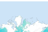
The Sea Ice Index provides a quick look at sea ice changes in spatial and historical context and gives a consistent, up-to-date source of sea ice extent and sea ice concentration values and images. The NSIDC Near-Real-Time DMSP SSM/I Daily Polar Gridded Sea Ice Concentrations and the Sea Ice Concentrations from Nimbus-7 SSMR and DMSP SSM/I Passive Microwave Data data sets are used to generate the monthly records of sea ice extent and sea ice concentration for the Arctic and Antarctica from satellite passive microwave data. Data files tabulate monthly mean extent and area, in millions of square kilometers, by year for a given month. Plots of monthly sea ice extent anomalies with trend lines and significance intervals...

The Sea Ice Index provides a quick look at sea ice changes in spatial and historical context and gives a consistent, up-to-date source of sea ice extent and sea ice concentration values and images. The NSIDC Near-Real-Time DMSP SSM/I Daily Polar Gridded Sea Ice Concentrations and the Sea Ice Concentrations from Nimbus-7 SSMR and DMSP SSM/I Passive Microwave Data data sets are used to generate the monthly records of sea ice extent and sea ice concentration for the Arctic and Antarctica from satellite passive microwave data. Data files tabulate monthly mean extent and area, in millions of square kilometers, by year for a given month. Plots of monthly sea ice extent anomalies with trend lines and significance intervals...

The Sea Ice Index provides a quick look at sea ice changes in spatial and historical context and gives a consistent, up-to-date source of sea ice extent and sea ice concentration values and images. The NSIDC Near-Real-Time DMSP SSM/I Daily Polar Gridded Sea Ice Concentrations and the Sea Ice Concentrations from Nimbus-7 SSMR and DMSP SSM/I Passive Microwave Data data sets are used to generate the monthly records of sea ice extent and sea ice concentration for the Arctic and Antarctica from satellite passive microwave data. Data files tabulate monthly mean extent and area, in millions of square kilometers, by year for a given month. Plots of monthly sea ice extent anomalies with trend lines and significance intervals...

The Sea Ice Index provides a quick look at sea ice changes in spatial and historical context and gives a consistent, up-to-date source of sea ice extent and sea ice concentration values and images. The NSIDC Near-Real-Time DMSP SSM/I Daily Polar Gridded Sea Ice Concentrations and the Sea Ice Concentrations from Nimbus-7 SSMR and DMSP SSM/I Passive Microwave Data data sets are used to generate the monthly records of sea ice extent and sea ice concentration for the Arctic and Antarctica from satellite passive microwave data. Data files tabulate monthly mean extent and area, in millions of square kilometers, by year for a given month. Plots of monthly sea ice extent anomalies with trend lines and significance intervals...

The Sea Ice Index provides a quick look at sea ice changes in spatial and historical context and gives a consistent, up-to-date source of sea ice extent and sea ice concentration values and images. The NSIDC Near-Real-Time DMSP SSM/I Daily Polar Gridded Sea Ice Concentrations and the Sea Ice Concentrations from Nimbus-7 SSMR and DMSP SSM/I Passive Microwave Data data sets are used to generate the monthly records of sea ice extent and sea ice concentration for the Arctic and Antarctica from satellite passive microwave data. Data files tabulate monthly mean extent and area, in millions of square kilometers, by year for a given month. Plots of monthly sea ice extent anomalies with trend lines and significance intervals...
The Sea Ice Index provides a quick look at sea ice changes in spatial and historical context and gives a consistent, up-to-date source of sea ice extent and sea ice concentration values and images. The NSIDC Near-Real-Time DMSP SSM/I Daily Polar Gridded Sea Ice Concentrations and the Sea Ice Concentrations from Nimbus-7 SSMR and DMSP SSM/I Passive Microwave Data data sets are used to generate the monthly records of sea ice extent and sea ice concentration for the Arctic and Antarctica from satellite passive microwave data. Data files tabulate monthly mean extent and area, in millions of square kilometers, by year for a given month. Plots of monthly sea ice extent anomalies with trend lines and significance intervals...
|

|
